Location: North 59.96892 East 005.94619 (GPS on the summit)
Difficulty: YDS class 2
Climbed May 14, 2014.
Information:
How to get there:
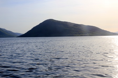
This top is located on the island of Snilstveitøy directly
outside of the small village Rosendal. The key question is how to
get across from Rosendal to the island. There is a very infrequent
ferry service, depending on it may imply that one spends more time, possibly
an overnight on the island. This, may of course be an excellent option as long
as it is planned.
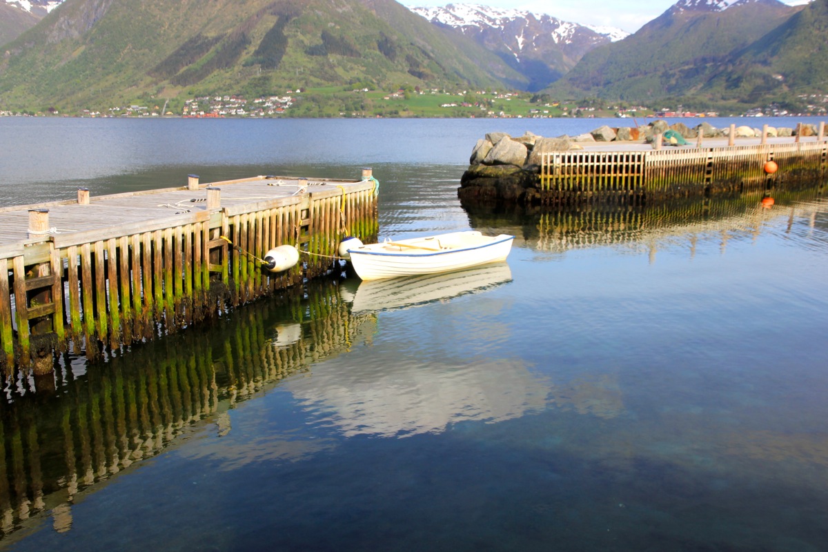
I ended up with borrowing a boat that could be rowed, from the Rosendal fjordhotel.
This is not a bad option if you are a guest there. A third alternative is certainly
to locate some local person that owns a boat and have a private charter across.
Route description:
The straight line distance from the Rosendal fjordhotel to a very suitable place
to anchor a boat at the island, was measured to 2830 meter. From here, walk along the
single road that runs a bit inland, but sort of parallel to the shore until you locate
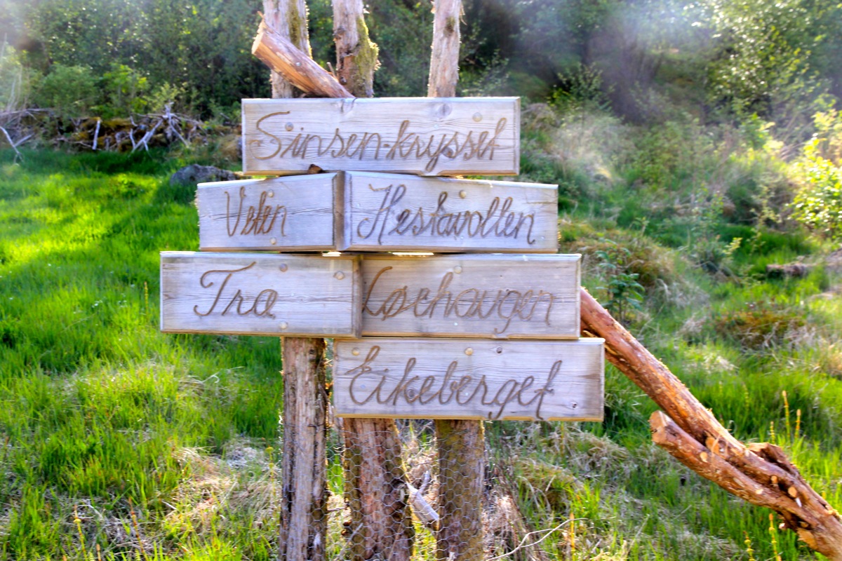
the first dirt road that heads uphill, serving a couple of houses. Take this road until
it forks with a nice signpost, called Sinsenkrysset.
(This is a well known intersection in Oslo.)
Go left and pass the last house on the right, cross through an old stone fence where it has a
road-sized gap, then follow what looks like an old forest road further left. This road (or path)
curves right after crossing the creek, then crosses back. The path is now very clear as it curves
uphill and eventually ends in a pretty flat location, quite close to the summit. From here,
just head uphill (slightly left). There is a pretty good trail running along the top
of the hill, so it really does not matter too much where you ascend. The terrain is generally
less steep and more pleasant a bit on the right. On top of the main ridge, turn left and follow
a good path to the local summit, a pretty small, but distinct hump. There is a visitors book
as well as a trigonometric marker on the top.
Comments:
I left Rosendal fjordhotell at 1530. There was a little wind and waves
coming in towards me. I rowed with a fair amount of energy and reached
the nice boat area just
near some vacation houses at 1620, so 50 minutes.
The subsequent hike wenth smoothly. First along the road, then up the very
nice path. I was on top at 1705, so another 45 minutes. The weather was just
nice and the top is a good viewpoint. The view directly across to Melderskin and
Rosendal was excellent.
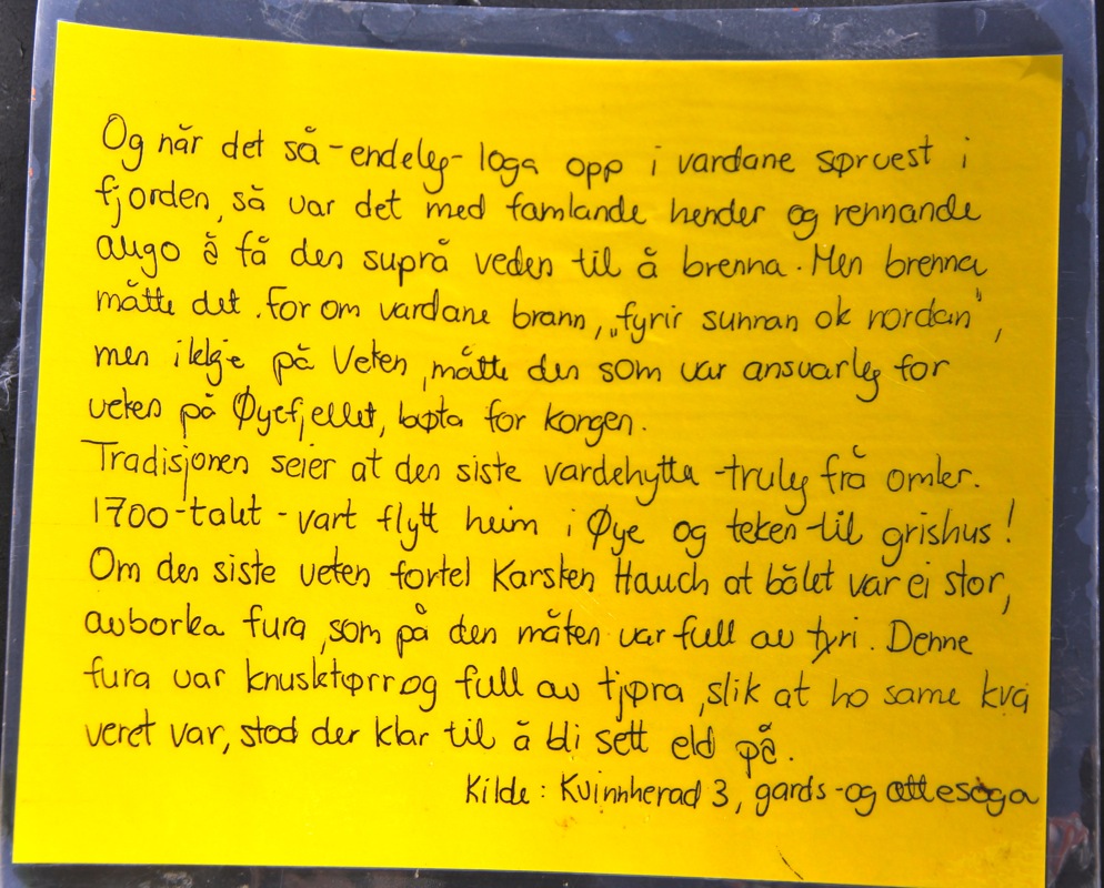
The register had one signed visit 2 weeks earlier, on May 1. The register also had
a one page note about the history of this summit,
Veten is a very common name along the coast
since these tops were used to light fires as a signal, way of communicating, that enemies
were coming. The local communities would then have time to mobilize forces and ships
to fight the arriving force.
I left at 1725 and reached my boat at 1805. The return rowing was slightly easier as
the wind was now helping. I stepped back into the hotel at
1845 after a very successful trip.