Location: North 60:30.103 East 005:19.259 (GPS on the summit)
Difficulty: YDS class 1
Climbed November 27, 2010.
Information:
How to get there:
From central Bergen, go north on E-39 to Åsane. Continue to
the first traffic circle (this may change when Ikea gets its new
building completed.) and exit left towards Salhus.
Locate a smaller road that (pretty immediately) forks right, the name
is Dalavegen. This road runs immediately on the left (west) side of the
new Ikea store, details may change a bit as this complex is completed.
Continue west and gradually north of Langavatnet as you drive by some
buildings before finding a pretty big, signed parking area on your
right hand side. Park here, location N60:29.242 E005:19.799, elevation
about 90 meter.
Route description:
The shortest route is to backtrack a few meter along the road, then take
the small dirt road signed as the old Bergen-Trondheim postal route, north
and uphill.
However, here a round trip will be described that ends up coming down this
road. The route can be done in either direction.
From the parking, continue along the road (ie. go right), as it curves around
the northen end of the lake. The road becomes a track then a path heading south
and bypassing the steep hill slope that runs down from your left. The path connects
with a dirt road called Teiglandsvegen. Follow this road, passing a farm and going
uphill before connecting to a paved road, Sæterstølvegen. Go left
and follow this road uphill, more steeply with two sharp curves. The road sort of
tops out near some buildings and a big trail forks of gently uphill to your left.
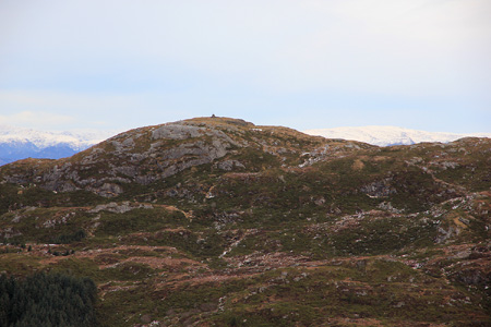
Follow this path as it climbs to the main (south-east) crest of the mountain.
The trail thus ascends north of the small top called Skagen. Follow this trail
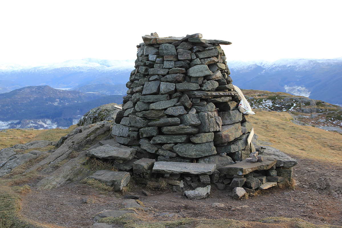
more or less along the main crest across a few local (false) tops to the summit
of Veten, marked with a big, nicely built cairn.
On the return, backtrack down to the first small plateau below the summit, then go
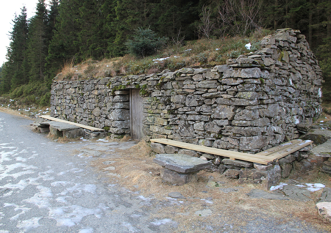
right and follow a pretty clear and well used trail that descends to the valley
that cuts between Høgstefjellet and Veten. The old postal road runs in this
valley.
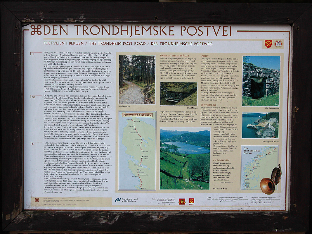
There
is a sign describing the old postal route as well as some
old stone huts near
the place where the trail from Veten hits the small road.
Go left (south) and follow this road down to the road near your parking.
Comments:
I did this hike with my son Tor Erling. We started around 1315 and hit the summit
at 1405. It was cold (much colder than normal in Bergen) and a bit windy.
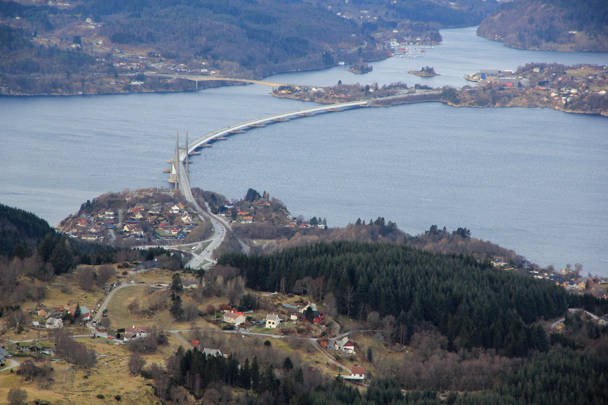
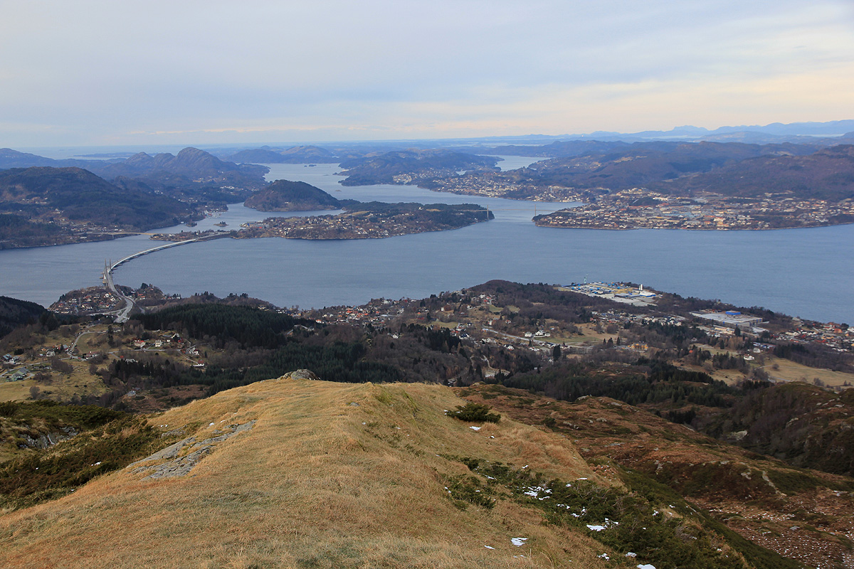
The view north to the
big floating bridge that
connects to Knarvik is very good.
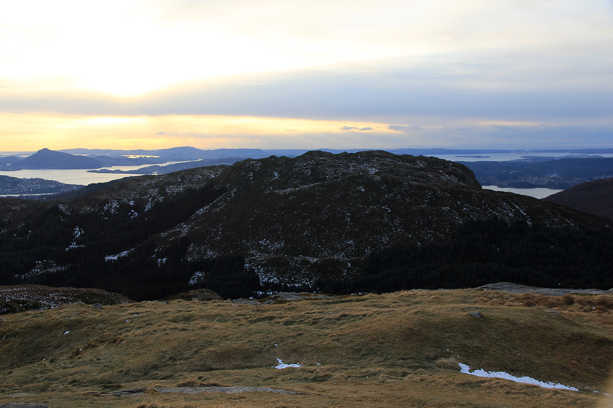
We stayed around for about 5 minutes before heading down into the pretty deep
valley that separates Høgstefjellet and
Veten. After reading about the
old postal route
(the sign has Norwegian, English and German text), we returned to the
car, arriving there at 1515. A nice, but pretty cold 2 hour hike.