Location: North 60.68949, East 005.62026 (GPS on the summit)
Difficulty: YDS class 2+
Climbed: April 27, 2014
Information:
How to get there:
Take E-16 from Bergen to Dale, shortly thereafter at the bottom of a long downhill, turn left towards
Romarheim and Modalen. This road is rather narrow with many sharp curves. Continue until you see the
concrete bridge across to Osterøy in front of you. Keep right here and cross the bridge.
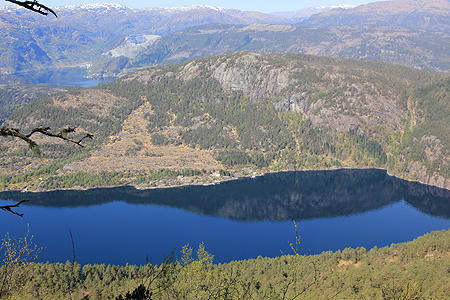
Continue on a very narrow road, to Grøssviki, this is where the road leaves the fjord and heads
uphill towards Toskedalen. Continue a bit uphill until the very first sharp (hairpin type) curve going
left. A forest road forks right in this curve. There is parking for a couple of cars.
This location is N60.67919, E005.67248, elevation
about 70 meter. Park here.
Route description:
Take the forest road that starts at the trailhead. When it forks, follow the left branch.
This road turns back and climbs the hillside. When it runs out, go right and gain additional
elevation while crossing the broad ridge you are on.
The next stage is to cross the narrow Norddalen and gain a local col on the opposite side.
There may be a reasonable route across, however, I never found it. Be prepared to negotiate
fairly cumbersome terrain when descending to the Norddalen. Ascend on the opposite side and gain
the col north of Raunalifjellet. From here, descend in the well defined gully all the way to the fields of the
farm named Heimviki. Pass by the farm buildings and locate the farmers (tractor) road that runs
next to the small barn (under a bridge used to access the second floor.)
Follow this tractor/forest road and keep left where there is a distinct branch. The road climbs
the hillside in many zig-zags. Continue until this road ends completely. Descend into a section of
tall trees, further downhill move right and locate the sharp col that separates you from Verafjellet.
There are some cliffs here, but traces of old paths will lead you to the spot where you may
descend into the bottom without any climbing.
Ascend easy slopes on the opposite side, then follow the terrain along some minor local ridges to
the summit.
Comments:
I left my car at 1035 and first climbed Raunalifjellet, since this summit is very
much on the way to Verafjellet. I made a short rest there at 1220, before returning to the col
and descending to Heimviki. To my surprise, there were people at Heimviki as well as sheep
with new born babys. I easily found the local farmers road that took me high on
Bjørnakanten. From here, it was not too dificult to find the proper descent into the
sharp col separating this mountain from Verafjellet. From here, it was quite easy to ascend
to the very summit of Verafjellet. I was there at 1420, the trip here from the road is certainly
nontrivial.
Returning the same way, except for a new scramble out of Norddalen, getting back to the
car at 1715. A pretty long hike, more than 6 hours, but the day was nice and this was a very
good way to complete my climbs of the 30 summits on Osterøy that have at least 100
meter of prominence.