How to get there:
Take E-16 from Bergen to Dale, shortly thereafter at the bottom of a long downhill, turn left towards
Romarheim and Modalen. This road is rather narrow with many sharp curves. Continue until you see the
concrete bridge across to Osterøy in front of you. Keep right here and cross the bridge.
This intersection is 37.3 kilometer from the turnoff to Modalen from E39 in Romarheim.
Continue on a very narrow road, about 7 kilometer from the bridge you start to leave the fjord as the
road now climbs and 10.4 kilometer from the turnoff to the bridge you have reached a place with good
parking on your right hand side. This is near Toskedalsvatnet, Park here, this is the trailhead.
N60.66224, E005.68651, elevation about 190 meter.
Route description:
Locate the forest road that starts out just opposite of the parking. Follow this road uphill and
pass a small lake on your left hand side. Continue along this forest road across meadows and even
slightly downhill. Note that you eventually shall keep right, but stay on what is still an old
forest road. Continue until you are at location N60.67103, E005.70237. From here, you should locate
a big couloir that cuts the hillside while providing a natural passage uphill. Follow this couloir
until near its end (where it will start going downhill). Fork right where you see a natural passage
that climbs slightly. Continue gently uphill with small cliffs on your right. As you reach the top of
this wide slope, you are close to the summit and there is an easy passage right that leads directly
to the summit marked with a nice cairn.
Comments:
I started out at 1140, but did not have patience to follow the forest road as far as I should.
I therefore continued at a more convoluted route that eventually brought me into the bottom
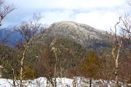
of the same couloir. From there, it was easy hiking to the summit, where I arrived after one hour
at 1240. After a few minutes enjoying reasonably good views, I started back down.
This time, I followed the forest road from the bottom of the couloir and returned to the car
at 1330.
My next goal for the day would be Sverrestuven.