How to get there:
This peak is at the coast between Honningsvåg and Kabelvåg.
Driving E-10 north from Svolvæg (passing Kabelvåg), make a left following
the sign for Honningsvåg. This is just after you have driven passed the lake
Rørvikvatnet. The trailhead is on your left as soon as the road crosses a small
fjord going left. There is limited parking at location N68.18776, E014.22466.
Route:
Follow the trail that starts at the parking along the north side of Djupfjorden.
At the end, the area is a bit complex with piles of large boulders, try to follow the
trail that first cuts a bit inland, then crosses over. You should get to the boundary
of a small spruce forest, first crossing the creek just near the top of a final, steep
section (of the creek) down to the fjord. Hike parallel with the forest for about
30 meter and look for a trail fork where a trail runs directly right. Follow this trail,
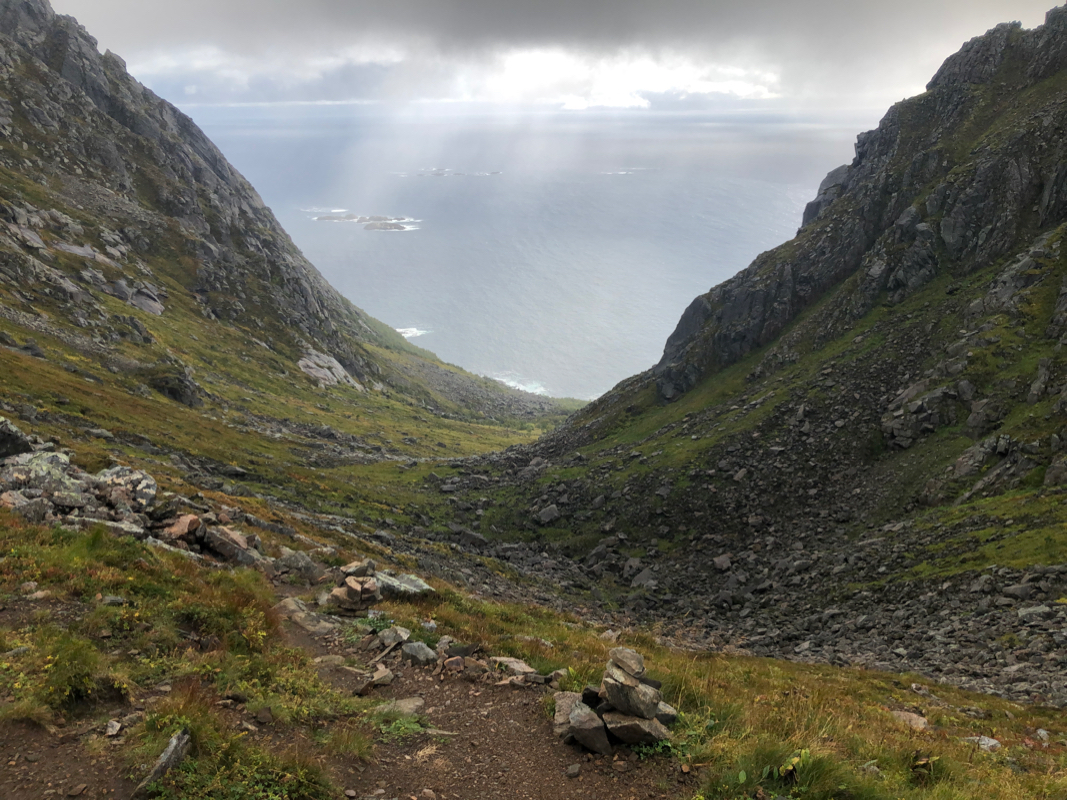
it will enter and ascend the Durmålsdalen valley.
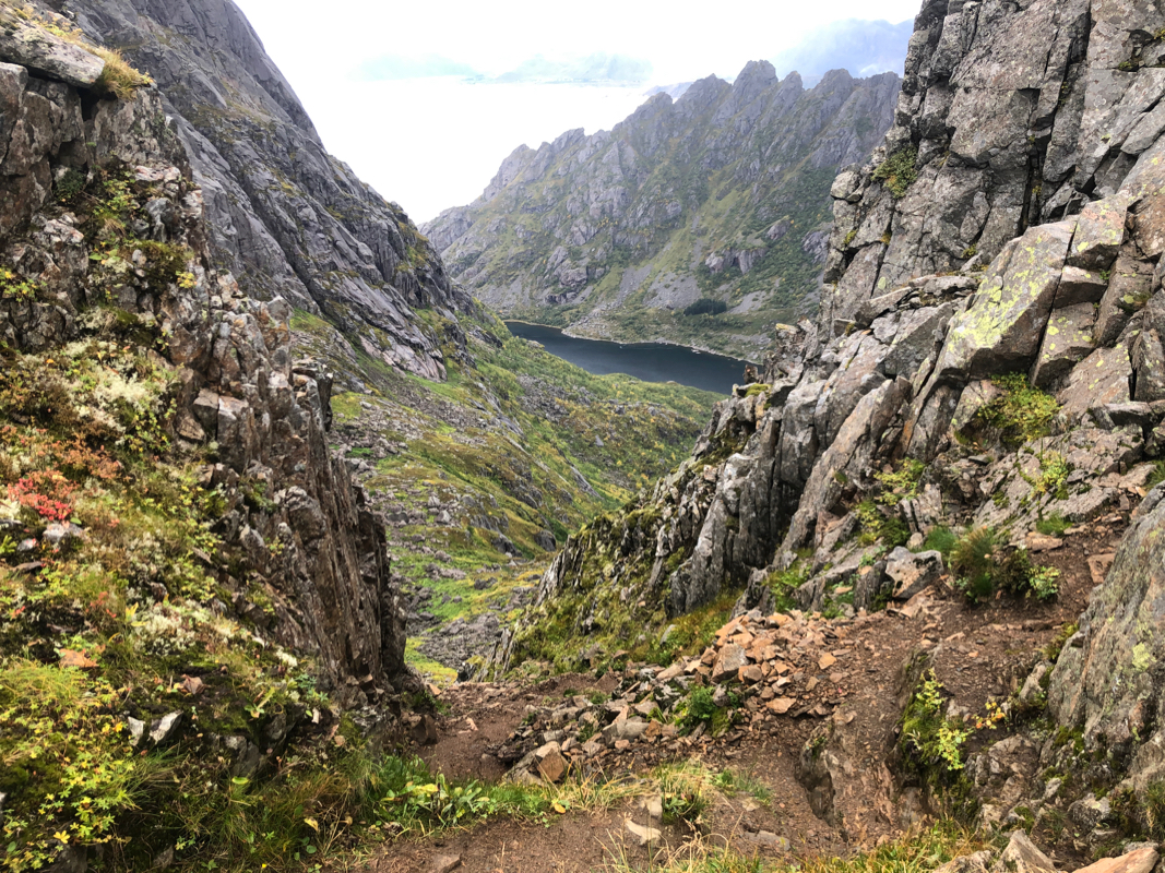
Walk this trail to the first col from where you see across and back down to the sea. The trail
then descends a bit on the east side, traversing (left) in order to enter a long gully. Ascend
this gully. On the top,
descend a bit on the far side to cross a second col, then ascend a
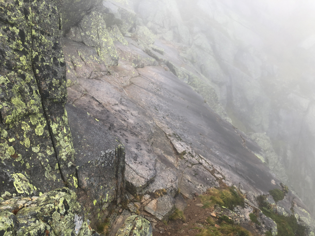
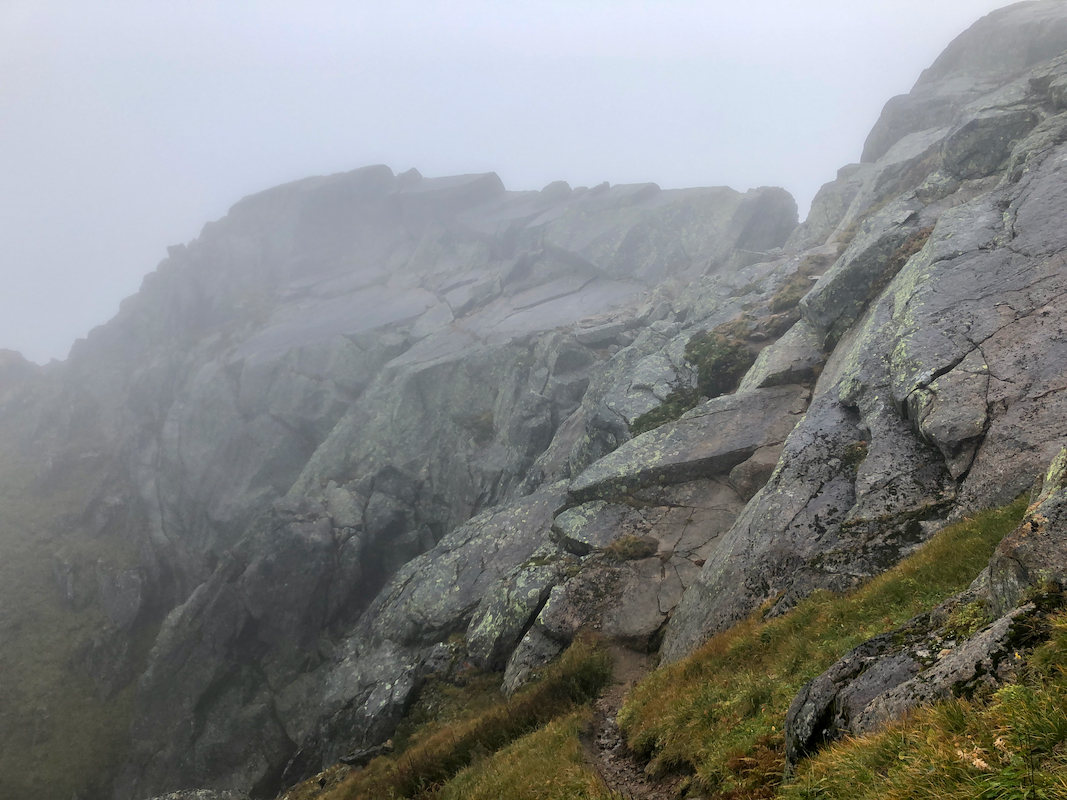
somewhat steeper (and much shorter) gully (YDS class 3). This brings you to the famous
"roof" traverse. This is a short section
of smooth rock tilting down (right) ending in
a cliff. There is enough friction to safely cross (with care) when this rock is dry.
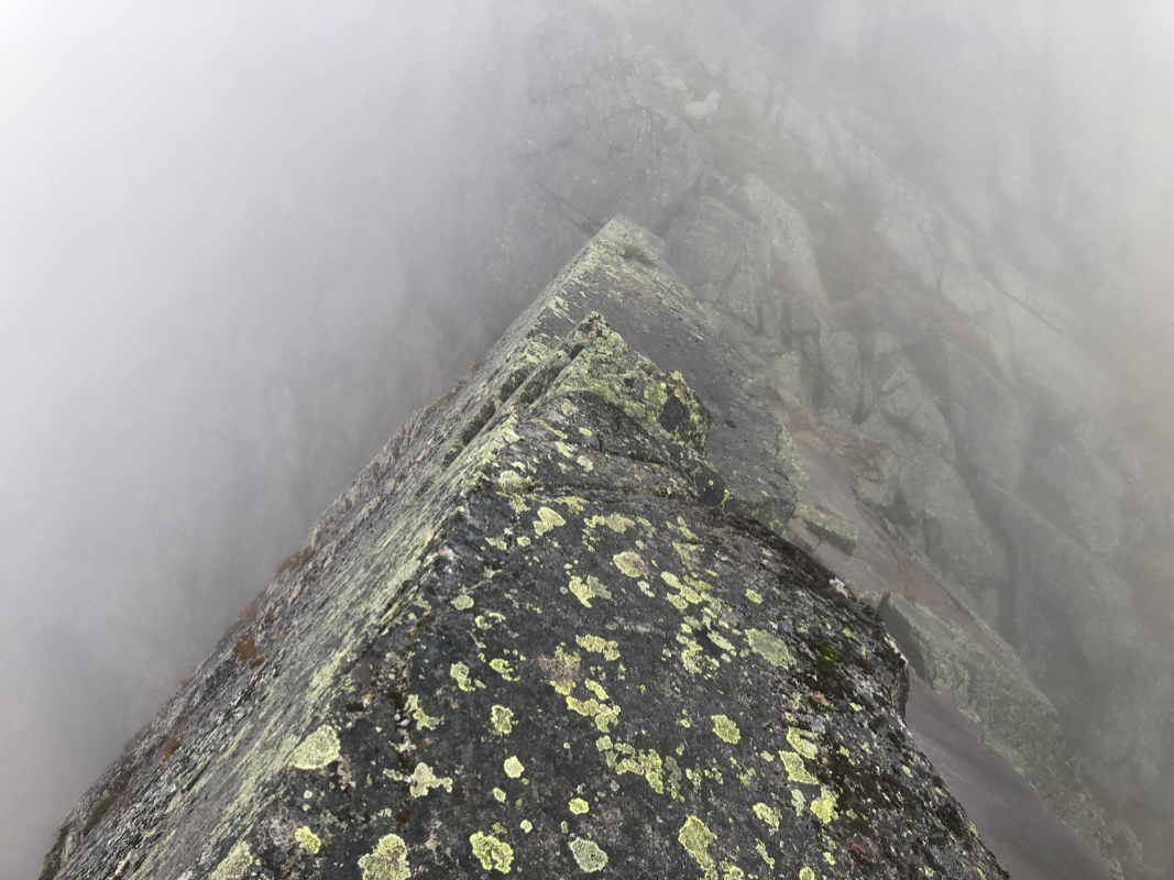
When this is not the case, there are two alternatives. One can ascend to the "roof ridge".
This requires a (YDS) class 4 move.
The roof-ridge is sharp and should only be traversed by
experienced people comfortable with a very exposed knife-edge type traverse.
The safest and by far the easiest bypass of the "roof" is to take the "basement" route.
Backtrack (5-10) meter from the roof to the obvious shoulder.
Descend a grass slope into a big gully.
When you get to the bottom, ascend on the far side on a gentle grass slope,
then climb a wet and narrow crack that
leads uphill. When you exit on top, you are only
a few easy steps away from the route, but now on the other side of the "roof".
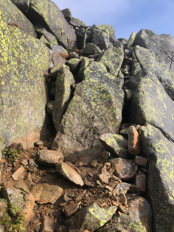
The route now traverses, a very clear trail and will arrive at a point marked with
a small pole. Ignore the trail
that continues ahead, turn left and scramble up
an easy (YDS class 3) passage. Once up, the route turns sharply right. (Ignore
the clear signs of a path across to your left). From here, the route is well
marked with small cairns as it zig-zags uphill
with more (YDS) class 3 scrambling.
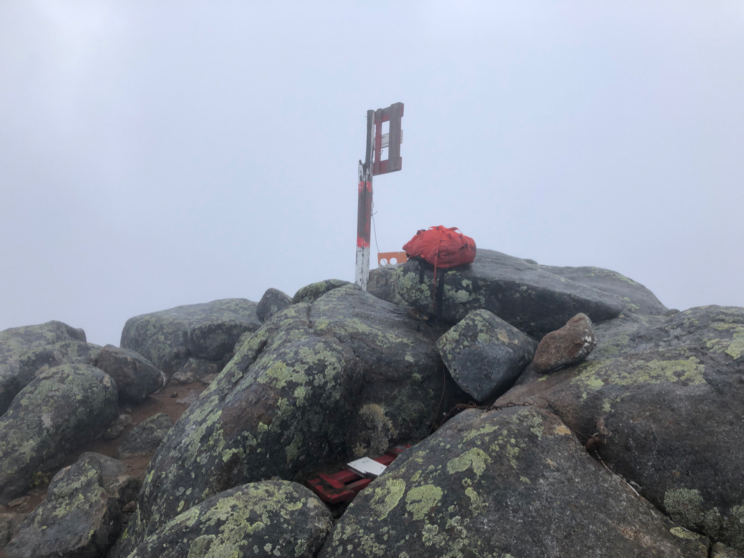
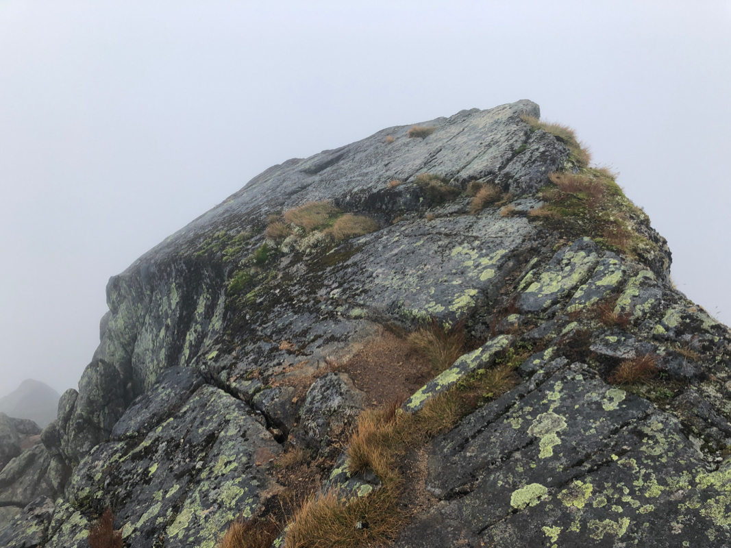
Finally, at the very end, the route tends left in order
to arrive at the nice summit. Comments:
I wanted nice weather for this climb, but the prospects looked slim.
Still, the best chance seemed to be my last full day in Lofoten - Monday.
The forecast said that rain showers in the morning would end by noon and that
some mix of sunshine and clouds would prevail in the afternoon.
I knew that a dry rock surface across the famous "roof" section would be nice, my
plan therefore evolved into driving to the trailhead in mid-morning, then do a slow
hike in order to arrive at the "roof" around mid-day.
I started hiking at 1000, but walked slowly
with a good break up at the first col.
The weather looked promising, no more rain and already a few patches of blue sky.
I continued slowly and reached the "roof" shortly before 1300. Bad news, the weather
had reversed and it started to rain. I tested friction on a few slanted rock surfaces,
not good.
I had read about only one alternative, to climb along the "roof-ridge". Thus, I explored this
option. To climb up onto the top of the roof involves 2 moves, first a short, ascending
step to a nice platform, then a pretty vertical, but short (YDS) class 4 move to enter
the roof. The first part of the roof-ridge was
pretty easy, but this ridge sharpens
considerably further along. I did not know if the exit would be tricky. This was certainly
"safer" than a slippery "roof", but I decided that a more careful investigation of possible
alternatives would be in order. I could always climb back up here later.
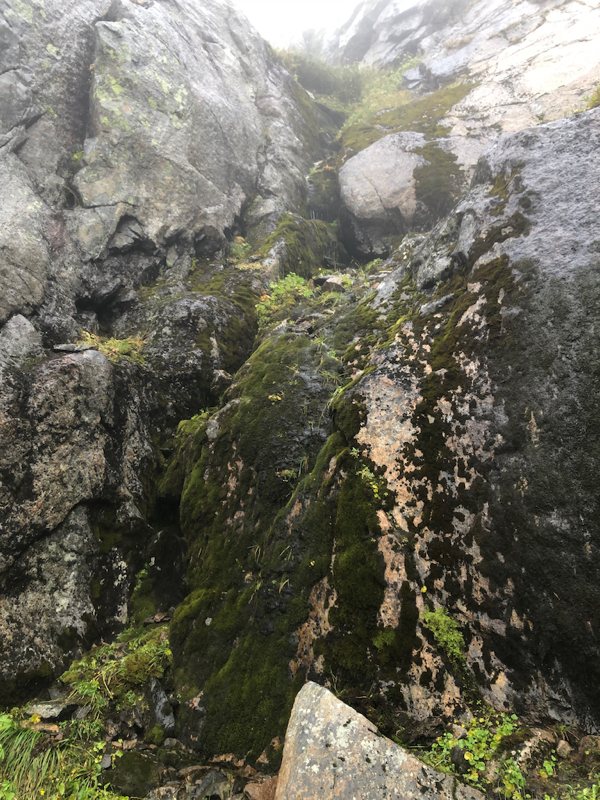
Thus, I climbed back down and started looking for a possible bypass below the "roof". A grass
gully going down to near the bottom of the huge gully at the bottom looked promising. The rock
at the other side could possibly be climbed. My first try, but it turned out that the climbing
higher up was tricky. Back down at the top of the big gully, directly below the "roof", I noticed
another grass ramp leading to a corner with a rock. Proceeding up that way revealed a wet crack
that looked quite easy to ascend. Before long, I was back on the summit route,
now on the far side of the "roof" - YES!
I felt confident that I could reach the summit in a safe way despite
the persisting rain and less than optimal conditions. I decided to name
my bypass route "The Basement Way." ("Kjellerveien" in Norwegian.)
This is an easy bypass that may feel appealing also in good conditions to people that
get intimidated by the "roof" passage.
Soon, I arrived at a small stick next to the route. A clear trail continued the traverse,
but I believed somebody had placed the stick there in order to indicate that the route
made a sharp left turn - more steeply uphill. The scrambling was easy and my next observation
was a big trail crossing a small plateau further left. I headed across without much reflection,
the passage was exposed and required care. Once safely across, I noticed that the route clearly
made a sharp right turn before this crossing and that I now was off-route. Well, crossing back,
then follow the route to the summit, no more difficulties of any kind.
The time was 1415, I had spent considerable time around the "roof" area.
Fog and no visibility, no reason to spend
a long time up here, but a small rest
was good. I was quite happy
with my climb given the bad weather.
I left at 1430 and descended without any hurry,
the same route as the ascent.
I was back at my car by 1730, so 3 hours down.
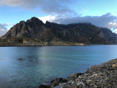
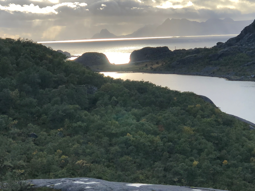
The weather now (finally) started
to improve. I drove around towards Honningsvær in order to see the
mountain. The top part
remained hidden in a cloud. Next, returning to
my hotel in Leknes - a good dinner and a cold beer waiting!