Location: North 60:19.722, East 005:34.584 (GPS at the summit)
Location: In Bergen, Norway.
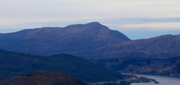
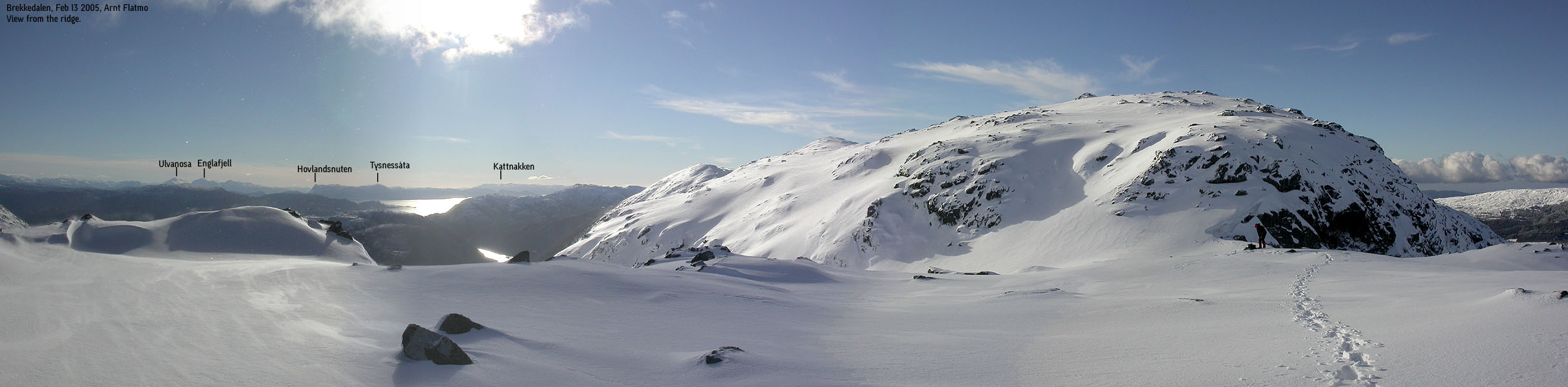
Saddle: The saddle is near Brekkevatnet (320-325)
Climbed February 13. 2005.
Information:
How to get there:
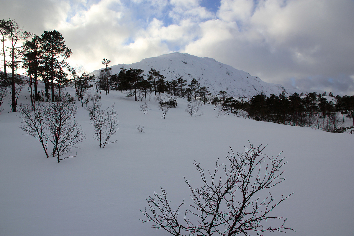
This mountain is located inside the city limits of Bergen.
Drive south on E-39 towards Os. Shortly after passing the lake
Kalandsvatnet (on your right), find the smaller road going left
to Hausdalen. Follow this road to the very end where there is parking.
The road continues up the valley, but is closed to traffic. Route description:
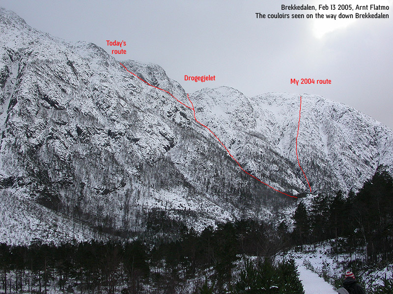
This route is not the easiest or normal route, our descent follows a normal
route. The ascent is a steep
couloir route that may be climbed in summer or in winter when there is
no avalanche danger.
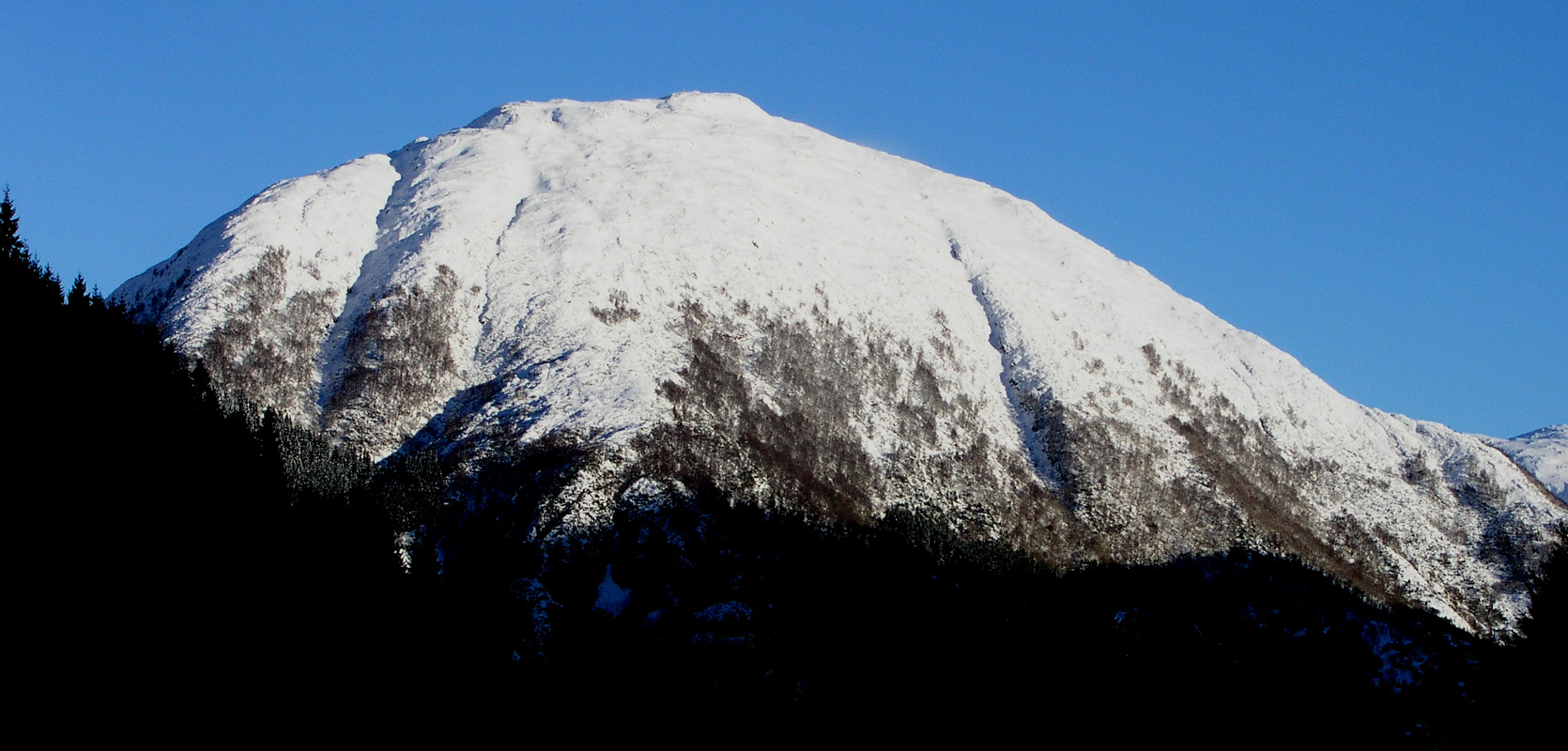
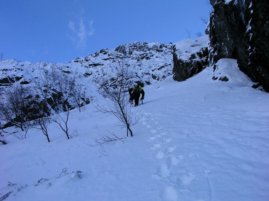
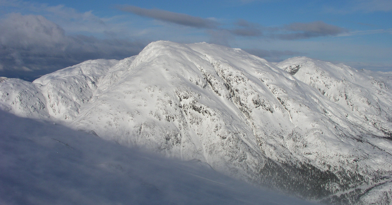
Follow the road along the river until you reach a wooden bridge that
crosses the river. Pause here and consider the mountain slope above on your
right hand side. There is an easy couloir called Drogegjelet that runs up
and slightly right, all the way to the horizon. This couloir is marked as a
creek on the M711 map, it may sometimes be dry. Our route follows this
couloir initially, but then forks left and completes the ascent via a steeper
and more direct couloir that runs to the top ridge on the left side of
a distinct hump (marked as point 705 on the map) on the horizon ridge.
See the picture below for further details.
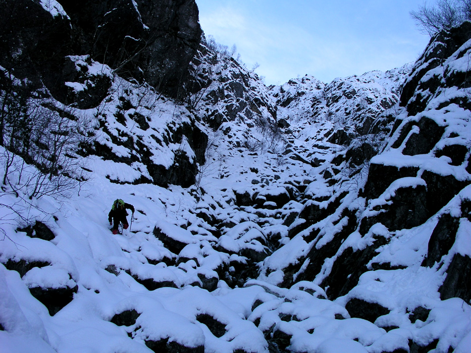
The first part of the route is not difficult, but you may have to use your
hands in a few places. The Drogegjelet couloir carries a YDS difficulty rating
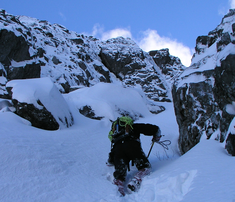
of 2+. When reaching a spot from where you can see a very straight (in winter smooth)
finish of the Drogegjelet further right, traverse left in order to reach the
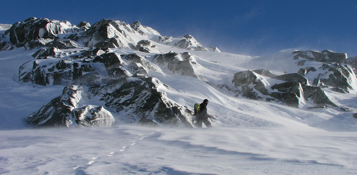
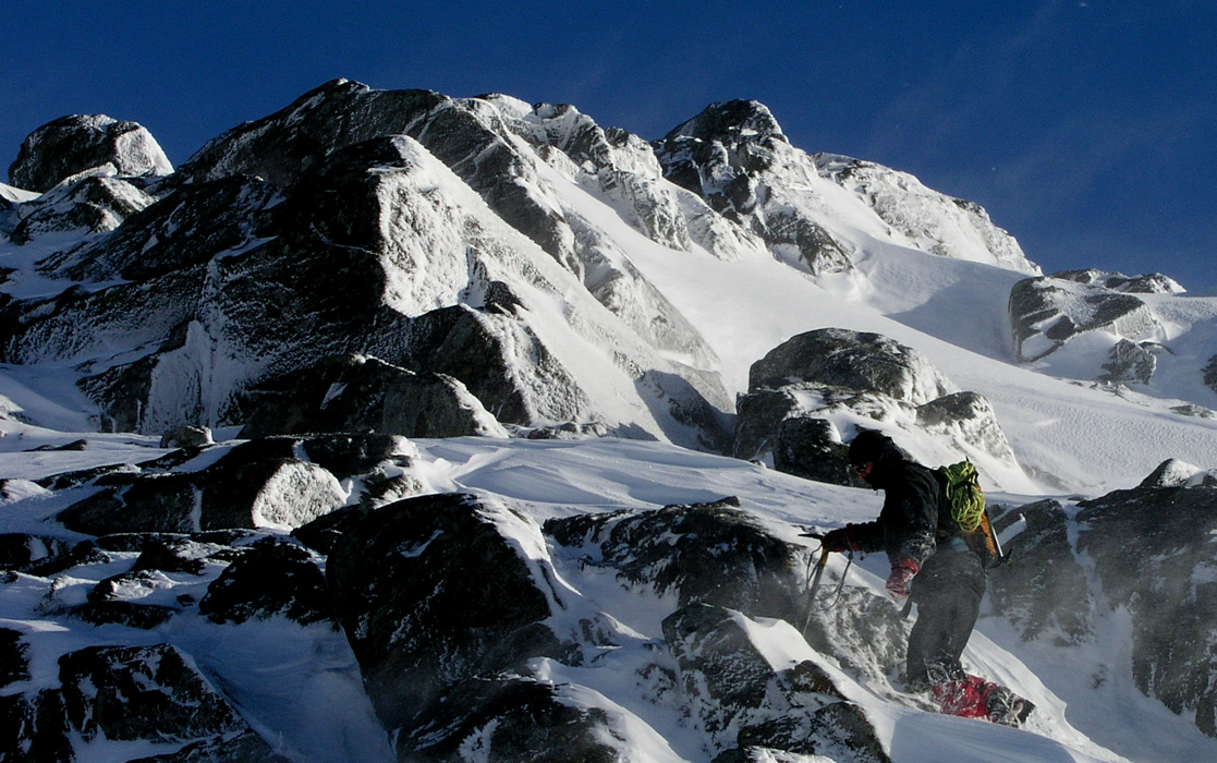
left fork of the couloir. The rest of this route is YDS class 3, in summer possibly
more difficult. The slope is about 45 degrees in the steeper parts. There is a distinct
rock in the middle of the couloir that marks the end of the first steep part. We passed
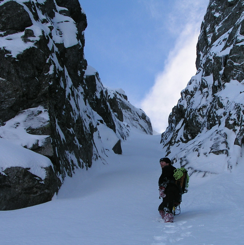
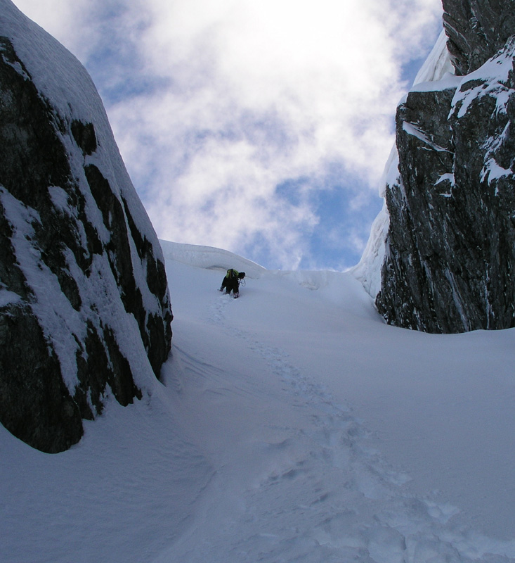
it on the right side as indicated on the picture below. After a short stretch of more
gentle terrain the couloir again has a steeper section at the same time as it becomes
quite narrow with near vertical walls on either side. This last section is great fun, but
soon you reach the top and find yourself on the main Sveningen ridge in a fairly well
defined saddle.
Turn left and follow the broad ridge to the summit cairn.
A gentle descent route continues down the ridge to north-east. Descend to the lake
Brekkevatnet (324m) continue along its east (right) side and locate the forest road just
as it defines the key saddle (that defines the primary factor of Sveningen) at elevation
See also the more complete description
on Arnt's
Hordaland page, (under Bergen) including several alternative routes. Comments:
I did this hike with my friend Arnt Flatmo. He did a great job breaking
trail all the way. He should also be complimented for finding particularly
windy places. On my last three hikes with Arnt, we always seemed to end up in gale to
storm wind with drifting snow and ice particles.
At the cairn, the conditions were so bad that we could not take a single picture.
We started around 1100 and were back
at the car after 4.5 hours. The wind and partly deep snow made this hike seem like
more work than one normally should expect.
This was my first visit to Sveningen, by a route that most likely is rather
infrequently used. Many thanks to Arnt for suggesting the trip and the route.