Location: North 60.83898, East 006.20133 (GPS on the summit)
Difficulty: YDS class 2
Climbed July 31. 2022.
Information:
How to get there:
Drive Hwy. E-16 to Evanger. This is about 20 kilometer from Voss in the
direction to Bergen. Measure from the exit to Evanger. Cross the narrow bridge
and continue left. Drive 12.2 kilometer, going uphill,
make a sharp left direction Eksingedalen. The road crosses a local
mountain pass before descending to Eksingedalen.
The road is
narrow and there may be
quite a bit of snow, so drive carefully.
At kilometer 23.4 you are down in the valley at
a place called Nesheim.
Make a right turn here. Drive past the lake Trefallvatnet, continue about 2.6 kilometer
after this lake. The road makes a right curve and crosses a small river.
Park on the right side of the main road immediately
after the bridge. This is location N60.83427, E006.22220, elevation near 580 meter.
Route description:
Walk back across the bridge and take the signed trail (to Selhamar) steeply uphill.
After about one kilometer you reach the summer farm Trefallstølen.
Turn left here and ascend easy grass slopes. Next, continue to the summit. The terrain
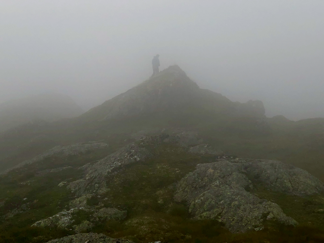
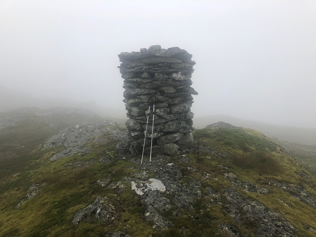
is quite agreeable. Note that the cairn is NOT the summit, however,
the highest point is not
far away.
Comments:
I did this climb with my friend Harald.
We started at 1000 and arrived at the summit after 50 minutes. Unfortunately,
quite a bit of fog. The summit area has a very nice cairn.
Fortunately, despite the
fog, we did notice a competing summit point not very far away. It turned out that
this summit and not the cairn is the highest point. This issue is a potential
serious problem when there is fog. On may easily conclude that the summit has
been visited when it has a big cairn, while nearby competing (and possibly higher)
points are invisible due to fog with very limited visibility.
We returned back down along the same route, the descent took 45 minutes.
