Location: North 62:07.482 East 005:33.746 (GPS on the summit)
Difficulty: YDS class 1
Climbed February 5, 2012.
Information:
How to get there:
This peak is located near the small community of Fiskå, Vanylven, south-west in Møre og Romsdal.
Locate Hwy. 61 where it connects the two fjords Vanylvsfjorden with Syvdsfjorden. Measure from the exit
to Fiskå. Drive 0.9 kilometer and make a right turn just where your road turns left. Continue another
0.9 kilometer and look for a small road going left with a small wooden sign saying "Fjellvegen". This road
is a toll road. In winter, ask permission to park somewhere here. In summer, pay toll and drive up this road.
This road starts at location N62:06.274 E005:34.932, elevation about 58 meter.
Route description:
Follow the road "Fjellvegen" as it climbs in several zig-zag turns up the steep hillside to just above the
trees. There is a place to park up here, a rough road continues to location N62:06.938 E005:35.759, elevation
about 396 meter, where there is a sign post.
Turn left (as the sign points) and proceed directly up the slope to the ridge line. Follow the ridge, but go left
of the summit called Litjbøra. There is a trail marked with small wooden sticks. Soon, your target, the much bigger
Storebøra comes into view. Ascend more or less directly up the slope, follow the wooden sticks if they are
visible. Be aware that there is a steep side on the north side of this mountain.
Comments:
After a late climb of Veten I drove to Fiskå and looked for a place to park
overnight. I located Fjellvegen and started uphill. It was very dark as I drove past the two last houses on
the road, then realized that this road was very narrow and that there was no obvious place to turn around the car.
I did not want to go in reverse in the dark on a narrow, slippery road, consequently I continued looking.
The snow got deeper, and I could see some tracks from skiers in the snow. Bad news, I was now driving uphill on a steep
and narrow forest road that was not being plowed in the winter! Here came a sharp hairpin curve, at least I got to
test the 4WD capabilities of my new BMW car! Anti-spin and full traction seemed to work. I kept a good speed as this
is often your best bet for not getting stuck. Finally, at a sharp right turn curve, there was space to the left for
turning the car. I was at location N62:06.704 E005:35.086, elevation about 250 meter, having climbed almost 200 vertical
meter on a snowed in forest road. I parked and quickly went to bed in the back of my car, quite convenient. How would
it be to drive down this hill? I decided to not think about it until after my mountain hike.
I started at 0715 using my torch headlight and completed the last part of the forest road. As it turned out, it had very
likely been better to ski this mountain. The snow was good, however at Veten there was no skiing even at 600 meter.
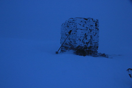
Hiking was also pretty good, I approached the summit cairn cautiously at 0835. Visibility was very low and the wind was
very high. I knew there was a steep cliff nearby and in a white-out, one must be very alert near any steep cliff.
The summit was no place to hang around, thus I descended after about 5 minutes. Back at the car around 0915.
The drive down the forest hill turned out to be somewhat easier than expected.
The wind was so strong that I wanted to reconsider my next mountain and rather attempt something below 1000 meter.
A quick call to my friend Arnt resulted in a recommendation to attempt Koppefjellet.
I therefore proceeded to travel to the base of Koppefjellet.