Location: North 60.74718, East 5.57452 (GPS at the summit)
Climbed December 12, 2020
Difficulty YDS class 2
Information:
How to get there:
Drive E-39 north from Bergen.
When you arrive in Romarheim,
locate the road fork where Hwy. 569 goes right to Modalen.
Continue 2 kilometer further north on E-39. Locate a small fork
signed for Stussdalen going left. Take this road. You will
arrive at the first house on your right. You need to pay toll in order to
continue this road. NOK 40 (in 2020), cash or by Vipps. Continue to
the next house, the correct road is to turn left at the second fork, ie.
you drive on the right hand side of the house below you.
Continue on this very nice dirt road in the valley, then uphill to
locate a road forking left at location 60.75919, 5.57942.
Find parking here (possibly at the end of this small side road). An alternative
is to continue up the last hill, about 250 meter, to the large parking there.
Route description:
If parked at the end of the main road, then walk back down the hill to
the road fork. From the end of the small side road, head across next to
the house, then ascend a very natural uphill slope. As you get higher, turn more
right and find your way uphill, follow vegetation, this is a must if¨thé rocks
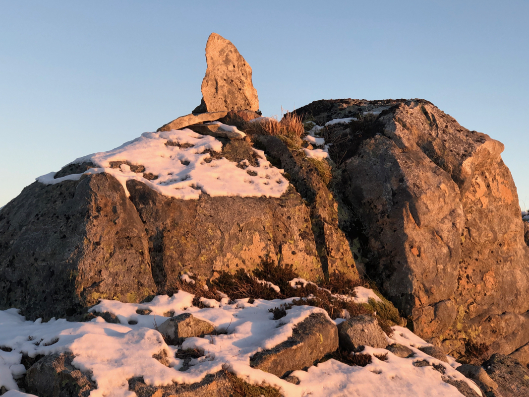
are wet and slippery. There are two almost equal summit points. The highest one
is to the east and marked with a nice rock. Comments:
I left from the car around 1355, having climbed Stussfjellet earlier in the day.
I started down the road to the small side road, walked by the hut, then uphill.
It was a bit icy, I needed to pick my route staying on vegetation all the way.
The ascent took 50 minutes. The sun was about to set,
I enjoyed the summit for
about 10 minutes, then headed back down. The descent took 50 minutes as well.
