How to get there:
In Steigen, locate the place Skjelvareid. This is a Y-fork where one road
heads north towards Engeløya, the other road runs north connecting with E-6.
Take the (third) road heading south. Drive 5 kilometer from the fork, then look for
a smaller side road going right. This road has a sign for "Skihytte". Drive this
road until you see a gate (may be open) and a sign informing you that one should not
drive any farther. There is parking for a couple of cars on your left. Park here,
location N67.82037, E015.06780, elevation about 75 meter.
Route description:
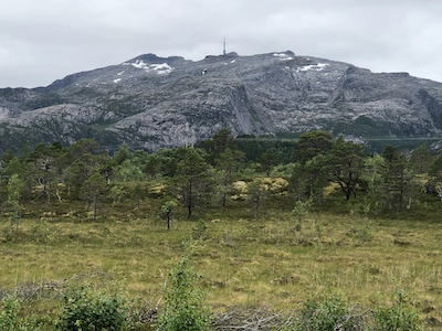
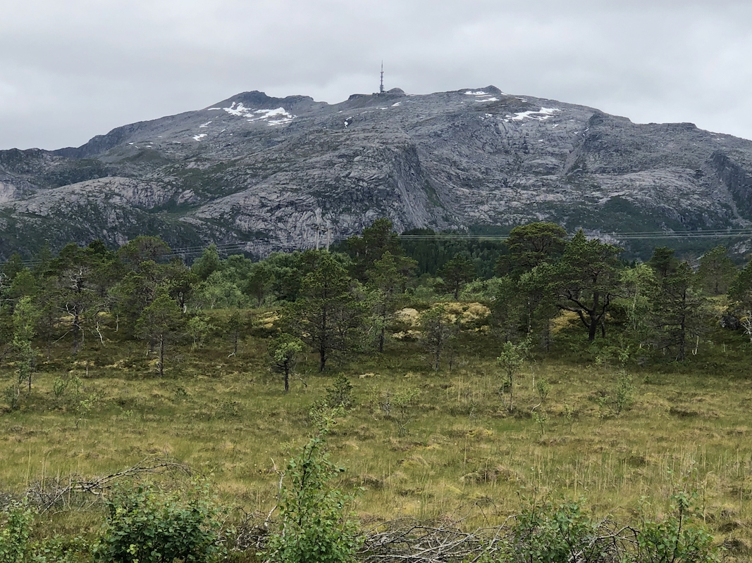
Hike up the road to the big communication mast on the main crest. There is an obvious
short-cut at one point where a grassy road-like path heads directly uphill. You may
take this reconnecting with the road a bit higher up.
From the tower, descend a bit left in order to bypass the very first cliffs. If you want
a summit route staying at YDS class 2 difficulty, then you should continue a traverse
well below the summit ridge about 700 meter, then do an easy ascent on the south
ridge.
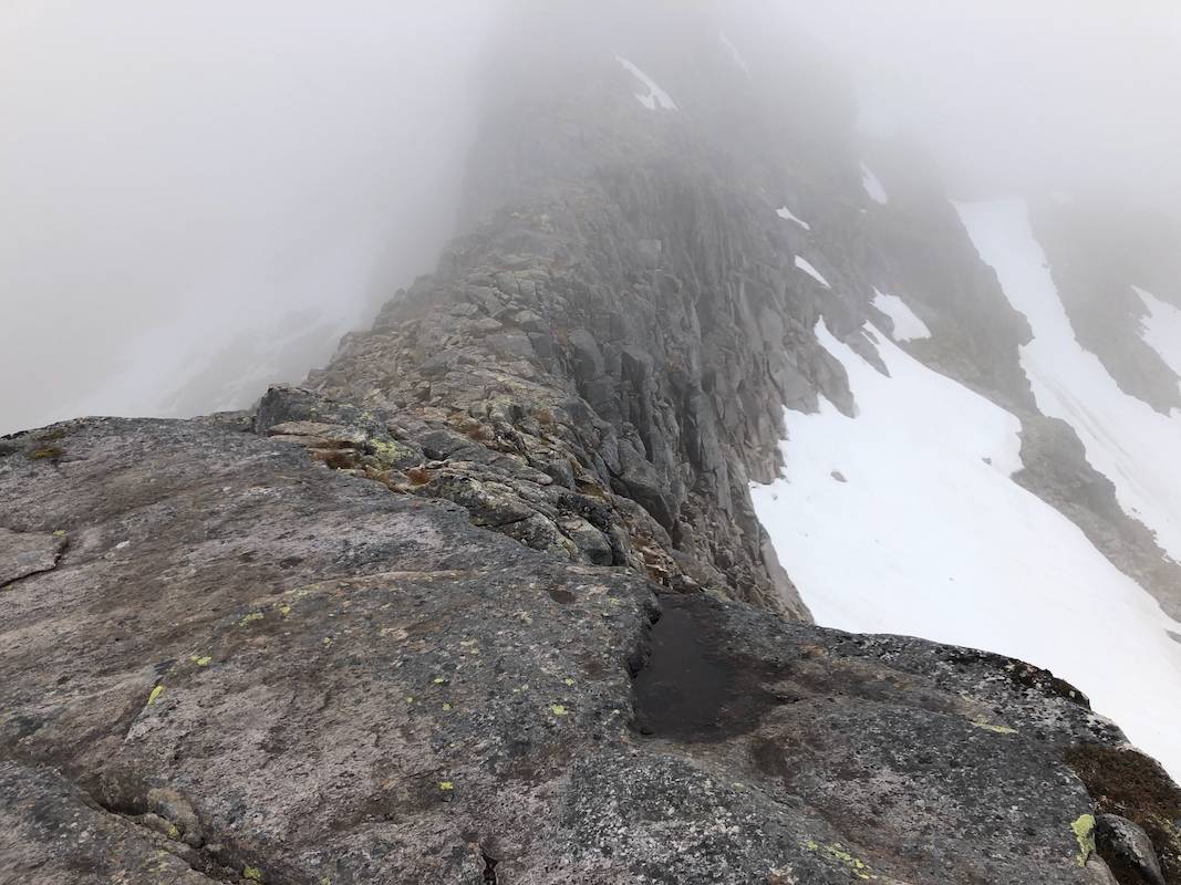
A more interesting alternative is to immediately regain the main ridge and continue with
fairly easy scrambling until you reach a fairly distinct uphill secction. Here, there are
again 2 possible routes.
Your first option is to stay on top of the ridge. This is (easy) YDS class 4.
An alternative is to leave the top ridge along a fairly natural broken ledge going to
your right. This is easy going, but eventually you need to ascend back up to your
left. You may do that (easy) YDS class 3, moving up on fairly good sized rocks. This
will get you back on the top ridge immediately before the summit, only a short walk
remains.
Comments:
I had just arrived at the nice house of Nina and Agnar in Bogøy.
It seemed correct to start my Steigen climbs with a peak that was both
nearby and fairly easy.
I left my car at 1100 and walked to the TV-tower, making the obvious short-cut along
the way. Next, I continued along the top ridge and explored a fairly steep down-climb,
but decided that most people probabely did not descend here.
Returning half way back to the tower, I descended to the left (when facing my intended
summit), then regained the ridge immediately below and beyond the steep step. I continued
along the top ridge without
much difficulty until the next climbing move. This was wet and
somewhat slippery. Perhaps only (YDS) class 3 when dry. I decided to explore the
bypass option on the right. This led me quite some distance before entering an area where
there are several options for climbing left in order to regain the main ridge. I scrambled
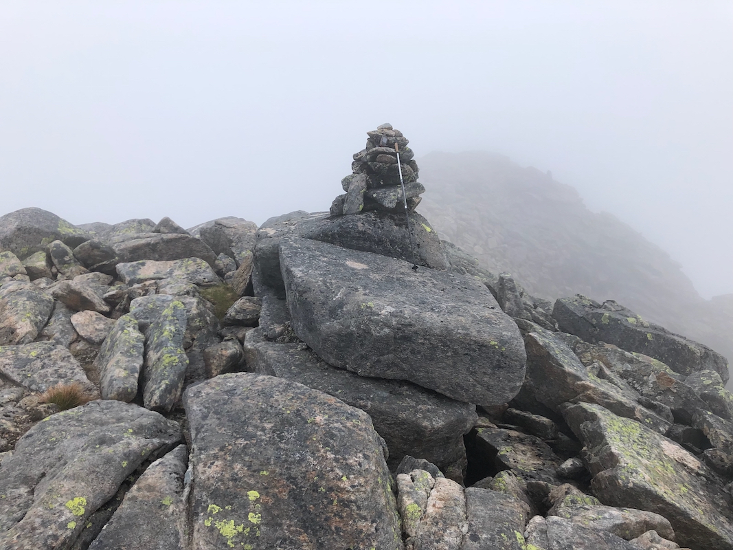
up and was soon back on the top ridge only
a short walk away from the cairn. It had taken
me 1:50 to get here.
The summit was in a cloud and visibility was quite limited. I descended the easy south
ridge, then traversed back to the TV-tower across easy slopes below the cliffs.
The final return hike on the road concluded this hike. I was back at my car by
1420.