Location: North 70:25.533, East 023:16.004 (GPS on the summit)
Difficulty: YDS class 2.
Climbed: September 1, 2007.
Information:
How to get there:
Se the description under Seilandstuva. Route description:
From Kufjordbotn, there are two alternatives. The easier route is described below
as a return hike. The first alternative can be combined in a long day, with an
ascent of Seilandstuva.
First, hike up to Straumskardet, see the route to Seilandstuva.
for a few more details.
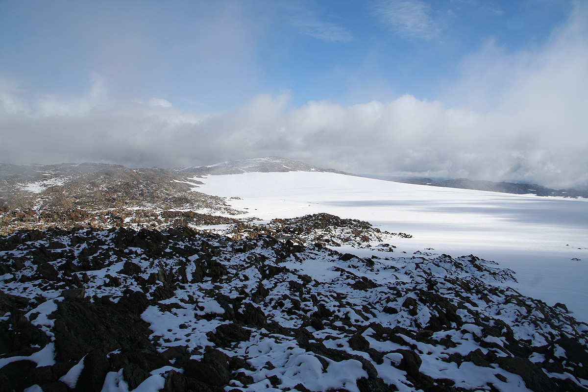
From Straumskadet, the mountain Gáhpu blocks a direct ascent. However, one can climb just north
of Gáhpu and gain its north ridge. See this picture of the slope
for a good line. This slope is
a bit loose and quite steep. Be careful in order not to release rocks. Do not climb too much directly
uphill, rather traverse uphill towards a pretty distinct, but ugly gully that runs downhill starting from
a large boulder that can be seen towards the horizon on top of the ridge. Stay to the right of this gully and
climb uphill to this boulder along minor ridges that runs downhill. Pass the big boulder on its left and gain
the north ridge of Gáhpu. The location here is N70:25.358, E023:08.721 with an elevation of 730 meter.
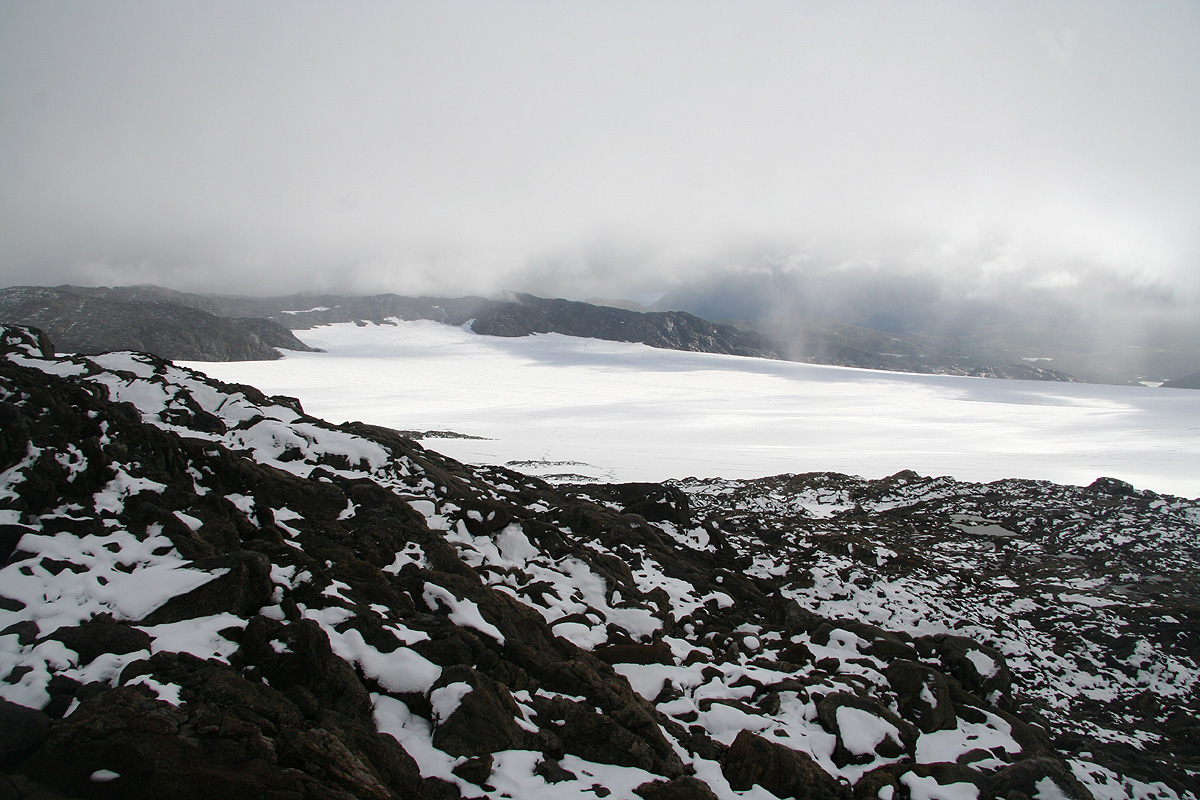
Next, the valley between your current location and the high plateau of the island must be crossed. There is a convenient
downhill slope right where you arrive at the ridge. Further down, the terrain is slightly complicated with many
small cliffs and drops. The mountain slope across the valley has a pretty distinct gully with a patch of snow
that resembles the shape of Norway.
Keep a line of descent slightly right of this and find your way down, then
across to the opposite side. You cross a small creek (location N70:25.289, E023:09.641, elevation 586 m)
before the ascent starts. Climb uphill and aim for the edge of the glacier. Our location at this
point was N70:25.197, E023:11.677, elevation 916 meter. From here,
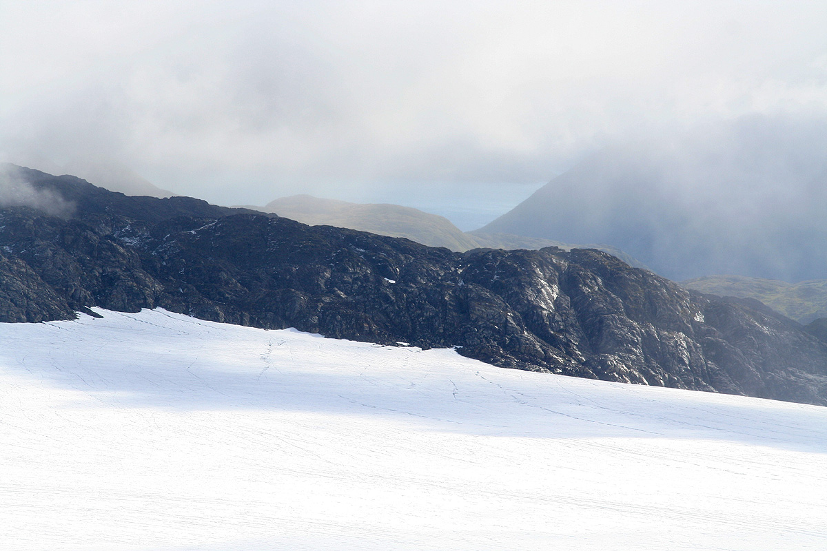
you may see the summit to the east. Cross this part
of the glacier and ascend the final slope to the summit. This section of the glacier is almost flat and have relativelyfew crevasses. However, this situation may change and hikers should be aware of safe glacier travel practice before
attempting this part of the route.
We next describe an alternative route from the summit back to Kufjordbotn. This route can be used in order to climb
Seilandsjøkelen directly (reverse the description).
From Seilandsjøkelen head back across the flat glacier to the area near location N70:25.197, E023:11.677. From here,
head gently downhill as you set course south of Gáhpu, 828m. The objective is to enter the valley called
Siskkimus Vággi. This area has cliffs and the best approach may be to go south
while staying east of the valley entrance in order to descend a gully that runs more from east to west connecting
nicely with the valley floor. One can then continue down this valley on the south side of the main creek until you
overlook Kufjordbotn a bit more than 200 meter below. Here, the terrain is again quite steep, but there are several
pretty wide sections with grass that connects through somewhat steeper, grassy slopes. Find your way down here, with the
final phase of the descent along a ridge that runs south of the creek.
Comments:
From Straumskardet we ascended the steep slope while aiming for the big, characteristic rock at the horizon.
We crossed a collapsed reindeer fence and generally had few problems ascending this "crux" slope. Reaching the
ridge around 1030, I was delighetd to see a good way down at the opposite side. The weather had certainly improved, blue
sky and continuous sun. We crossed down and found somewhat more complex terrain than expected, thus arriving at the
creek around 1115, 45 minutes to cover a rather short section. We declared "major rest", drank water and had lunch while
enjoying the good weather. Leaving uphill, the terrain became much easier and we soon reached the lower part of the
snow slope that looked like Norway from the previous ridge. We ascended this snow all the way to its top and I
remarked that as (a small) part of this hike "we had now also walked Norway south to north".
The rocks continued and we finally reached the edge of the glacier at 1215.
We carried gear for glacier travel, however, this glacier was extremely flat and nice. I carefully probed
a few possible crevasses and soon noticed that even very small crevasses could be detected. We proceeded
unroped across to the base of the high point that would be our second target on this trip. Arriving there
at 1300, precisely 5 hours after our arrival on Seilandstuva, we were happy with the trip and at the same
time realizing that this would indeed be along day. The views were a bit obstructed by clouds, but we could
see quite a bit of the main glacier as well as all the way to
some of the surrounding fjords.
The weather again took a turn for the worse and by the time we left the summit, it was snowing quite intensely.
We walked back across the glacier, then set course for the upper part of Siskkimusvággi. The weather
continued to be a mix of snow and fog, thus a bit of navigation was called for in order to find a good
way into this valley. It is always a bit interesting to decide on a descent route that has not
been ascended. Any showstopper here and we would have an extremely long way home. Thus, we were prepared to
downclimb pretty steep terrain if necessary. We carried my 30 meter rope and enough gear to set up a
safe abseil if needed. This precaution was certainly reasonable, but we did find a quite easy way down
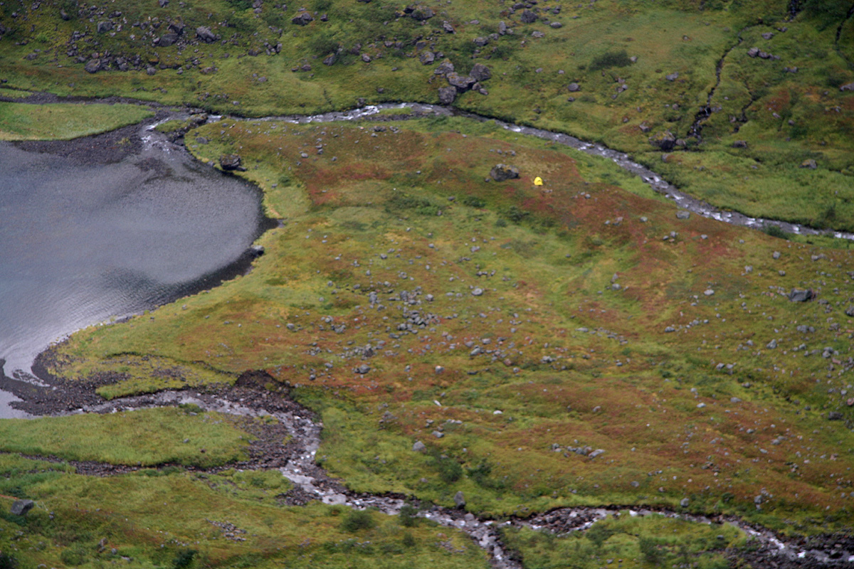
from the south side of the valley and shortly before 1600 we were on top of the last slope, being able
to see our tent in Kufjordbotn.
This final slope could be downclimbed in several ways with the difficulty
staying at (YDS) class 2 or 2+. We reached the tent at 1645, almost 12 hours in completely unknown
terrain.
Time for a brief rest in the tent, then dinner. The weather changed yet another time and made the
evening quite memorable with its changing light under a low sun.
Knut's son came already at 1815 and we left around 1845. We were taken directly out Store Kufjorden,
across Rognsundet and into the protected fjord called Indre Pollen. This is located at the island
Stjernøya. Our ambitious goal for the next day would be to climb Kjerringa,
the island highpoint.