Location: North 67:06.674, East 014:04.076 (GPS at the summit).
Difficulty: YDS class 2
Climbed April 27, 2007
Information:
How to get there:
This mountain is located in the Gildeskål kommune, south of the city of Bodø.
From Bodø, drive east on Hwy. E-80 (towards Fauske) approximately 20 kilometer to
Løding. Turn south onto Hwy. 17 (signs for Saltstraumen).
Saltstraumen is a narrow passage where the flow of the sea water resembles a river that reverses
its direction due to the out- and inflow due to the tidal variations.
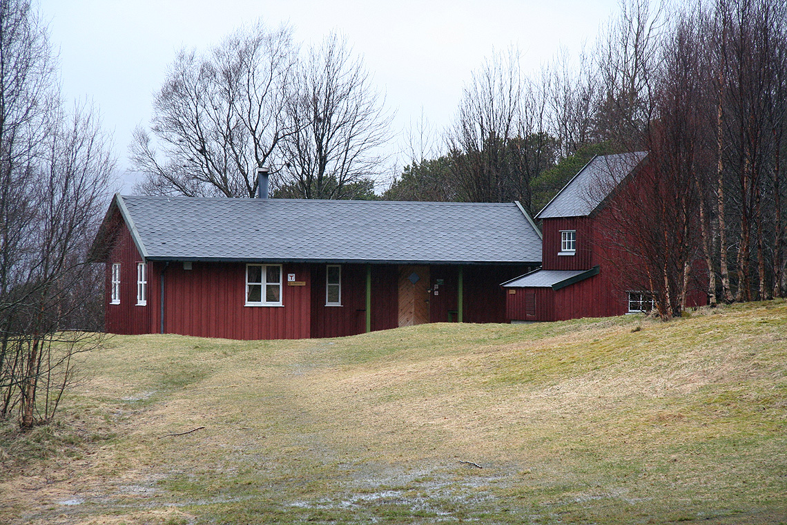
If accommodation is needed, then
the DNT/BOT self-serve tourist hut of Gjælentunet can be recommended.
To find it, look for a sign (pointing right) saying Valnes 3 kilometer, this is
a short drive further south along Hwy. 17. Take this road and drive 5 kilometer where
you locate a parking area on your left. This location is N67:11.258, E014:25.486.
Cross the road, hike up a small gravel road (with a gate) to a private parking area, then
turn left and follow a broad trail partly along a fence for about 800 meter. Gjælentunet
has a main building often rented to groups, but also two self-serve units. There are row boats
and sea access. You need the standard DNT key to unlock the huts.
From the Valnes (Gjælentunet) turn-off, continue 20 kilometer further south along Hwy. 17 to
locate the road to the island of Sandhornøya. Turn right onto this road and drive in the
direction of Horsdal. (Stay right just after the bridge, then make a left as you get to the west
side of the island.) After driving 27.3 kilometer (from Hwy. 17), make a left onto a dirt road
and continue 600 meter to an area where you may park. There is a rack with mailboxes there. Respect the
privacy of the local driveways serving two farms. This is the trailhead, location N67:05.694, E014:03.048,
elevation 12 meter.
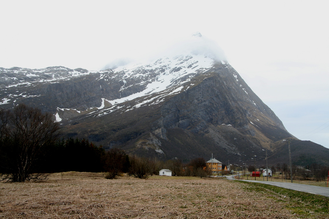
Route description:
Take the small road that leads downhill and somewhat south-east. This road serves a couple of smaller
buildings, then turns into a clear trail. The trail climbs across a small hump before descending
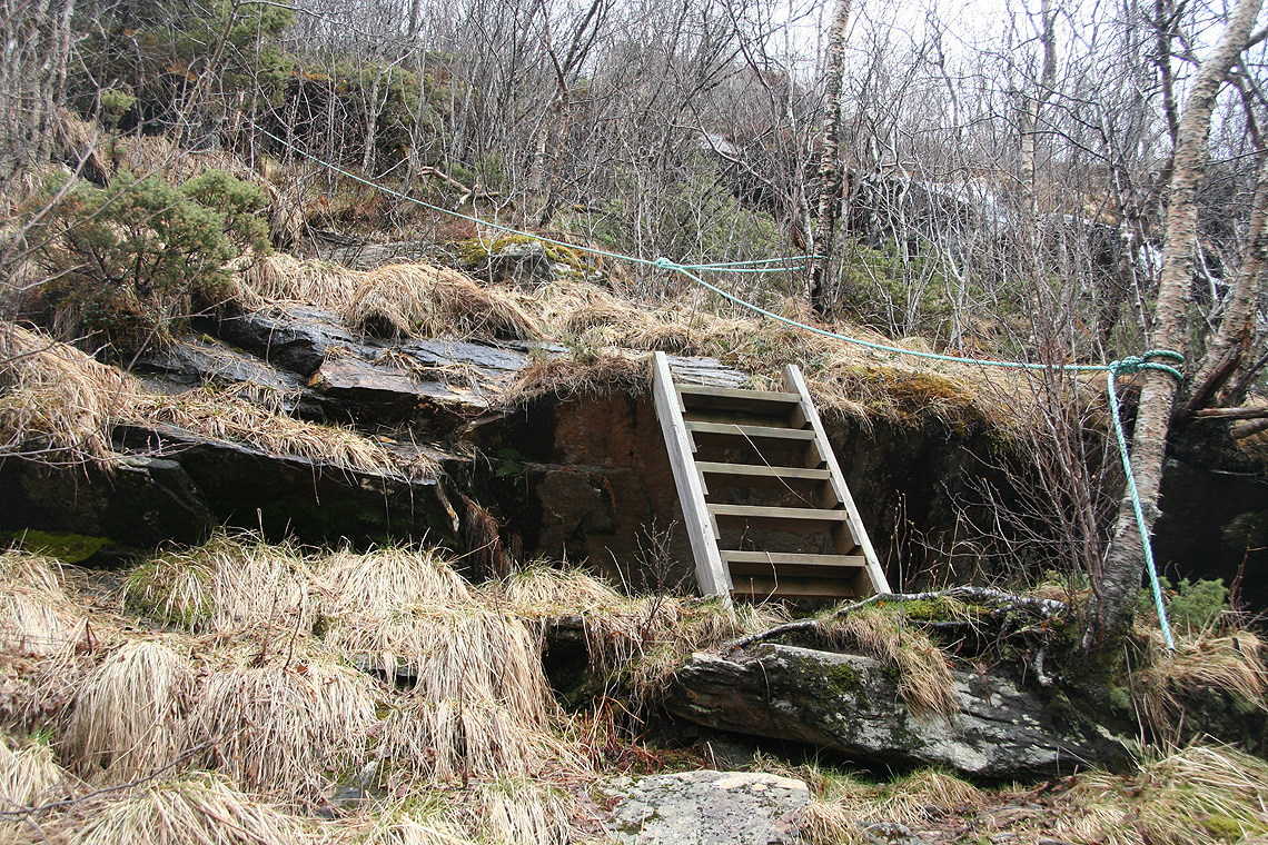
all the way to the fjord. Cross the creek and note that the trail turns left and heads
uphill on the right side of the waterfalls above. The trail is well developed, there is
even a short section with wooden steps and a rope that one may hold onto for added security.
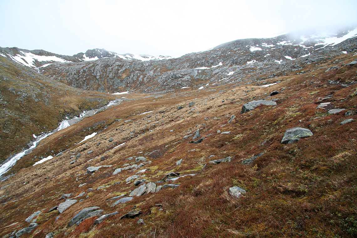
Soon, the terrain becomes more gentle and the trail continues uphill along the creek. Stay on the
right side in this small valley in order to avoid some steeper cliffs, then proceed straight uphill
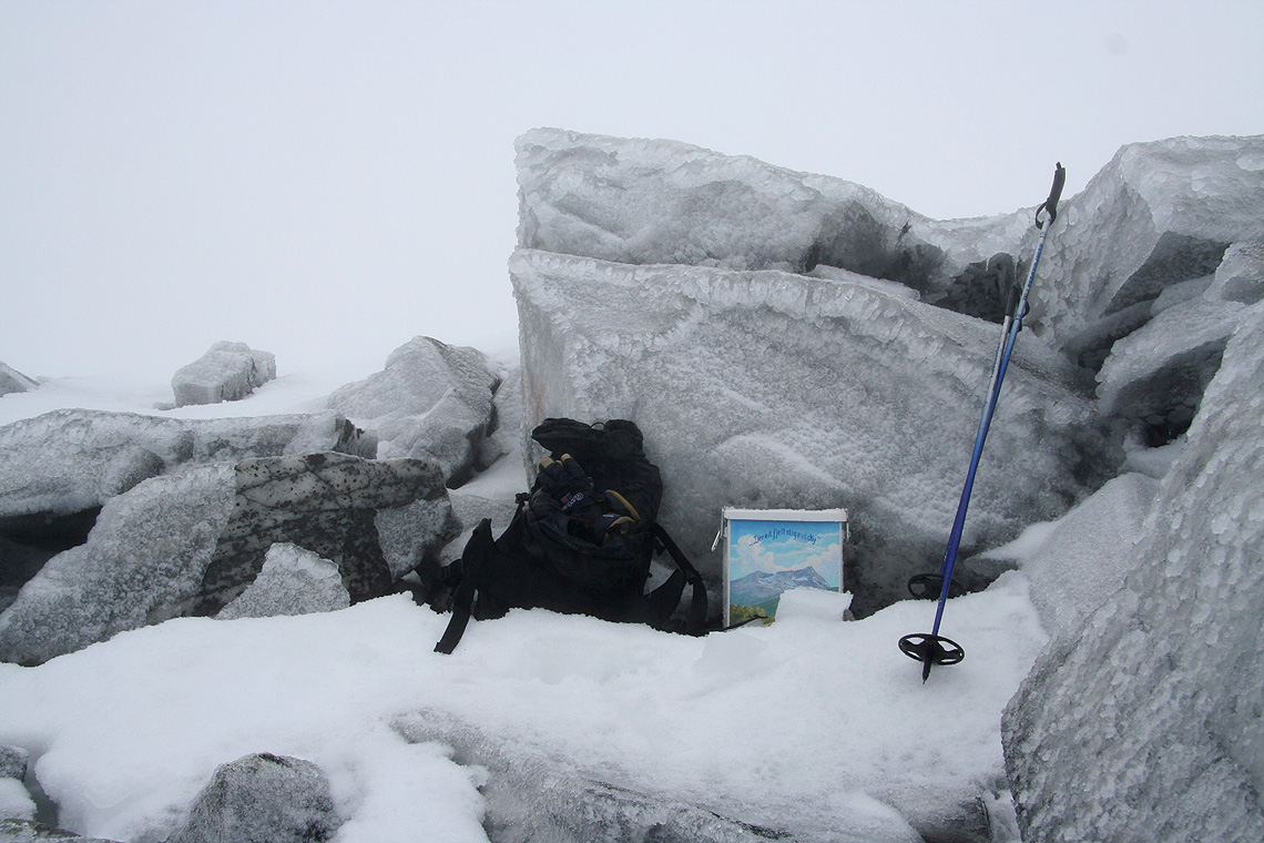
to the summit. There is a nicely decorated mailbox holding the summit register.
Comments:
I arrived from Oslo to the Bodø airport, picked up a rental car and drove to
Gjælentunet where I stayed until the next morning (NOK 100 for DNT members).
Friday turned up with gray and overcast weather, but just traces of rain. I drove to the
trailhead and set out at 0900 with my skis on the backpack. Based on the snow I had seen on
mountains while driving, I expected to ski from about 400 meter. However, the snow did not
start until near the 700 meter level and here it was firm enough to easily support walking.
Thus, it was a mistake to bring the skis. I still skied about one kilometer, then left the skis
and completed the slightly steeper and rocky upper section on foot. I reached the summit at
1140, signed the register and looked around - into the gray void.
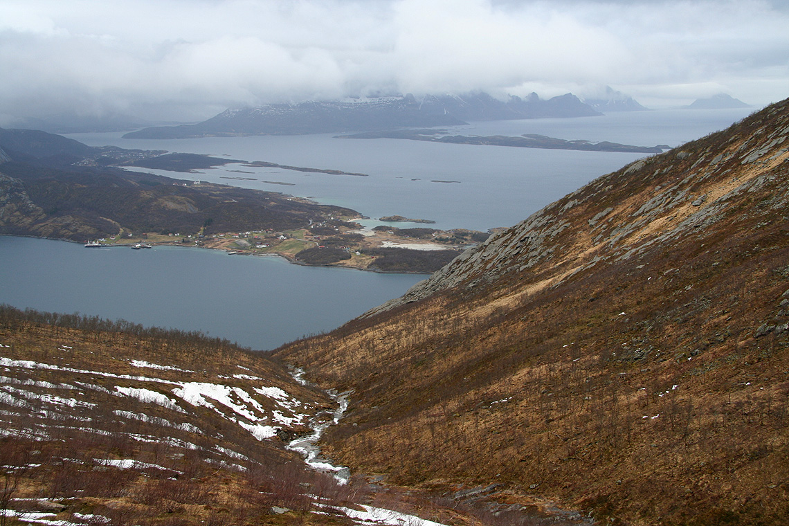
While descending, the weather cleared a bit and gave me a fairly nice view down to the fjord and
across to the rugged coastline that continues south. I reached the car at 1340 and
drove to the old mining town of Sulitjelma in order to
make a new attempt on Suliskongen, the second highest
mountain in Northern Norway.