Location: North 60.78394, East 005.71672 (GPS at the summit)
Difficulty: YDS class 2
Climbed July 15, 2022
Information:
How to get there:
From Bergen, drive north on E-39. Note the road fork to Modalen (also signed to Dale),
this road going right has Hwy. number 569. Take this road and drive approximately 4.8 kilometer.
Look for a small forest road that runs uphill on your left. Park off the highway at the
start of this forest road.
Route description:
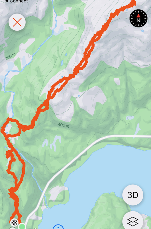
Walk up the road to the dam.
This is near elevation 280 meter.
Contine a few hundred meter along the trail near the river. If the
water is not to high, then cross the river. There are several spots with enough rocks to
cross in a safe way unless the river is going very strongly. If you cannot cross the river, then continue
along the trail to the old summer farm house, then onwards up the rightmost valley until it sort of ends.
One may traverse out to the right and follow a ledge that will gain the main south-east ridge.
If you cross the river, then continue up on grassy slopes to gain the main south-east ridge.
Follow small (animal) trails. A couple of steepish areas may be bypassed on natural ledges and gullys.
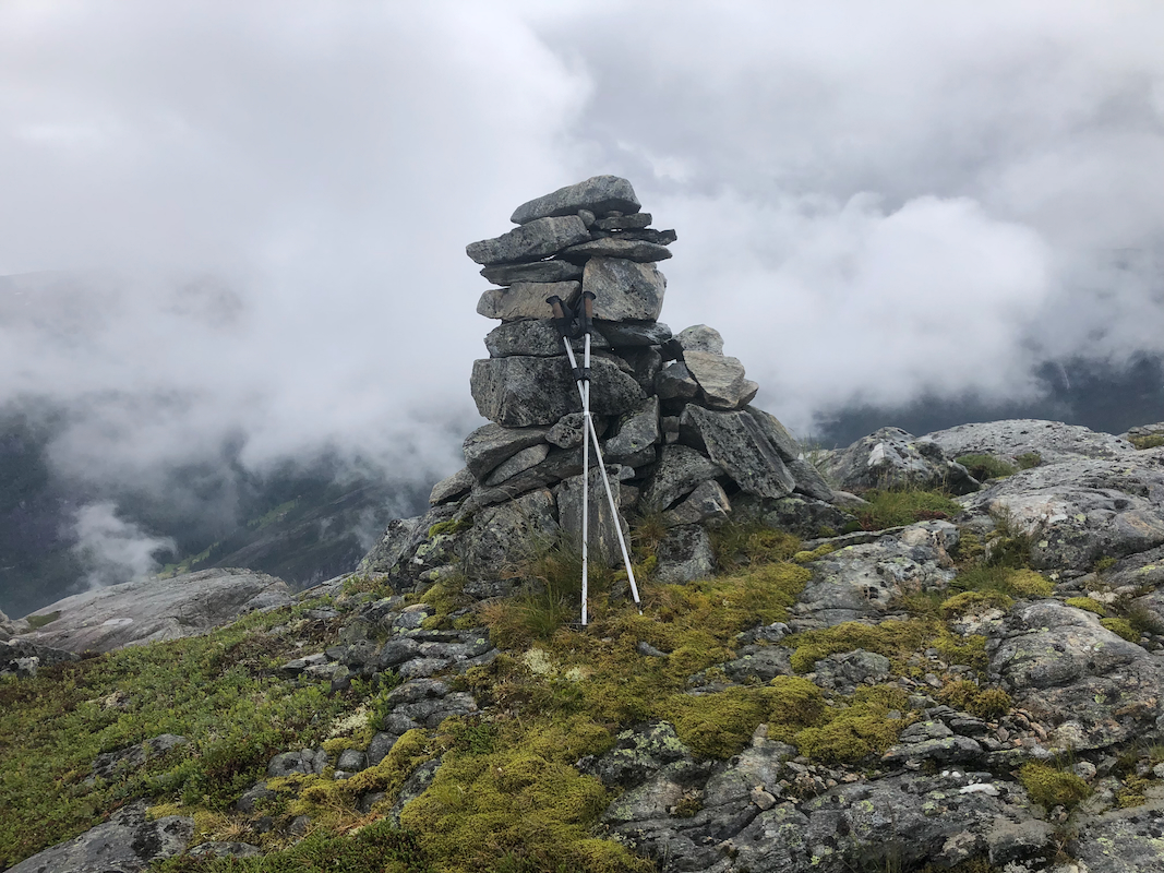
Follow this broad ridge all the way to the summit. Comments:
I came to the trailhead around 1115 and needed about 15 minutes to change into hiking gear.
The weather was not very good, quite a bit of rain, but also a few periods without rain, even short
periods with sunshine.
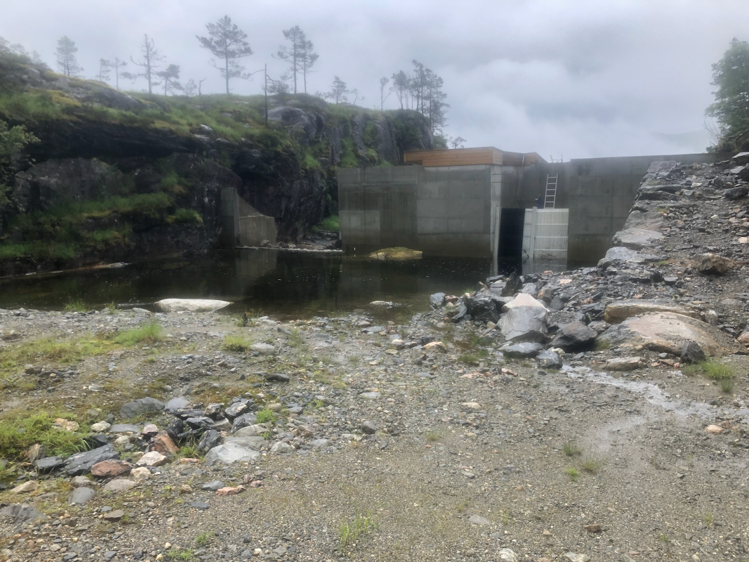
The road going steeply uphill is relatively new. It seems to be built in order to establish a small
hydro power facility higher up. The road had an ugly sign
all the way down near its beginning. This sign saying no access is likely in violation with
the law. They cannot block access to the mountain only because of some construction a long distance
higher up. In fact, they should faciltate access that is safe and if needed bypass the actual
construction.
However, as I suspected, there was not a single person present, everyone on summer vacation.
In such a case the sign should have been removed completely.
It was easy to cross the river and the uphill hiking was quite straigtforward. I arrived at the
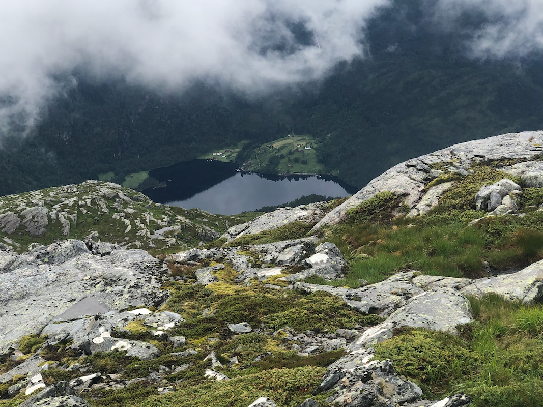
cairn 2:10 after leaving. Not much view, but I had a brief look down to the Modalen fjord.
After a brief rest, I continued back down along more or less the same route.
I got myself into some unpleasant terrain in the very first part, thus I angled a bit more right
and hit the river a short distance upstream relative to my uphill route. This was clearly better.
I was back down in 1:50, soaking wet. After a complete change of clothes, I had a nice and easy drive
back to Bergen.
