Location: North 60:13.983, East 005:31.198 (GPS at the summit)
Climbed April 10, 2008
Difficulty YDS class 1
Information:
How to get there:
From Bergen, drive south towards Os. Just north of Os, there is a large
traffic circle. Just before you get to this traffic circle, a small road runs left.
Take this road, after three speed bumps and a bridge you arrive at a road fork, keep right. Approximately
1.2 kilometer from the beginning of this road, there is parking on your left. (The road continues a short
stretch uphill serving a few houses.) This is the trailhead, location N60:12.744, E005:28.106, elevation 55 meter.
Route description:
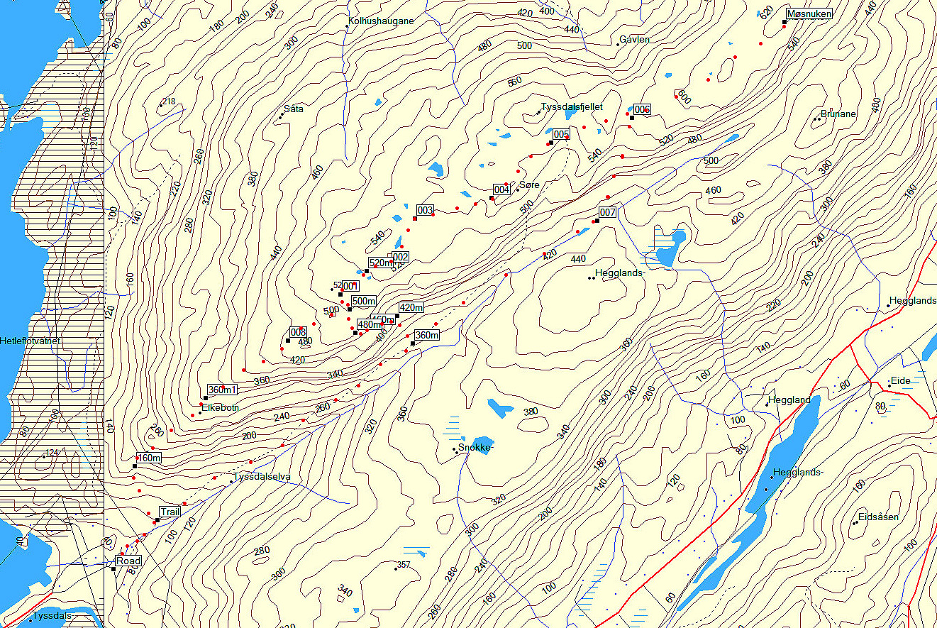
There are three trails to the summit. Curiously, the only trail that is marked on the map
is wrong. They are indicated on this map.
From the trailhead, continue straight, crossing a small bridge and going uphill in an open field.
You will soon arrive at a trailfork with good signs. Straight ahead is Møsnuken, while the
trail going left serves Tyssdalsfjellet and subsequently Møsnuken.
Consequently, the more direct approach is to continue straight here. The trail climbs steadily and joins
an old forest road (briefly) before it continues (as a trail) gaining elevation above the valley on the right.
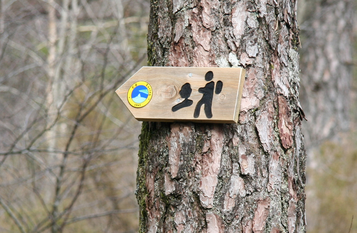
At location N60:13.261, E005:29.501, elevation 360 meter, there is a new trail fork. Just after this fork, you
will see this sign posted on a tree.
You may go left here and loop around or continue and take the next trail uphill (see the map).
The uphill trail runs more left higher up, then gains the mountain and continues just south of
Tyssdalsfjellet (Tyssdalsfjellet has only 41 meter of prominence).
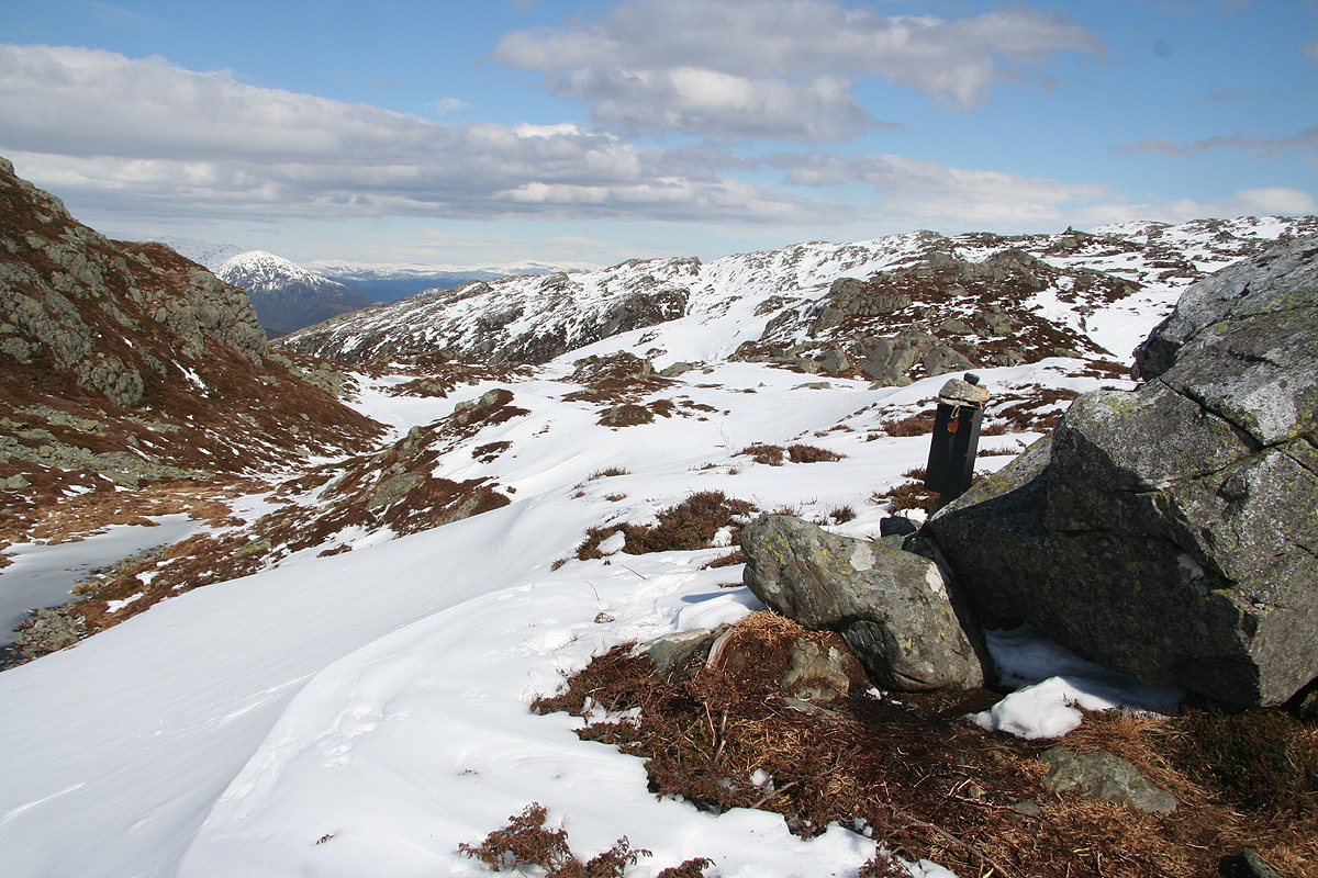
There is a trail register here, placed at location N60:13.584, E005:29.860, elevation 578 meter.
The trail continues with a few minor
ups and downs to the summit of Møsnuken.
Alternatively, one may continue straight along the main trail at elevation 360 meter, then turn left and
climb the slope that connects with location N60:13.765, E005:30.498, elevation 575 meter.
Comments:
I had been attending a two day meeting at the very nice hotel Solstrand in Os, about a 30 minute
drive south of Bergen. This meeting ended with lunch and I decided to climb Møsnuken on my
way home.
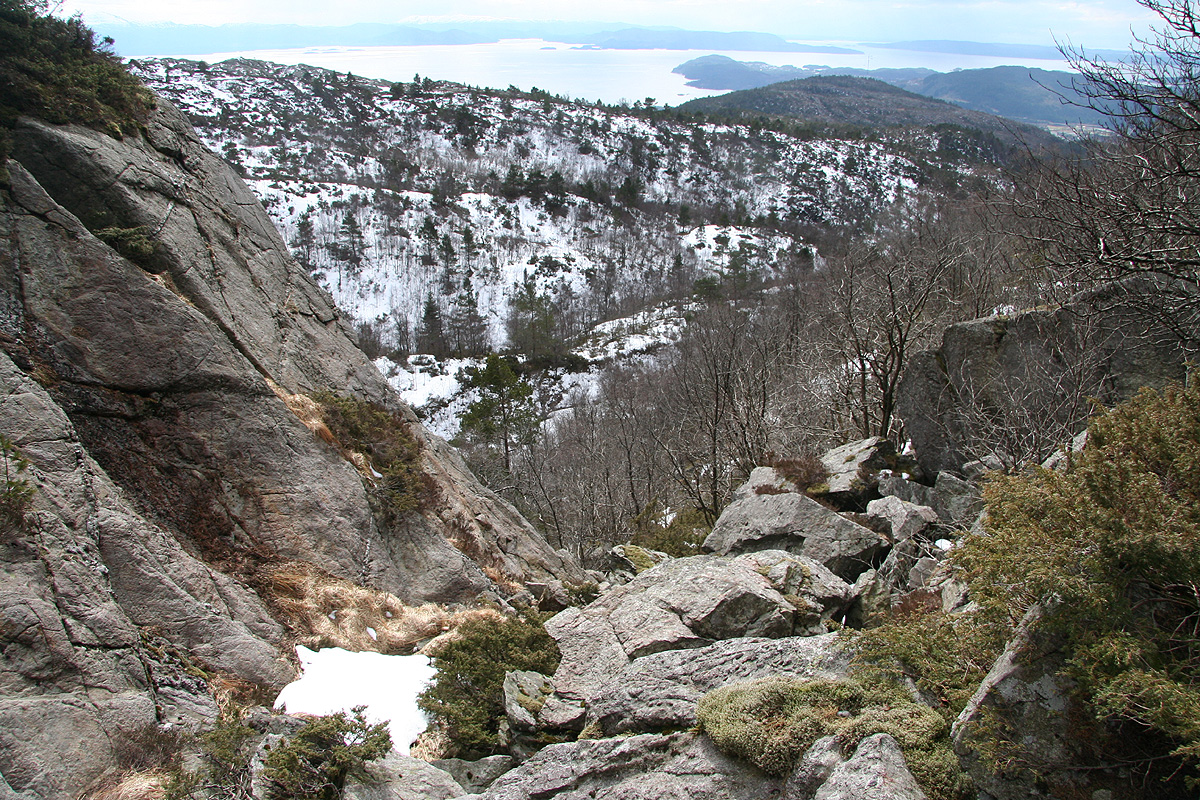
I left my car at 1245, and followed the main trail until I came to the distinct gully that climbs
left and that according to the M711 map, has the only trail that accesses the higher part of this
mountain. However, there was no trail here and the terrain was indeed a bit cumbersome. I continued
in easier terrain on the top, partly snow that supported me well. Arrival at the summit marker by
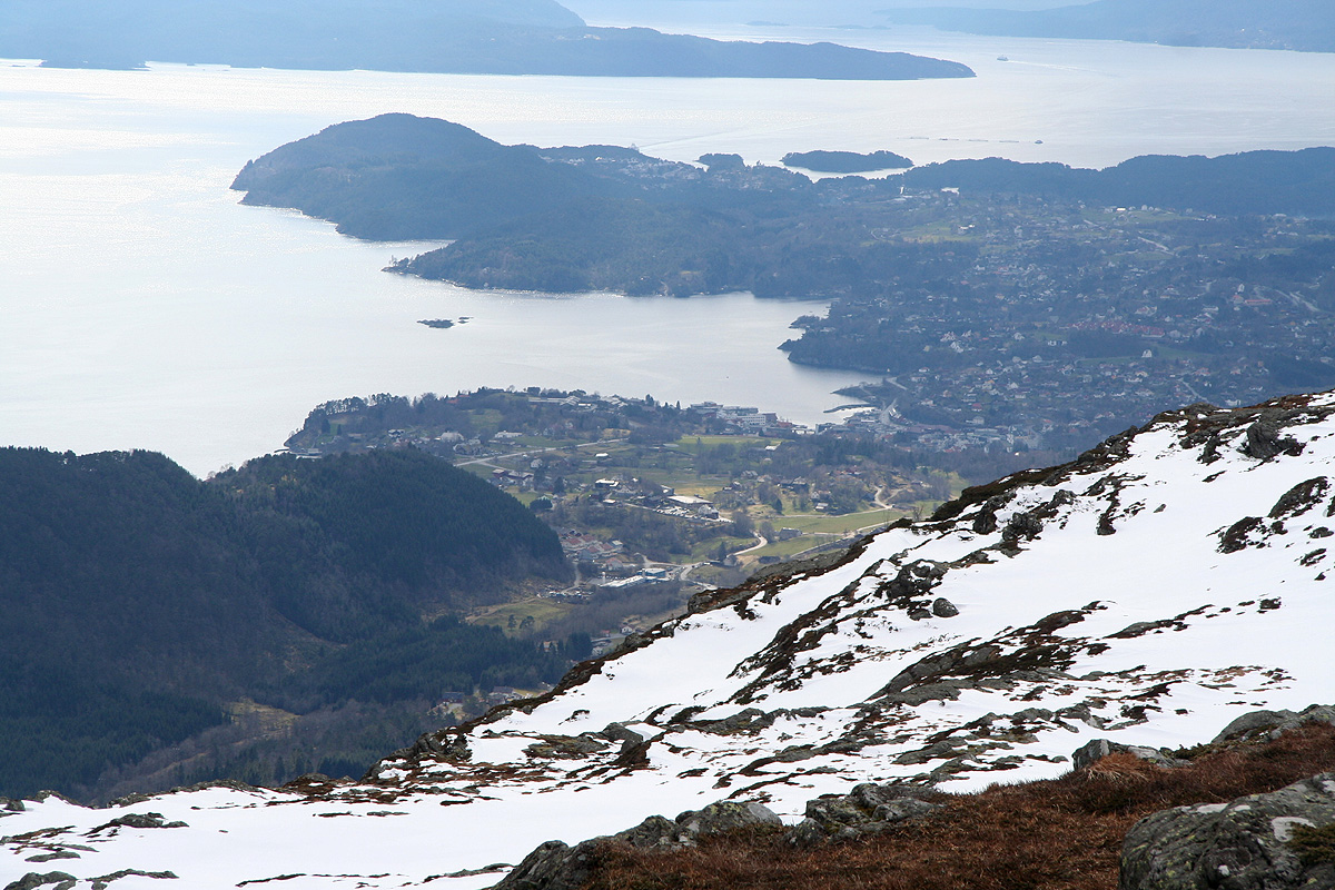
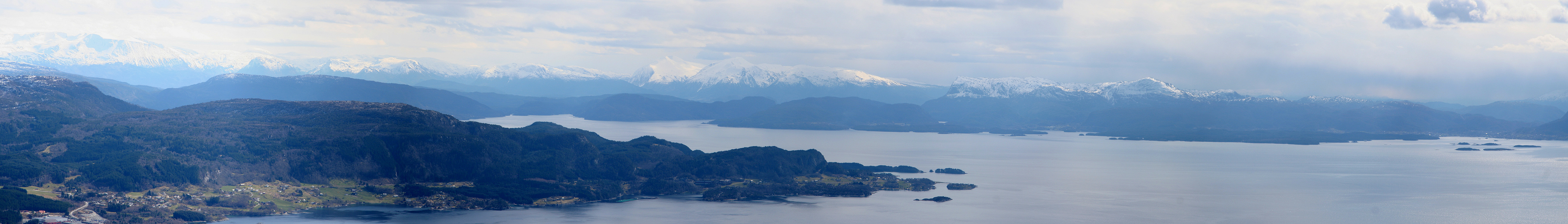
1415, the view from here is quite good. I signed the summit register, seeing that two other hikers
had been here earlier in the day. After about 10 minutes I started my return hike.
I noticed that a trail came up the natural (broad)
gully that was closer to Møsnuken than where I had ascended.
I decided to traverse most of the mountain plateau on my return hike. As I passed near Tyssdalsfjellet,
I noticed a second trail register (with the same two names). As I continued south-west, I noticed a trail
that took me to location N60:13.281, E005:29.219, elevation 484 meter, then more steeply back down to the
main trail at elevation 360 meter. I returned to the car by 1535.
Resources:
Images
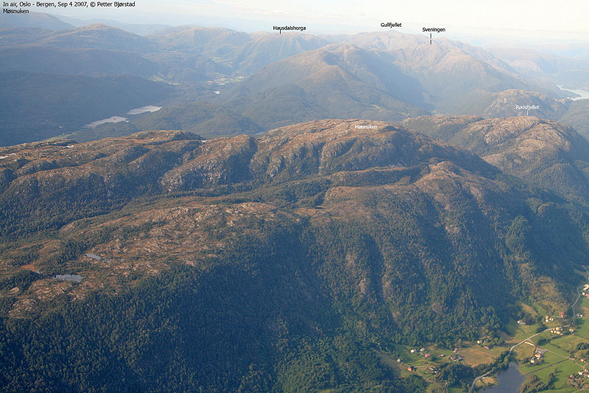
Møsnuken, as seen from the air on September 4th. 2007.
