How to get there:
This mountain is in Austevoll. From Bergen, take the ferry
from Krokeide, then drive south from Hufthammar.
Drive south along the west side of the mountain.
The Loddo trailhead has a signed exit (left) from the main road at a point where
the main road is running quite near the coast. The trailhead location is
N60.04668, E005.25938, elevation about 12 meter.
Route description:
Follow the nice walking path towards Loddo. Eventually, the path
turns into a more normal trail heading uphill. Higher up,
the trail again has several board-walks and staircases before
arriving at the summit. Keep right at a trail fork about 300
meter before the summit.
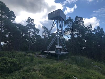
The summit has a tower with a small viewing platform on top.
The highest natural terrain is located quite close to the base
of the tower.
Comments:
I started from the trailhead around 1145, arriving at the summit
after 30 minutes. Heidi had continued to lake Vinnesvatnet where
she was going to do some recreational orienteering while I
collected my mountains. Thus, I descended back to the place
where I had seen a trail signed for Veten. From there, I
continued to climb Skaftafjellet.
Resources:
Images
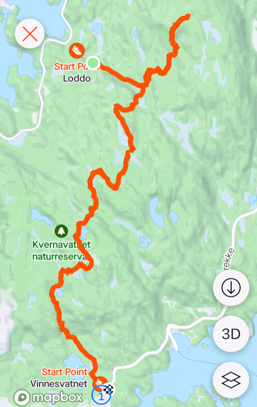
My route, to Loddo, Skaftafjellet and lake Vinnusvatnet.