Location: North 61:14.098, East 005:44.006 (GPS at the summit)
Climbed April 27, 2008
Difficulty YDS class 2
Information:
How to get there:
This mountain is located north-west of the small village Vadheim.
From Bergen, drive north on E-39 to Oppedal (approx. 1.5 hours), take the
ferry to Lavik and continue E-39 towards Vadheim. Approximately 27 kilometer from
Lavik, just as you are high above the fjord and can see Vadheim below you (in front),
look for an almost 180 degree turn left with a sign for Guddal. Take this road, it is
a pretty spectacular road with hairpin curves as it climbs a very narrow and impressive
valley. Drive this narrow road 6.9 kilometer. You are now in Røyrvika.
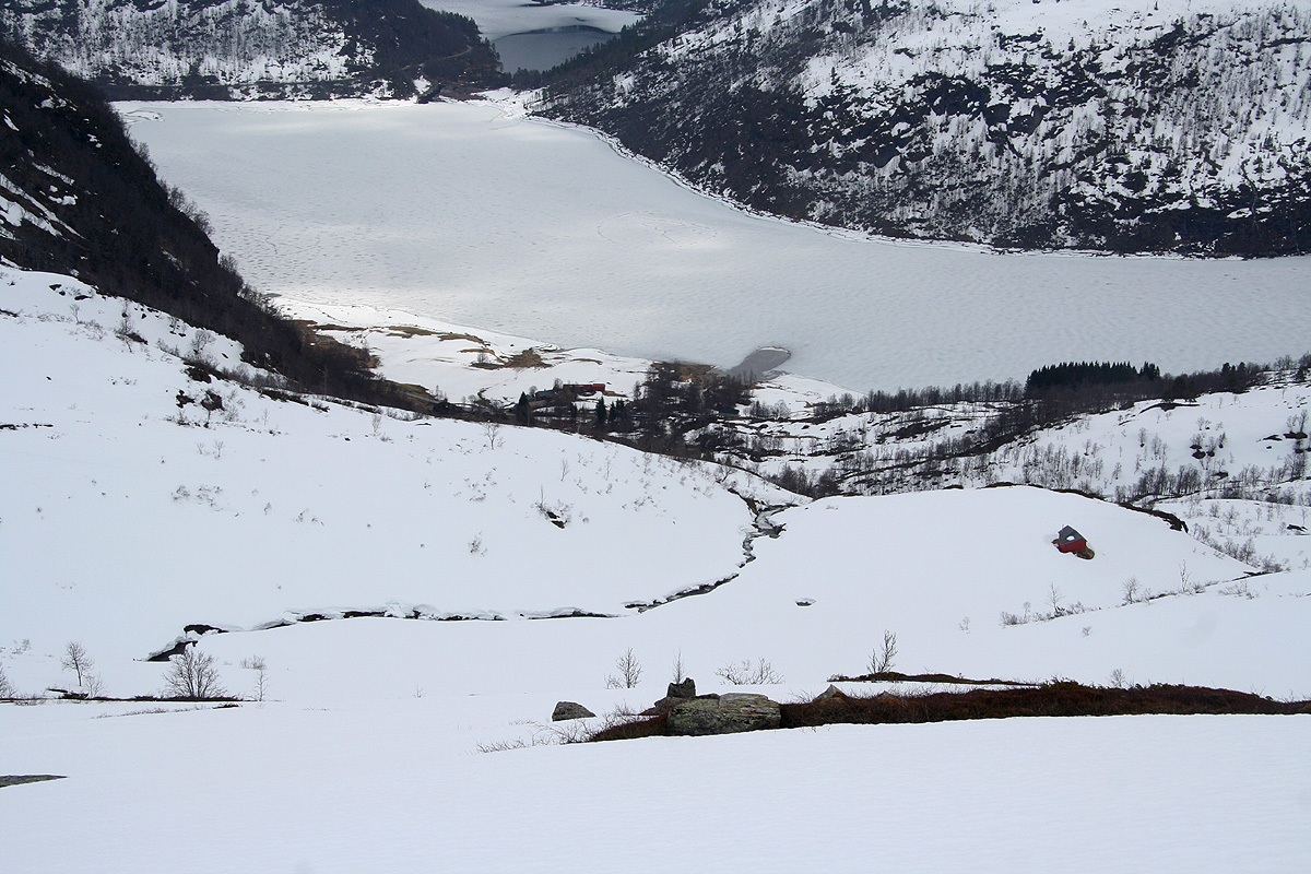
At this point you have a lake on your left
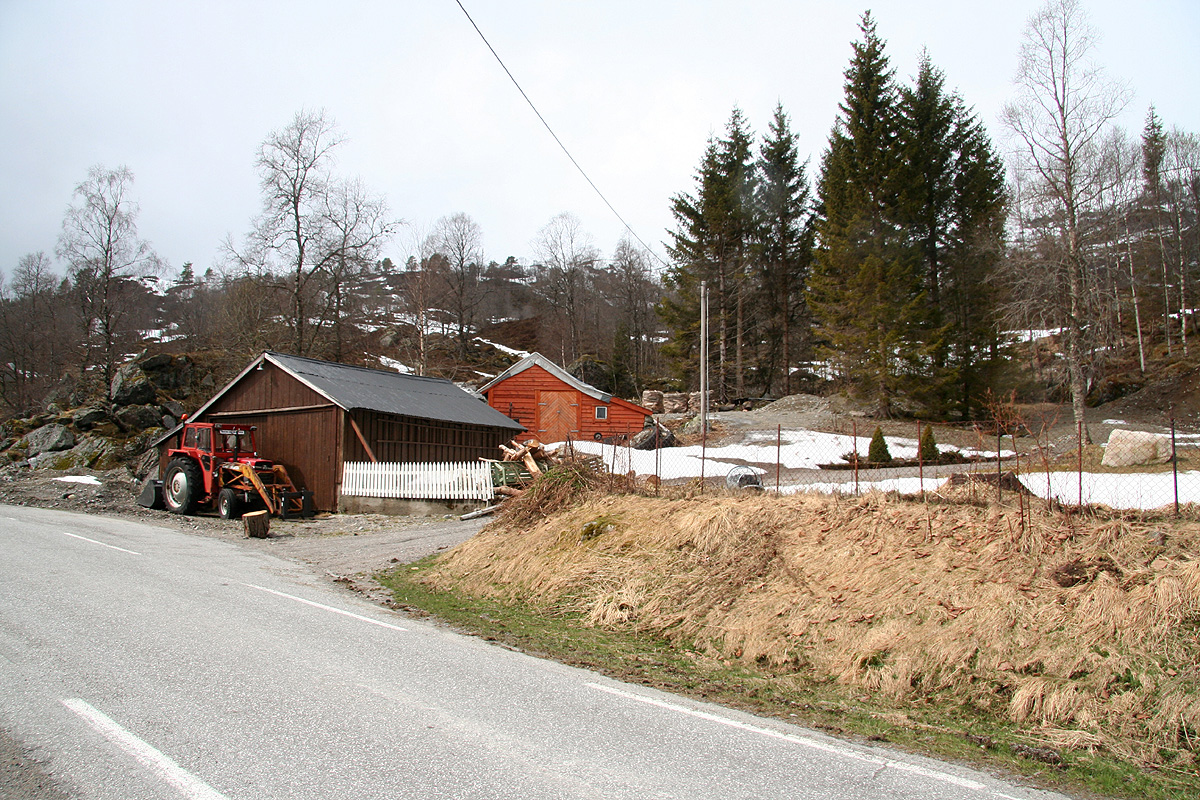
and you arrive at a few houses and a swift creek coming down from your right side.
Find parking here, there are a few turnouts. This is the trailhead, location N61:13.025, E005:45.001,
elevation about 356 meter.
Route description:
From the trailhead, head uphill along the creek. The snow is best on the left side of the creek.
The route is pretty obvious and soon, you will see the summit. You may pass the farm cabin named
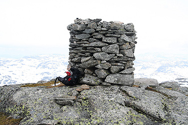
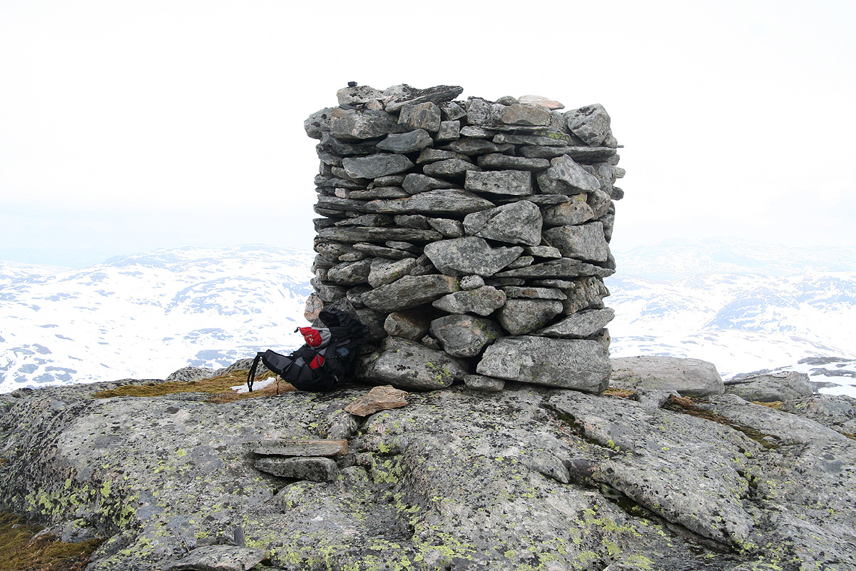
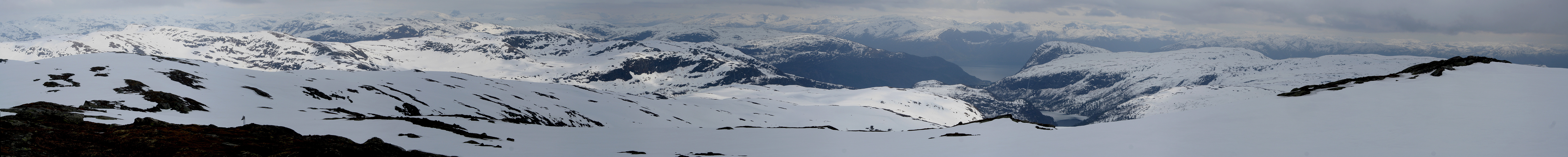
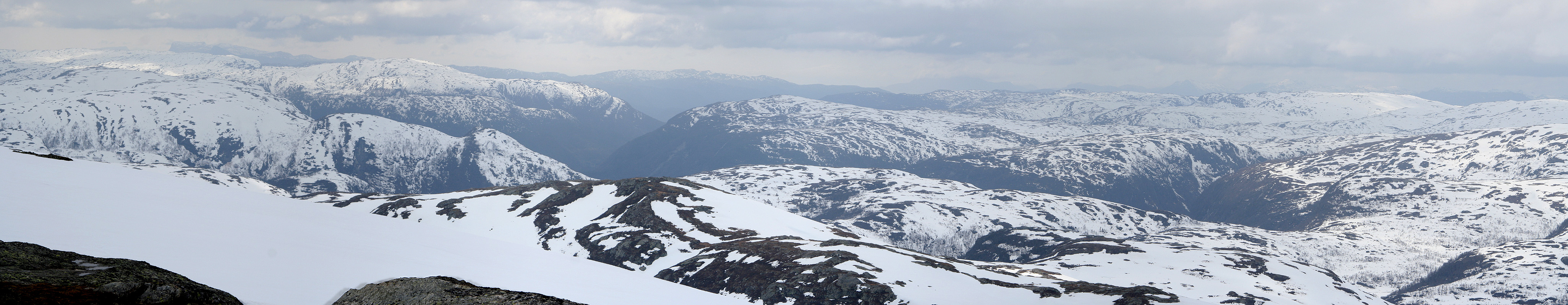
Røyrvikstølen along the way. The peak has good view in all directions and a very
nicely built cairn.
Comments:
This weekend had miserable weather in its forecast. I had decided to make a trip north to
climb Kvanngrødfjellet on Saturday, then stay home on Sunday. However, on Saturday morning
the weatherman suddenly projected good weather on Sunday. This made me change plans and schedule the
trip for Sunday. Later on Saturday, rocks fell (from high above) onto E-39, the main highway connecting
north. One rock slammed into the trunk of a car, the woman was lucky and escaped unhurt. The difference
between life and a certain death is just a few hundreds of a second, scary, scary. A young student was
instantly killed in a similar accident last year just a bit further north on the same highway.
This meant that the trip north would be longer and involve two ferries instead of one. I assumed that
they would reopen the road well in time for my return drive. As things were, I realized that this
trip would mainly be a long sightseeing trip along the west coast, hopefully with a nice ski climb
along the way.
I left Bergen at 1000 and arrived at the first ferry (Leirvåg to Sløvåg) at
1100. The next ferry would leave at 1215, long wait. Arriving at Sløvåg about 5 minutes
behind schedule, the 40 minute drive to Rutledal was now a 35 minute drive if the next ferry should
not be missed. The distance is 36 kilometer of narrow (one lane) winding roads. I had a few cars
ahead of me with the same destination, passing is out of the question, so it was sort of fun to just
"hang on" and hope that the drivers ahead timed this well. Indeed, we arrived in Rutledal just as
the ferry had completed loading local cars. On board and off we sailed in order to cross the
Sognefjorden, Norway's longest fjord.
Arriving in Rysjedalsvika, it was clear that my route would involve more interesting sightseeing
than originally planned. I drove north to Nautsundet, then east on the southern side of
Hovlandsdalsvatnet towards the small place called Guddal. I was very happy about the route, this
landscape was breathtaking. Waterfalls, lakes, steep hills and a very varied landscape.
I finally arrived at my trailhead around 1445, almost 5 hours after leaving my home in Bergen.
I started uphill at 1450 and climbed perhaps about 100 vertical meter before I could start
skiing. I noticed that one could ski almost down to the road a little bit further west. Skiing
was nice and I soon reached the top at 1600. The view was nice, however, clouds everywhere so
no good for panorama pictures. Leaving the summit at 1610, I skied slightly further west
and reached the car in 30 minutes.
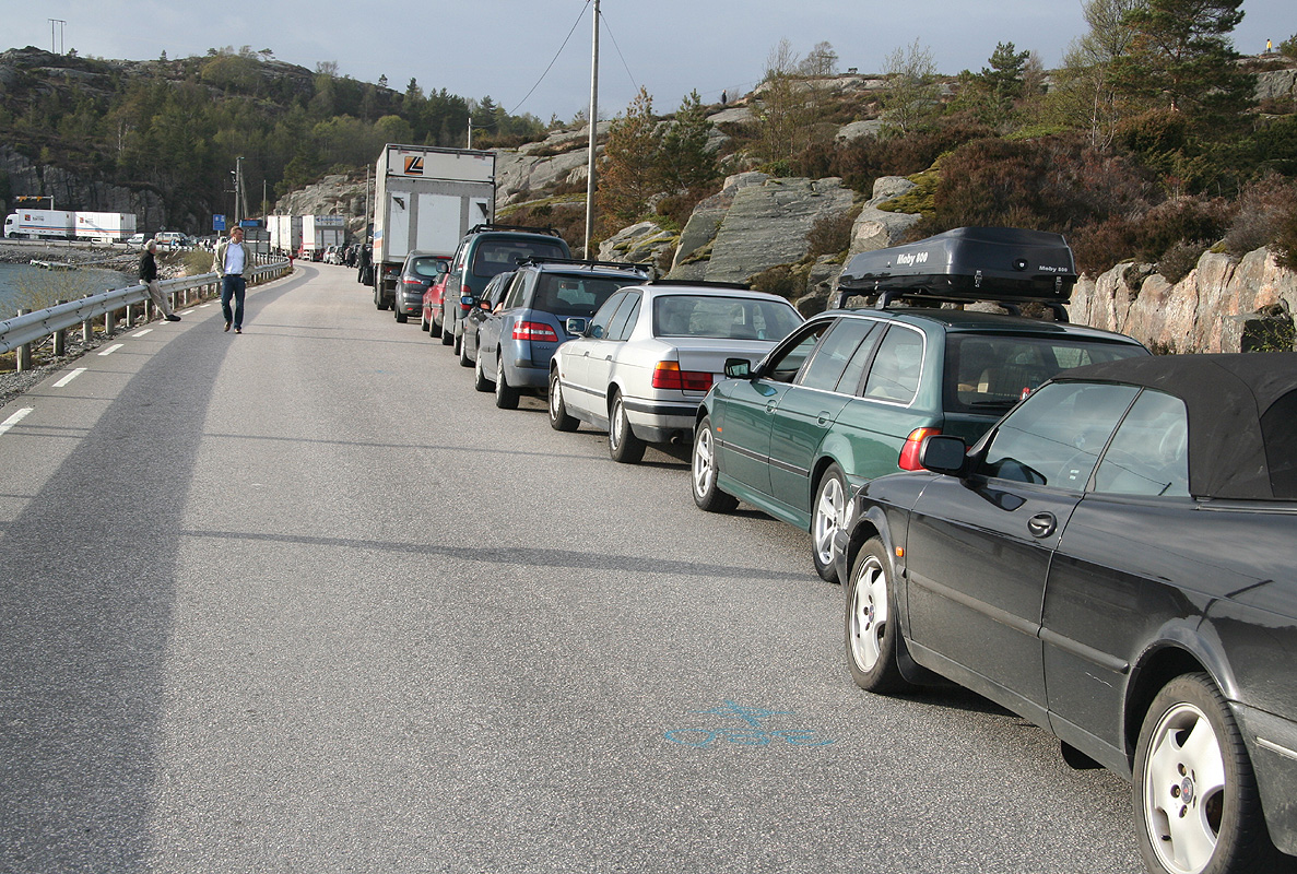
Driving back to Lavik, I got the news that the E-39 highway back to Bergen would remain closed
the entire day. I made the 1730 ferry from Lavik and as a long line of cars (and trucks) took the
road along Masfjorden, I made a quick decision to drive via Brekke and Yndesdalen to Hosteland
and Sløvåg. This road is 4 kilometer longer, very narrow, but takes you through
another beautiful part of Western Norway. The gamble paid off, I only met one car on a stretch
of more than 30 kilometer. Thus, arriving at Sløvåg, the cars lined up for the
ferry all came from the 1630 and 1700 ferry from Lavik. Still, the ferry queue was long and
it soon became clear that I would only catch the second one. This ferry takes a full hour to
complete a round trip. The idea to add an extra ferry when the main E-39 highway is redirected
here on a Sunday (return to Bergen from a weekend type of traffic), obviously never
occured to the people responsible for roads and traffic. However, the weather was nice and
I was in no real hurry. Getting to Leirvåg around 2100, I made it back to Bergen
by 2200, exactly 12 hours after departure.
Resources:
Images
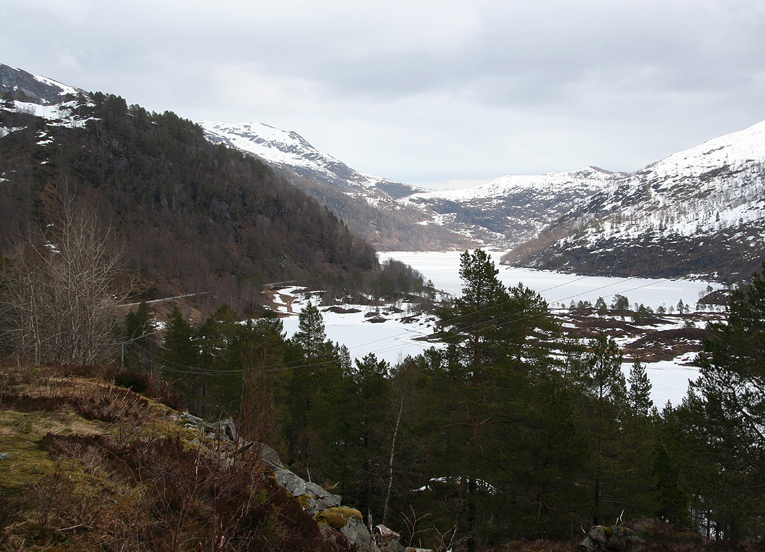
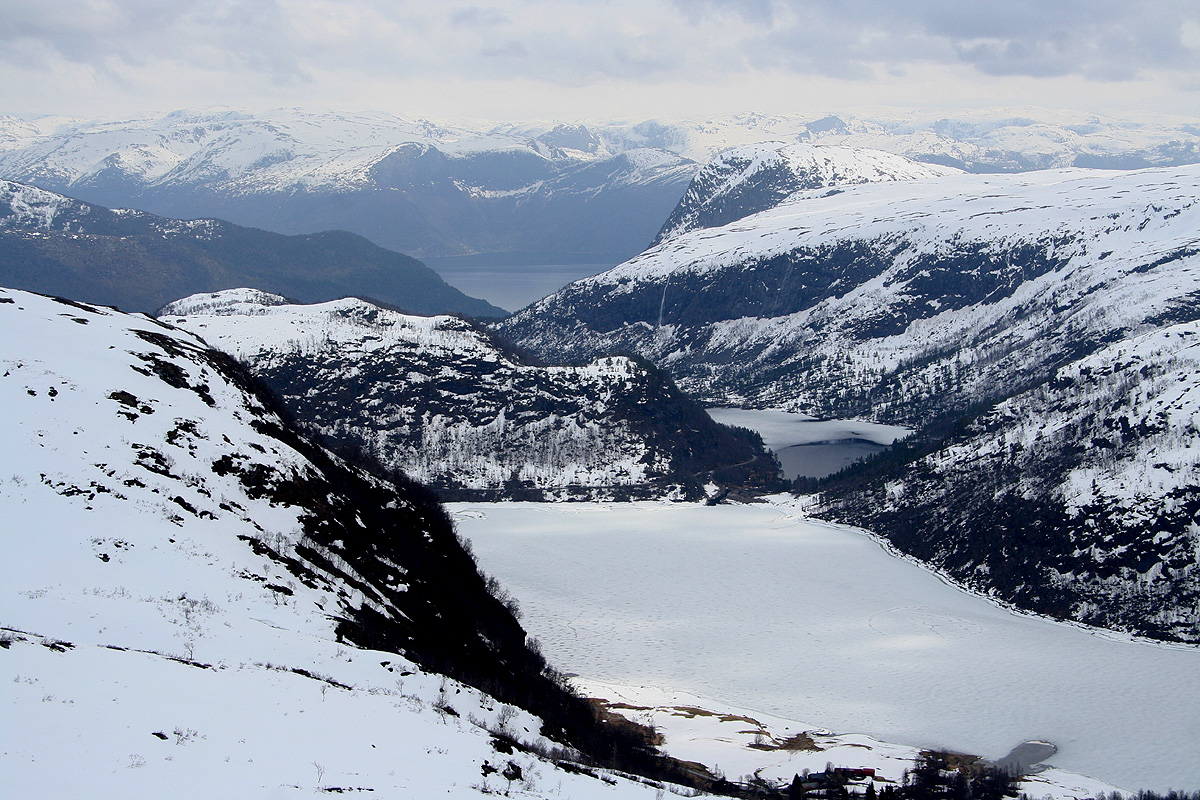
Røyrvikvatnet, the view is east. I am approaching the
trailhead from the west.