Location: North 60.80495, East 005.87739 (GPS at the summit)
Difficulty: YDS class 3
Climbed July 17, 2022
Information:
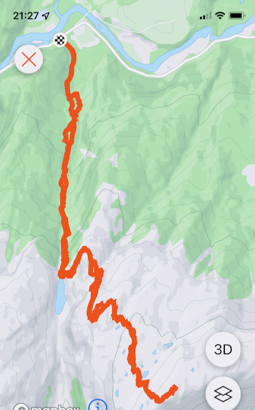
How to get there:
From Bergen, drive north on E-39. Note the road fork to Modalen (also signed to Dale),
this road going right has Hwy. number 569. Take this road and drive
towards Dale, you pass Mo and cross the river on a narrow bridge. When you come to the
fork where the road to Dale is about to enter a long tunnel, leave the main Hwy. by going
straight (do not turn right). Continue about 2.8 kilometer, an old forest road forks right.
There is room for a few cars to park. This is immediately before a small bridge.
There is a trail sign saying Høvik 11 kilometer. The location is
N60.83125, E005.85925, elevation near 20 meter.
Route description:
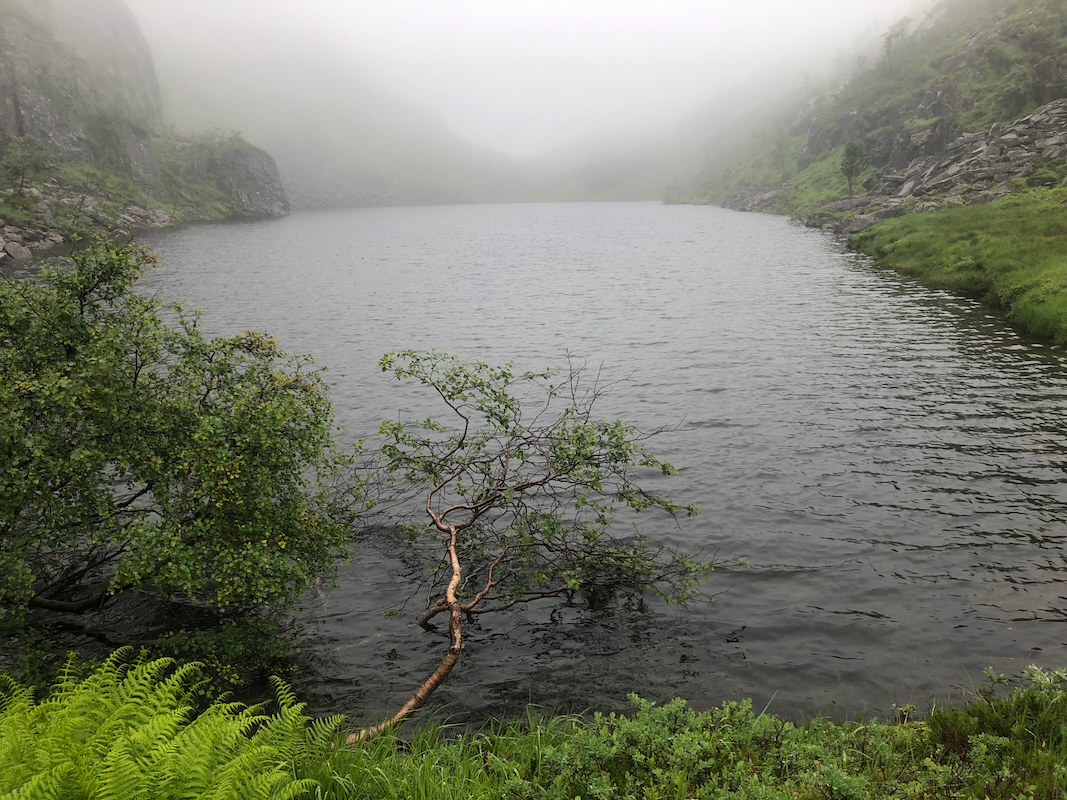
The route first follows the trail to lake Hevikatjørna, elevation 553 meter.
This is easier said than done. In old days, this trail connected two valleys, but they
are now connected with the tunnel (opened in 1976) that is almost 50 years old.
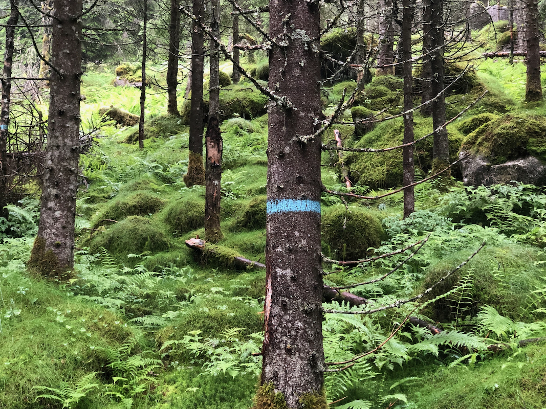
It looks like few people have used this trail since the tunnel was built. It is marked
with (old) blue paint on the trees.
This can be seen, however in many places there
are no visible trail. Many trees have fallen across the trail and fern is growing with
no visible trace of where the path goes.
This is particularly true in the upper section
of the route before the lake.
The trail does cross the creek about half way up and continues
on the left side.
Towards the end, the route climbs a natural rib, then traverses right. One will
see a faint trace, but it is hard to follow all the way.
From the lake, head up to the left,
cross under some power lines, continue up a broad
ramp going (hikers) right. Then aim for the summit. You will arrive at the base of
steeper terrain. Just right of a small lake, one may ascend left, then right to gain
more gentle terrain higher up. There are a couple of (YDS) class 3 scramble ppints here.
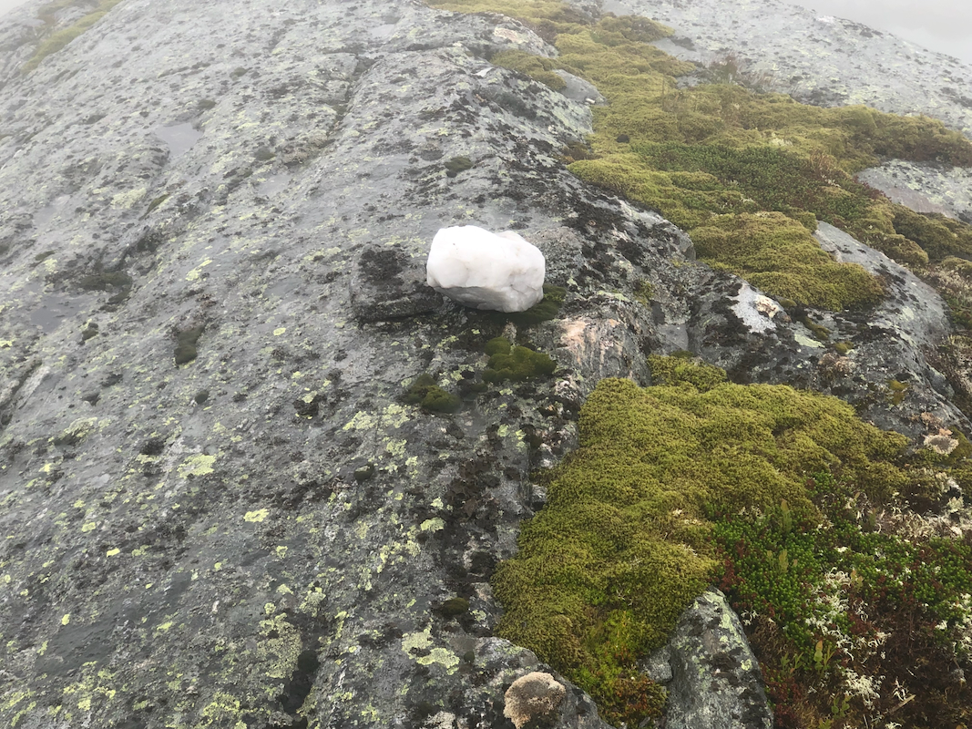
The highest point is a curved, pretty smooth rock surface
marked with a white rock
(credit: Rune Blomberg in 2015.)
Overall, this route was pretty complex and it is very likely that an ascent from the
east side (Eksingedalen) is preferable.
Comments:
I started pretty late at 1145. It soon became evident that the trail, marked as a pretty
major passage on the map, had seen little use, at least in the past 20-30 years.
Hard to follow, impossible without the blue marks.
Higher up, I lost the path among dense ferns, while traversing going right. I then found it
again higher up. It was raining and I had fog with very limited visibility.
After the lake, the terrain had several cliffs blocking direct access, but navigation was
overall not too hard. It turned out that the final steep ascent was possible more or less
straight up. I visited two competing summit points.
The map shows the one south, while it
appeared (hard to see in the fog) that the bump slightly north marked with a nice, white
rock is indeed the highest point.
I was there shortly before 1500. The ascent had taken 3 hours. I realized that my second
goal for the day, Nipekråni, would be left for some future trip. After a short
stop, I retarced my route of ascent using my GPS. No point in trying anything new
in this fog. I was back down by 1745.
