Location: North 60.89735, East 005.62775 (GPS at the summit)
Climbed January 14. 2022.
Difficulty YDS class 2
Information:
How to get there:
Drive E-39 north from Bergen. Continue passing Romarheim, crossing
the mountains, then descending to Matre at the innermost
place in Masfjorden. Immediately after you pass some powerplant
installations on your right, turn right onto
Hwy. 5442. Drive this road about 4 kilometer. Fork right onto a smaller
road serving a power plant and cross a small bridge.
Park right next to the first building on your left, this is location
60.90086, 5.61746, elevation near 65 meter.
Route description:
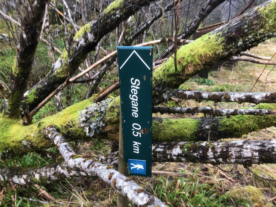
Locate the beginning of the trail very near where you parked, close
to a pipeline that serves the old, nearby building. There may even
be a sign pointing to the sky,
maybe just a hint that this trail
will proceed steeply uphill.
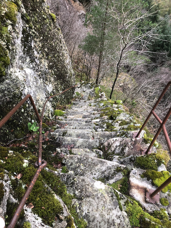
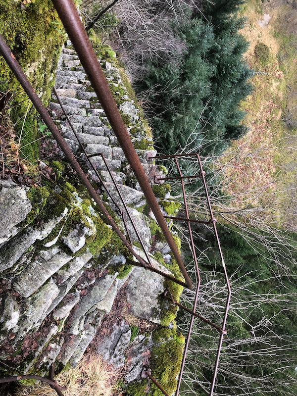
Follow the trail uphill through some dense forest (big trees). The trail
is badly eroded here, but there are clear signs that this used to be
a nice trail. You will soon have steeper terrain above, looking left you
should see the lower
part of a staircase built from stacking natural
rocks. There is a hand rail for increased safety.
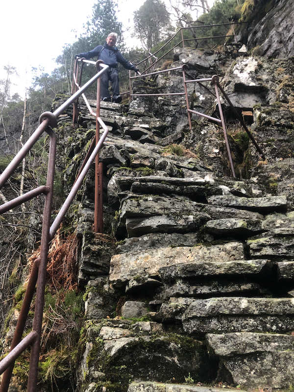
From here, the trail is very clear, there are several
sections of steep steps all
built manually by stacks of rocks. There is a hand rail supporting
all these sections. Eventually, you reach about 250 meter of elevation and
the trail almost as wide as a small road, curves around left to reach
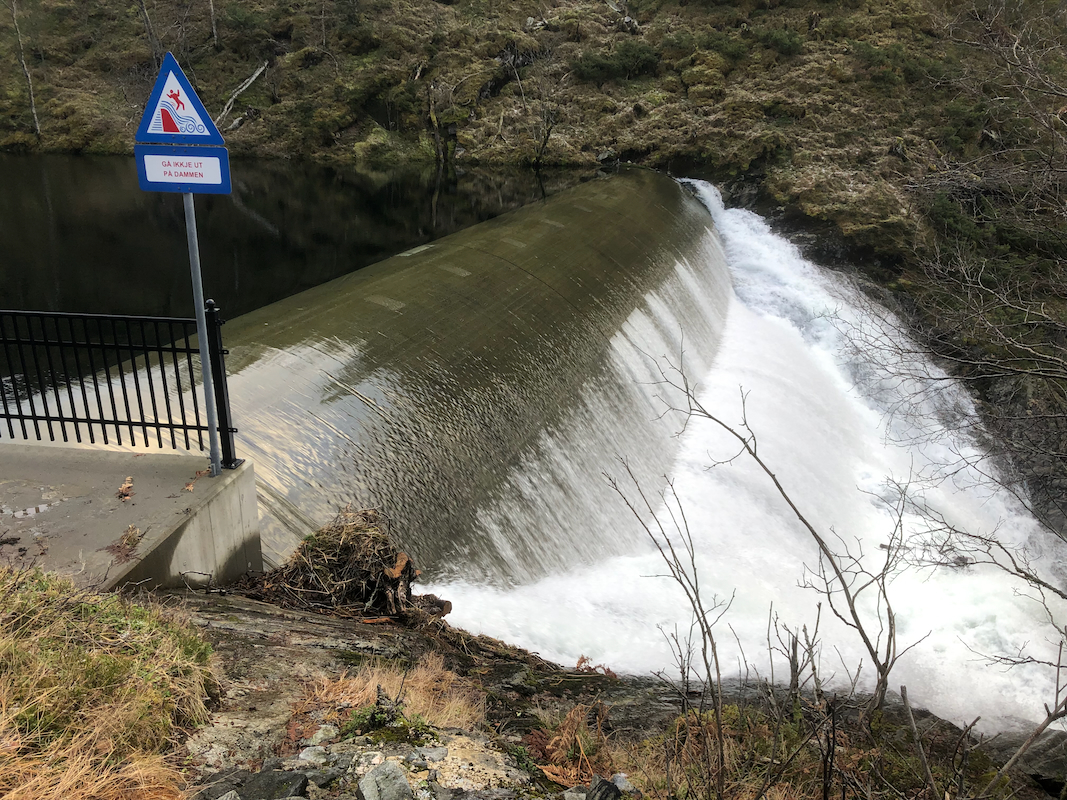
the small dam that has been built to support the hydro power plants
below.
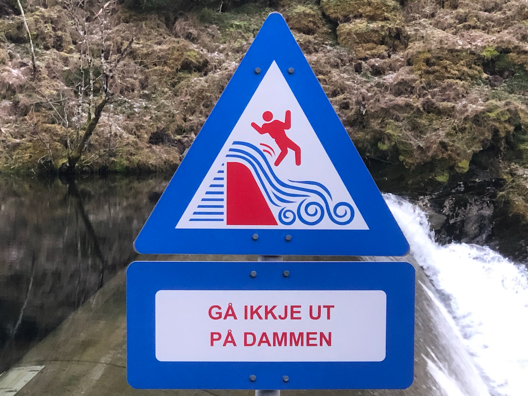
The next problem is to get to the other side of this dam. If the water is
flowing across the top of the dam one should not attempt to walk across.
There is a warning sign posted
that one generally should not walk on top
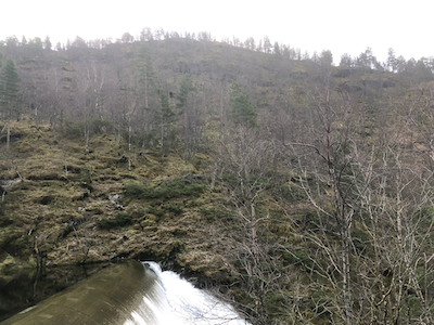
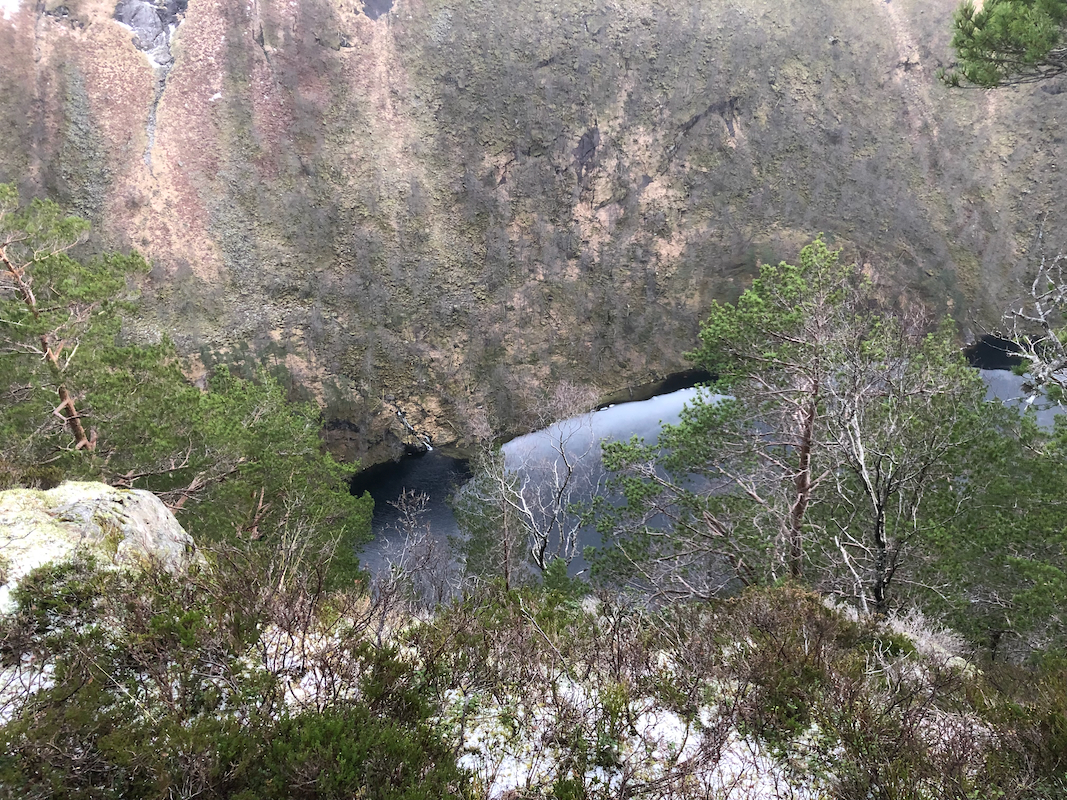
of the dam as there may always be some danger of falling off. The river
below cascades down to the impressive Hummelfossen waterfall, thus it is
extremely dangerous to fall into the river.
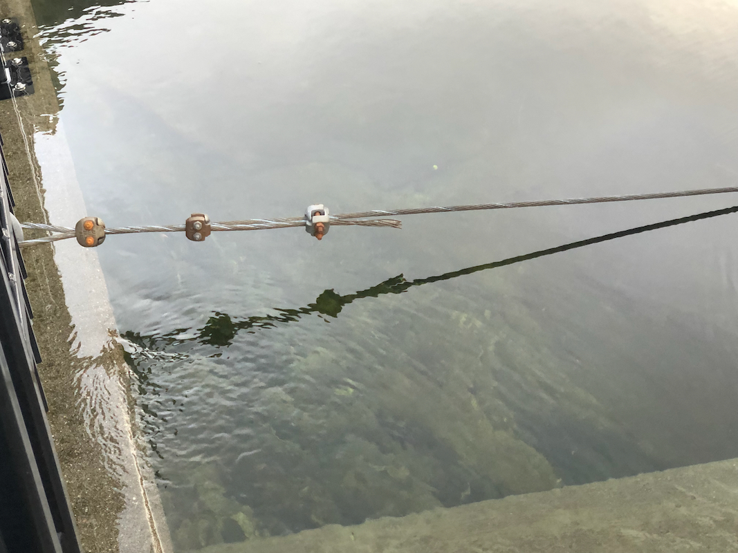
Upon closer inspection, a metal wire has
been strung across, just on the inside of
the dam. A carabiner and a (long) sling attached to a harness will certainly provide
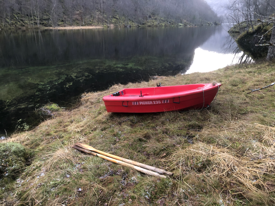
protection if crossing. A better alternative is to check if one could get
permission to use a boat. There are some boats located a short distance upstream along
the lake.
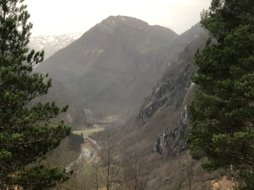
Assuming that you are able to cross safely, the route now
ascends a fairly nice hillside
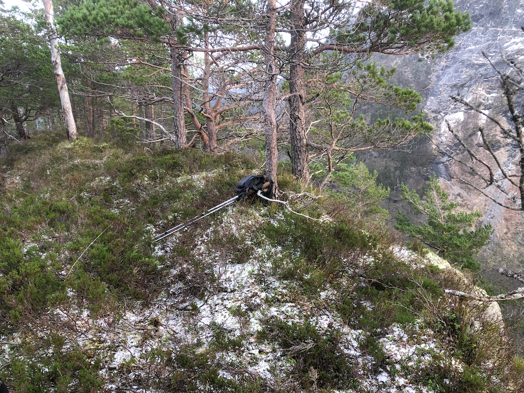
in order to gain the summit. The summit is very close to the steep south
side dropping almost 250 meter directly down to the lake Litle Hummelvatnet.
Comments:
I did this hike with my friend Eric. We had already visited the nice viewpoint
overlooking Matre, called Matre-Nipa.
Parking next to the old power plant, we first
headed over to get a straight view of
the impressive Hummelfossen waterfall.
A big storm (named Gyda) had just passed, dropping a lot of rain (not snow) and
thus all creeks and rivers were running at capacity.
We started hiking at 1215 and quickly got to the first steep steps leading uphill.
Impressive manual work to stack all these rocks in a stable fashion.
Work on the old power plant started in 1917,
so this trail was built more than 100
years ago.
Arriving at the dam, it immediately became clear that
we could not cross on the dam as
planned. Earlier trip reports indicated that this was possible, but the river was
going at capacity with lots of water flowing across the top of the dam. We therefore
assumed that this hike would be limited to the nice ascent of the old historical trail
and that we would have to return at a different time when the dam would by dry on top
and permit crossing.
However, Eric soon discovered boats pretty close to the dam and we decided to
borrow the smallest one in order to complete what would be a quick and easy ascent
on the opposite side.
We arrived at the summit at 1330, nice views.
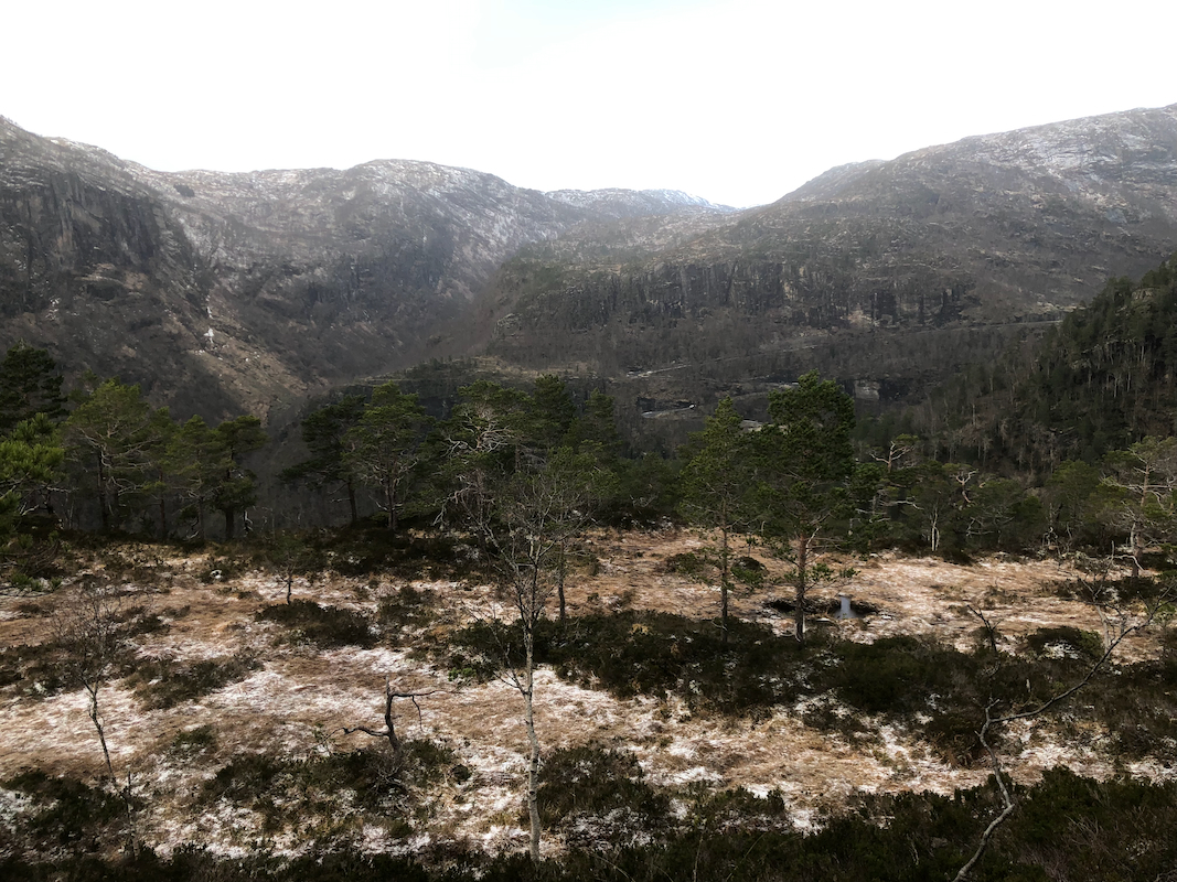
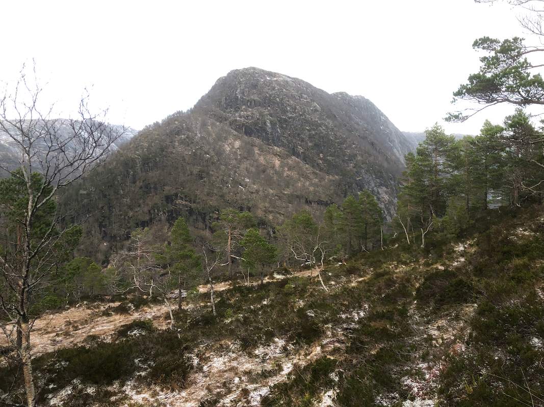
The landscape is very rugged and the
drop down to the Litle Hummelvatnet impressive.
The big mountain across, Gråfjellet,
seems quite close.
Returning at 1340, the descent was quick and efficient.
We were soon back down by the boat, a quick
crossing then We put the boat back in its
proper place. Many thanks to the owner, whoever that is. We subsequently descended
the steep trail with its many rock steps,
arriving back down by the car well before
1500.