Location: North 60.59540, East 005.77070 (GPS on the summit)
Climbed October 29. 2017
Difficulty: YDS class 2
Information:
How to get there:
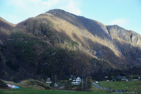
From Bergen, take E-16 towards Voss. The first village after Vaksdal is Stanghelle.
Drive through the first tunnel after you have arrived in Stanghelle, then exit left
(sign may read Helle), before the next tunnel. The narrow road will lead towards the
fjord, then cross it on a very narrow suspension bridge. Just before you arrive at a
railroad crossing, pull over and park on the left hand
side of the road. This is the trailhead/parking, location N60.56590, E005.75335, elevation
about 3-4 meter.
Route:
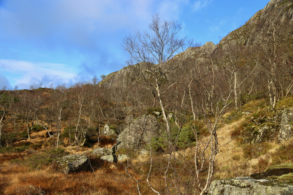
Continue along the road in order to cross the railroad. Next, turn left uphill, this road
serves some private houses. Cross the creek and turn uphill along a small, short tractor
road. Locate a small trail that climbs out on your left. This trail will soon cross the
creek, this time left to right (facing uphill), then continue along the trail uphill. The trail
is marked with some red paint.
A bit higher up at a fairly flat area, the trail forks. There are wooden signs. The trail to
Hestafjellet follows the right fork. The trail continues its ascent up the valley located between
Storafjellet (west) left, and Hestafjellet (east) right. The main trail, however, serves Storafjellet,
there is no marked trail onwards to Hestafjellet.
There is, however, clear signs of a small trail that leads to a good way up the steep
cliffs that block easy access to the higher parts of Hestafjellet. Leave the main trail and
continue up along meadows that gradually bring you
closer to the cliffs. There is a pretty
distinct drainage (running south-west) above you, the access is marked with a rock on top
of a larger rock. You should see traces from previous people if you are at the right spot.
Follow ledges as they zig-zag uphill while conecting to each other. This route stays at
(YDS) class 2, but one may easily run into class 3 terrain in this area.'
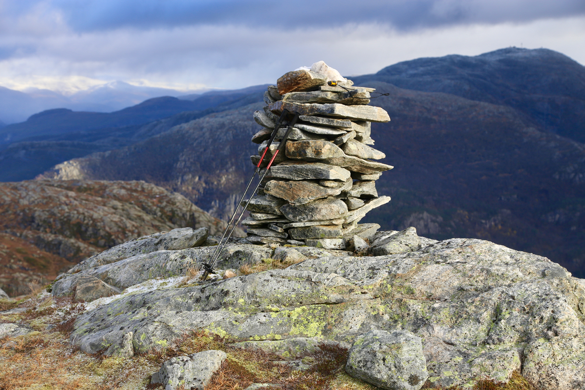
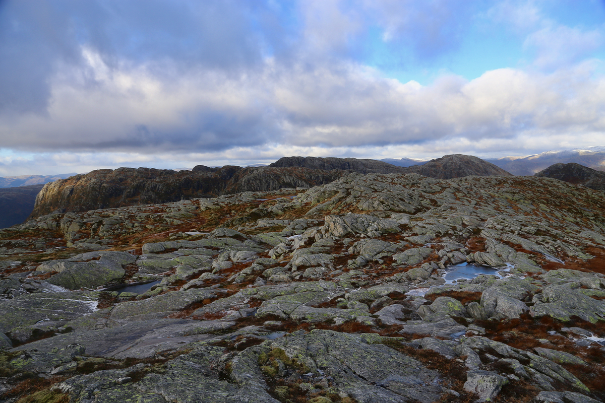
Higher up, the terrain is more friendly as one continues to a small (false) summit that
exceeds 800 meter. This summit (loc. N60.58725, E005.7613) has a
large cairn, but it is located about one kilometer
before you reach the proper summit. Comments:
I had looked at this mountain many times, while driving through Dale.
It was about time to climb it. My plans called for doing a few smaller
hills near Norheimsund, due to an injury in my left leg. However, as I
reached Trengereid, I made a quick new decision and drove to Stanghelle.
The only problem was no map or GPS data, I largely ignored this as the
ascent looked straightforward.
Ready to leave around 1120, I headed up the forest trail and soon arrived
at a (signed) trailfork. I headed left and quite far uphill, I ran into a new sign
for Hestafjellet, this one pointed back down or at best directly right out into
what looked like a cumbersome hillside.
I was now below the cliffs of Storafjellet, but without any map, my only idea
was to somehow ascend higher.
I headed off into rather complex terrain, gradually making my way back to
the upper end of the distinct valley that separates Storafjellet from
Hestafjellet. This took considerable time and I was quite happy
when finally connecting back up with my former trail.
No trail seemed to fork right to Hestafjellet, I thus continued past the
highest col wanting to explore if the cliffs above could be turned.
This was not successful, I therefore decided to ascent right uphill if at all
oossible. This strategy got me to the first cairn, then onwards to the true
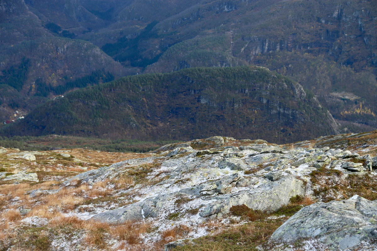
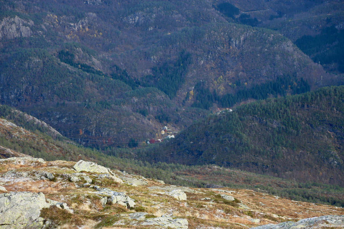
summit, arriving there 1400. The view was pretty good. I could see the small
hill Beitelen near Dale as
well as the general area of Dale,
very rugged terrain around here. The view
onwards to Høgenipa was also good.
The weather was ok, but windy and
I turned back around 1415. A better route back was a given, the first question
where to descend more directly back. I followed the main drainage, first on the right hand
side and the way down presented itself quite easily. There were clear signs of
other people having used this route, below the cliffs even some modest markers, a
rock having been placed on top of another in a few key locations.
I next followed the trail back down to the fork where I had gone wrong while
ascending. I was quite determined to try to get the offending sign somehow
corrected. However, to my surprise and embarassment, the signs looked perfectly
ok upon closer inspection. Thus, my navigational error earlier in the
day had absolutely no excuse. I continued down the last section, arriving
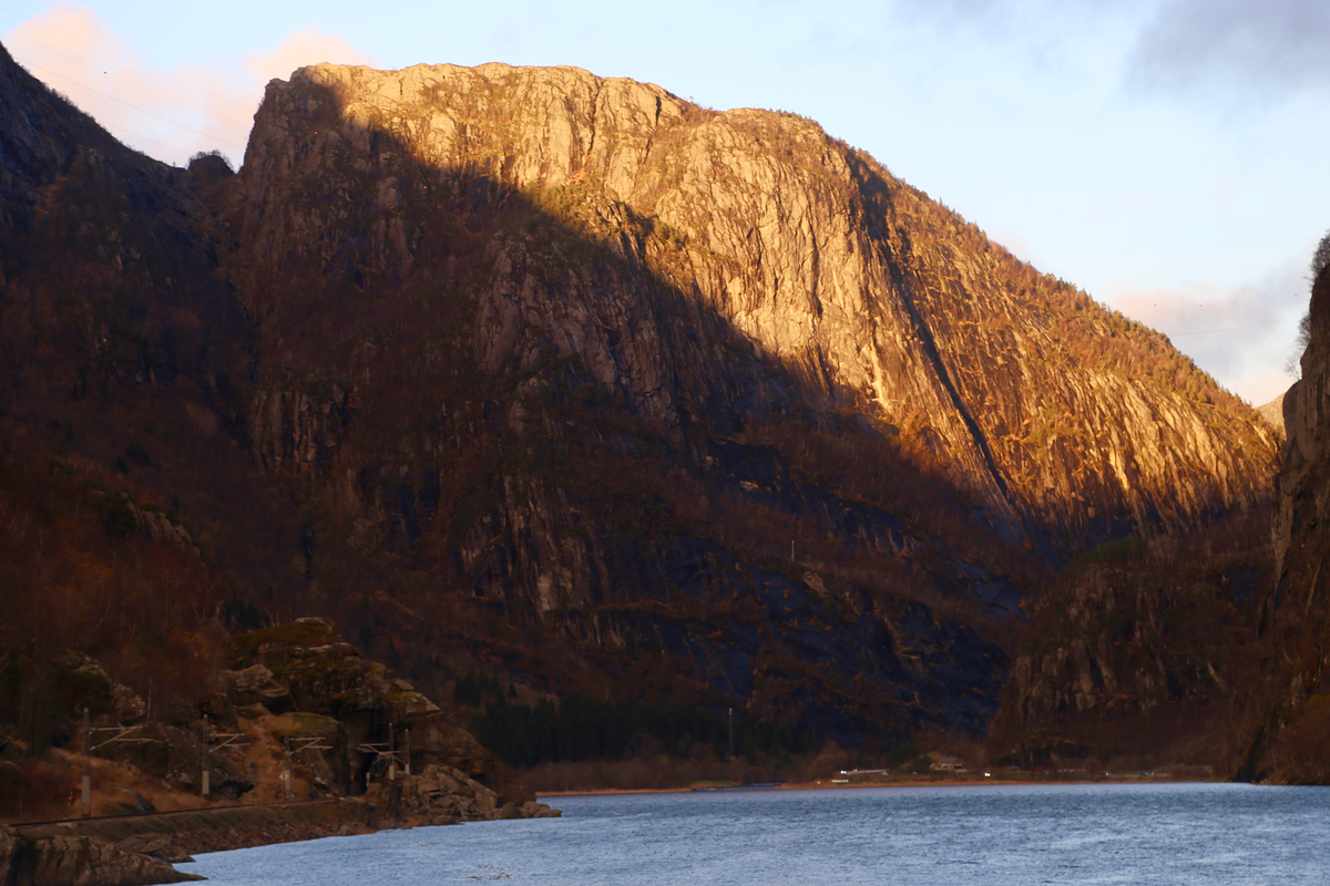
at my car at 1600. The sun was striking the cliffs a last farewell as I
drove home where a warm sauna and a delicious dinner were waiting.