How to get there:
Driving Hwy. E-10 from Leknes towards Svolvær, after about 20 kilometer
the road crosses a col before descending to lake Hauklandsvatnet. In a sharp right
curve, a road forks left signed for Kvalnes. Take this road. After passing lake Urvatnet,
you enter the small community Bø. Look for a small parking spot on the left hand
side of the road, near location N68.32354, E013.91849, elevation about 15 meter.
Route:
Look carefully to find the trail on the opposite side of the road. In any event
proceed to hike up the valley starting across the road from the trailhead.
You will walk parallel to a fence and the trail will turn right (staying
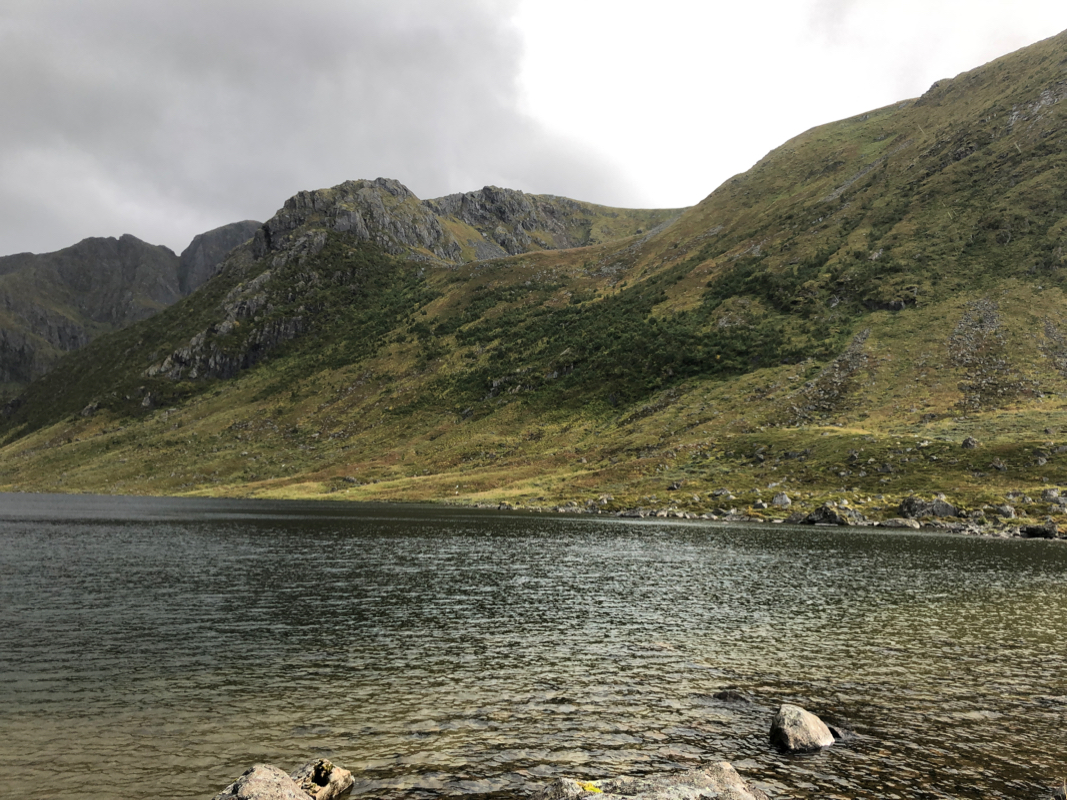
outside of the fences) and cross the creek that drains the lake Dalvatnet (also
called Bøvatnet). Do not hike along the shore, but find the trail that
runs up a tiny ridge line (away from the lake). Be certain to find this
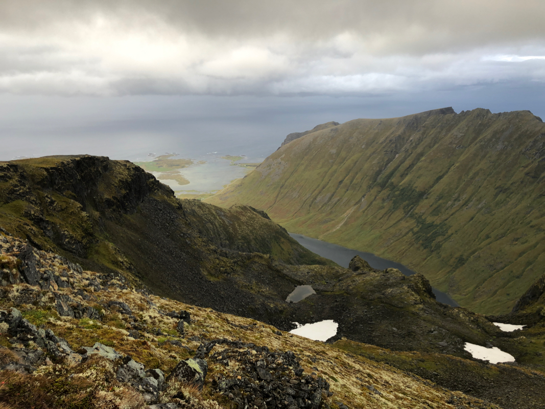
trail. The trail will climb to the upper basin,
named Trolldalen, then climb the
right side and gain the main crest.
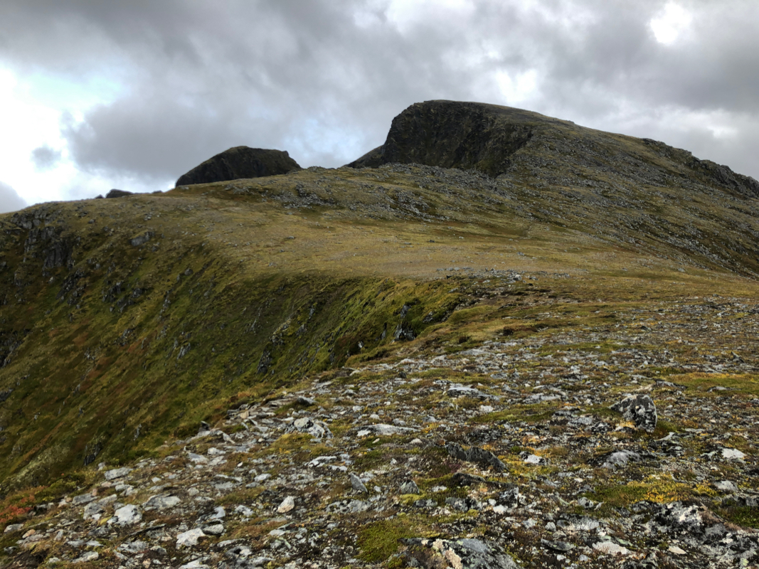
Next, head towards the broad ridge
leading to the final summit ridge.
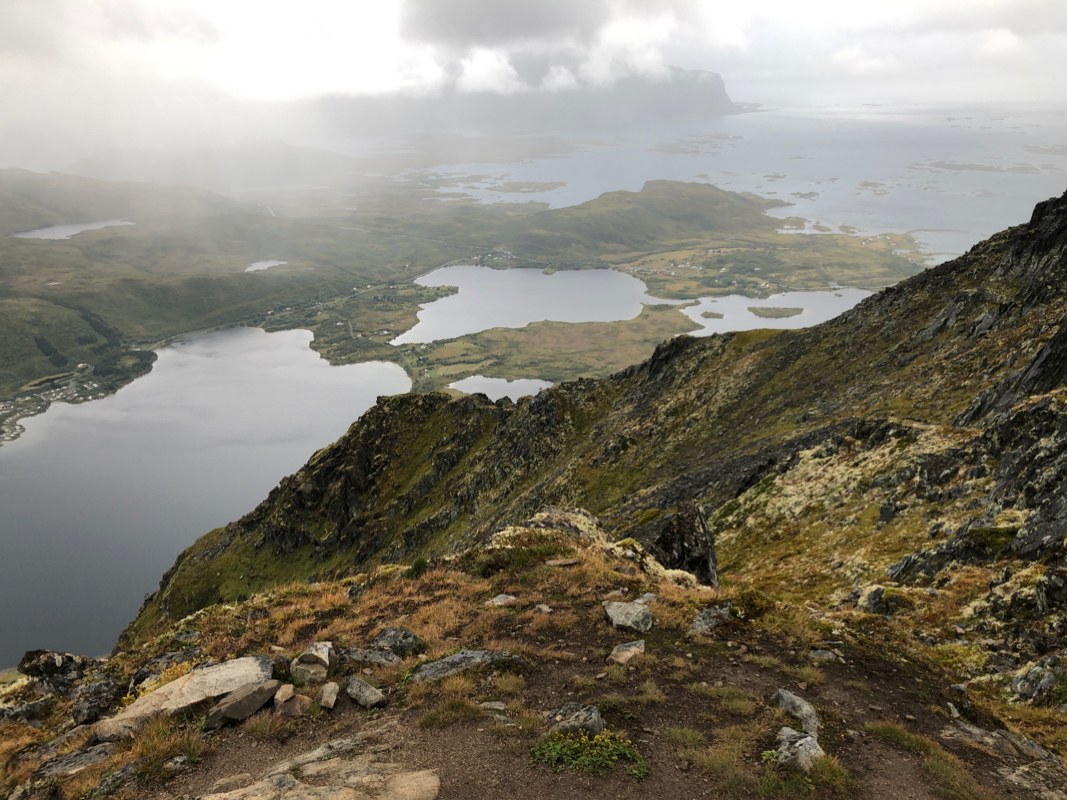
There are a couple of trails, the best trail cuts across, ie. a bit away
from the slope going down on the left. Ascend the ridge and arrive at a flat
plateau from where you have a clear view
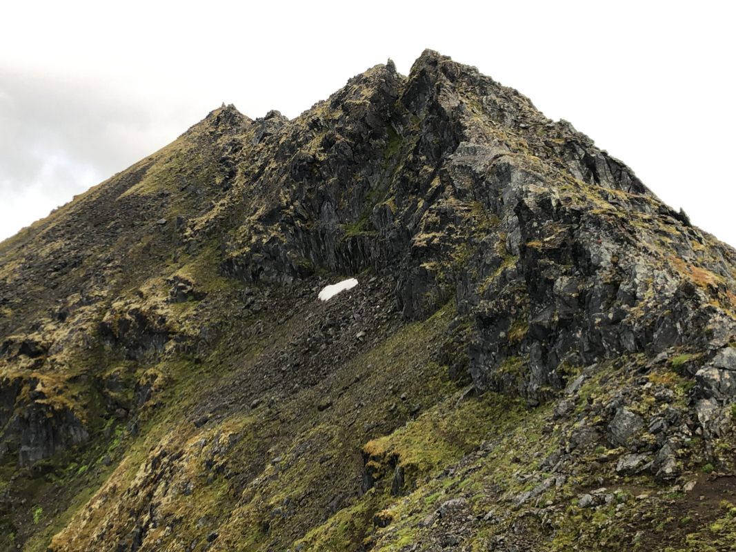
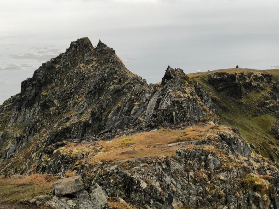
of the more rugged final ridge
with the summit visible at the end.
Just follow the climbers trail, it winds its way and there are no serious
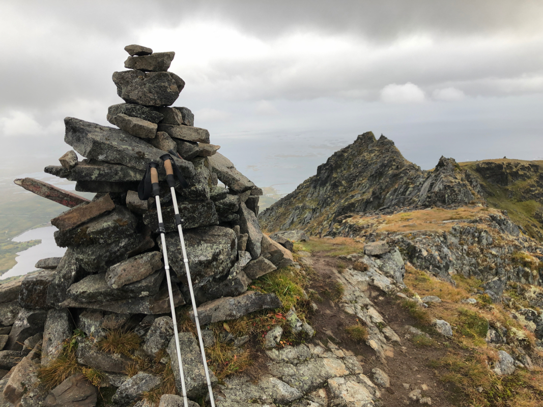
difficulties. The summit has a nice cairn. Comments:
I arrived by airplane to Leknes in the afternoon. It would be
nice with a hike after a long travel. Pretty efficient rental car (Avis)
and I drove directly to the trailhead.
Ready to go at 1645, I was not very confident with the time and did pack
a head-lamp just in case. I seemed to remember (wrong as it turned out)
that the route went along the shore of the lake, then uphill. Thus, I lost
the route and since I did not see any trail going uphill, decided to just climb
straight up. Half way up, I came upon the trail. From here, it was easy going
to the main crest. Next, I made another (minor) mistake by following
a trail that stayed on the left side and got me into some slightly
cumbersome terrain. I recovered the proper trail and the final ridge
was certainly easier than it looked.
Summit at 1815, so 1:30 up. Nice summit, and a resonable view despite a solid cloud cover.
The final ridge looks harder than it is
when viewed from the summit.
The descent went fine, I followed the trail and this got me directly to the
creek. Back at my car by 1940, so less than 3 hours trip time. Still plenty
of daylight, it was now time to get to my hotel and check in.
