How to get there:
Locate Hwy. 13 heading north from Stavanger. There is a ferry crossing
of Jøsenfjorden that ends at Nesvik (north side of the fjord).
Immediately after the ferry, make a left (leave Hwy. 13) towards Skiftun.
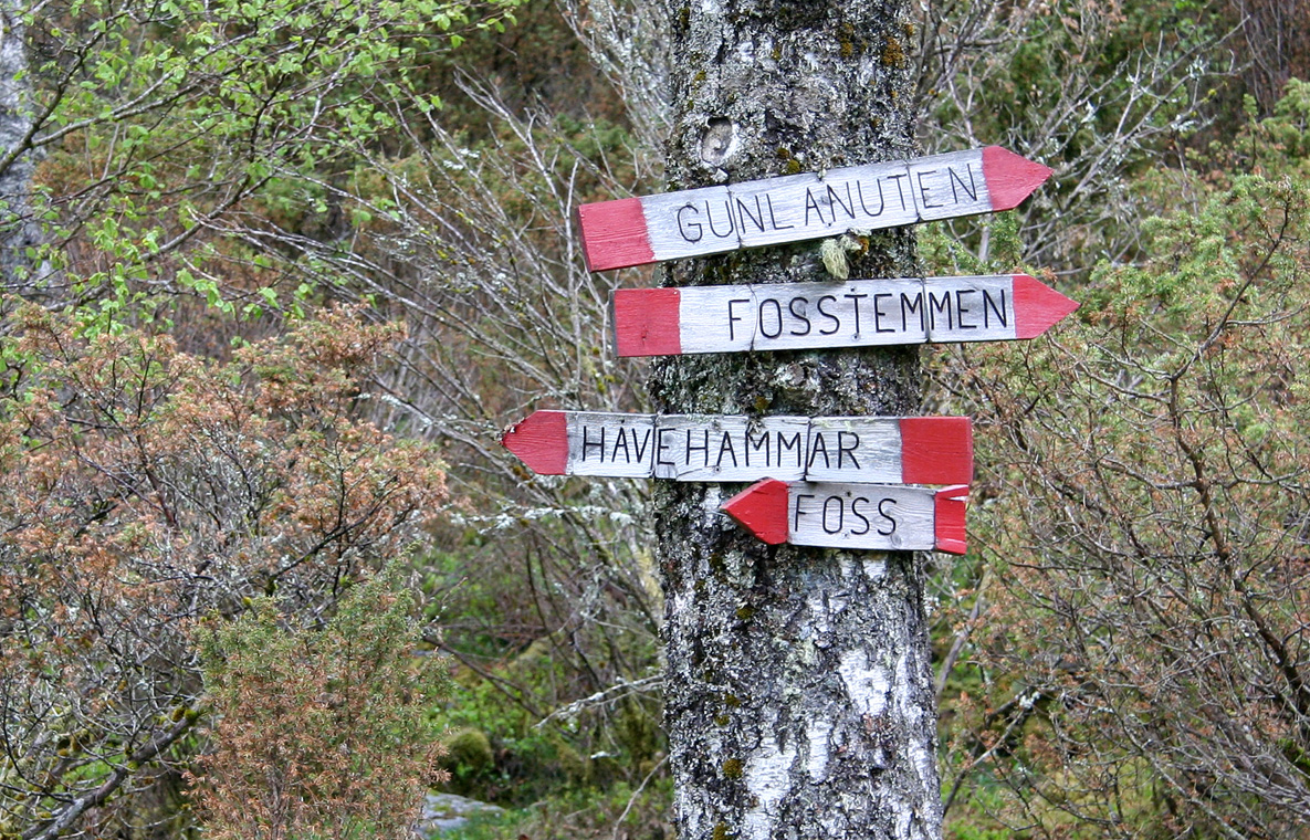
Follow this road 1.6 kilometer and look for a road going right to Foss.
Drive towards Foss 800 meter. About 100 meter before the Foss farm, there is
a farmers road that forks left. There are (small) wooden signs right at the
road fork. This is the trailhead. There is limited parking just opposite (on your
right). Make sure that you are not blocking access. The elevation is about
90 meter.
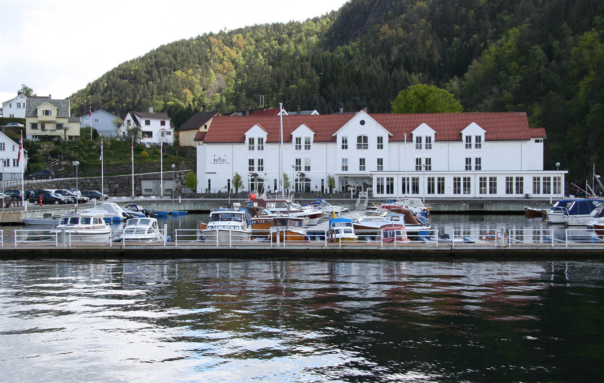
From Haugesund (or Bergen), take E-134 east from Haugesund, then Hwy. 46 to
Ropeid with a ferry crossing to Sand. Sand is a charming village with white
wooden buildings. There is a nice hotel, Ryfylke Fjordhotel, that can be
recommended. From Sand,follow Hwy. 13 to Nesvik. This road, called Ryfylkeveien,
runs in spectacular terrain with impressive scenery. The drive alone can be
highly recommended. Route description:
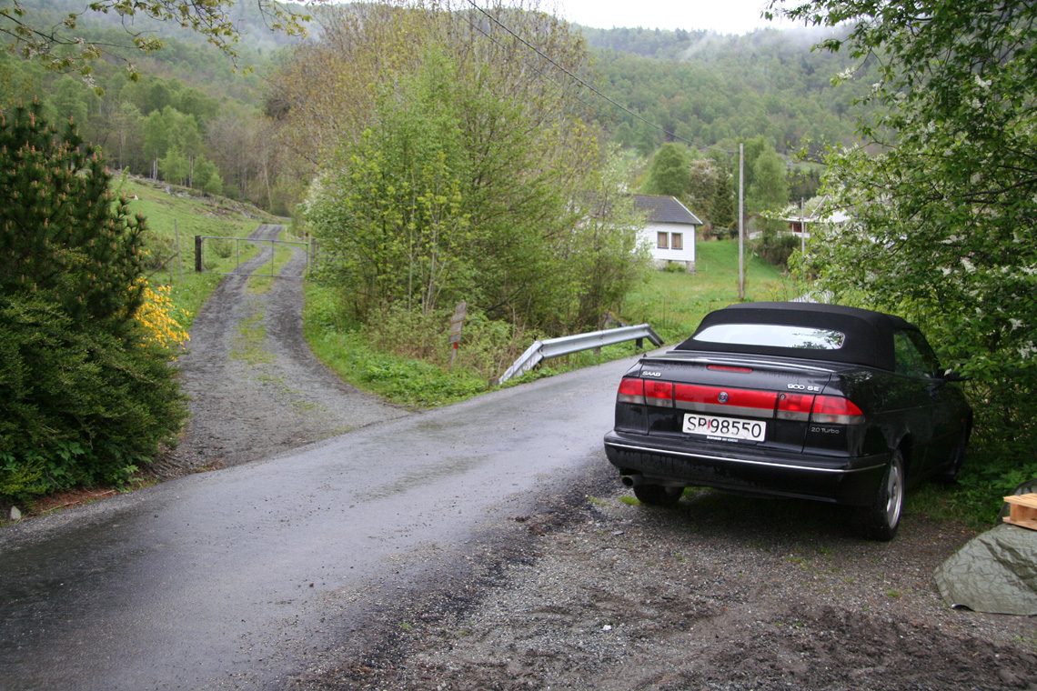
Go through the gate and continue up along the forest road. As this road bends right
and levels off, a clearly marked trail (red paint) turns sharply left. At this point
there are two variants of the trail: The first and perhaps nicest option is to follow the
red marked trail as it forks sharply left. This trail climbs gradually and eventually reaches
a local ridge. There are signs here, cross right and find the red paint and a sign for
Gunlanuten. You should see some farmers field (green grass) ahead, do not go this way, but right.
The second option is to continue along the forest road for about 200 meter, then follow a sign
and red paint steeply up the hill on your left. A bit further along the road there is a gate, you
must turn uphill well before this gate.
The two different trails just described merge at a small farmers field higher up on the hill.
There is a sign there (at the upper end of the field). The trail heads further uphill. Then
more gently along small meadows and between trees. After quite a bit of hiking, this trail
hits the lower part of an impressive old dam. Follow around the small lake above on the left,
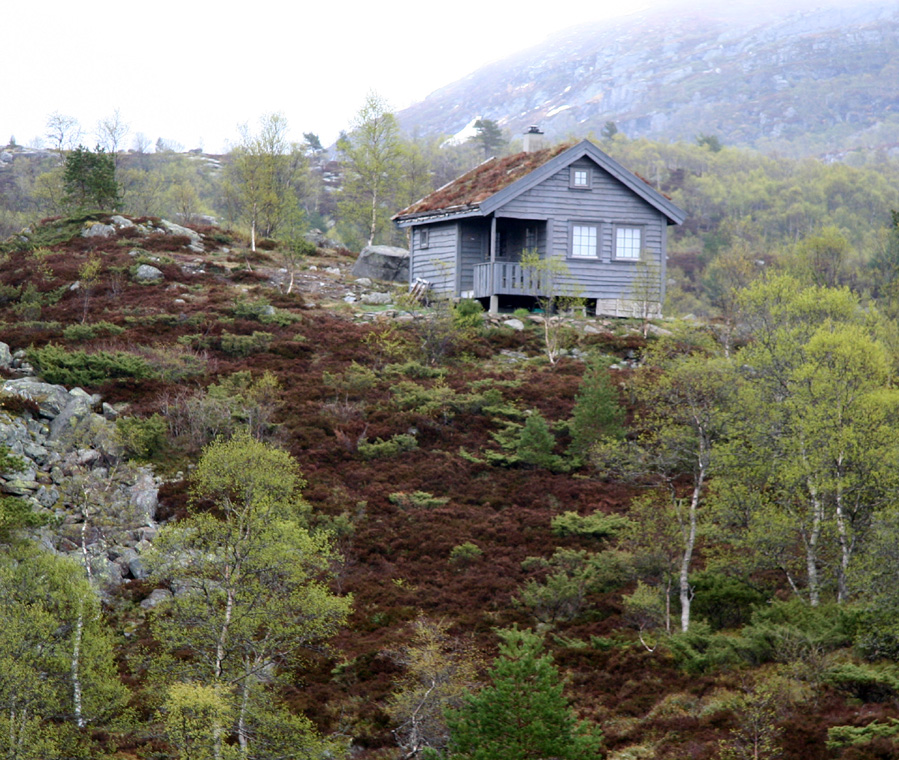
then pass near a mountain cabin. Surprisingly, one then finds a road. This must be the
continuation of the forest road that we followed in the very beginning, but certainly the trail
has been much better than following this road. Cross the road, then find the red marked trail
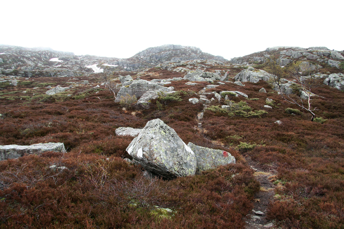
as it continues on the right side. The trail now climbs out of the last few trees and heads
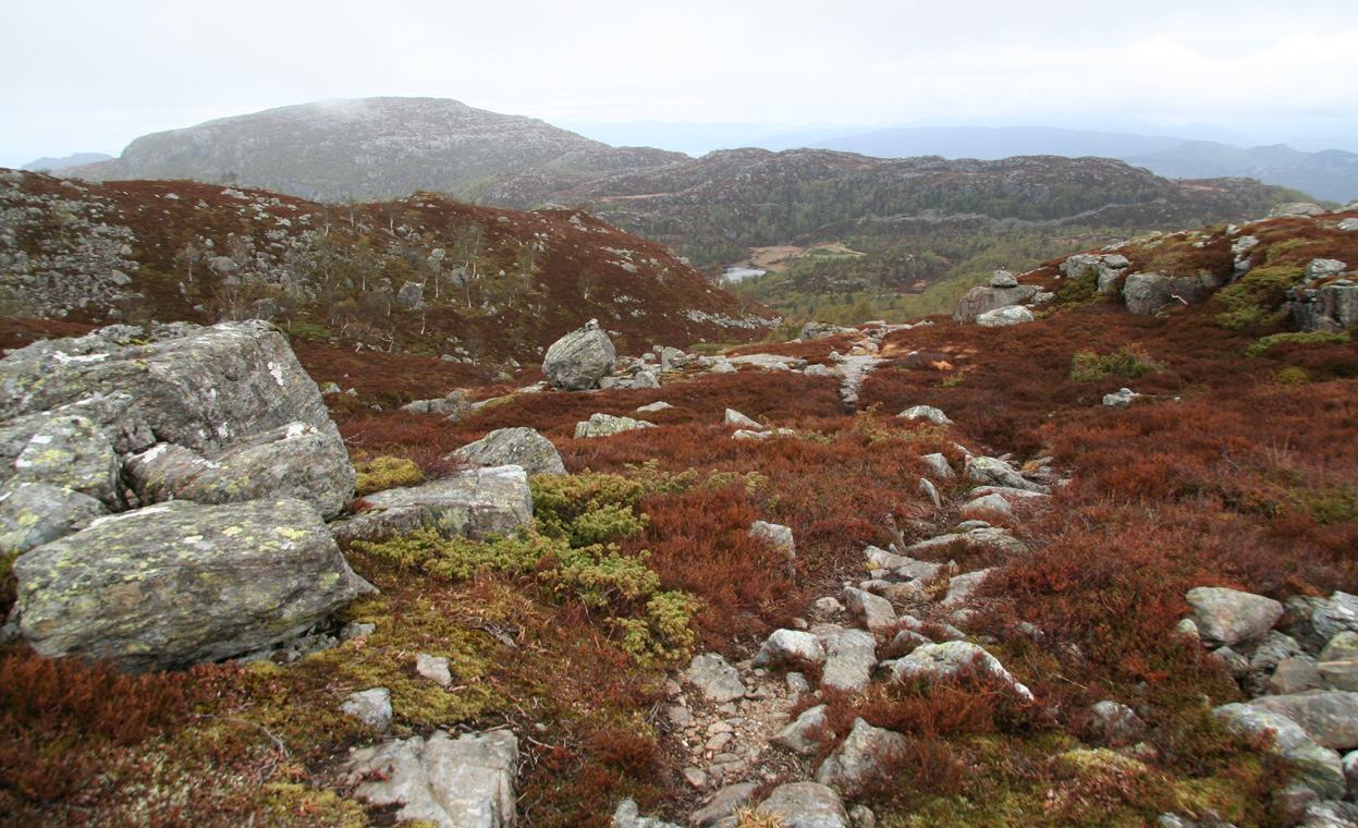
towards a distinct knoll, then up in the col on its left side. The final part follows the broad
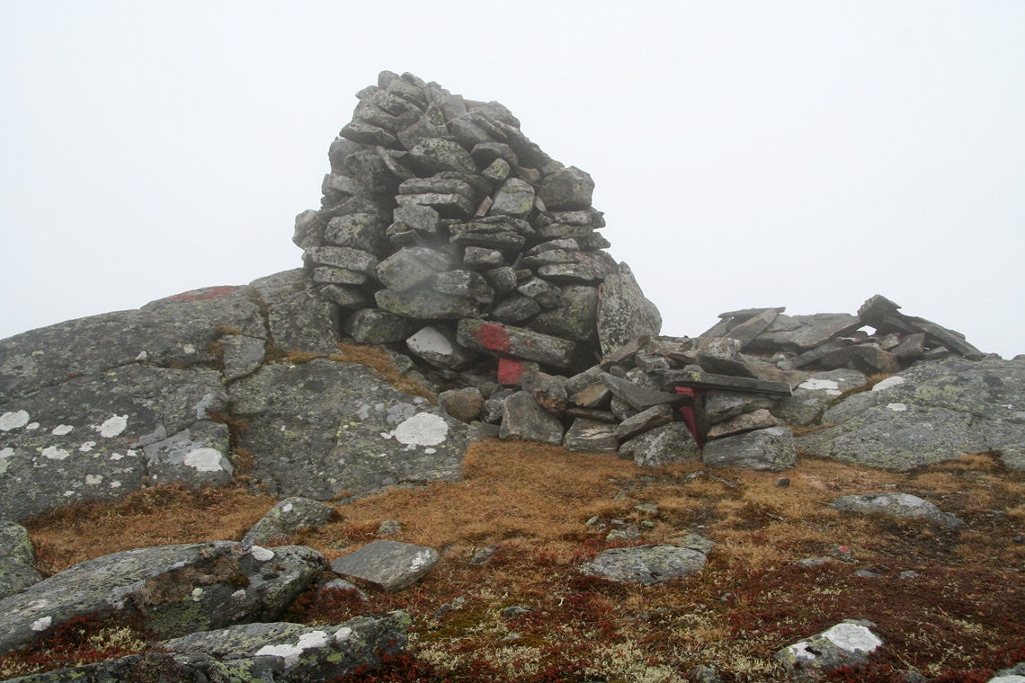
ridge, passing a small cabin next to a small mountain lake, then the final climb to a nice
summit ridge with the largest cairn to the left. There is a trail register at the base of this
cairn. Comments:
I had driven Pål Jørgen to a track and field event in Haugesund
the day before, climbed Døldarheia
then continued to Sand where I (luckily!) came across a nice hotel that even
managed to serve me a late reindeer dinner and provided free wireless internet
access.
I left Sand around 0800, drove to the trailhead and was ready to hike at 0845.
A nice trail and nice terrain, this would be a good family hike. I was quite
surprised to stumble on a road after about 1:15 with only this small, but well
marked trail. The old dams, built from huge rocks were quite impressive. Gradually,
the trees gave way to a true mountain landscape and patches of snow that still
remained. Unfortunately, the summit was still hidden in a cloud and the view
became correspondingly bad. The view from this summit on a clear day must be
quite good, as fjords are almost everywhere.
I arrived at the summit cairn at 1100, about 2:15 after starting out. I signed
the summit register as number 20 in 2006, however most of the visitors were part
of an organized group that had hiked here earlier in May.
After 15 minutes on the top, including a visit to the (smaller) cairn at the
opposite end of the summit ridge, I started down and reached the car after
1:30, at 1245.
Resources:
Images
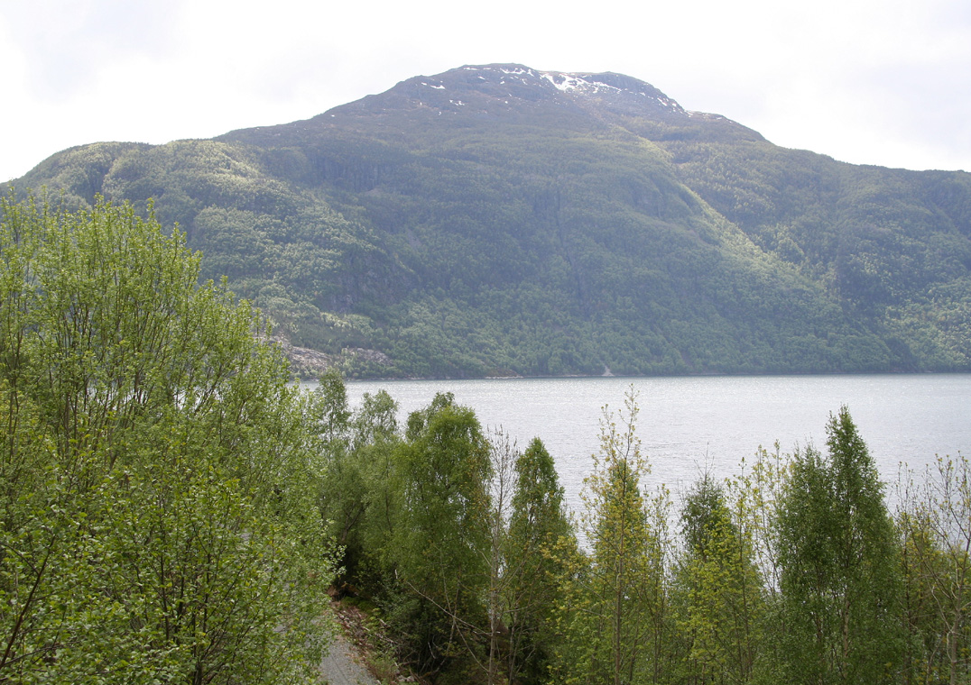
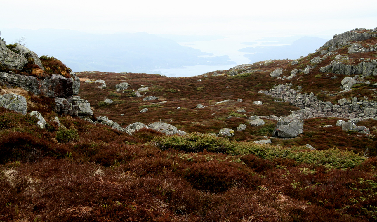
Gunlanuten, as seen when driving back. The weather has improved.