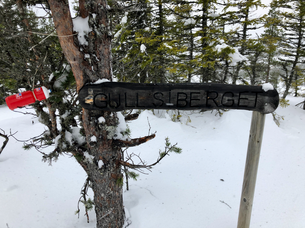
Location: North 63.30747, East 10.54711 (GPS at the summit)
Climbed November 21, 2020
Difficulty YDS class 2
Information:
How to get there:
This summit is east of Klæbu, the former center of the
small municipality having the same name, merged (in 2020) with
Trondheim. From Klæbu, head 2.4 kilometer north on hwy. 6680,
then turn right on hwy. 6700. Continue about 1.8 kilometer, then turn
sharply right (keep right again) and finally, a very short fork left to
arrive at a place you may park at location N63.32173, E010.51133, elevation
near 235 meter.
Route description:
Continue on the forest road. Keep right at the first fork, then stay
left at the fork near the small lake with elevation 264 meter. Follow
the road uphill until it ends. Continue up along the small ridge up
on your right hand side, then traverse east (left) in order to reach
the area with a small creek running north to the lake Syrsjøen at
elevation 436 meter. As you approach Gullsiberget from the west, head
north to avoid the steeper terrain, then turn south to reach the
summit. The summit is between trees at a fairly flat area.
Comments:
I did this trip with my friend Jostein. We started breaking trail at 1045.
It turned out that the terrain after the end of the forest road was quite
complex for skiing this early in the season. Progress was slow and eventually
we decided that I should ski to the summit while Jostein started a careful
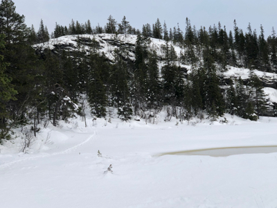
return. I crossed a meadow
that led me to a narrow passage connecting to
a small pond below the summit. From here, I needed to ski north before gaining
the summit plateau. I made the summit at 1340,
a bit breezy and not a place to linger long.
Leaving at 1345, I soon caught up with Jostein and we returned to the car at 1500.
This was my first ski trip for the season.