Location: North 22.35300, East 114.18716 (GPS on the summit)
Difficulty: YDS class 1
Climbed November 3, 2019
Information:
How to get there:
This mountain is best accessed from the long and well used
MacLehose trail. Thus, one need to access this trail in an area not
too far from the mountain. Look at a map and find your best access point.
One possibility may be to take Shatin Pass Road up to the pass located
at N22.35545, E114.19939.
We took the MTR to Ma On Shan (next to last station on this line), then a taxi
up the Ma On Shan Tsuen Road all the way almost to location N22.40140, E114.24535,
the road turns rough shortly before this point, so exit the taxi there.
Route description:
Starting at the location described above (end of Shan Tsuen Road), hike the nice trail
uphill to the MacLehose trail at location N22.39595, E114.24892. Continue along the
MacLehose trail (start out downhill), until you reach Buffalo Pass at location
N22.37371, E114.23770. Locate a vague trail forking right. This trail becomes better as soon
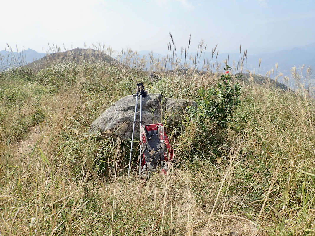
as you proceed the first few meters. Follow this trail to the summit of Buffalo Hill.
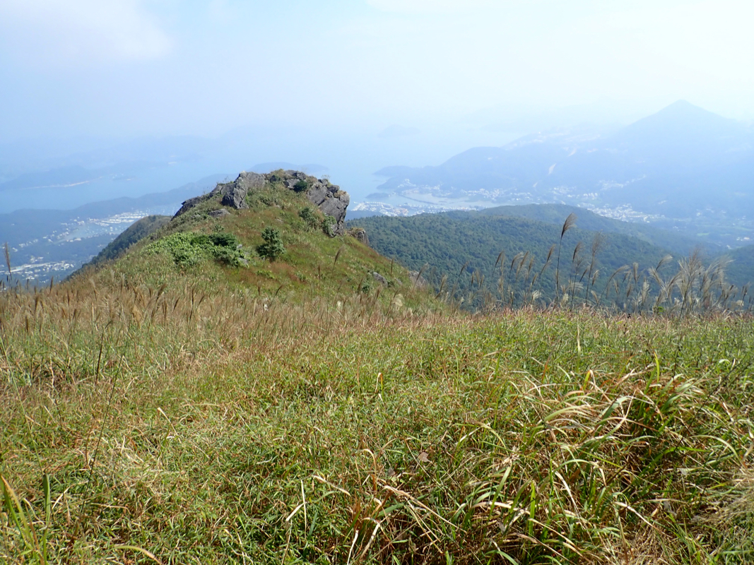
There is a rock near the highest point.
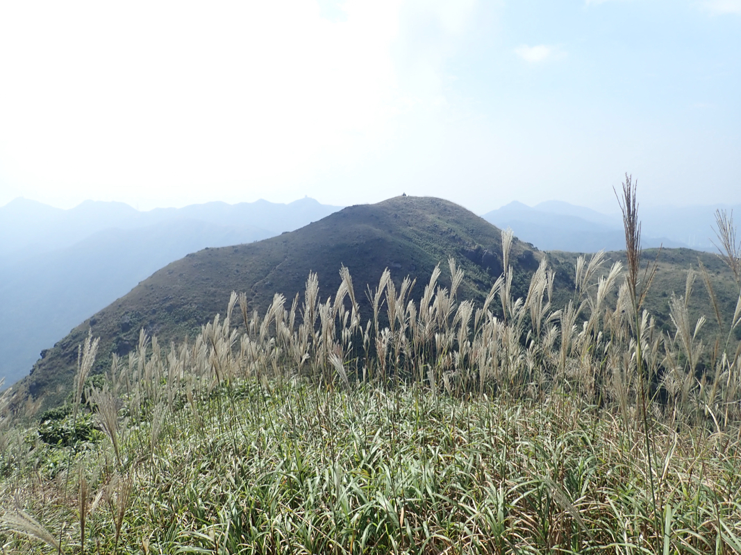
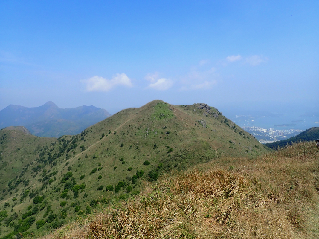
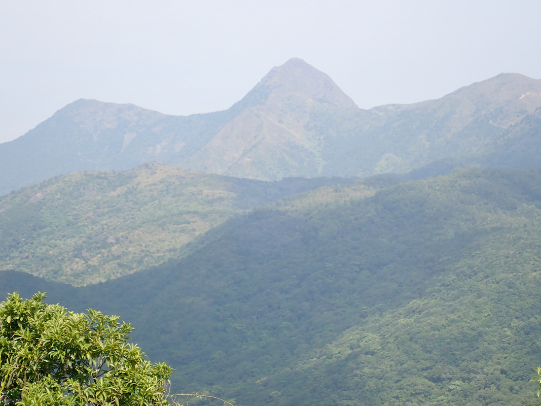
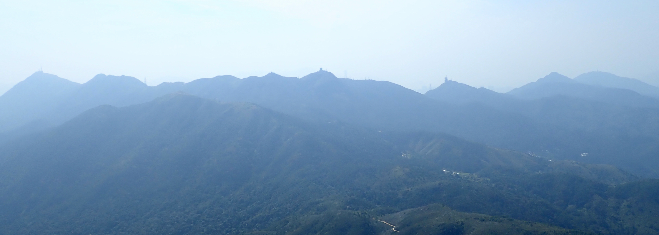
From here, you have a good view across to the almost
equally high West Summit. There is a nice
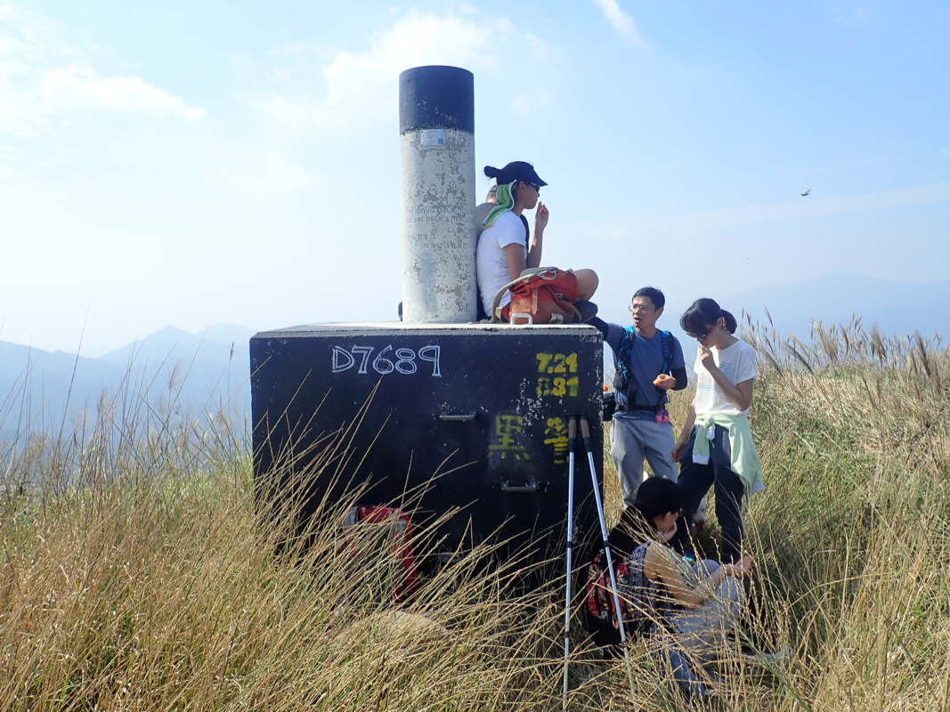
trail connecting the two summits. The west summit has an
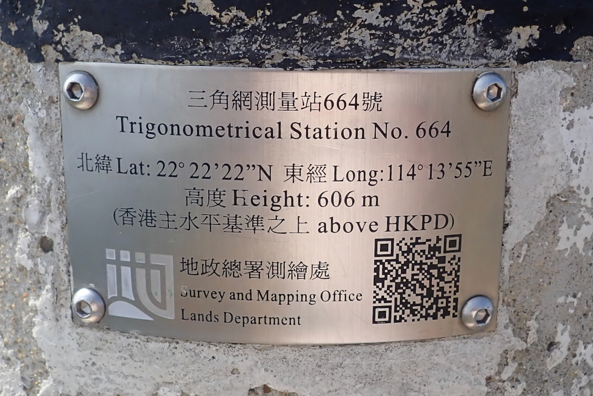
official trigonometric pillar with a
sign stating that its elevation is 606 meter.
Since the map elevation of the west summit is
2 meter lower, I have assigned an elevation of 607 meter to Buffalo Hill.
There is a pretty steep and quite overgrown trail that runs from the saddle between the two
summits directly back down to the MacLehose trail.
Comments:
This Sunday, Heidi suggested that we do a hike together. The choice of route
became important. She does not like too much (endless) uphill and she is not too
happy about steepish downhill as her knees complain under such circumstances.
I thought that going back up where I had descended
from Ma On Shan, and then continue
along the MacLehose trail might be a good option.
We took the MTR to the station named Ma On Shan, then a taxi up the road to
where the trail started. This trail climbs the final slopes to a local saddle
on the main crest where it merges with the MacLehose trail.
We had a good hike and noticed that quite many people were out on the trail today.
We made a brief stop at the grassy area overlooking the sea below. Many people
here including a few that came to launch a para-gliding trip. Continuing along the
trail, we arrived at Buffalo Pass. There, we agreed that Heidi would go ahead to the
next trail fork, then wait, while I would visit this nice looking hill.
I first tried a vague trail going directly uphill towards the saddle between the two
tops, but this trail seem to lead nowhere. Turning around, I went back to Buffalo Pass
and ascended from there. This worked well and I was on top at 1250. The view was nice
and I could see people and what looked like an official marker across at the West summit.
Heading there, I arrived at 1305. The official inscription on the pillar said that this
hill was 606 meter. That is 2 meter higher than my map elevation and equal to the
map elevation of the first summit.
I returned down a vague path from the saddle between the two tops. This trail was indeed
overgrown and pretty bad. As it turned out, I connected directly with the spot where
I had turned around on my first attempt.
I caught up with Heidi and we continued the MacLehose trail all the way to the
Shatin Pass Road. Here, we descended (south) along this road, then picked up the long
set of stairs passing the Kwun Yum Temple while descending down to a bus station in town.
Just across the very first road, we found a bus stop for route 73 serving the Festival Walk
shopping mall. This is also the Kowloon MTR station, providing a 2 stop ride back to
Sha Tin were we bought dinner before catching our local 23A bus back to My Fair by the Sea.
Thanks to Heidi for a very nice day of hiking, our walk was about 13 kilometer.
