Location: North 62:59.731, East 008:22.788 (GPS on the summit)
Difficulty: YDS class 2
Climbed November 8, 2010.
Information:
How to get there:
Starting from the city Molde, drive E-39 in the direction of Trondheim.
Take the ferry across Kanestraum and measure from here.
Drive 7.1 km and take Hwy. 65 right (south) towards Surnadalsøra.
At kilometer 16.0 (you are going downhill) look
for a road that goes right and turn onto this road.
At kilometer 19.6 (again after a downhill), turn left and cross
Åsskardfjorden on a draw-bridge. Continue to kilometer 21.9.
You are now in a gentle downhill and there is a small (turnout), parking area
on your left, just space for a single car. Unless you ask permission to park,
this is about the only area for parking.
This location is N63:00.435, E008:21.651, elevation about 5 meter.
Continue driving and take the 2nd. small side-road uphill on your left. Higher
up this road forks, take the right fork going uphill to a dead end where there
are a couple of houses. Ask permision to park somewhere here.
Route description:
A forest road continues from where you just parked, follow this until it enters
a small farmers field. Continue along its perimeter, cross a small ditch and locate
a forest road that runs perpendicular to your direction (ie. along the base of the
mountain). Enter this forest road and turn right. After just a few meter, this road
starts uphill, climbing the side of the mountain. Follow this road as high as possible,
then continue to climb until you reach the main ridge going south from Bølia.
Follow the broad ridge among trees, then up a slightly steeper step in order to
reach a good viewpoint at location N62:59.809, E008:21.047, elevation about 450 meter.
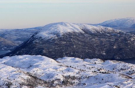
From here you see the main mountain further uphill. The best route is now to follow the
left side ridge, a small basin is located to your right. Subsequently, climb the slope above
you to reach a plateau from where you see the last uphill slope. Continue across the flat and
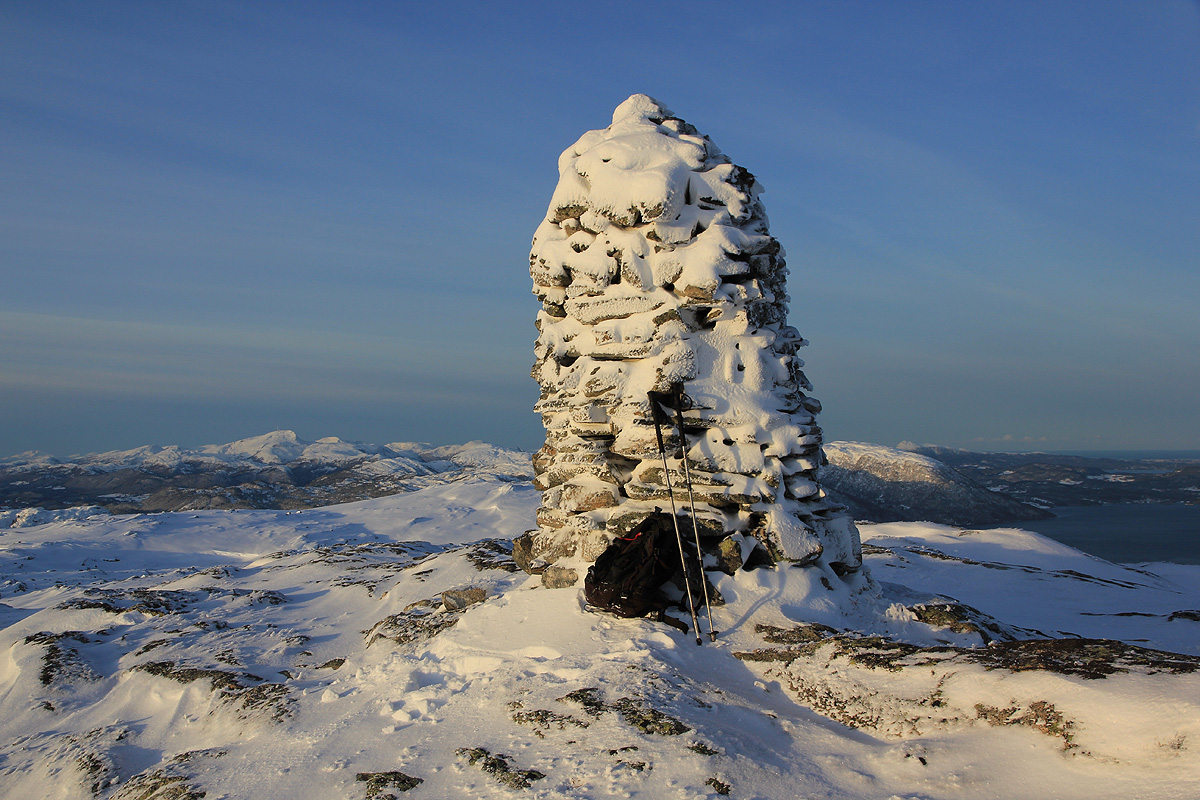
ascend the last slope. You will arrive at a small cairn from where you see the true summit
with a much larger cairn a bit futher onwards.
The terrain is easy and you will soon
arrive at a very fine viewpoint, the summit of Bølia.
Comments:
After two nights in my rental car, I slept
at a nice little place called "Rasteplassen"
located at a sharp bend of E-39, a few kilometer north of the intersection where
Hwy. 65 runs south (Liabø).
I drove down to the trailhead area, it was still pitch dark and everybody asleep.
No point in waking somebody up, just to ask for permission to park. Thus, I parked
at the small turnout along the main road (see above).
Leaving the car at 0710, I walked up the first side-road and proceeded across to the
second a bit higher up and well below a house. It was really quite a short walk to
where the road ended and I probabely could have parked later in the day.
Going up the forest road, I noticed a pretty good trail in the snow. Since it snowed
yesterday, somebody had walked here recently. A moment of reflection and I realized
that the entire track was made by deers. Must be quite some busy traffic. Higher
up, I came upon two deers and they ran away rather fast (the hunting season for deers
is still open.).
The tracks ended and I decided to cut directly uphill. Walking in deep snow is heavy
work, going more steeply uphill does not make a big difference, but shortens the route.
I hit the main ridge, turned left and struggled up across a small meadow, then more steeply
to reach a fine viewpoint near a rock at the end of a shoulder. Time to put on a jacket,
the temperature was -10 Centigrade and the wind was noticeable.
From here, this climb was about as cumbersome as the climb of
Korsbakkfjellet yesterday. Unavoidable sections of very deep snow that slowed progress.
I arrived at the summit at 0920, 2:10 showing the effect of the deep snow.
Today was sunny and the panorama of mountains blended with fjords all around is quite
exceptional. I signed the summit register, then left by 0930 as the wind made it quite
cold to hang around. Going back was quite easy, the steps are certainly much easier to
walk when already made. I was back at the car by 1040, about half of the uphill time.