Location: North 60.73930, East 5.48828 (GPS at the summit)
Climbed November 30, 2020
Difficulty YDS class 2
Information:
How to get there:
Drive E-39 north from Bergen. Immediately before the long
Eikefet tunnel, take Hwy. 570 (left turn) north towards
Masfjorden. Measure from here. Drive 12.3 kilometer. In a left bending
curve, locate a big parking area on your right. Park there. The location
is 60.74858, 5.39001, elevation about 35 meter.
Route description:
This is an official trailhead for a trail to the DNT hut Kalvedalshytta. This is also
the trail that may be followed almost all the way to the summit of Storevasseggene.
First, follow the well marked trail as it heads uphill and then crosses back down to lake
Sørkvingevatnet. The trail follows the lake shore, then turns left and
ascends a very interesting ravine. Near the top, a trail merges from the right. Continue
straight to lake Blådalsvatnet. The trail turns right here and ascends to lake
Setretjørna. There are several huts across this small lake. From here, you will
see the Storevasseggene ahead and a bit of Blådalsnipa hidden behind further left.
Continue up the T-marked trail towards Kalvedalshytta, leave the trail shortly before
the main crest and complete the easy ascent to the summit of Storevasseggene.
Cross over this summit and continue north towards Blådalsnipa. The descent to the
very distinct col is steepish and slippery when wet or partially covered by snow.
You need to head a bit north-east, there are a few small rocks/cairns showing a feasible
way. This descent/ascent has a few (YDS) class 3 moves. When slippery, one needs to
exercise caution here. If too steep, then look for a better alternative. I did not
find any completely easy route when wet and with some minimal snow cover.
As soon as you are down in the col, the ascent
to the Blådalsnipa summit
is straightforward.
Comments:
I first climber Storevasseggene, the first part of this
trip report may be found there.
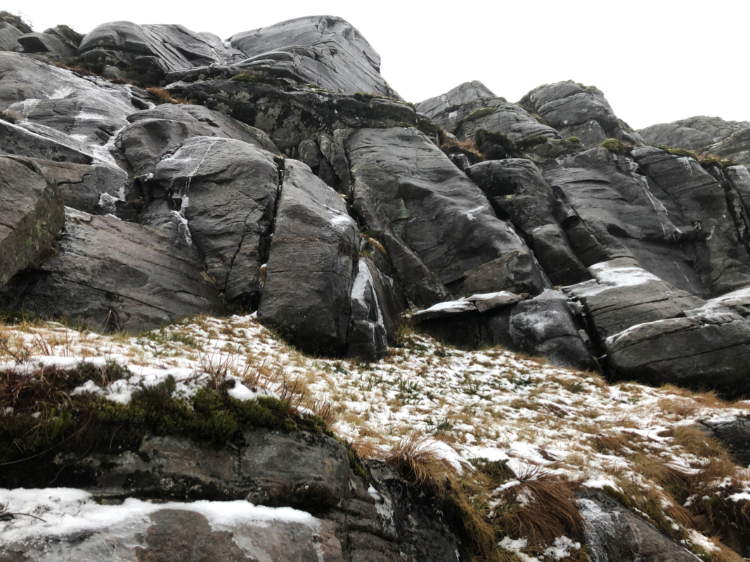
I left the summit of Storevasseggene at 1140 and started down towards the col separating this peak from
Blådalsnipa. The terrain was surprisingly steep and slippery. Wet rocks and rocks coated with a thin
layer of ice or snow. I needed to proceed with great caution. As I moved lower, there was no obvious
route that would get me down. I jumped down a step that would be pretty hard to reverse. The only exit seemed
to be a narrow ledge going right. I could not see if this would work, but gave it a try.
The ledge narrowed, but then turned a corner and provided a way down. Puh, a bit more exciting
than needed.
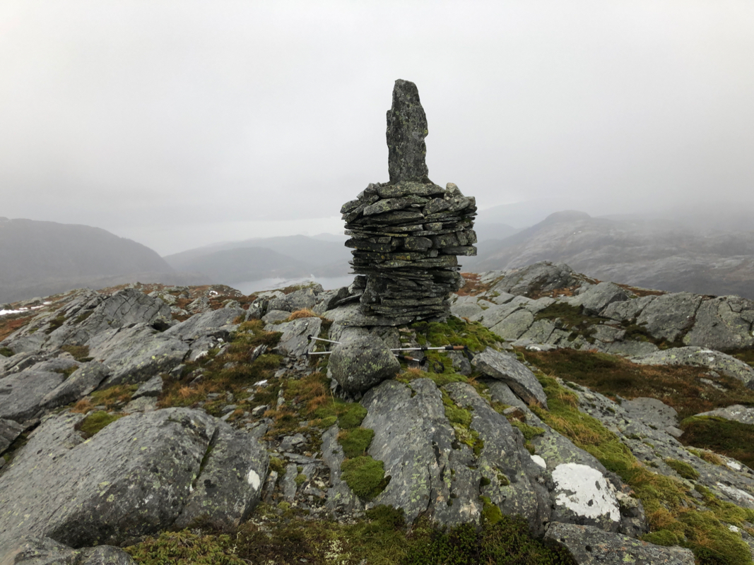
I ascended to the Blådalsnipa cairn without any issues, arriving there at
1230. A brief stop, then returning to the col.
Looking at the rocks from below
revealed an option that would avoid the narrow ledge. I ascended carefully and discovered my
footsteps higher up. Proceeding uphill more or less in the same way as my descent got me
back up on more level ground. From here, the return hike went pretty smoothly, I was back at
my car at 1525, so 2:50 from the summit of Blådalsnipa.
