Location: North 60.65845, East 006.48288 (GPS on the summit)
Difficulty: YDS class 2
Climbed: October 24. 2021
Information:
How to get there:
Take road 5386 towards Mjølfjell / Raundalen from Voss.
After about 2 kilometer, the road crosses the railroad on a bridge,
then (immediately) Hwy. 5388 signed for
Nordheim forks sharply left.
Locate a smaller farm road that forks left, after driving road 5388 about
one kilometer. This road is pretty good, but clearly private. Continue
uphill until you arrive at location
N60.65789, E006.48879, elevation near 350 meter. This is shortly before the road ends.
There is parking on the left side of the road.
Route description:
Follow the trail directly uphill until it sort of tops out
and turns more left. There is a trail sign near this location.
Fork right and follow a smaller trail that continues uphill.
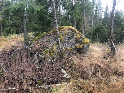
Finally, just head for the local top. You will notice a pretty
big boulder that seems to define the highest point.
Comments:
I was on my way from Lillehammer to Bergen and took the opportunity
to visit this small forest hill.
The ascent/descent took about 10 minutes each way.