Queimadas (Vicente)
- Queimadas (Vicente)
- 1500 m
- Primary factor 290 m
- Location: North N32:46.912, W016:59.753 (GPS at the summit)
- Madeira, Portugal
- Difficulty: YDS class 2 (rough trail)
- Climbed: December 16, 2011.
Queimadas (Vicente)
|
|
Summary information about all hikes and climbs in Madeira.
How to get there:
Drive from Funchal west towards Ribeira Brava, then via Serra de Agua towards Sao Vicente on the north coast.
Be prepared and measure distances from the point where you enter the big tunnel that cuts through from the
south to the north. After 5.2 kilometer, you will enter a traffic circle. Turn right here (sign for Vicente).
At kilometer 6.2, a new traffic circle shows up. make a right turn here and follow signs for
Lameiros and Rota da Cal. At kilometer 6.6, turn right and follow the same signs (Lameiros and Rota da Cal).
Almost immediately, there is a new right turn with sign for Rota da Cal. Then at kilometer 7.6, turn left,
the sign for Rota da Cal continues. Shortly thereafter, kilometer 7.7, another left towards Rota da Cal.
Finally, drive the paved road steeply uphill, ignore side roads and Rota da Cal. You will arrive at the
end of the road at kilometer 8.9. There is a small area for turning around and parking. Park such that cars
may still easily turn. This is the trailhead, location N32:47.777, W017:01.250, elevation about 430 meter.
Route description:
This is a pretty long hike on narrow, wet and slippery trails. A strong party should
allow a minimum of 6 hours. There is a trail all the way, but I still assign a difficulty level of (YDS) class 2.
The trail starts uphill near where the road enters the small parking area. The first section
runs directly uphill to an old farm house. Higher, the trail bends left and continues to climb steeply.
You will emerge on the right hand side of a distinct ravine.
The first trail "crux" comes next.
Traverse on a slanted and narrow section (YES, there is exposure!) in order to reach safer ground further onwards.
Continue up this small but steepish valley, first on the right hand side, later cross and advance higher to the left side.
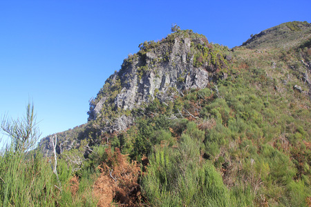
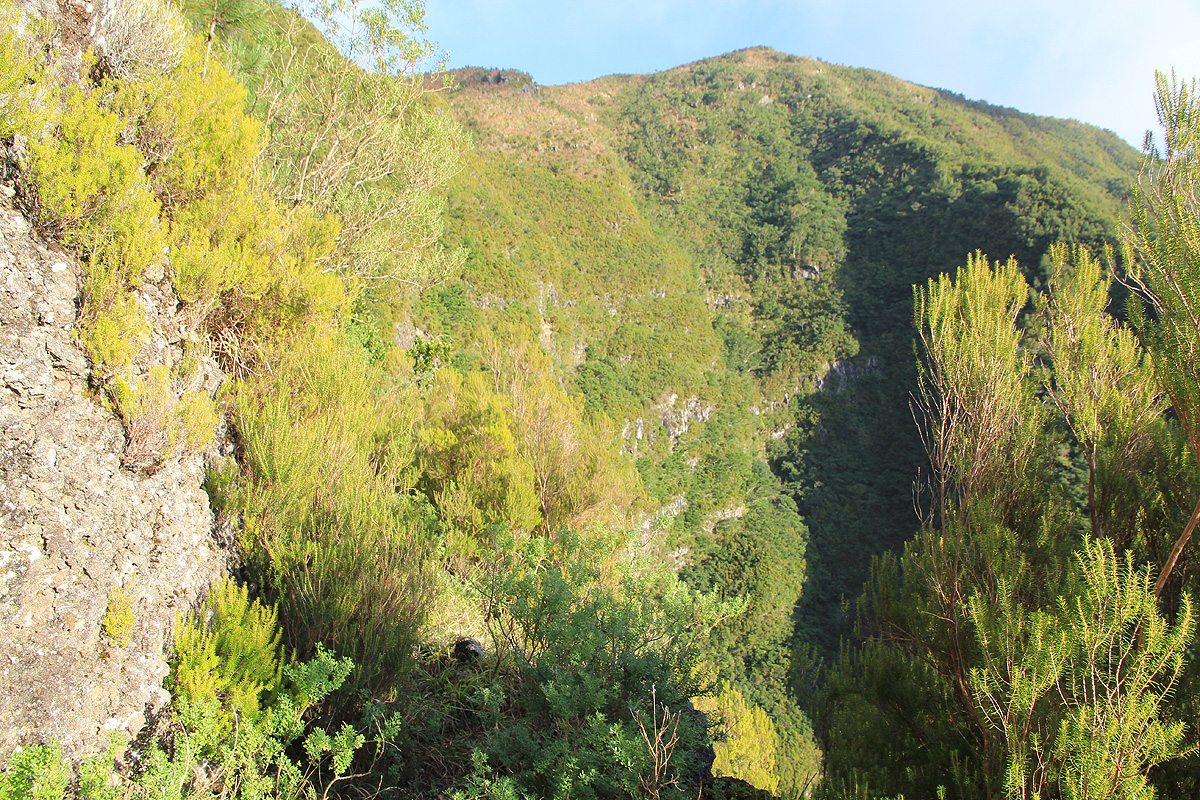
The terrain above looks absolutely impossible.
The trail hangs on to a ridge, then turns right while
traversing a small ledge (significant exposure!)
Higher, you may notice a (pretty obscure) trail fork (location
N32:48.101, W017:01.154, elevation about 920 meter). Take the right fork and continue uphill.
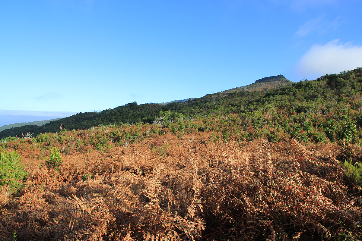
At elevation near 1000 meter, the trail reaches the crest of a wide,
pretty flat plateau. This area is full of
brush and smaller bushes, including thorns. The trail is not hard to follow, despite being pretty overgrown.
Cross this area and descend slightly on the east side. The route now
traverses more south-east in the north-east facing hillside in order
to bypass several subsidiary tops along the main ridge.
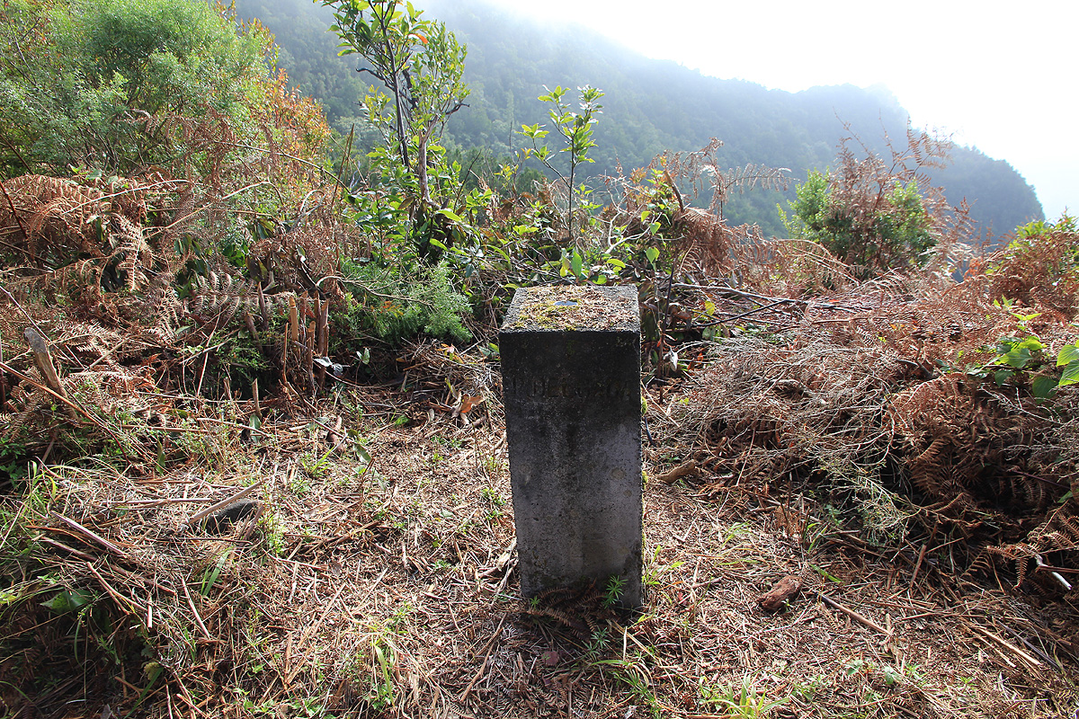
The trail turns more south and emerges in a distinct saddle
having a marker (trig. point?) of concrete.
The elevation is
about 1120 meter. Continue uphill more on the main ridge to a new saddle near elevation 1245 meter.
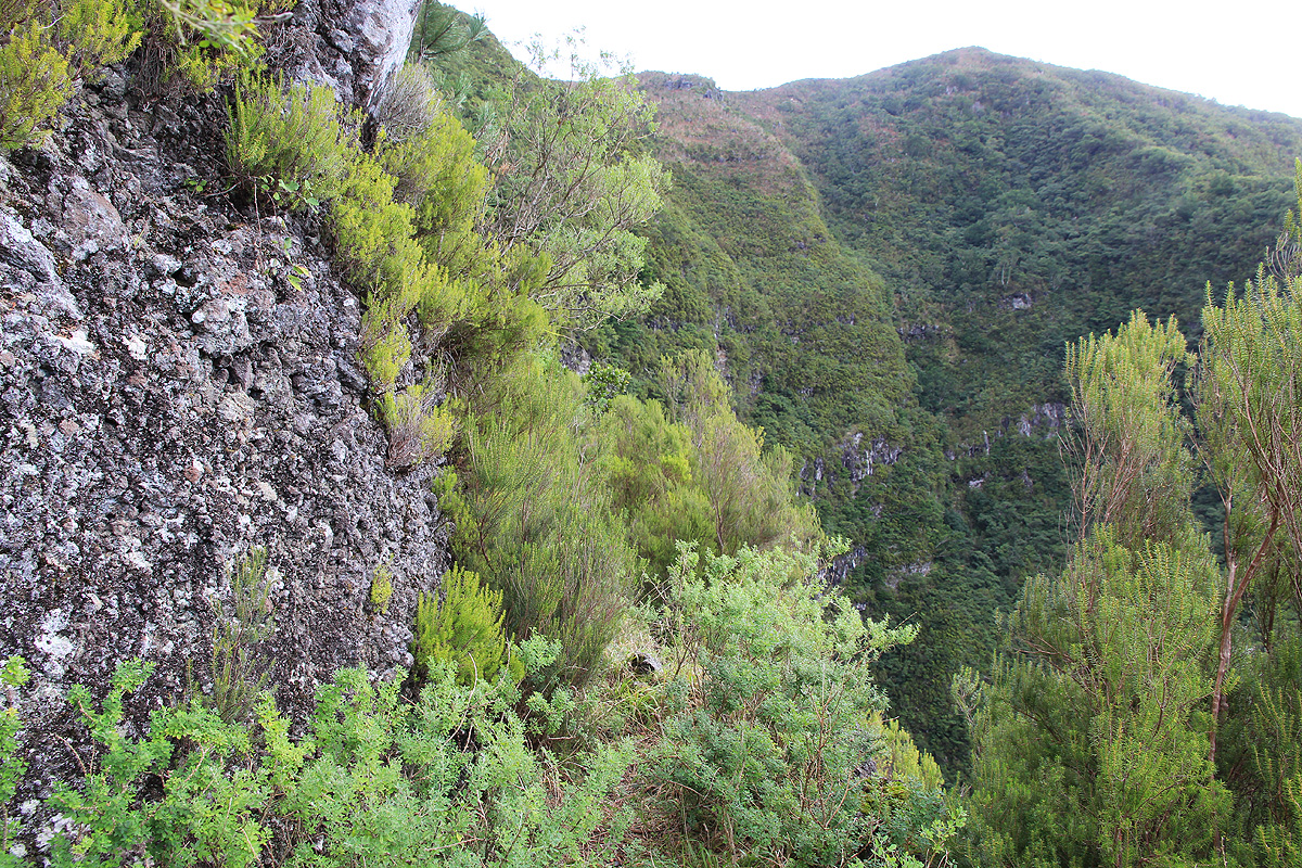
There are cliffs higher up
and the route now traverses left. Proceed along
some overgrown ledges with steep cliffs above and significant
drop below until gaining the very broad north-east ridge of the mountain. You will eventually arrive at location
N32:47.431, W016:59.573, elevation about 1335 meter (in the forest). There is a significant trail fork here that
may be otherwise overlooked. The right fork heads uphill towards the summit, while the main trail (left fork) continues
north-east in a gentle descent. This trail most likely ends near Ponta Delgada.
Proceeding uphill, there is a second fork, however, the left going
trail is short, - only serving a viewing area. As you
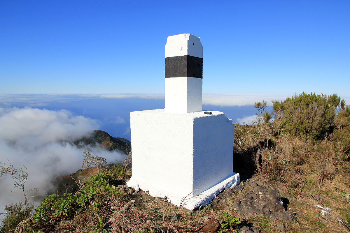
follow the trail higher, you will pass a large,
white (official) summit marker a short distance on your right hand side.
Why such a large marker (the same kind as found also on top of Pico Ruivo etc.) is placed at such an odd location is
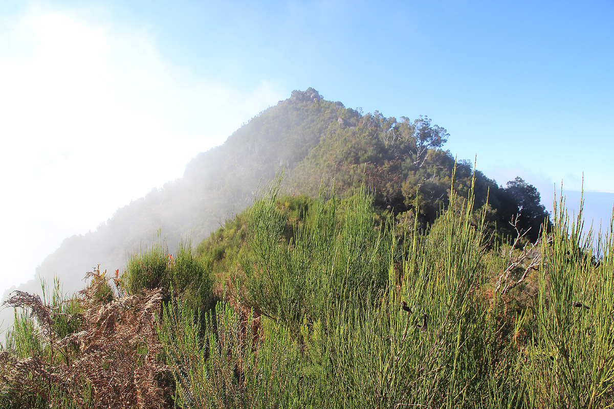
utterly unclear. As you continue, the trail runs across to the left side and follows the rim (large drop!) to the final
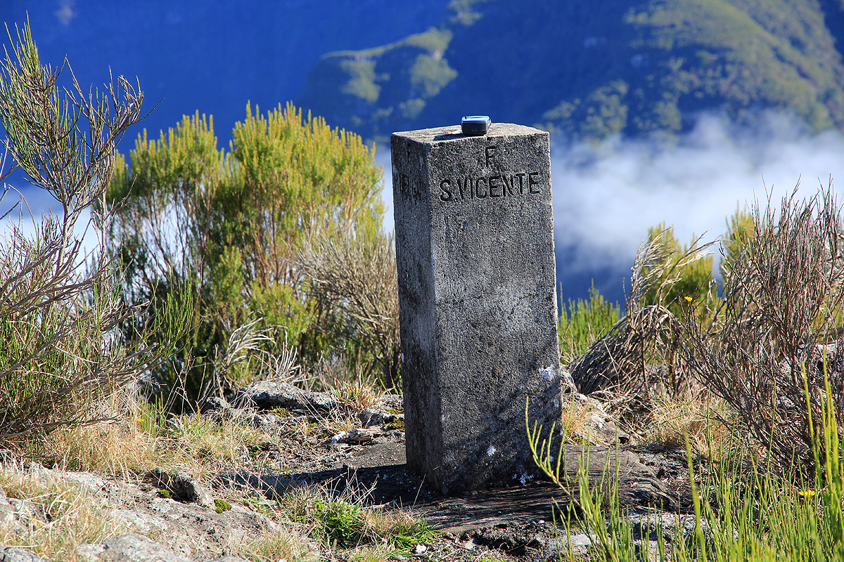
summit plateau. A very nice location, with less vegetation and a
more modest summit marker made of concrete.
Comments:
On my last day to hike in Madeira, my eyes had noticed the mountain east of Sao Vicente. It stands pretty independently
and seemed to be served by several trails according to my map of Madeira. The shortest trail came directly from the west and
I drove there in the morning. A paved road ran steeply uphill to a horizontal farmers road that contoured around the hills.
I parked and started looking for a trail. No obvious signs. I first walked south, then turned around and walked north.
Eventually, I met some local farmers and asked about where I could find a trail. They looked at my map and told me that
the trail I was looking for simply did not exist. About one hour had passed. I thanked them and drove further north.
In the tiny village I asked a girl about trails to the mountain, she nodded and said she believed there was a trail
higher up along the road. OK, promising. I drove as high as I could and parked at the small turn-around place.
More searching for a trail. Well, I found a very tiny trail heading directly uphill. Could this possibly go all the way?
Very unlikely. With no better option, I started out. Quickly, I realized that this would not work as my trail went directly
up to an old farm building higher on the slope. Getting there, to my surprise, the trail sort of continued beyond.
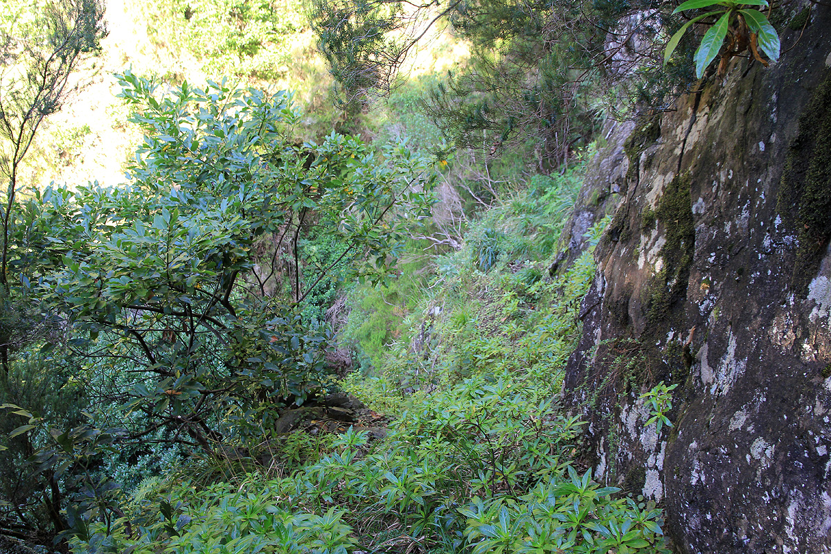
I kept going and the trail kept climbing. This was one of the smaller trails I have ever followed. Overgrown, I had to look
carefully in many places to determine where the path continued. I was on the right side of a deep and steep ravine.
It looked as if the trail would have to traverse into it, and that turned
out to be true. A first crux, a pretty nasty
looking dirt slope (wet and slippery) only half a meter wide with unpleasant exposure, seemed to be the only way forward.
I walked rather carefully and was happy to be back on safer ground.
The trail headed up terrain that looked impossibly steep.
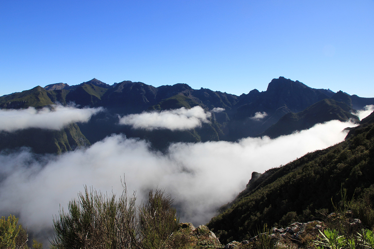
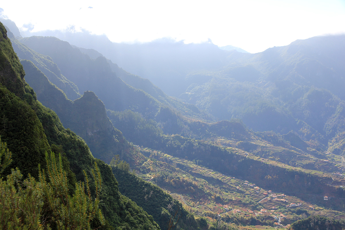
At least, there was a nice view down to the
small community below as well as to the fields in the valley with the
Boca Encumeada hidden in clouds.
Gaining a local ridge, then switching back
along a narrow ledge,
I finally made it to the main, very broad ridge.
Totally overgrown with all plants and leaves dripping wet, I was quickly soaking wet and my map well on its way to
disintegrate. Worse, there were plenty of sharp thorns, hiking in shorts was not a great idea. My legs took quite some
suffering, being criss-cross scratched by the sharp thorns all over. This hike was not meant to be easy. The peak still
looked very high and very distant. I got across the plateau and - to my concern, the trail started descending as
I could see the surf on the north coast below me. The loss of elevation fortunately stopped and the trail stayed pretty horizontal.
I was still not convinced that this trail would indeed lead me to the summit. Turning more right, I arrived back at a distinct
saddle on the main ridge, very good news! Cliffs higher up showed that the route would need some sort of bypass.
This led out on the left below a towering cliff and above an even higher vertical drop. The ledge was pretty wide, but
sloping downward. The vegetation could give a false sense of safety, I decided to be very careful.
I had set my turn around time to about 1400, knowing that I needed daylight to get safely off this mountain.
Unfortunately, this time was approaching quickly as my trail started a gradual descent. There were some clouds/fog, but
I did not see any higher hills ahead. I turned around and hiked back a bit, then discovered that I had missed
a key trail fork. The trail I had taken was headed down towards the village Ponta Delgada.
Sensing that the top was within reach, I gave myself another 30 minutes. This turned out to be needed, I arrived at the
very well defined summit plateau exactly at 1430. It had been a considerable effort
to get here, the view and the sense
of accomplishment were rewarding. I took some photos, but
realized that the summit break would be relatively short.
Thus, after 10 minutes I headed down. This trail was not really a place to run, but I speeded up in the few
places where possible. I definitely did not want to navigate down the steep section with limited visibility.
The return was pretty straightforward, I remembered the trail fairly well. Just after dropping off the rim, I took the
wrong turn and discovered another trail fork. This trail must also come up from the coast somewhere east of Sao Vicente.
Backtracking, I found the correct trail and continued carefully downhill, arriving at my car by 1715.