Location: North 60.47966, East 005.95361 (GPS on the summit)
Norland, Norway
Difficulty: (YDS) class 2
Climbed January 23. 2016.
Information:
This mountain may most conveniently be
climbed from the south, driving Hwy. 134 to the north side of
Kvitingsvatnet. This location is south-west of the summit.
However, this report describes a ski ascent from the
north using the DNT hut Gullhorgabu as a base.
How to get there:
Drive E-16 from Bergen towards Voss. In Dale, turn right and follow
signs to Bergsdalen. The trailhead is located at N60.54463, E006.03247, elevation
about 530 meter. There is a small road going right here. Enter this road and immediately
find parking on the right hand side (Parking reserved for people going to Gullhorgabu).
There is also parking off the main road exactly opposite to this road, at least for 2 cars.
Route description:
Continue on the small road, cross the river on a good bridge, then follow shortly along the
west side of the lake. An old military road heads steeply uphill (west). Follow this route up
to lake Moavatnet, along its east side to Moastølen. The old road continues uphill to reach the
small lake Grågavitjørnane. Continue directly south, up a small, distinct valley to
reach lake Storlitjørni at elevation 820 meter. Ski across to the south side, then climb an
easy slope to south-west. Continue along a natural route until this starts descending, move more east and
follow natural routes to Gullhorgabu, located just north of lake Øvsta Dukavatnet. The Gullhorgabu
DNT hut is a selfe serve hut with food supplies and capacity of 30 people. Its location is
N60.50087, E005.96019, elevation 850 meter.
In order to continue to the mountain, descend to the lake, then ski all the way to its south end.
The broad north ridge of the mountain extends into the lake here. The first 10 meter of ascent
is steep, the best place is likely a bit on the east side. Ascend south to about 1000 meter, then
more south-west to the summit. The highest point
s located near the north end of a fairly
jagged ridge.
Comments:
This trip was totally unexpected. I had been attending a winter school in Geilo and had
planned to ski a few summits near Hemsedal on Saturday and Sunday. However, on Thursday
evening I noticed a call for assistance from Bergen Turlag (The Bergen mountain trekking club),
one of their guides could not participate in an organized ski-trip to the hut Gullhorgabu.
This trip was scheduled to start around 1800 and (hopefully) provide the participants with
a memorable ski under a full moon to the hut. Thus, a winter guide was needed.
I thought this was a call I should respond to, thus I needed to drive back to Voss. I stayed
at Geilo until lunch had been served, then drove across the Hardangervidda and to the agreed upon
trailhead.
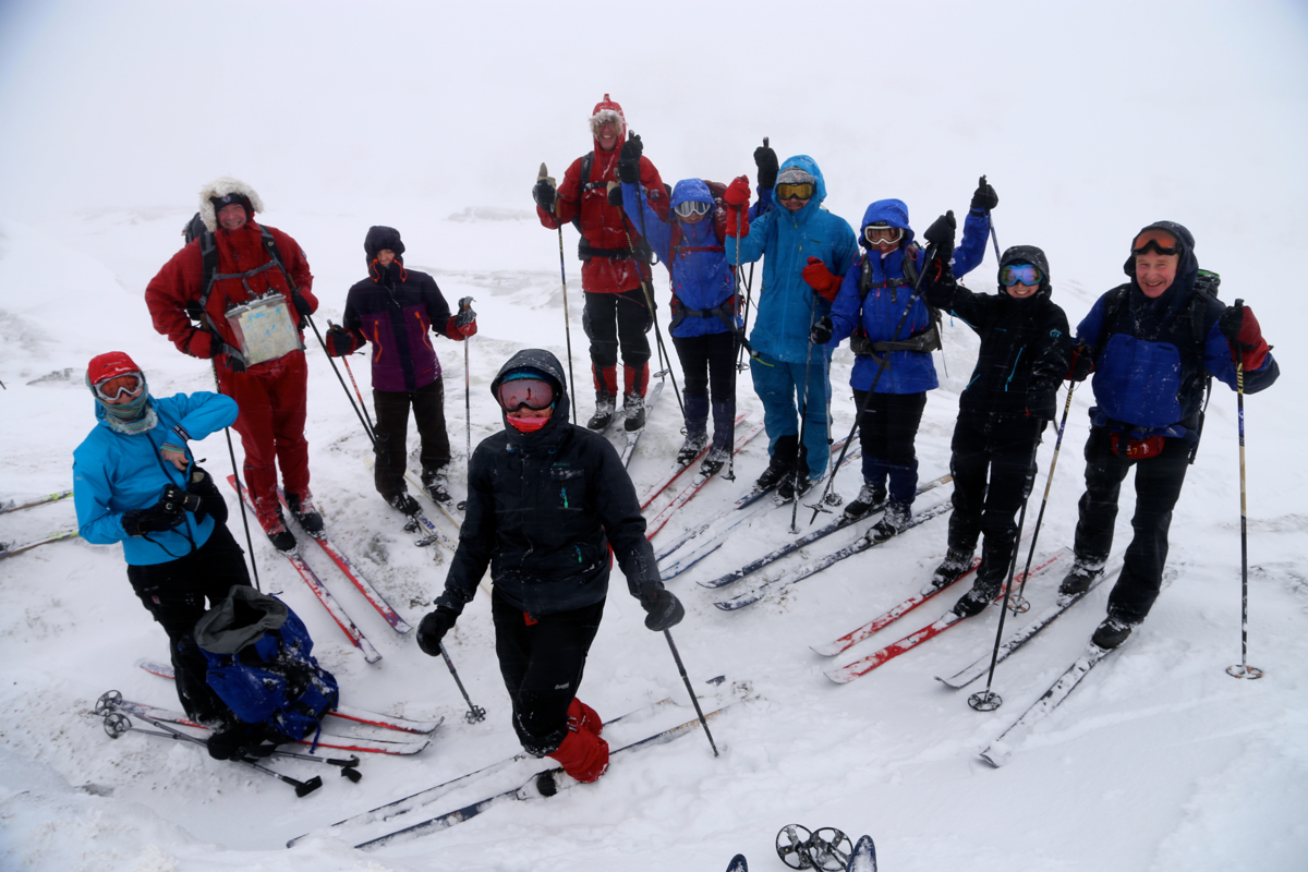
The group was a bit late, arriving around 1830 and we were ready to ski at 1900. The weather
was completely overcast, no moon. Worse, the forecast called for some snow and a gale wind from
the south, that is directly in our face.
I had no map in my GPS, but had entered 3 waypoints the previous evening. Above the first hill,
I told everybody (12 participants) to put on warm clothes, ski googles and protection against
strong wind. I realized that this trip would be rather rough and I did not know how much
(if any) experience the participants might have in skiing in a complete white-out with a blizzard
headwind making progress quite difficult.
We arrived at Gullhorgbu at 2230, 3.5 hours. Quite a few were tired, but happy to see that we
had arrived. It was clear that this night ski-trip had been a very new experience for many.
Breakfast at 1000, the weather was still bad. Still, all but 2 wanted to come along on a ski-trip
planned to a nearby summit - Trollskardtinden, 1074m on the general map. We started at noon, with
zero visibility I led the group uphill towards point 926. I noticed that we clearly were on the
"wrong mountain", I had misplaced the waypoint late last night. Thus, ignoring my GPS, we quickly
descended and skied across the lake to the proper ridge. The first 10 (vertical) meter were quite
steep, skiing around to the east side, I located a route that would work for everyone. Reaching the
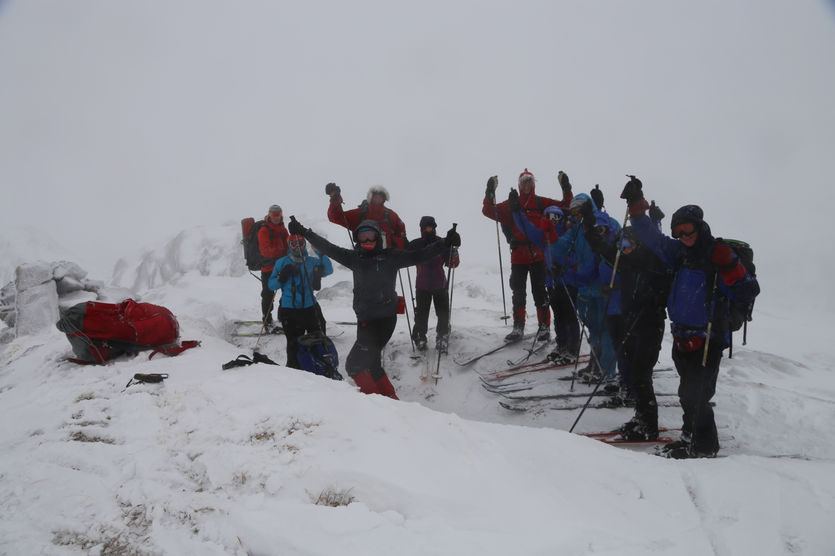
summit ridge, I was fully aware that we should proceed a bit further south to find the 1074 point that
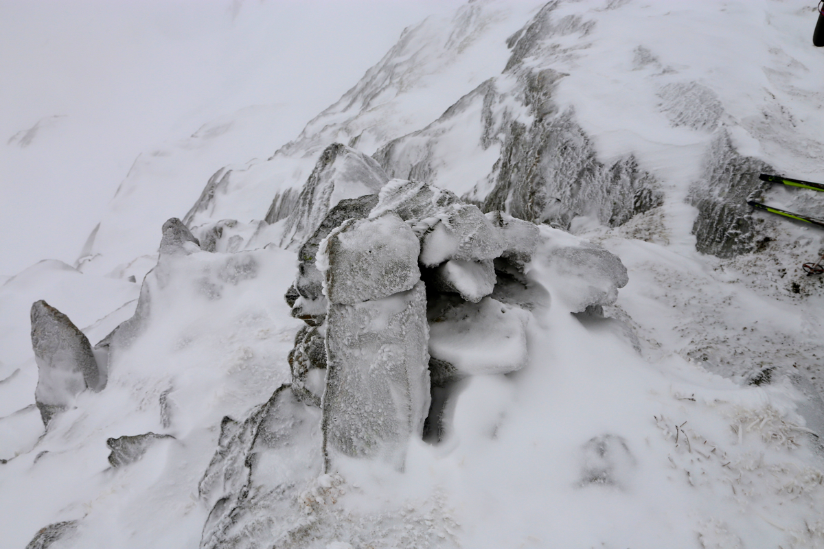
I believed was the summit. However, up left looked pretty
high and I soon located a cairn and measured
the elevation to be slightly above 1080 meter. I declared that we had made the summit and
everyone were happy.
No visibility, but the wind was not as bad as yesterday. The time was 1345. Skiing back down
was easy and we were all back at the hut by 1500.
On Sunday, we started at 1115 and had an easy ski back down to the cars, arriving there at 1300.
The weather was now very mild and the lower part of the track was completely wet with water running
on the surface several places. Not good nor normal in January!
