How to get there:
Locate the town of Rieti. In the south-west, locate road SP-46 going south.
Follow this road, then turn right to location N42.30594, E012.75029, elevation about
810 meter. Tancia Hostel is located here. Good parking.
Route:
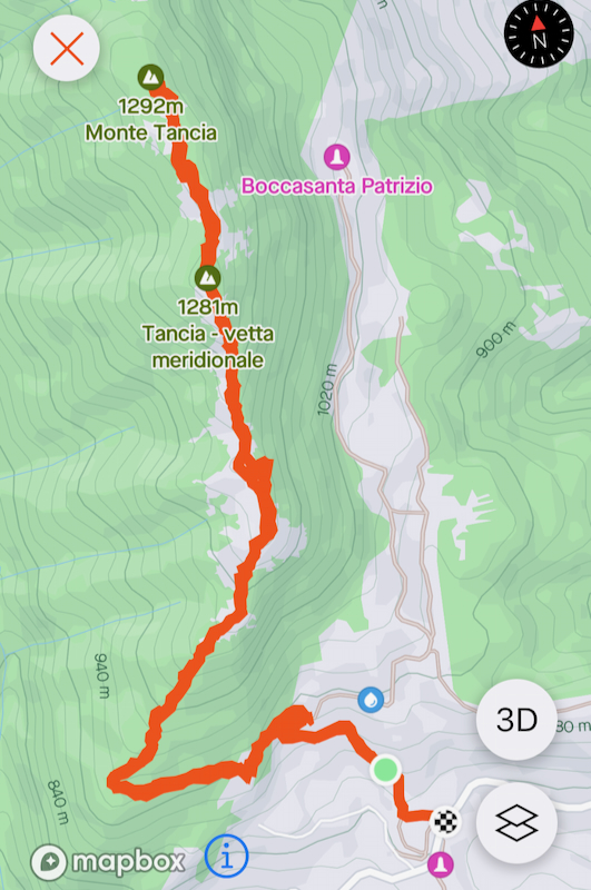
Take the road that has signs for Monte Tancia. Follow this road uphill, but pay
attention as the marked (white and red) trail forks left, this may be hard to
spot. See also the map with the route below.
Once you are on the marked trail, there should be no big issues. The trail is mainly
marked by cairns. The trail starts out ascending gently towards the east. When on the
broad, main ridge, it heads directly uphill. You pass across several local hills along
the way to the highest summit.
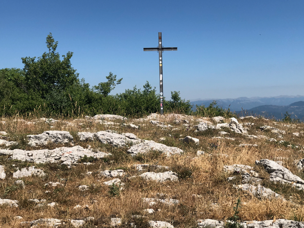
On one such top, there is even a summit cross.
Stay on top of the ridge, a big trail descends right
at one spot, do not descend!
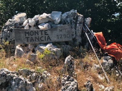
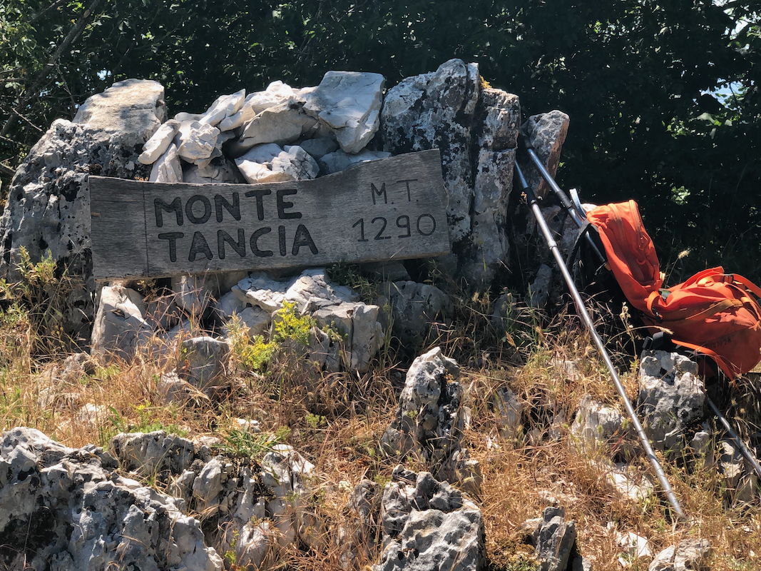
Finally, you get to the highest point,
marked with a nice sign. The local hill just
prior to this top is very similar in elevation.
Comments:
I had been climbing Terminillo, but it was still early
and I decided to look for a second P600 hill in the general area near our hotel.
The choice fell on Monte Tancia.
I started hiking at 1335, boy it was hot! It took me 1:15 to reach the summit, then
45 minutes to descend. A nice little hike that can be recommended.