Location: North 61:43.888, East 009:27.209 (GPS at the summit).
Oppland, Norway
Difficulty, YDS class 2
Climbed on October 9. 2010
Information:
How to get there:
Driving north from Lillehammer on E-6, you shall turn off onto Hwy. 257 at the
small place Sjoa. There is a gas station right ahead and your turn is just before.
Measure from here. At approximately kilometer 4.7, look for a road going right with
the sign Øverbygdsveien, take this road. The road climbs, at kilometer 8.0, take
a sharp right onto the road Espesetervegen. At kilometer 8.7, you arrive at a self serve
payment of toll. (Just before a cattleguard) Pay (2010) NOK 20 for a regular car. This road
may be a bit marginal, in particular, just after heavy rain. At kilometer 10.9, keep left.
The road ends at kilometer 11.3, there is a place to turn around. Just before the end of the
road, there is parking for 2 cars on the right hand side. This location is
N61:42.586, E009:28.246, elevation about 916 meter. This is a reasonable trailhead.
Route description:
The map may show some trails and there are indeed some vague trails. However, the best
approach is to bush walk directly uphill from this trailhead. Follow small open passages
between the trees, it is not very far, about 300 meter,
and you are above treeline. The summit
will now be to the north (left). The nicest route is perhaps to continue uphill and gain the
main (north-south) crest. One can then follow a small trail going north to the summit. Alternatively,
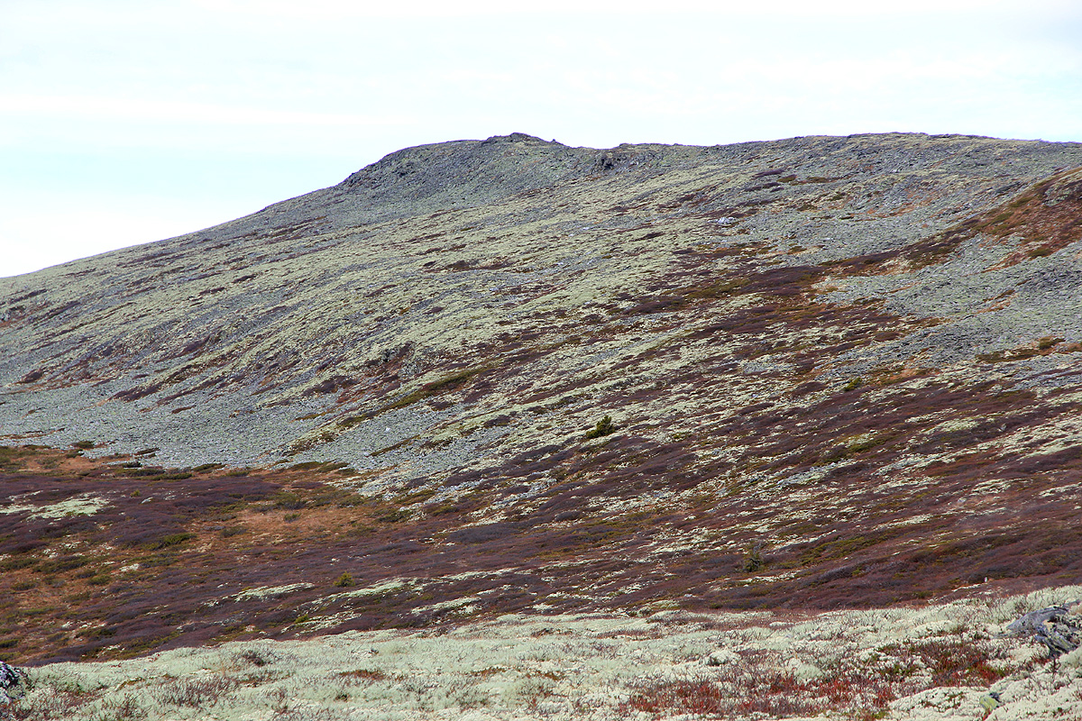
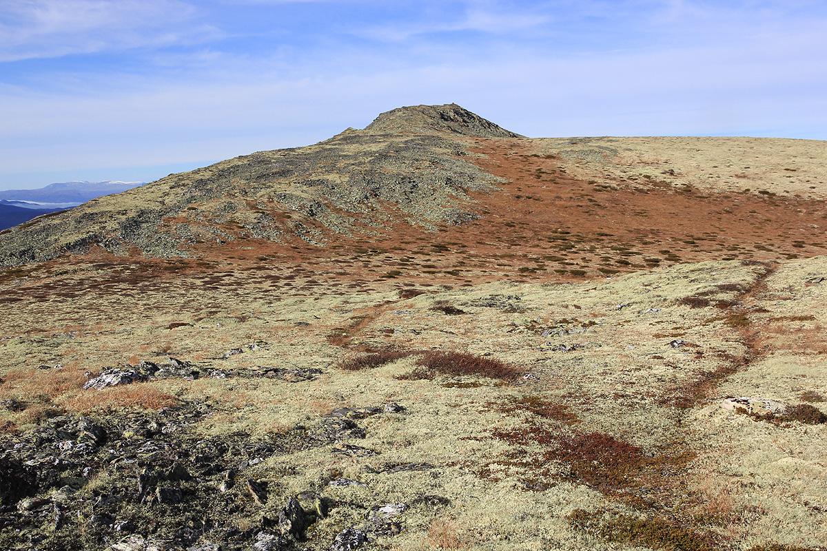
just angle uphill while steadily moving north. The terrain is easy, the lower part of
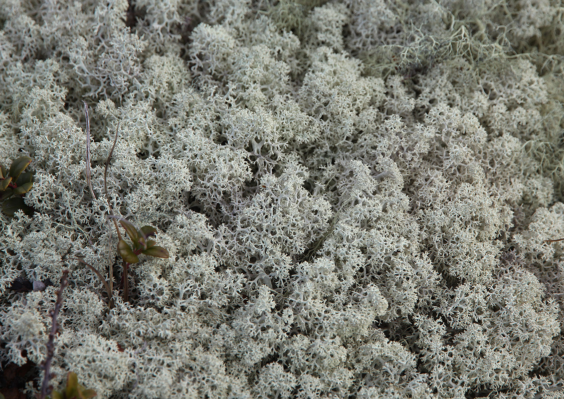
the mountain is covered by low vegetation,
while the higher parts have a carpet of
(reindeer) lichen. There
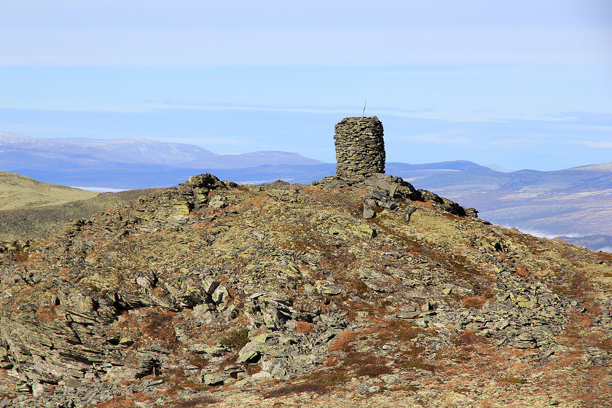
are two summit points, very close together and of approximately the
same height. The northernmost has a big cairn, while
the south summit has a (fallen down) trigpoint
marker and an iron bolt. The south summit has coordinates N61:43.858, E009:27.264, it measured
marginally higher on my GPS.
Comments:
After climbing Skaget on Friday,
I drove to my mountain hut and
made preparations for the coming winter. The "skigard" (fence) needed a few small repairs and the
day was sunny and unseasonably warm. Lunch outside in the sun.
The evening came with a display of red colors.
Later, I had dinner by the fireplace and listened to the radio as Norway defeated Cyprus
in a football qualifying match.
The next morning, after a tasty breakfast, I finished the winter preparations, then drove via Lillehammer
to the trailhead. All
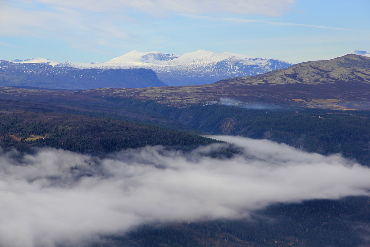
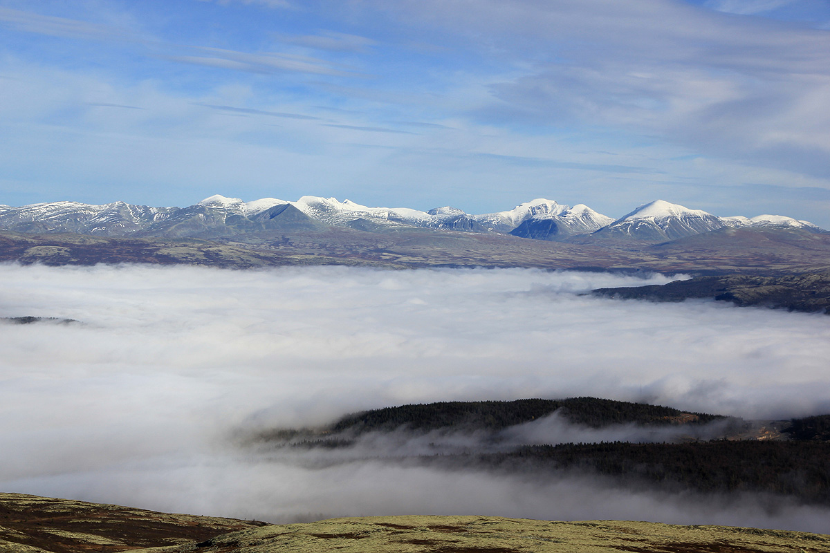
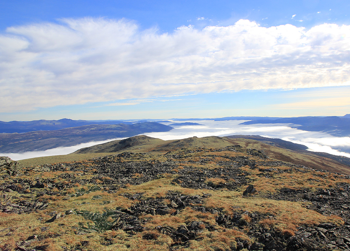
valleys had a pretty dense cloud cover, that lasted all day while the mountains enjoyed the October sun.
The trailhead was already above the clouds and I had a good view
across to Jotunheimen.
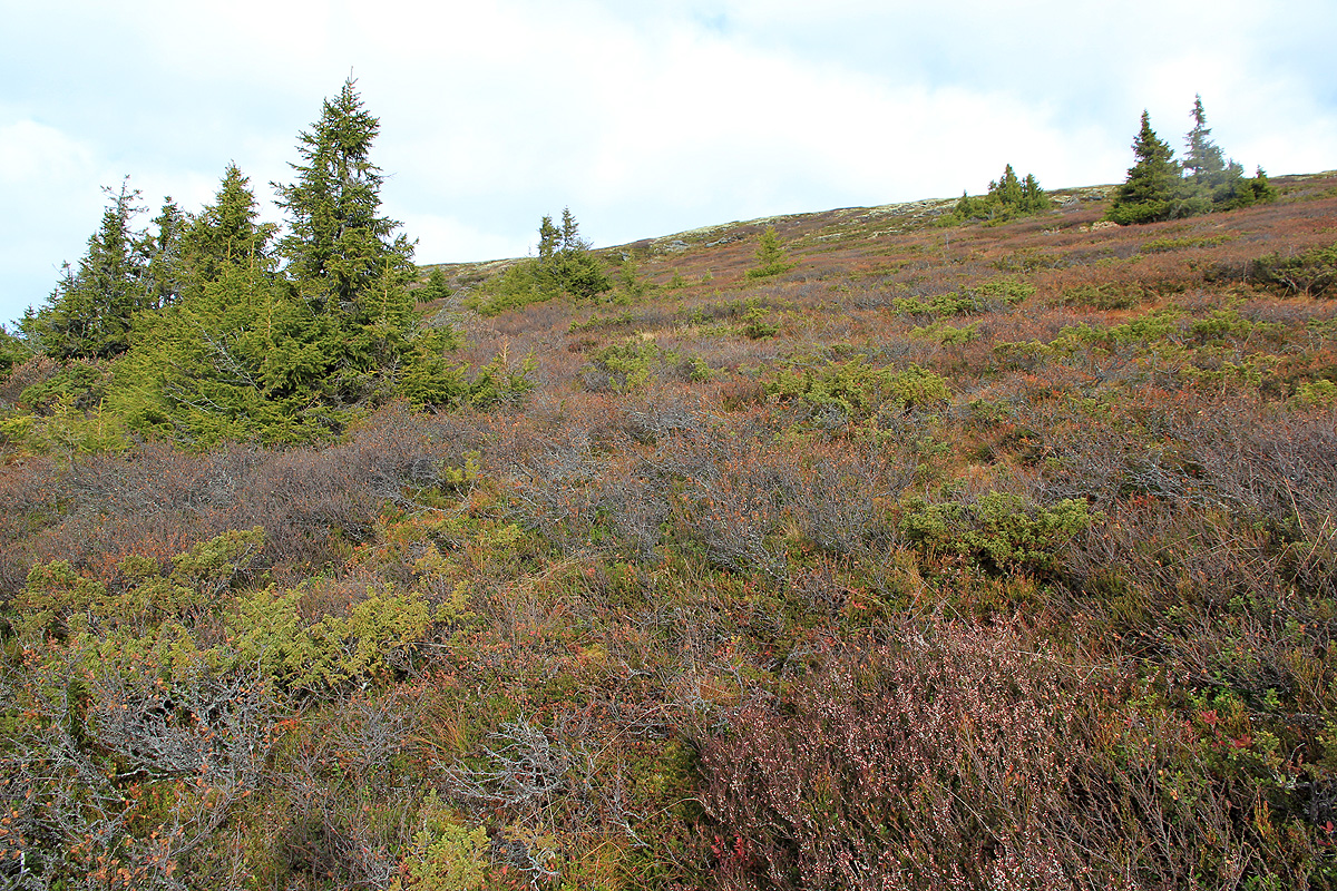
I started out at 1150 and tried to follow a trail that sort of traversed north in the hillside. Very wet
and very obscure, I soon decided to just head uphill in order to get above the treeline. This was a very
smart move and the rest of the hike was very nice. The sloping mountain dressed in fall colors, low brush,
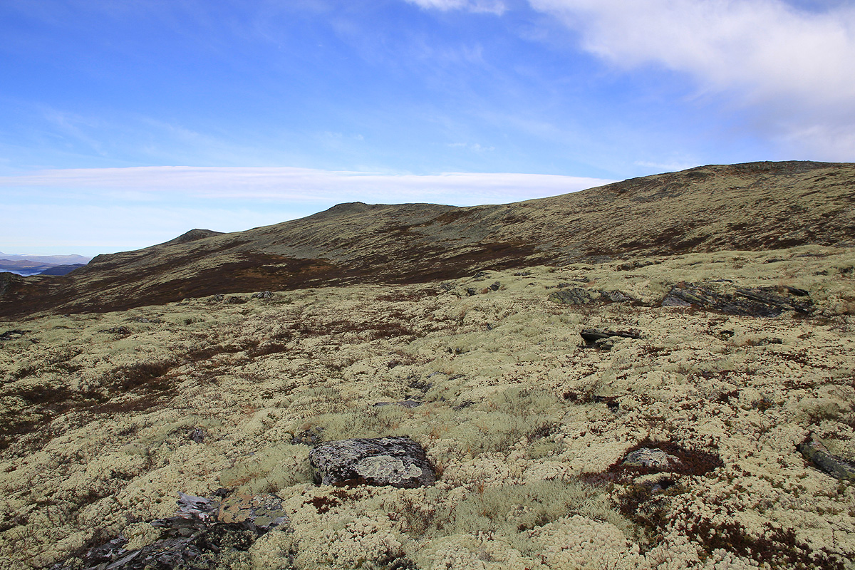
then white lichen higher up. A soft carpet to walk on. I made the main crest, then
followed it north towards the summit, arriving
there by 1245. There are two small summits of essentially equal height. I measured
both, took my panorama picture from the southernmost (since it did not have a cairn), then a "Kvikk lunch"
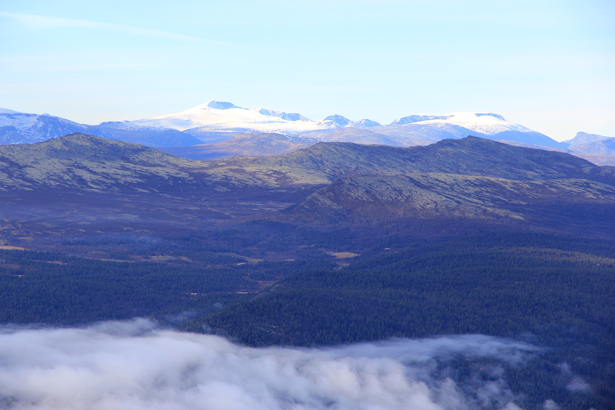
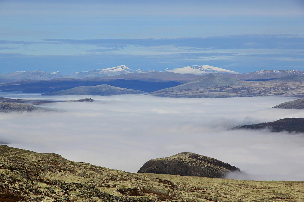
chokolate by the cairn. The view east to Rondane was
outstanding. To the west, the big bulk of
Heidalsmuen, then eastern parts of Jotunheimen.Dovre was also quite visible to the north.
I left around 1305 and followed the main crest southwards a bit further before turning west and descending.
The entire Gudbrandsdalen valley covered by clouds going south.
In fact, these clouds never went away and
provided a nice setting for the mountains all around. I was back by the car in about 45 minutes, a very nice
hike altogether.
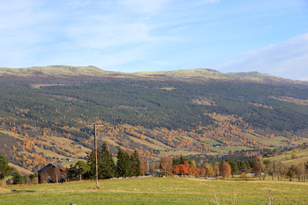
I completed this smaller road going high in the west slope, with a good
view of the valley,
by driving to the centre of Heidal. Many old
farm buildings along the way and some
very well kept farms in
the valley itself. My trip continued
across Strynefjellet where I took the old road, a very nice alternative to long tunnels.