Location: North 64.80305, West 023.77921 (GPS at the summit)
Difficulty: YDS class 3 (summit spire)
Climbed May 20, 2016.
Information:
How to get there:
From Reykjavik, drive Hwy. 1 north to Borgarnes, then
Hwy. 54 northwest, subsequently more west as you drive on
the south side of the big penisula that extends west. When Hwy. 54
heads north across to the north side, fork left and continue on
Hwy. 574. Shortly, this road heads south towards a distinct local
top, Stapafell, 526m. The road F570 forks right here. This road connects
north to Olafsvik in the summer (closed in winter). Still, in the spring one
may be able to drive this road a short stretch. The trailhead is where you
cannot drive any further, or when reaching a point directly east of the
mountain. We drove to location N64.78773, W023.68731, elevation 350 meter.
At this point the road was closed by a wall of snow put in place by human
operated equipment.
Route:
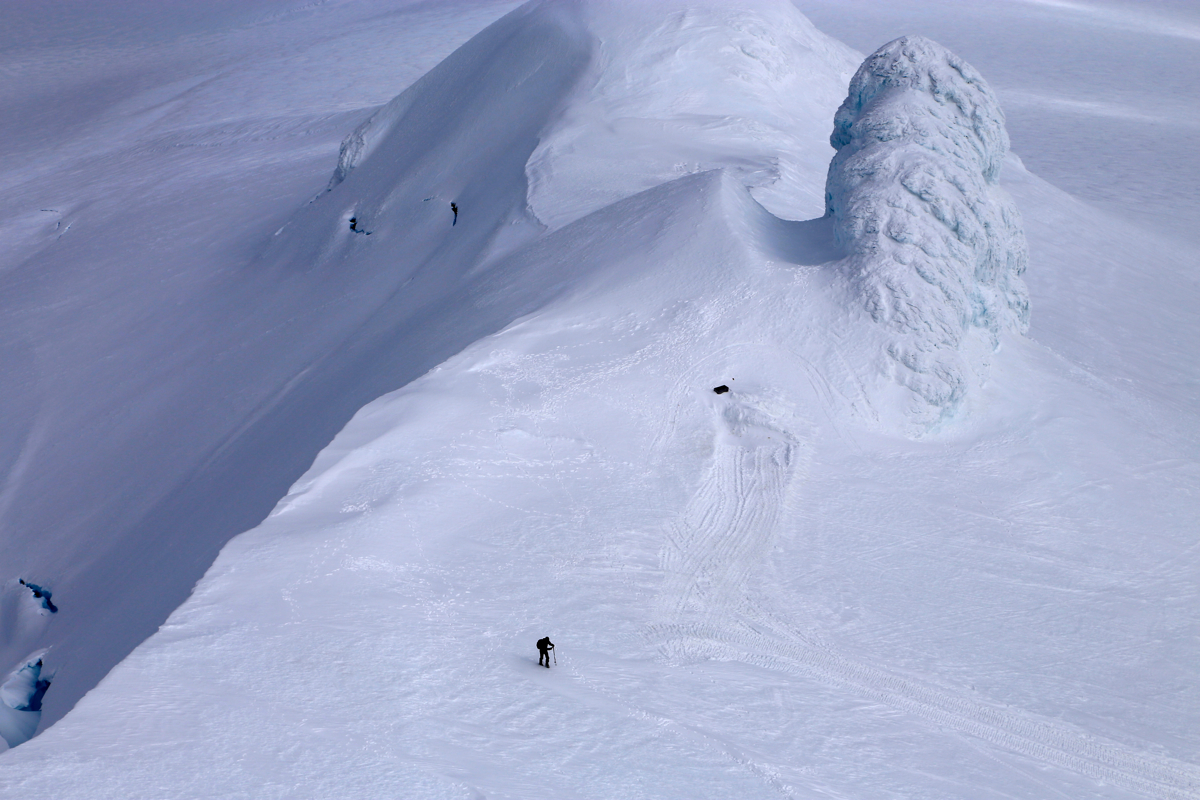
Ski further along the road while observing the mountain. There is a small
skilift and a steeper section a bit south of this. The most direct and good ski
route is to ascend diectly up the very smooth slope that you observe before
this area, ie. a bit further south. Ascend here, the slope becomes slightly less steep
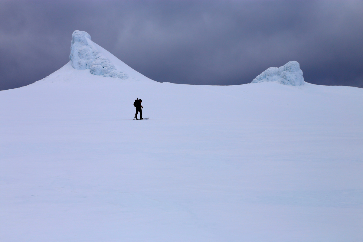
higher up. Aim directly for the col between the two small summit points that
will appear high on the horizon. The highest point is the characteristic pointed
peak that lies to the left. One should ski up to the col/ridge on the right hand
side of this peak.
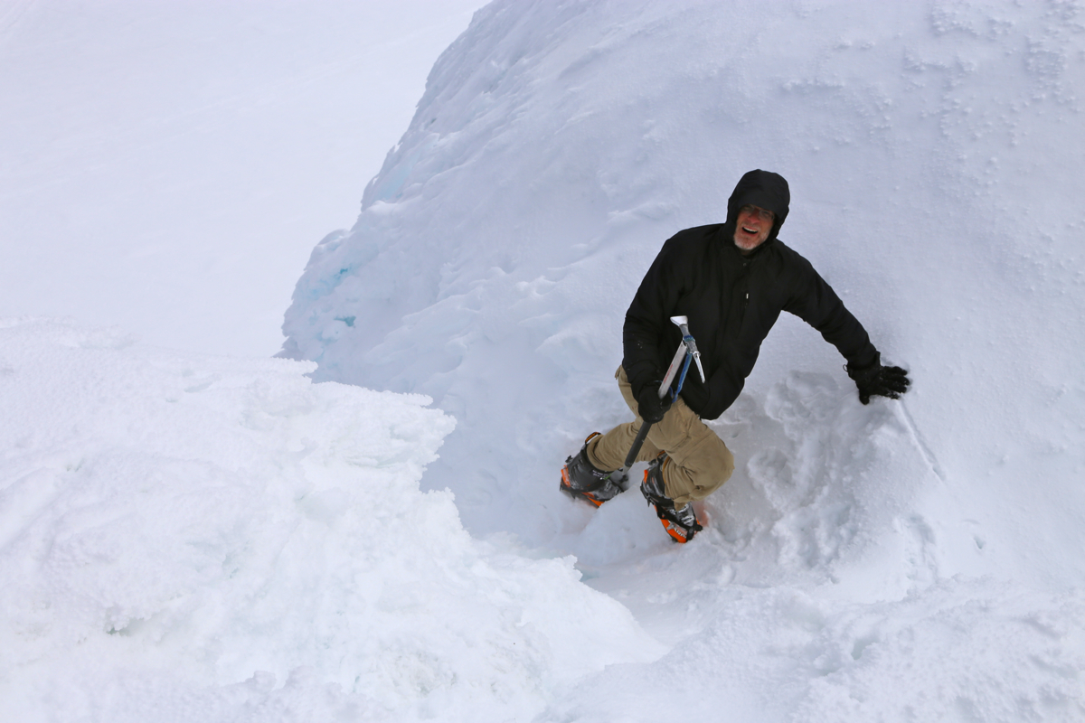
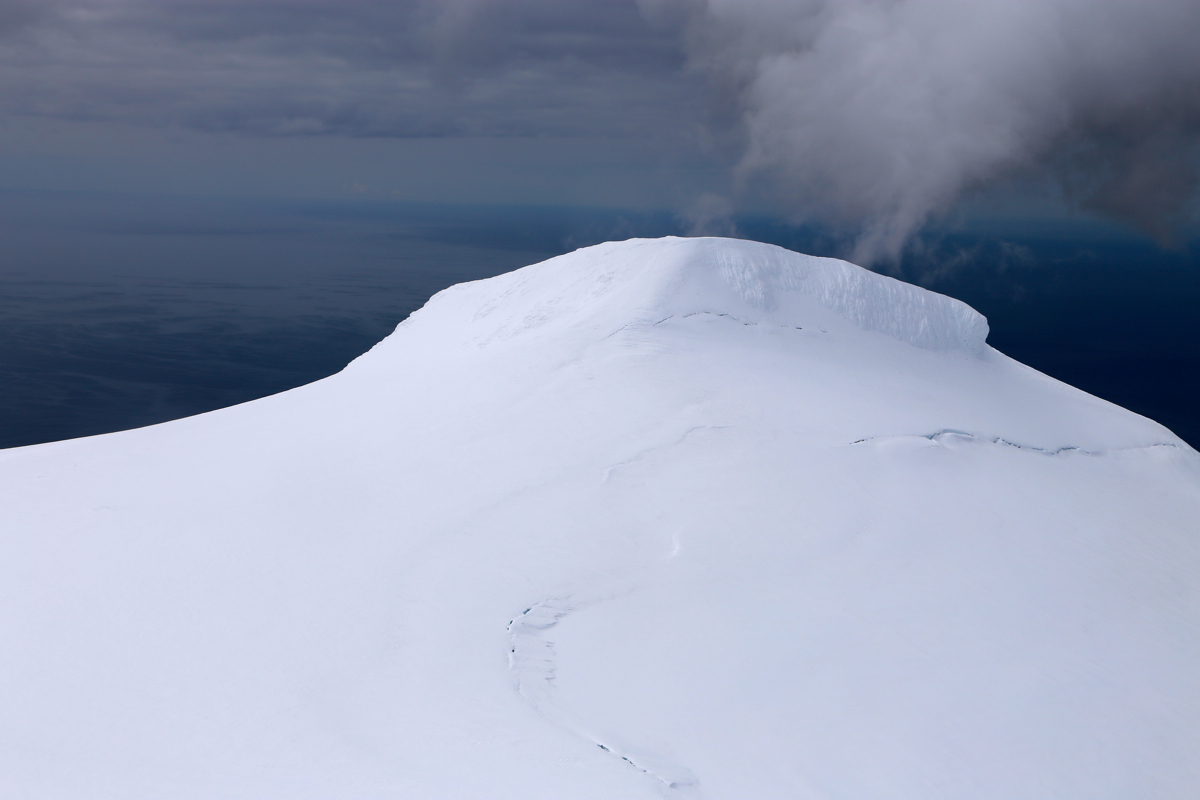
From the base of the 50 meter tall summit spire one must proceed on foot. Ice axe and crampons are
strongly recommended. First proceed up a smooth, pretty gentle slope until you are
just below the summit (ice) block. Traverse higher on its left hand side, gaining
a small notch between the lower summit (left) and the highest point (up right).
Finally, turn right and climb a very short pitch directly from the notch to
the summit.
It is possible that the ice and snow on this upper part may change quite a bit
from year to year.
Comments:
We started from Olafsvik and drove around the penisula
on the west side of the mountain.
We drove the road that runs just east of the mountain from the south side until
blocked by snow at location N64.78773, W023.68731, elevation about 350 meter.
Starting on skis at 0810, we skied a bit parallel to the snow covered road, then
turned more uphill towards the summit.
Arriving at the base of the summit spire in
2:40. We rested and fitted crampons to our boots before heading up the last, steep
slope. From below, it was difficult to judge
just how hard the top pitch would be.
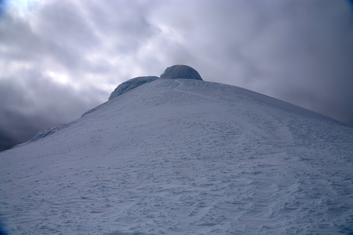
As it turned out, a route led us into the small notch between the two summit snow
domes, then easily up right to the highest point. The traverse to this notch was straightforward,
but care should be exercised as a slide left would go directly into a steep and
unpleasant looking crevasse. We spent quite some time at this small and interesting
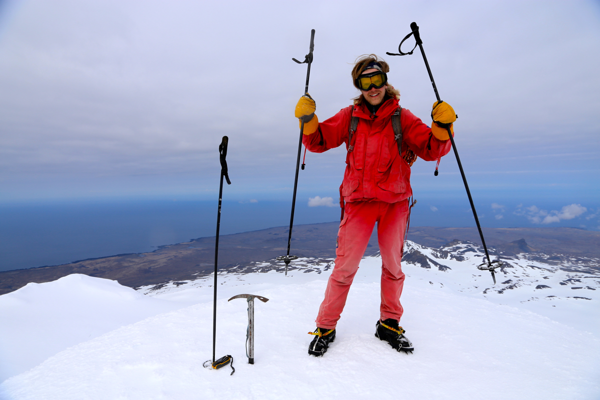
summit. The weather was nice and we had no wind.
A single hiker from Germany
appeared below, he turned back down from the base of the spire, a reasonable decision
as one really should have crampons and an ice axe to attempt this final part of the ascent.
Pål Jørgen led the way uphill with me following. I soon hear his voice telling that
the entire ascent was straightforward. A few moments later,
I joined him on the summit.
Shortly, also Greg appeared,
completing the final steps.
We spent one hour around the summit spire, this included the rest at the base, the ascent and descent
as well as a fair amount of time on the summit itself.
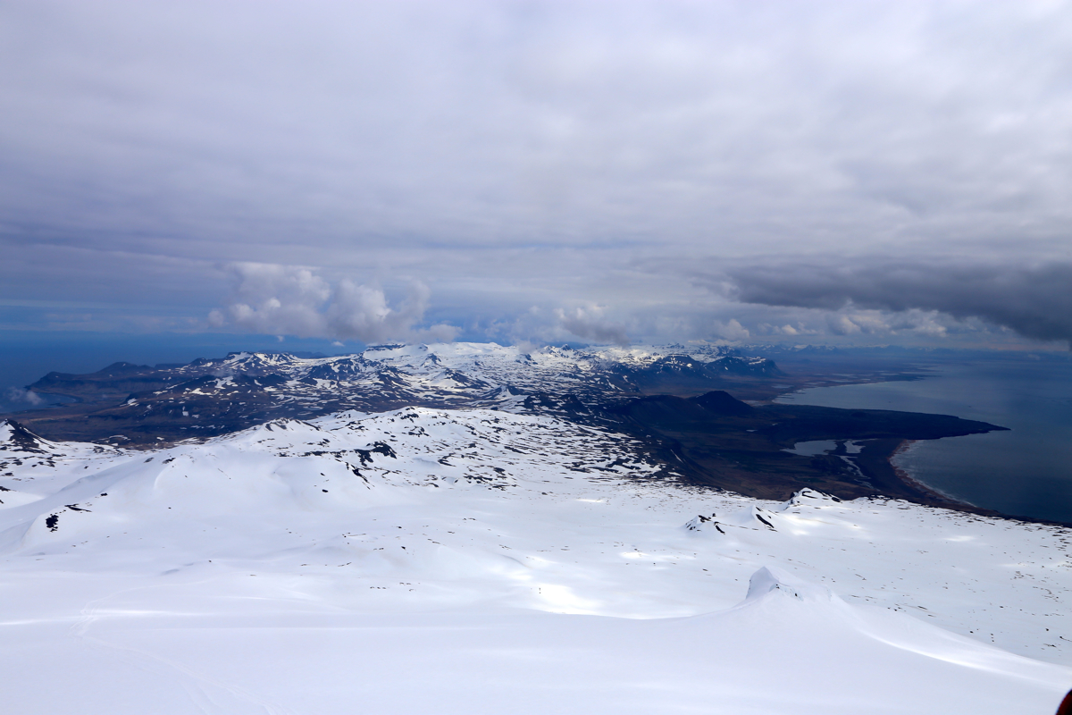
The scenery gradually improved, however some
clouds did remain, the weatherforecast did not deliver a perfect day. No complaints, the weather
was quite reasonable and the sun broke through now and then.
The ski back down was very nice, a single slope with a drop of more than 1000 meter.
Payback time for all the work to ski with randonnee uphill.
We were back at the car at 1245.
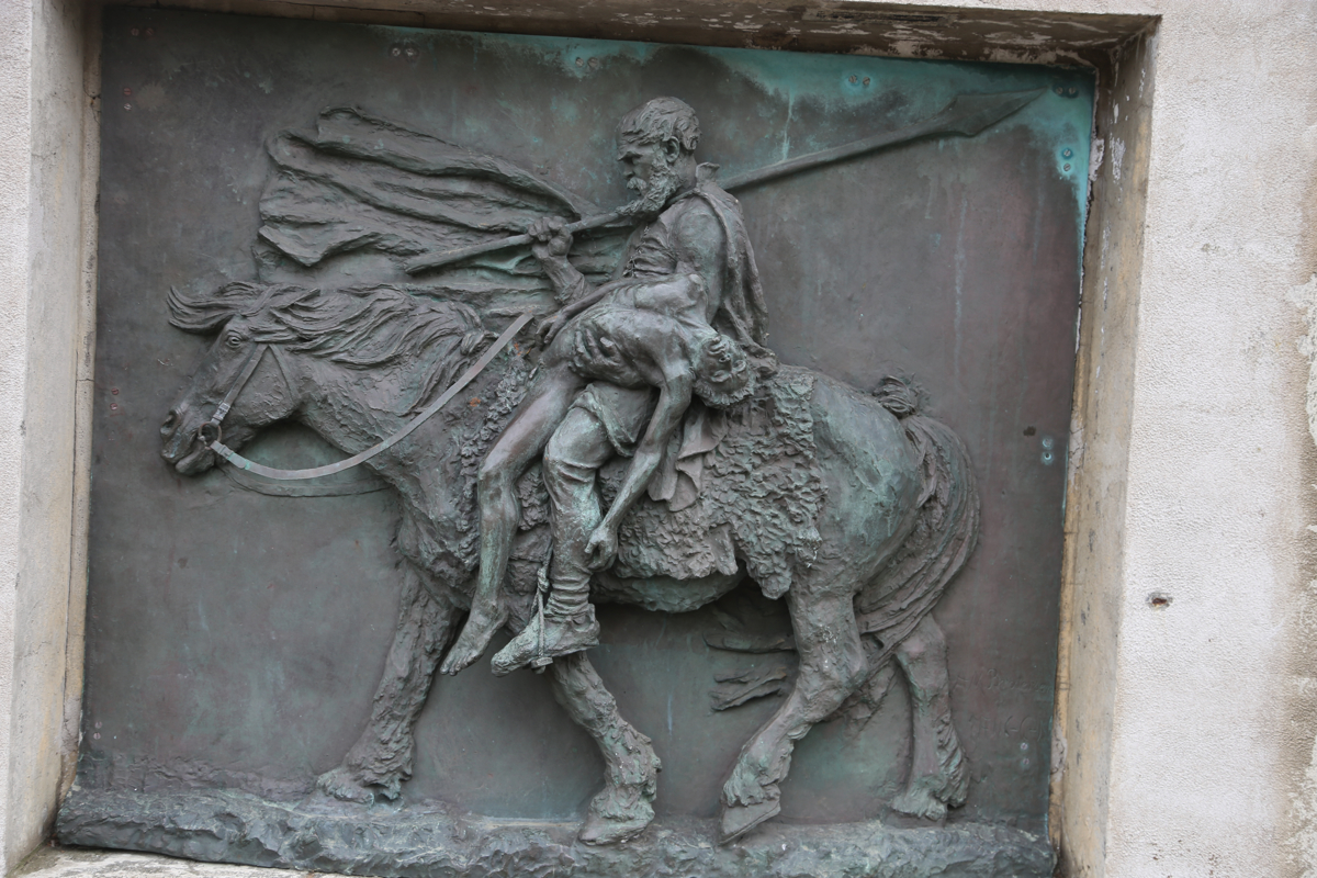
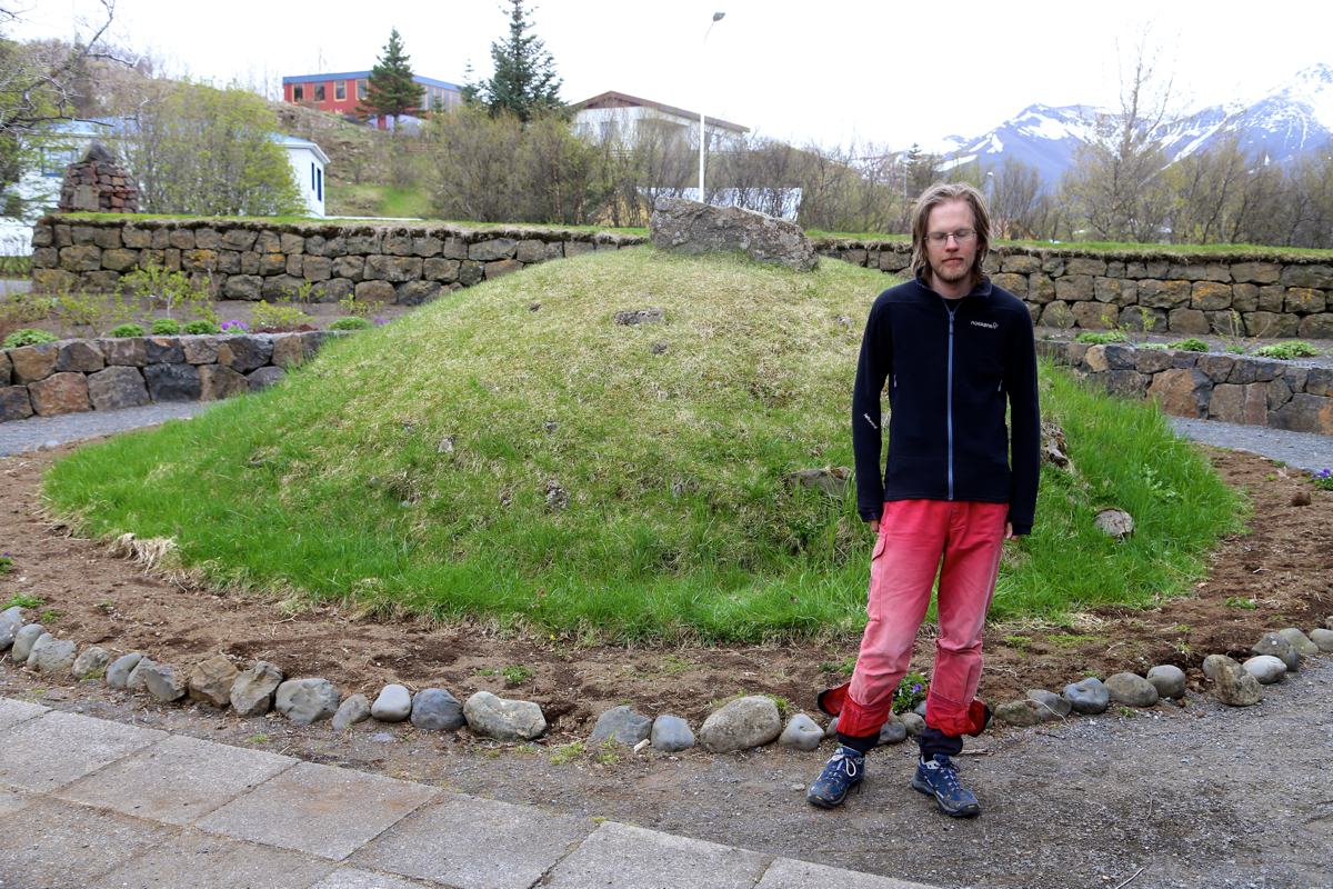
We next drove to Borgarnes to a well deserved lunch
plus sightseeing the memorial for
Egill Skallagrimson, the burial site of his father and son.
Here is a quick summary of peaks climbed in our trip to Iceland.
Resources:
Images
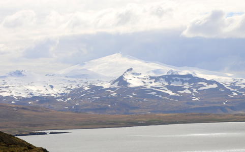
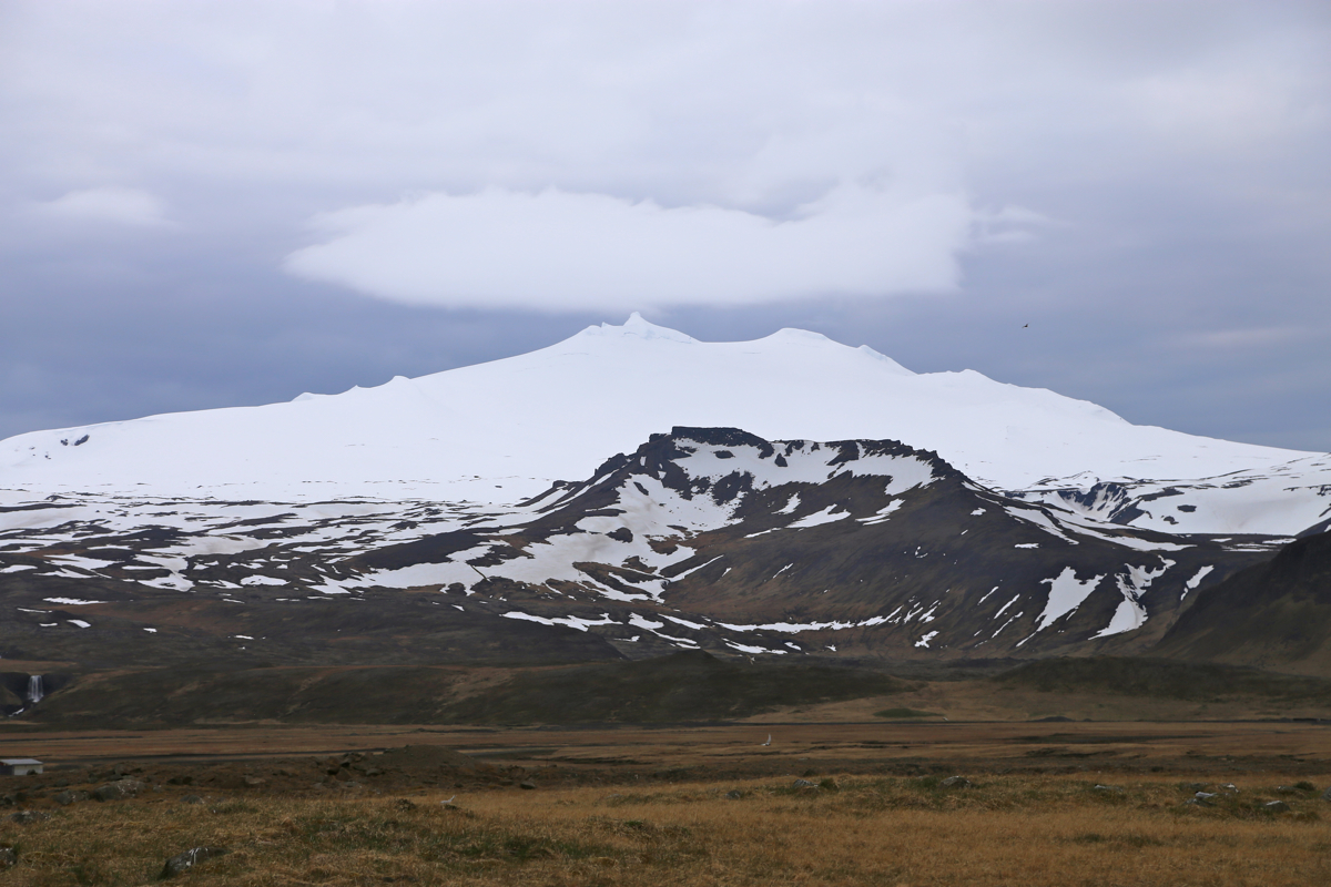
Snæfellsjökull, as seen when driving west along the north coast of the penisula.