Location: North 61:38.145, East 006:24.306 (GPS at the summit).
Sogn og Fjordane, Norway
Difficulty, YDS class 2
Climbed on October 16. 2010
Information:
How to get there:
A good place of reference is the village Skei on E-39.
Skei is located at the north end of the big lake Jølstervatn.
Measure from the traffic circle at the end of the lake, just in front of
the Skei hotel. Continue north on E-39. Around 3.2 kilometer, look for a small
road that goes left. There is a sign saying "Breimsvatnet 6 km". Turn onto
this road. At kilometer 7.4,the road forks. Take the left fork and continue
to kilometer 7.7, there is a turnout on your left side, before you get to
the first farm. There is space for 2 cars. Park here, the location is
N61:37.030, E006:27.212, elevation about 72 meter.
Route description:
You start 1400 meter below your destination, which can be seen straight ahead.
Continue along the road about 100 meter, before the first farm a forest road
turns left and climbs uphill. Follow this road (new in 2010), as it zig-zags uphill.
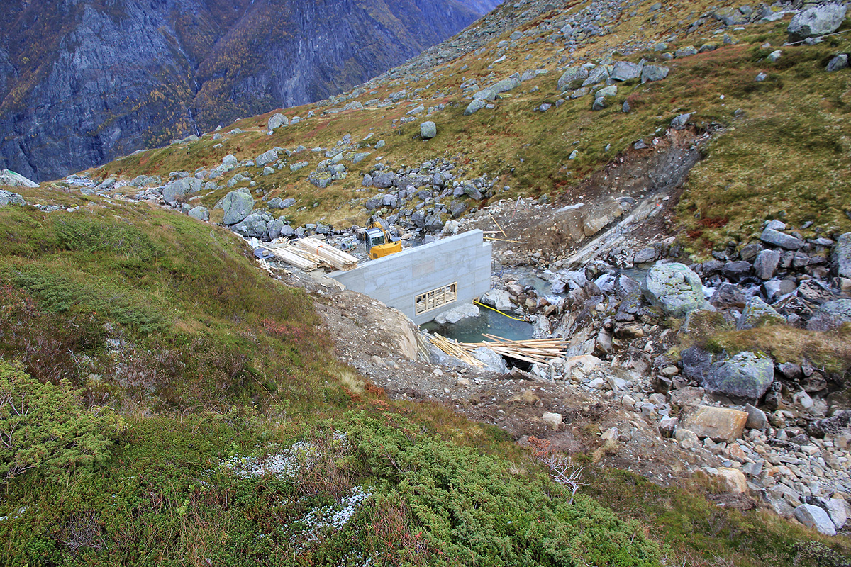
The road serves a tunnel that (in 2010) is being built quite high up, most likely
some hydro power project. In the last sharp curve going left, leave the road and
pick up a small trail that traverses a bit right. In about 50 meter it merges
with the old trail that continues steeply uphill. Follow this trail until
the terrain gets more gentle. The trail is now close to the creek and in this
area (again in 2010) a small concrete dam is being built. Cross the creek just below the
dam and continue uphill along the trail. This trail will get you up to a level area,
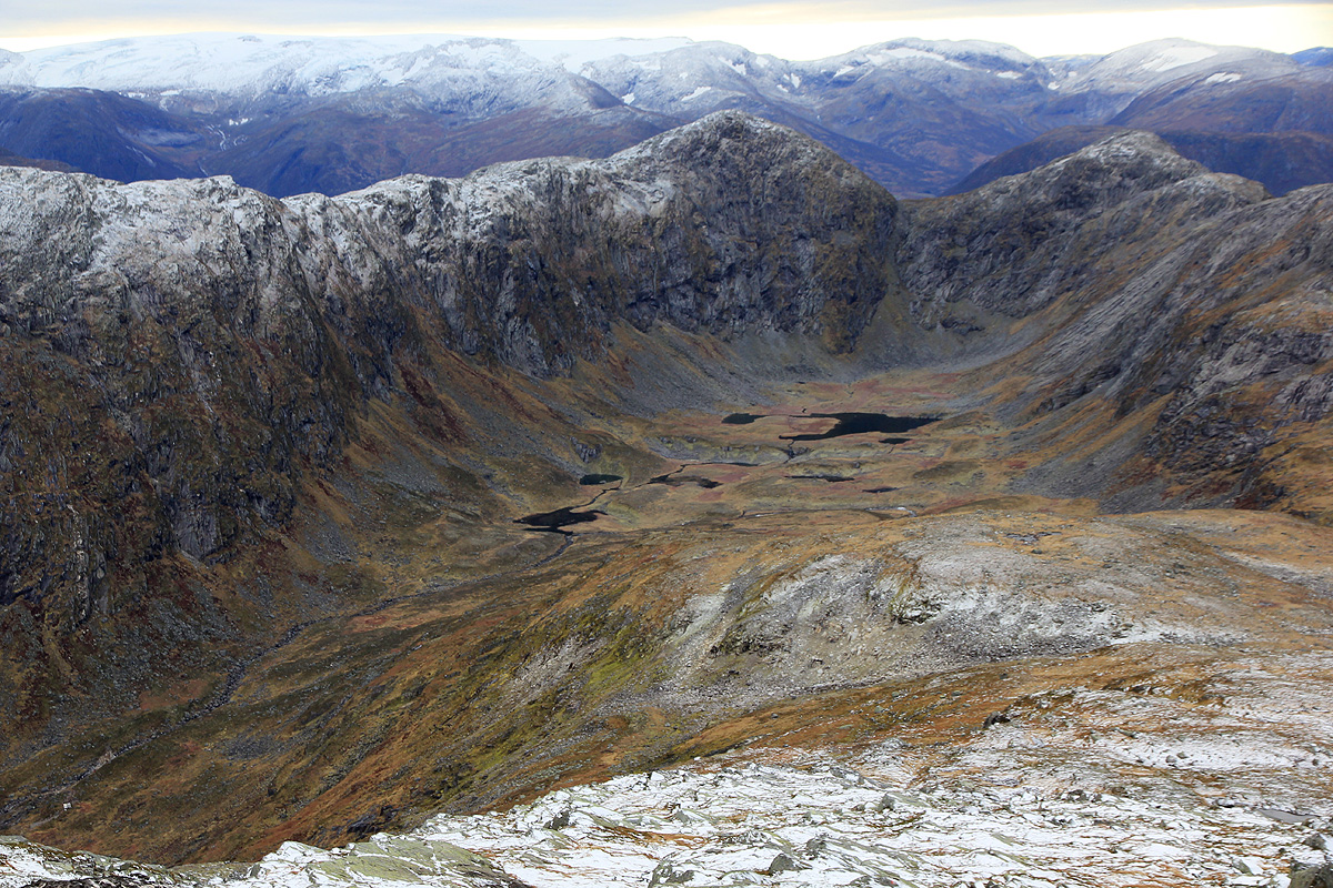
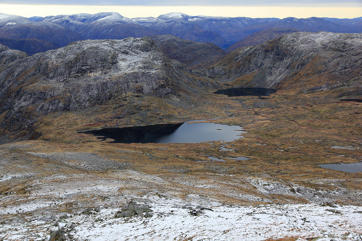
then curve right, you will see a nice basin circled
by mountains straight ahead.
Follow the trail as it stays on the right hand side of the creek and gain the area just
before Tverrlivatnet (859m), there
is a mountain hut near the lake outlet.
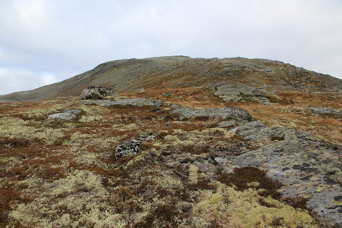
Turn more right and gently gain more elevation as you now hike more north in order to
follow the Skjorta south ridge to
the summit plateau. Higher up, you will merge
with a cairned trail (also marked with red paint). Continue along this trail, it
will gain the almost flat summit area. The summit is almost one kilometer further
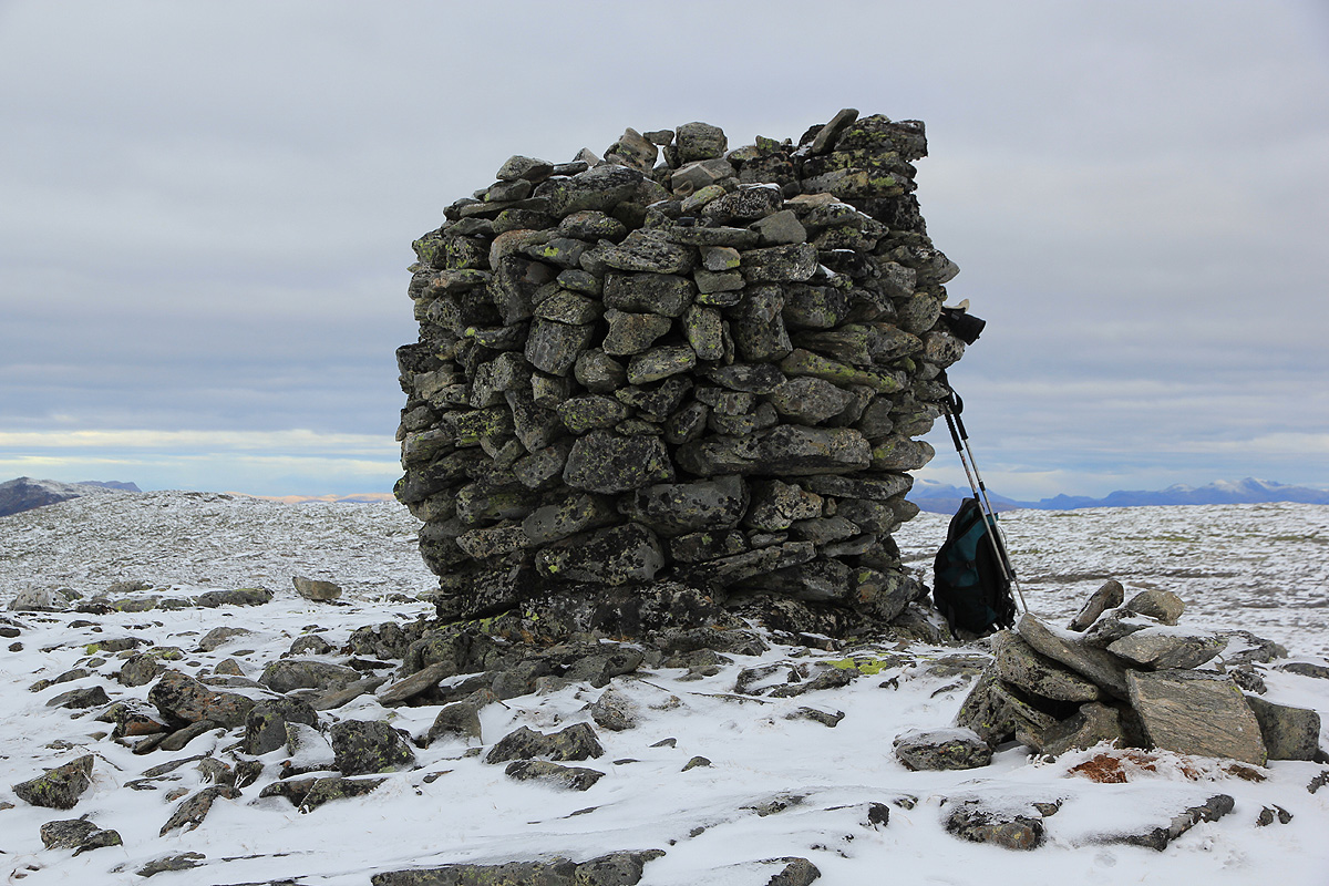
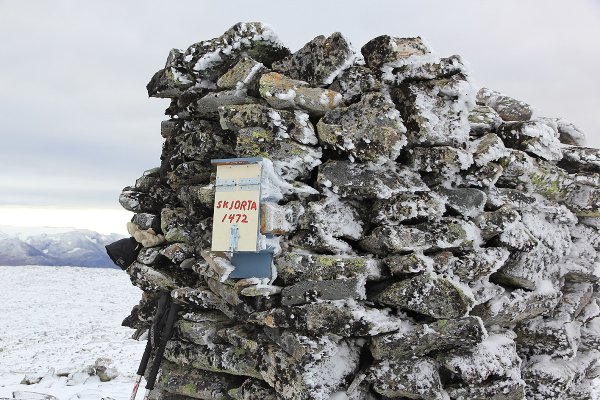
north, marked with a large cairn and a summit register box.
Comments:
I drove from Bergen around 1600 and arrived at Skei hotel shortly before 2000.
A nice meal (local trout) and early to bed. I woke up around 0600, Orion could
still be seen on the southern sky. A bit of internet, then breakfast at 0700.
I drove to the trailhead and realized that a new road going uphill the way I
intended to go, had been constructed. I found a good place to park and headed
uphill by 0800.
Getting near the end of the
road, a small rockslide suddenly appeared in front
of me. Rocks came down from above
and bounced onto the road. I quickly
realised that a truck must have sent these rocks crashing down from the
next switch-back on the road higher up. A warning sign would perhaps have been
in order?
I left the road in (what turned out to be) its last sharp left curve and picked
up a small trail that soon merged into what obviously seemed to be the old
trail coming up from the valley.
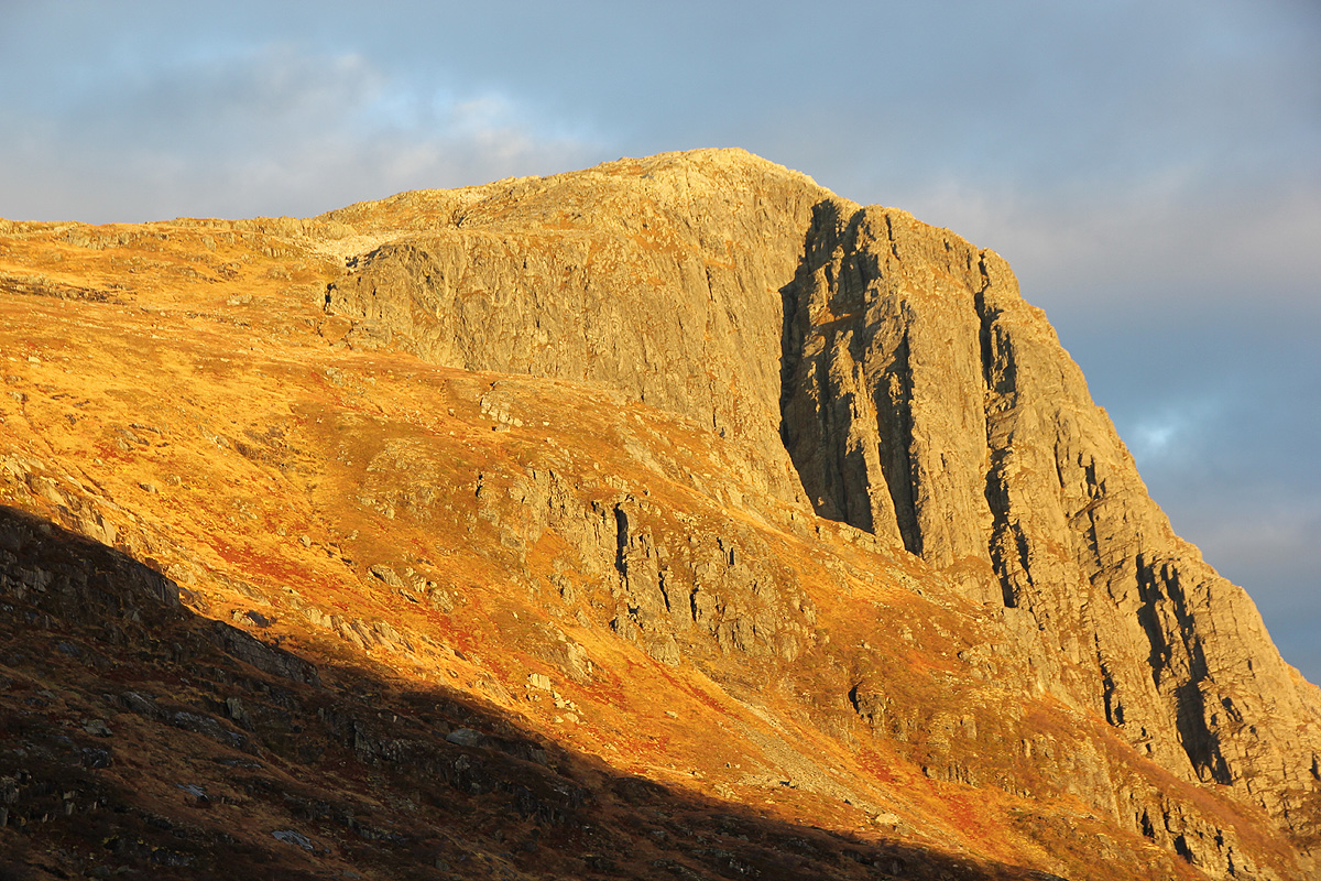
The sun was now hitting Skjorta, great morning light.
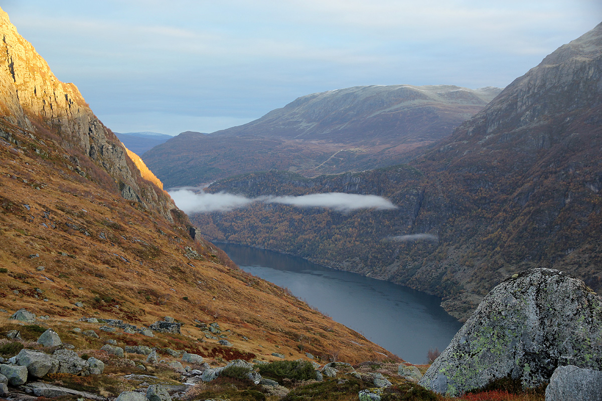
I was definitely about to leave the valley below me.
Higher up, this trail crossed the small
creek on a (possibly temporary) bridge, then led me to a new (local)
area of construction.
The trail continued uphill and turned along the creek, obviously heading
to the small hut near the lake outlet. I turned more right and started to
climb towards the south ridge of Skjorta. The route was pretty obvious and
quite easy. Soon, I gained the main, almost flat summit plateau and started
across to the main summit, located on a small, local top. Arriving there at
1045, the weather was overcast, but with pretty good visibility all around.
I signed the very well
designed summit register, and
took some photos. The forecast
had predicted -10 Centigrade here today, a definite sign that winter is
around the corner. I guess it was slightly warmer and no wind. I left at 1100 and
started retracing my steps across the big, flat area.
I returned by going slightly closer to the lake, the visibility was still nice
as I looked across into Stardalen as well as back down to the small farms
near the trailhead. Nobody to be seen as I walked down the new (and very ugly)
road, reaching my car by 1120.
Resources:
Images
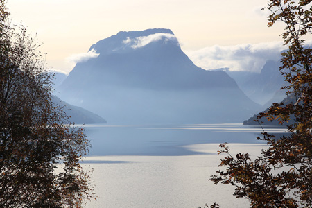
Skjorta, seen across Breimsvatnet, a week earlier.