Location: North 68.57893, East 016.95423, (GPS on the summit)
Difficulty: YDS class 2.
Climbed September 15. 2019.
Information:
How to get there:
From Narvik, travel north on Hwy. E-6 to Bjerkvik. Leave E-6 here and continue
(west) on Hwy. E-10. Drive to the small village named Bogen, cross the river, then
immediately turn right. Drive past a signed trailhead, then turn left up a small road
(This turn is 1.6 kilometer from the main Hwy. E-10.)
and finally, turn right and drive only a few meter to a small parking area.
There are signs for Niinghytta that may assist you in finding this trailhead.
Park here, this is the trailhead, location N68.53726, E017.01773, elevation near 35 meter.
Route description: The trail to Blåvatnhytta.
Note that there are somewhat shorter trails several not marked on current maps. This description will
mention a few. This trail runs from the trailhead to the hut Niinghut, then another trail forks off shortly
before this hut and connects to Blåvatnhut.
First, the trail climbs pretty much directly uphill to the water pipe that serves a (hydro) power plant below.
Next is a section of concrete steps right next to the pipeline. The trail crosses over left and makes
a small loop left before joing the pipeline again for the last few vertical meter. Next, the trail runs
horizontally with great views on the right. A small descent to Djupåvatnet, then onwards to lake
Niingsvatnet with a (open) hut Niinghut just across
a small dam. Note, however, that the trail
to Blåvatnhut forks left (there is a sign) shortly before the trail gets to the lake.
This part of the trail is very nice and walking is easy. The next section, across to lake Blåvatnet is
quite different. Rocks and talus, repeated small uphills and downhills, overall quite a bit rougher and
also very slippery in several places when wet. Mostly well marked with cairns and red paint, but in a few
places one really must pay attention in order to not get off-roue.
The trail forks left, steeply uphill just before the main trail arrives at the lake Niingen. A wooden sign
points left here. Once you are up the first hill, the trail continues uphill to your right hand side, the
cairns may be harder to see initially. The route crosses over the local tops, them descends slightly as it crosses
ia fairly rough section. Next, there is a descent with views of the fjord, you are now above lake Djupåvatnet
that you passed on the way to the Niingen hut. More ascent, the trail reaches its highest point near 840 meter
directly east of Niingen (1073m). From here, a pretty long descent to lake Blåvatnet.
More direct, shorter route.
There is a much shorter route, also marked by cairns and red paint. Start
at the first signed trailhead (about 1.3 km from E-10). First, take the trail to Rogndalsvatnet, then
sharp left to gain the flat plateau at elevation 215 meter.
From here, a minor (but red-marked) trail forks right and ascends steeply, directly to
the small lake at elevation 525m, named Åssiettvatnet. From this lake, the trail curves
north to reach the lowest saddle (near 680 meter) west of mountain Niingen, then descends to lake
Blåvatnet. From this trail, one may also easily cross Rogndalsfjellet (about 760 meter) and
cut directly across to the trail that ascends Skittendalstinden. This is the shortest and most
direct route in order to climb this mountain as a day trip.
The summit route.
From the hut at the
east end of lake Blåvatnet,
follow the marked path to the west end (south of
the lake). Ascend west of the lake to about 800 meter (marked route), then go more north to near
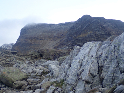
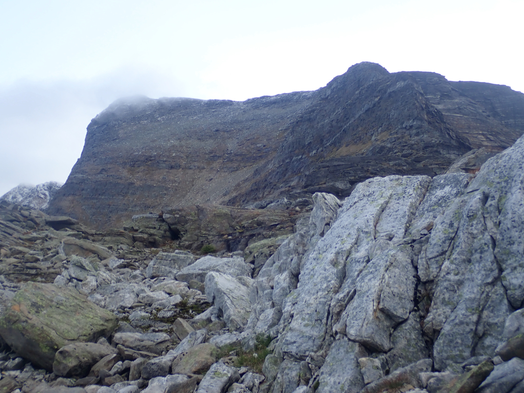
location N68.56665, E016.94651, elevation about 830 meter. You will see a (large) gully that provides
easy walking gently uphill in the direction of Skittendalstinden.
Follow this natural passage, you will
see cairns as you get higher. The cairns climb on the right hand side of some patches of snow (perhaps
a larger snow field earlier in the summer), a pretty clear trail emerges as you get higher. This trail
(well marked) ascends the slope, makes a right turn higher up as it follows the easiest slope in order
to reach the main ridge. A very clear trail climbs just left of the crest to gain the wider summit
area followed by an easy ascent to the summit block. Go left of the final cliffs to find an easy
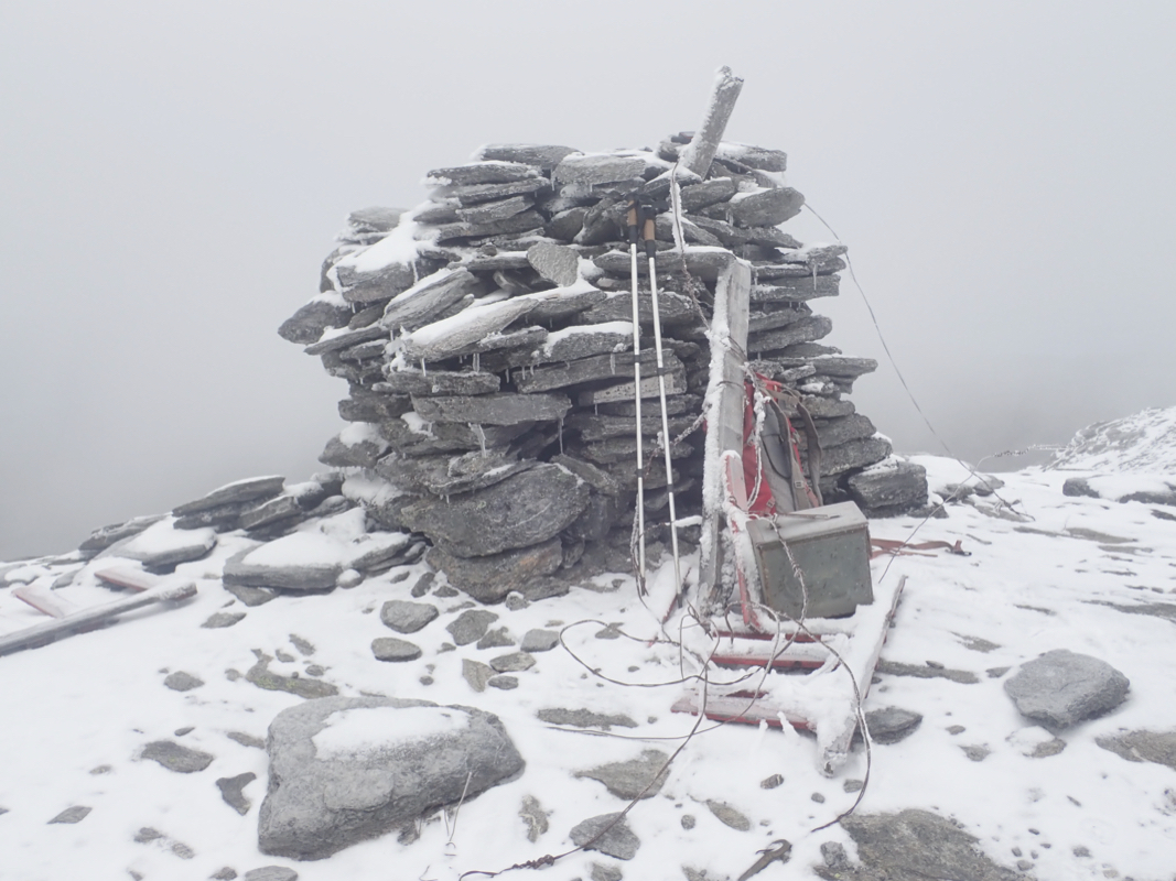
way to the very top. The summit
has a good sized cairn and a summit register in a metal box.
Comments:
I had decided to do this as a 2 day trip with a stay at the DNT hut Blåvatnhytta. Thus, Saturday
would be an easy day and I took the route that would also visit the hut Niingenhut. I left my car around 1010
and followed the steep trail that climbed up to and next to the pipe leading water downhill to a power station.
A very nice route that has good views all the way to lake Niingen. Highly recommended. I took the small detour
to actually visit the Niingen hut. After a short break, I walked back across the dam and returned to the
trail fork. This trail that crosses just east of the mountain Niingen, is substantially rougher than the
first trail. One must constantly look for the cairns in order to stay on route.
Near location N68.55319, E017.03531, elevation about 745 meter, there seems to be a cairned route that may
provide a short-cut back down to lake Djupåvatnet. Ignore this, continue uphill in order to crest the
east side of the Niingen mountain. I then descended and arrived at the nice huts around 1400.
Early evening was spent reading the documents for a mountaineering board-meeting in Bergen next Thursday,
I will arrive the night before, so some extra time available here was welcome. This also meant that I would
climb Skittendalstinden carrying my laptop computer, the only P1000 meter in Norway where this has been the case.
Early to bed and early up, breakfast shortly after 0500 and ready for departure at 0610. Following the south side of the lake
was easy and I soon discovered the natural passage that would lead me directly to the foot of the peak.
I did not expect to find a cairned trail up here, making the ascent easier than expected. The weather
was nice, but with a strong wind (gale force) from the east. Climbing from the west, I did not feel this
wind before near the top. I arrived at 0850, pretty good views, but the wind dictated a short
summit break.
Descending, I decided to cut across Rogndalsfjellet, descend south and pick up the trail to the small
lake called Åssiettvatnet (strange name). From here, I followed red painted cairns east in order
to descend nd connect with the trail down at 250 meter of elevation. Unfortunately, some critical
cairns seem to be missing (or I simply did not see them). Thus, I lost the route where I really
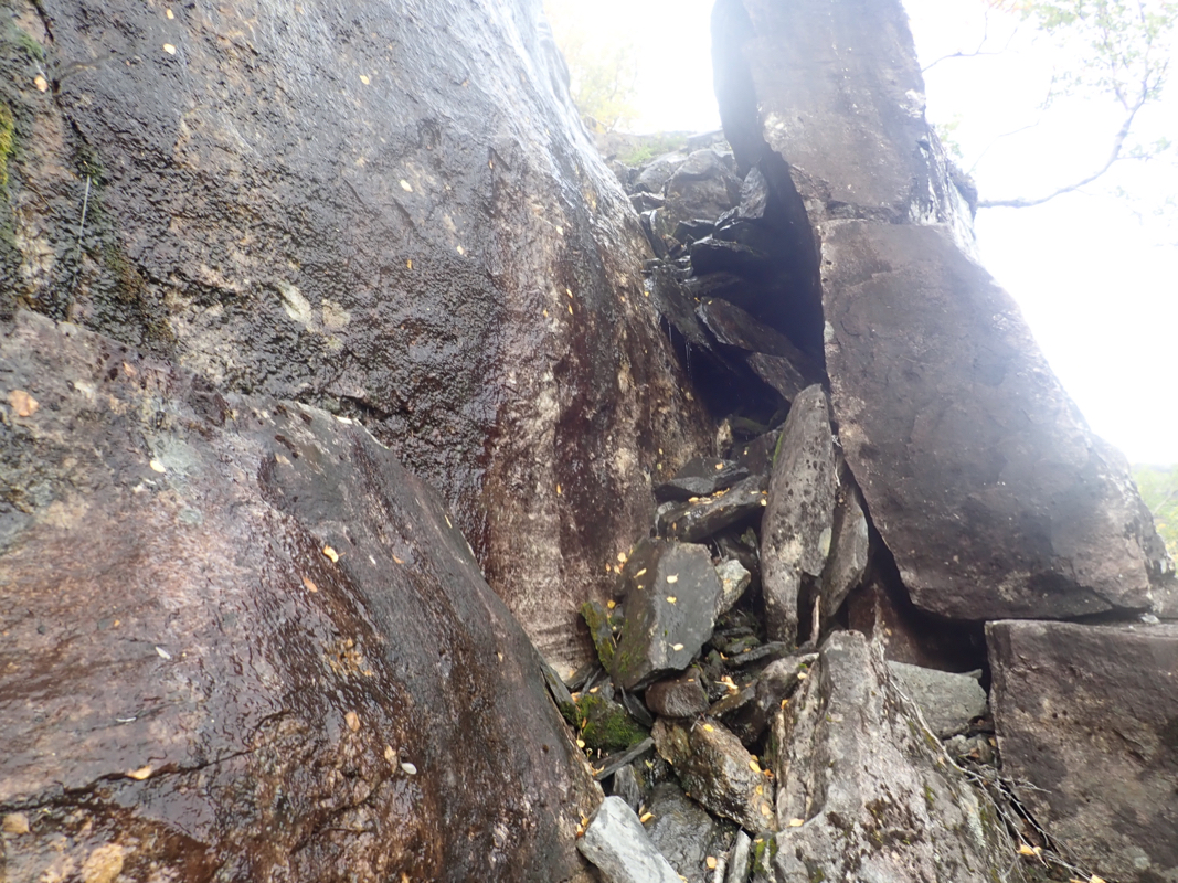
should not and ended up with a bit of steep scrambling. Trying to avoid cliffs, I finally descended
down a steepish crack with
water splashing from above. Finally down (relief!), I headed for the
trial that should descend a small valley towards lake Rogndalsvatnet. It turned out that this
valley was a steepish gorge with the trail on the opposite side. Pretty typical for this part
of my hike. I followed downhill on the north side and finally joined the big trail by the lake.
From here, an easy hike took me back to the road and then across to my car. I was back at
1300, having spent quite a bit of extra time on a rather cumbersome descent.