Location: North 60.45345, East 006.25059 (GPS at the summit).
Hordaland, Norway
Difficulty, YDS class 2
Climbed on September 28. 2019
Information:
How to get there:
Drive E-16 from Bergen, in the traffic circle at Trengereid. Go right here, that is continue
on Hwy. 7. Drive on Hwy. 7 until you have crossed the bridge (traffic light, only one way traffic alternating)
across the small fjord to Fykse. Continue on Hwy. 7 about 650 meter, then turn sharply right, road signed for
Klyve 4 kilometer. Drive this narrow road towards Klyve. Just as the road shall start climbing there is space for
1-2 cars on your left (sea-side). Park here, there are no obvious parking higher up. This location is
N60.41887, E006.24539, elevation about 4 meter.
Route description:
Walk up the private access road to the house immediately above. The people (and a small dog) living
there are friendly, say hello! Continue up across grass, cross a small fence on your right hand side in
an obvious, easy to cross spot, then continue uphill to find a tractor road. Alternatively, on may
walk up the main road, turn right and access the tractor/forest road from where it begins (see a map for this).
Continue this forest road to the right, it climbs a bit, then quickly ends. A trail continues uphill to
your left. Follow this trail all the way up to a more level area near location N60.42165, E006.25716,
elevation near 420 meter.
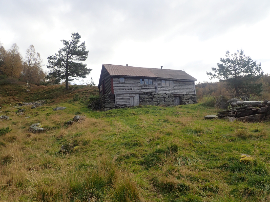
A very nice trail continues through forest to
the old farm building called Rymbedalen. The trail continues
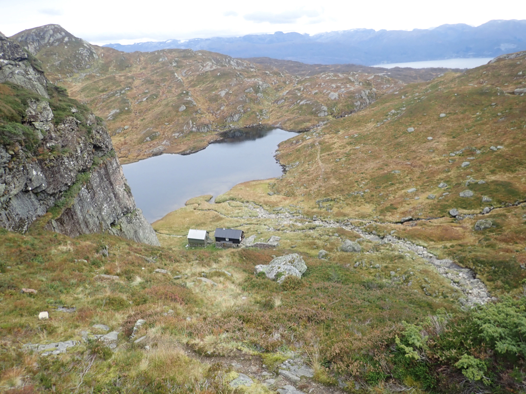
left from this house and climbs up a small obvious valley, then continues, now above the tree-line, up
to a small lake, Vetlavatnet. There are 2 cabins on your right just before this lake. Continue along
the trail to Mødalsvatn, where there is a third cabin.
Follow the trail as it climbs more steeply
above this hut, then enters the plateau between Klyvenuten (left) and Pyttafjellet (right). Leave
the main trail here and follow a smaller trail (may be hard to see),
The route should go directly north,
you first loose a little elevation, but then you should regain this as you cross under a power-line
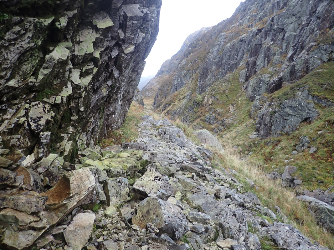
very near a distinct notch. (You should see this notch higher up in front of you as you approach.)
Ascend to this notch and pass through it.
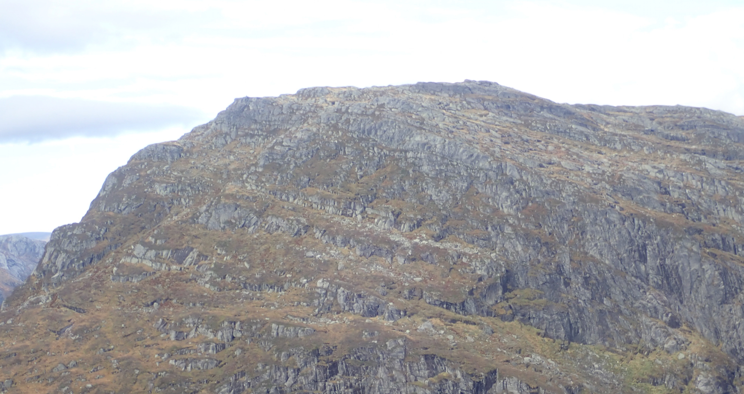
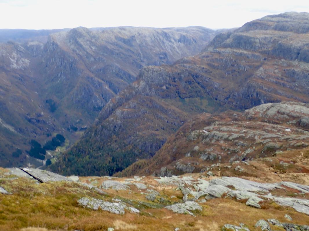
You will see Simlenuten directly across the steep Kastdalen valley.
The route must find a suitable way to cross
this valley.
You can now follow a pretty wide ramp that will lead you
all the way down into the narrow valley Kastdalen.
Stay to the right (under cliffs) as you descend, there
is a vague trail. It pays to connect to Kastdalen as far up (north-east) as possible. A small trail
will take you across the last slope and connect nicely with a trail that actually runs up the valley
well above the narrow valley
floor (that is on the right hand side of the valley when looking uphill.)
Follow this trail to
near location N60.46189, E006.27847, elevation near 700 meter. At this location
it is easy to see that one may ascend towards Simlenuten, climbing out of Kastdalen.
Finally, just follow the terrain (south-west) as
it gradually climbs, ending at the summit of
Simlenuten.
Comments:
I left Bergen around 1000 and after looking for parking higher up, I parked at the spot described above
shortly before 1200. Leaving at 1200, I enjoyed the old farm trail leading up to Rymbedalen. On my way
from there to lake Vetlavatnet, I met a man coming downhill. I said "hei" and expected a reply, but the
man just looked at me. Finally he spoke: "You are not a local"? I told him that I came from Bergen
and was On my way to climb Simlenuten. He then asked: "Do you plan to have an overnight"? I responded
that this was definitely not in my plans. He then ended our conversation by saying: "You are possibly faster
than normal people. I hiked to Simlenuten last weekend and I still feel it in my legs." I guess this
reinforced what I alreday knew, this hike was pretty long when starting at noon and I also looked forward
to a nice evening meal with Heidi back in Bergen.
The walk went fine, I had little trouble finding a good passage across to Kastdalen. Still, every leg of the
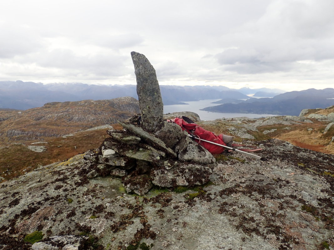
route took time and when I arrived at the summit the time was 1550. Very good views and indeed a pretty
nice summit.
The deep cut made by the fjord from Fykse is very visible.
I had a short rest, took some pictures and left by 1605, hoping that the return hike
would be slightly faster. This turned out to be true as I arrived back to my car at 1915, so 3:10 on the
return.
My drive back to Bergen went smoothly and I could enjoy a nice evening with Heidi from 2100 and onwards.
This would be my last mountain hike in Norway for 2019, since we shall travel to Hong Kong
this coming Monday.
