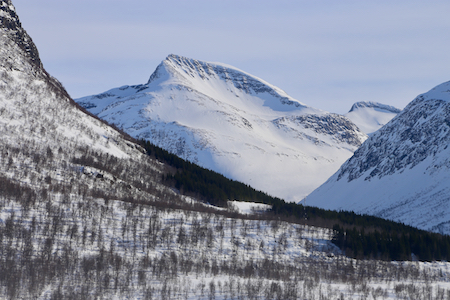
Location: North 62.35004, East 007.28353 (GPS on the summit)
Sunnmøre, Norway
Difficulty: (YDS) class 2
Attempted March 18. 2018.
Climbed July 17. 2020.
Information:
How to get there:
The normal approach on skis is from Seljebotnen. To get there,
locate the town Stranda in Møre og Romsdal. There is
a ferry connecting across the fjord. On the other side, drive towards
Ålesund, that is, first towards the small community called
Stordal. About 5 km before Stordal, another valley forks right and
the road going that way has signs for a ski area called Øverøyane..
Follow this sign, however, before getting there, as the main road curves left, take
a signed road (Seljebotnen) that forks left. There is parking just
before the last farm at location N62.38271, E007.22918, elevation about 410 meter.
Alternatively, this peak may be climbed from the east side. The starting point is then
near some athletic fields next to the road in Valldalen. This location is where
the river Myklebustelva joins the main river in Valldalen. The river drains the small
valley Valldalsbotn to the north. Note, however, that this approach can be problematic
in winter as the access to the south-east ridge near Firskorne may be difficult.
In summer, there is a toll road serving Valldalssætra that runs up on the west (left)
side of the river. In winter, groomed ski tracks start at the athletic field on the
opposite side of the river.
Route description:
Note: This description is incomplete, it details the approach from the east side.
Ski up along the farmers (summer) road on the west side of the river. At location
N62.35096, E007.34524, elevation about 340 meter, leave the road going left and follow
open terrain into the lower part
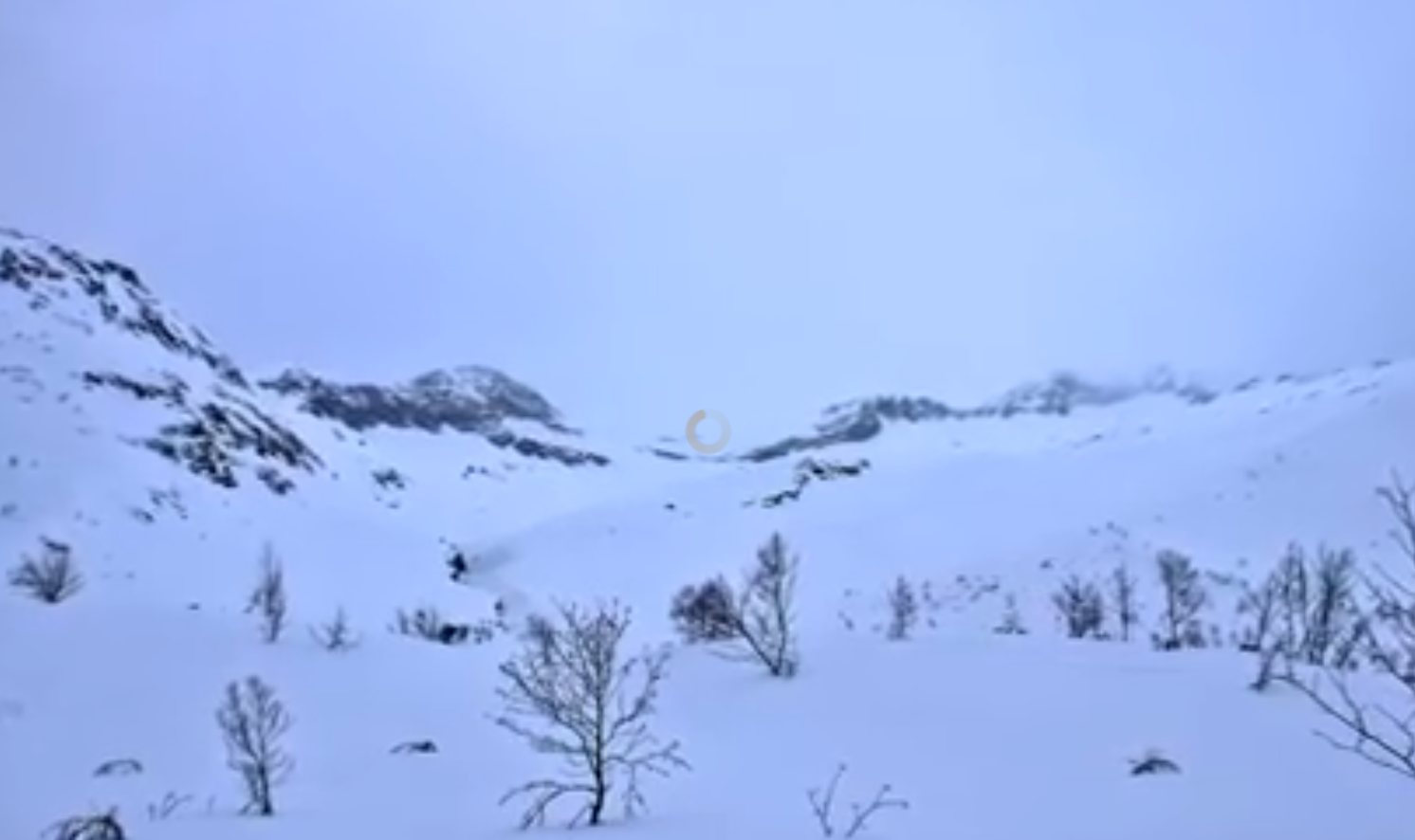
of the large bowl above. Ascend the bowl, one can stay
at slopes that do
not exceed 30 degrees. With good snow, this is a very nice area for
skiing. Higher up, traverse left and approach the obvious area between the peak and
the somewhat higher bump on the ridge named Firskorne.
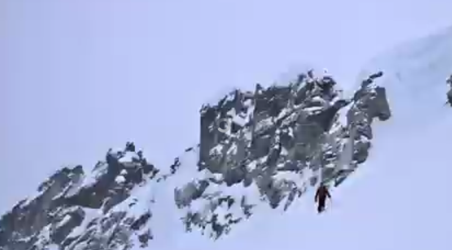
The question is now how to gain the ridge from here. In summer, late spring, a pretty obvious
notch may be used, however (at least in 2018), this access was blocked by a huge
cornice in March. Slightly left of this, a ramp offers an alternative, however, again in
March 2018, this route involved crossing a steep chute with unstable snow. A third alternative
may be to ascend steeper terrain well to the right of the notch, then traverse left to the
ridge. With stable snow, this may be quite doable.
Summer 2020 route.
Follow the tractor road that runs further into the valley, starting from the farm. You pass 2 gates,
make sure to close them after you. Continue along the edge of the meadow and parallel to the river,
then curve right. Do not cross the big river, but you need to cross the smaller rivers coming from
Tverrbotnen. This may be hard without getting your boots wet. Higher up, there is a nice trail
climbing the small ridge quite close to the river. This gets you into the upper valley, called
Uriskarbotn. Hike past the lake while slowly gaining elevation. There is a small trail marked by
cairns, that follows a nice route up to near the 1200 meter elevation level. The best route
continues along a pretty natural formation that will top out a bit north of the summit. Turn more
right and gain the summit. The summit is a big snow cap with no signs of any cairn. However, I did
find one cairn on the south side of the snown cap.
Comments:
Arnt had arrived the evening before, thus
we would be 3 attempting this peak. Eric and I had already skied two
nice mountains on Friday and Saturday. We needed to drive to Bergen, thus an
early start was planned. We were so fortunate to stay in Børre's house,
skiing could therefore start and end at the house.
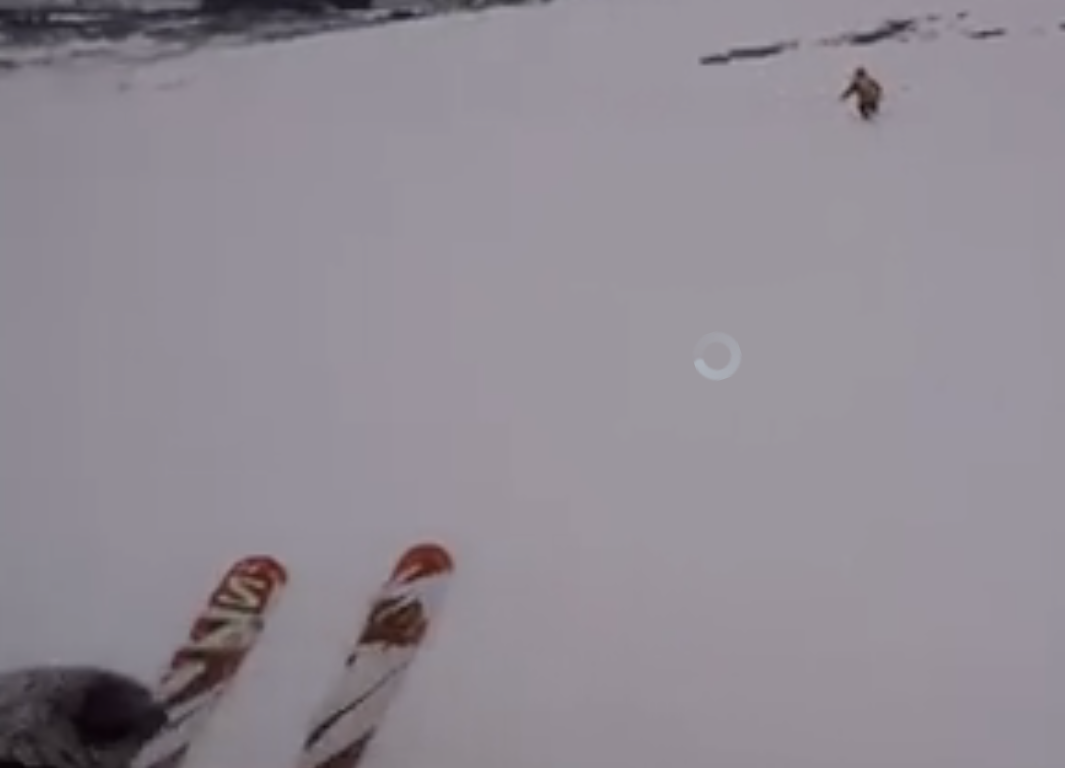
We got going at 0730, the terrain was quite nice and we skied to about 1360 meter
of elevation where we left our skis in order to complete the climb on foot.
The ski ascent had taken us 3 hours.
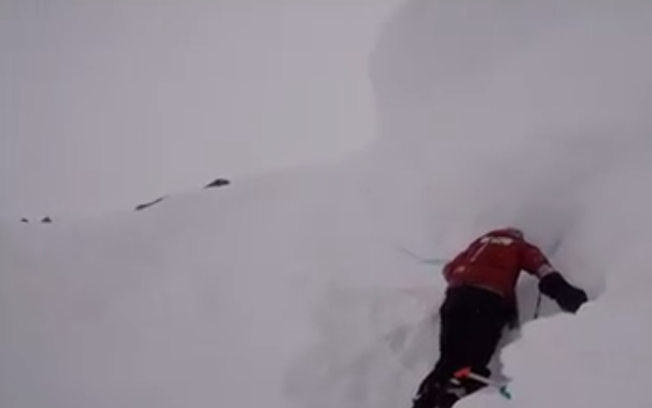
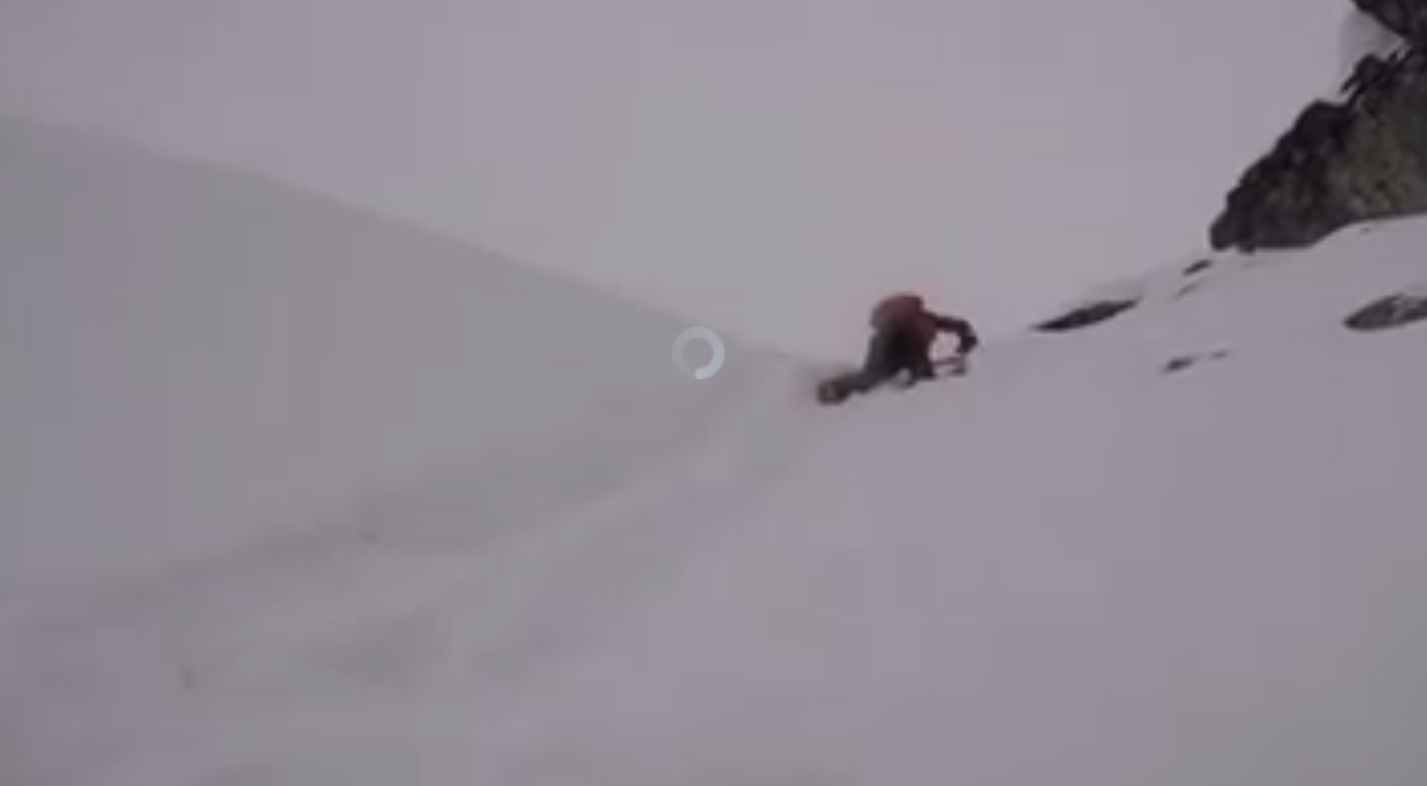
Unfortunately, the access to the
ridge was more difficult than we had hoped. A big
cornice blocked the natural chute and
the snow ramp ended up in very unstable
snow. The weather was gradually getting worse as it started to snow. Overall, the decision
was easy, let us enjoy the fine skiing back
down and return to this peak another day.
Summer ascent in 2020:
I started at 0830 from my car parked just before the farm Seljebotn.
Easy walking until I needed to cross a pretty big river coming down from Tverrbotn.
I managed to get across on under water rocks without gettin water into my (new) boots,
but this was close. Next, I did not find the good trail that ascends on a small ridge
pretty close to the river. Proceeding up the steep hill involved some bushwack among
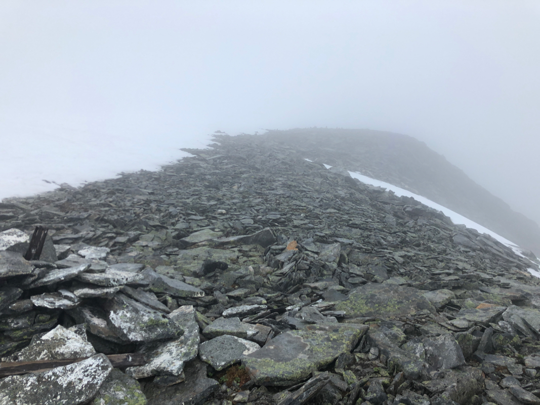
very wet birch trees. Near the top of this hill, I ran into the proper trail.
Since it was very wet and raining, I decided to be patient and try the approach ascending from
the west, almost all the way into this upper valley called Uriskarbotnen.
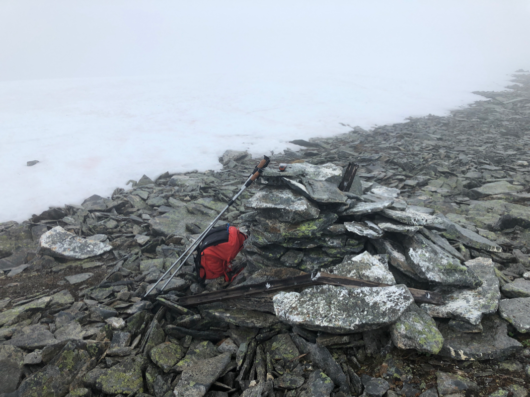
The ascent went better than feared, the rocks were mainly both stable and mostly easy
to walk. The summit was engulfed in clouds and consisted of a big snow cap. No signs of
a summit marker or cairn. In made a brief stop next to a small cairn that
was located on the south side of the snow. I was at the summit around 1215 and started
descending by 1230. Back at the car at 1520, so all in all a 6:50 hour trip.