Location: North 65.63499, East 015.6035 (GPS on the summit)
Tarnaby, Sweden
Difficulty: (YDS) class 1
Climbed August 15. 2021.
Information:
How to get there:
Locate E-12 running from Mo i Rana, Norway, into Sweden,
then turning south. Locate the town of Tärnaaby along this Hwy.
Continue south from this town about 17.5 kilometer.
Locate a small road that forks uphill (left) after the Hwy. crosses a
small creek (before you cross a second creek). Turn up here and find
parking on your right before this road climbs a hill while turning
more left. This location is N65.63190, E015.53564, elevation
about 450 meter.
Route description:
Walk up the next hill on this small road and find a signed trail that
forks right. Follow this trail (well marked) uphill until you
find a sign that declares "end of trail". The trail continues
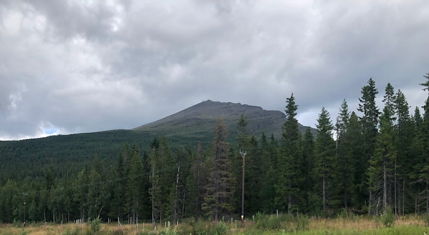
perfectly well, now climbing out of the trees. You will see the summit
with a building and some antennas straight uphill. Continue to
follow the trail all the way to the summit. On the upper slopes, there
are several variations, some more direct while other vague trails
lead more left before turning towards the summit.
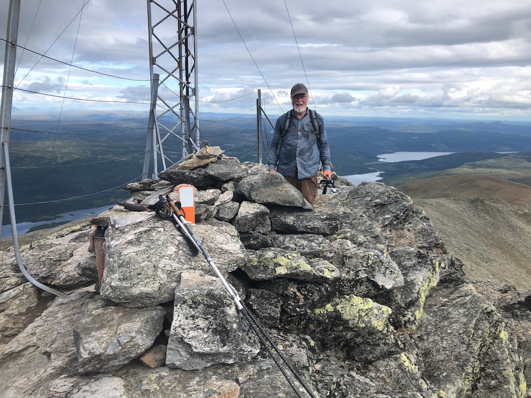
There is a cairn near the highest point,
as well as a building below.
There are also some ugly remains of a fence. This summit should
be cleaned up! A visitor book is located in a cairn built
below the building, quite a lot lower than the summit.
Comments:
We drove from Mo i Rana and started hiking at
1100. The weather was good. We arrived at the summit by 1315, good
views that could have been better if all the garbage (fence structure)
had been removed.
After 15 minutes, we headed back down in 1:30. Overall, a nice
hike on a good trail.
