Location: North N63:10.390, East 009:08.617 (GPS at the summit)
Climbed February 21, 2009.
Difficulty: YDS class 2
Information:
How to get there:
From Trondheim, drive south on E6 to Leinstrand (just after Heimdal).
Locate the traffic circle where E39 goes west and follow this road.
Hwy. E39 is quite new and runs through several long tunnels to Orkanger,
a toll road. South of Orkanger, Hwy. 65 forks left (just after a bridge), continue
uphill along Hwy. E39. The road is now smaller as you cross a somewhat higher
plateau called Hemnekjølen. There are many vacation huts in this area and
the terrain has good skiing terrain (cross country). The road runs north of the lake
Søvatnet (280m) before descending towards the trailhead. Pay attention, as the
turnoff to the small parking near Bordstad is easy to miss. There is a small parking
area on your left at location N63:12.504, E009:10.419, elevation about 230 meter.
This is the trailhead, park here.
Route description:
From the parking, follow the small road or skitrack west towards a small house, then
downhill and across the river on a bridge. After the very first uphill after crossing
the river, leave the road and go south.
The next task is to climb into the small valley that extends south. There is a power line
that is easy to see, going the same way.
There is a small sign pointing to a marked
summer route to Ruten (going left), however the best skiing is to climb the hillside
on its right side as you look south (that is on the right (west) side of the creek that
runs down from the valley. As you enter this small valley you have reached about 400 meter
of elevation. Continue pretty flat until a small creek comes down from your right. At this
point, you may see that the power line turns right and climbs a somewhat bigger valley
further ahead. This location is N63:11.622, E009:10.445, elevation 420 meter. Turn right
(west) here and climb more steeply up this side following the natural route. You will gain
about 100 vertical meter before the slope again becomes very gentle. From here, one can
follow the broad ridge as it gradually curves left towards the summit.
The final summit ridge has several
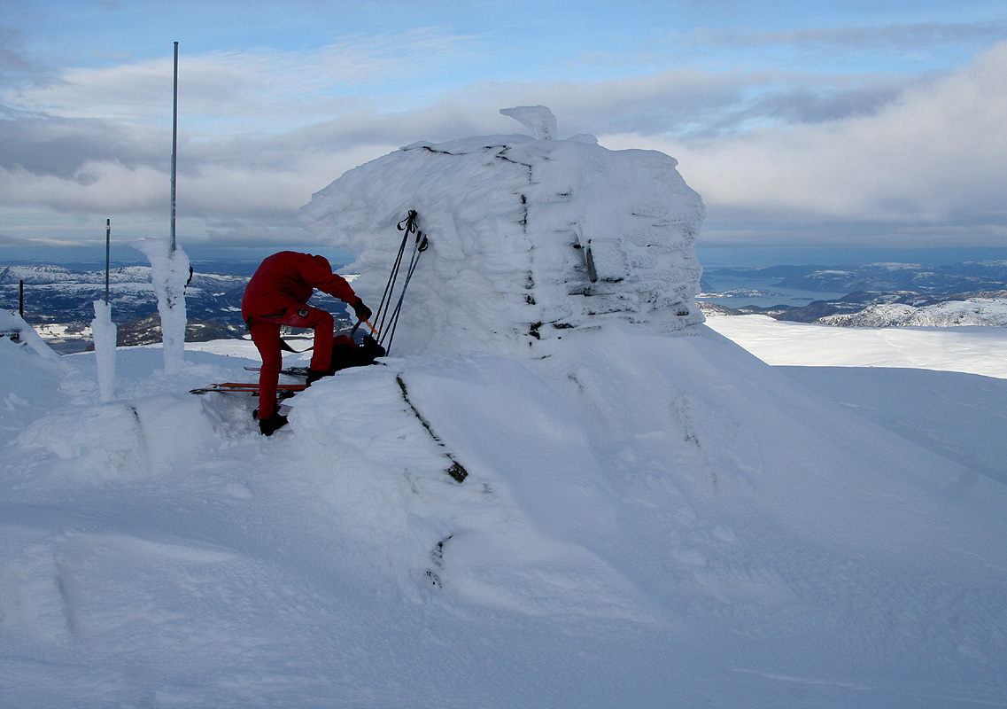
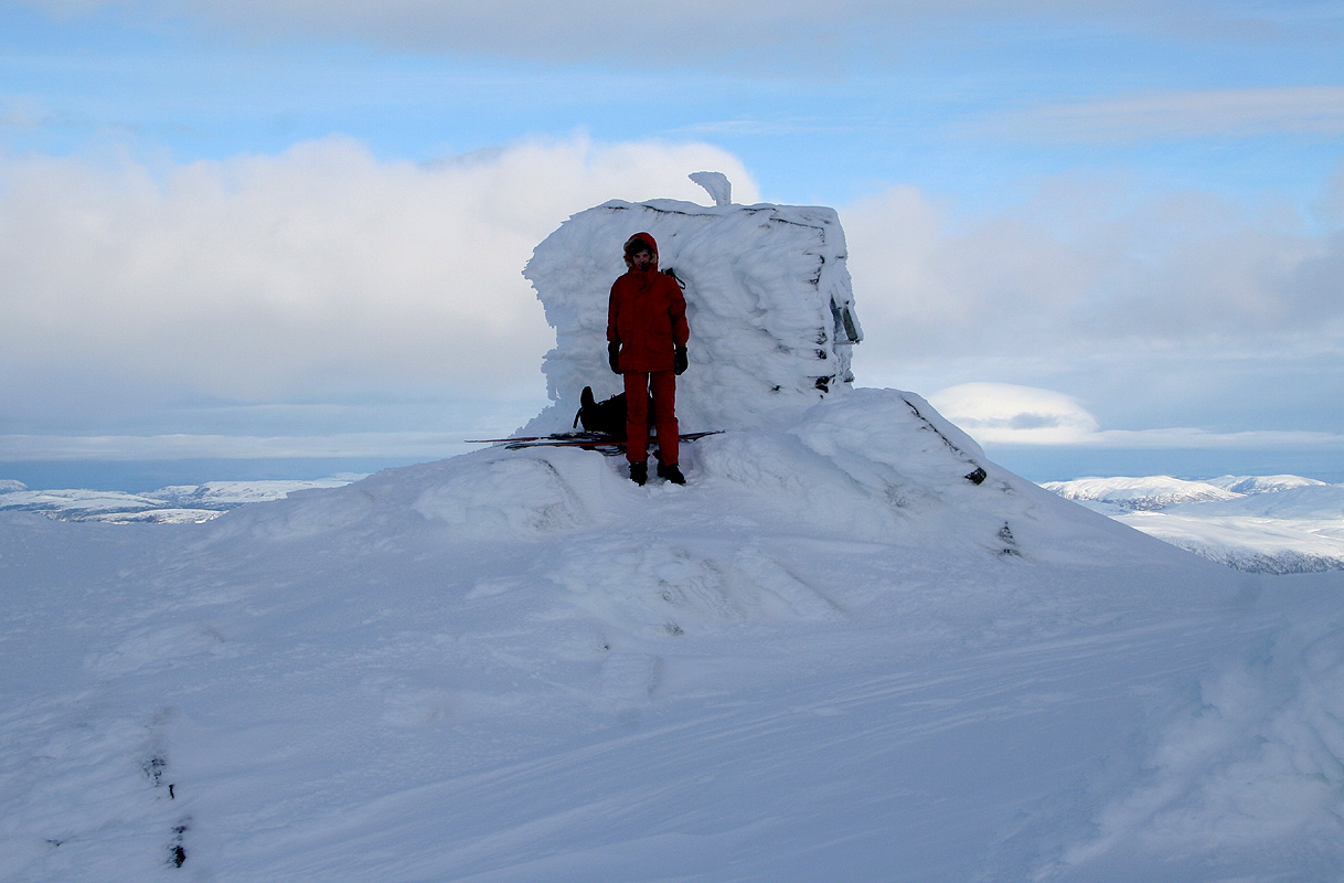
antennas (a radio link), there is also a small hut at the very summit.
Comments:
I did this climb with Pål Jørgen, age 19. We left the trailhead around 1025 and
followed the road downhill and across the river. The weather was partly sunny, but with a strong, mild wind.
Overall, much better than the forecast. We reached the summit by 1245 and stayed about 15 minutes.
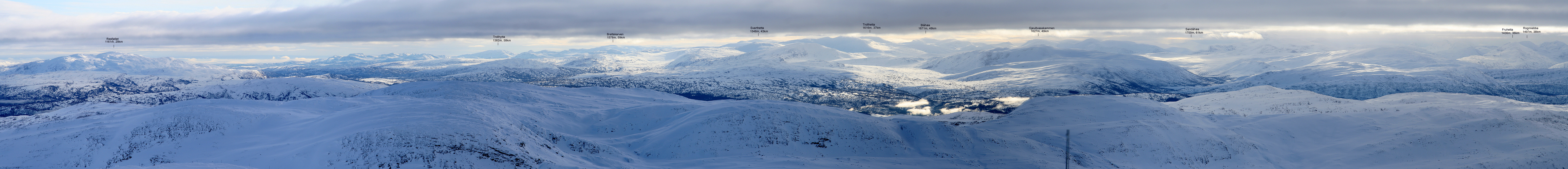
The view was nice, but the wind strong enough to make us descend rather soon. A very nice downhill
ski, Pål Jørgen using his "pro" Telemark skis. We were back at the car shortly before
1400. A nice trip on a day that promised only horrible weather.
Resources:
Images
Ruten as seen from the trailhead. The summit cannot be seen.
At the summit. Pål Jørgen is removing the skins from
his Telemark skis.
