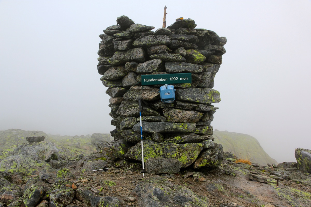
Location: North 61.02779, East 006.04902 (GPS on the summit)
Climbed October 5, 2013
Difficulty: (YDS) class 2
Information:
How to get there:
Drive E-39 north from Bergen to Romarheim. Make a right turn there, the road
has signs for Dale and Modalen. Measure from here. Drive 15.1 kilometer to the roadfork
with the road going to Dale (through a tunnel) going right. Take the left fork going north
to Steinlandsvatnet. At kilometer 38.0, you are at the north end of this lake. Take the
road going right, a sign says BKK. Shortly, after a bridge, turn left. Continue to
kilometer 46.0, you are just below a large dam, keep left here. The road climbs in several curves.
At kilometer 50.6, the road looks a bit rougher, but one may still easily proceed with
a normal car. Roughly at kilometer 51.4, the road ends. Park here, the location is
N60.99093, E006.04876, elevation about 940 meter.
This trailhead is really far into the mountains, normally this hike would have been quite
a bit longer. The activity caused by the hydro electric power plants may be blamed or
thanked for this situation (take your pick).
Route description:
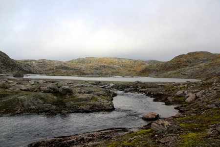
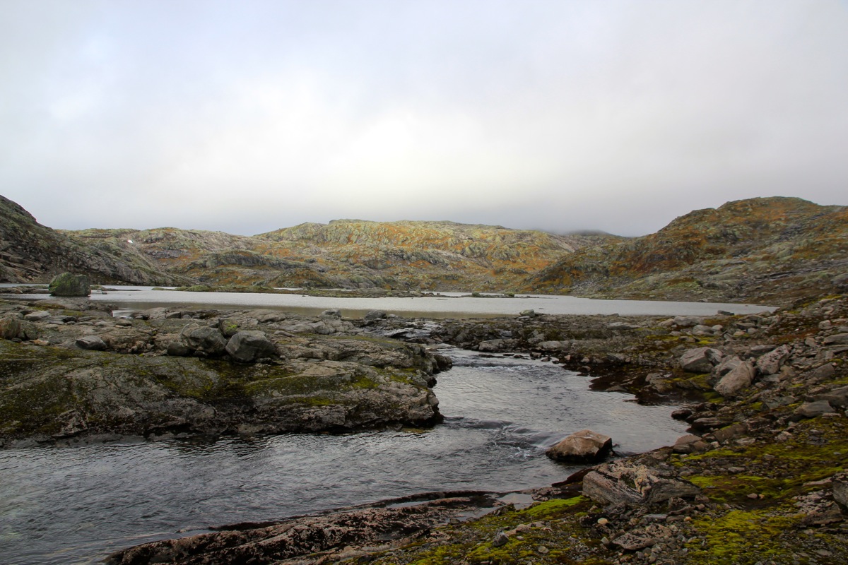
A trail marked with red Ts continues up along the river. The trail continues north
along the east side of
the first Åsabotnvatn,
then along the second lake.
A bit north of this lake, there is a signed trailfork. Continue right up the valley
essentailly to the border between Hordaland and Sogn and Fjordane. From here, turn
left and ascend pretty gentle terrain to the summit.
Trip Report / Comments:
I got a pretty late start, leaving my car at 1300. The hike was easy and the scenery
pretty nice. Fall has arrived. This area has been subject to hydro power plant regulations,
it was nice to observe that excess rock from tunnels had
been landscaped quite nicely.
I arrived at the summit at 1420.
I signed the register, last vistor was almost a month
ago. The summit area was unfortunately, in a cloud so I left at 1430. Returned back
at 1550, exactly the same time each way.
in the clouds.