Location: North 63.18856, East 012.98057 (GPS on the summit)
Difficulty: YDS class 2
Climbed November 20, 2021.
Information:
How to get there:
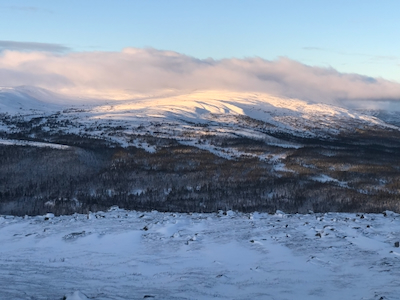
The best starting point is the mountain hut Vålådalen.
This is about 40 kilometer (mainly south) of the ski resort Åre.
The precise location is N63.14820, E012.96708, elevation around 580 meter.
Route description:
Ski the prepared ski track that runs above the road serving the hut, this
is right as you face uphill. Connect with the road (clossed to vehicles) that
is snow covered and runs uphill heading slightly west of north.
Follow this road
to about 800 meter of elevation, then locate a marked route that forks right and heads
towards the mountain. Higher up, several trails merge, follow the one that runs directly
towards the east peak.
Comments:
I did this hike with my friend Jostein. We stayed at Vålådalen tourist hut
and started after breakfast around 1030. When we arrived the day before, there was no
snow on the ground anywhere to see. Fortunately, it snowed that night. In the beginning,
the weather was quite a lot better than the forecast.
Higher up, the conditions were
quite nice, but the wind started to show its presence. The summit was hidden in a cloud.
Close to 1100 meter of elevation, the conditions detoriated quickly. I decided to
leave my skis and continue on foot. It was agreed that Jostein should begin a careful
descent. The time was
1240. I continued on foot and the weather got significantly worse. The wind increased
to near 20 meter per second and the snow drift was bad. I struggled uphill until there
was no more up. A quick look around then descent. The climb had taken 30 minutes
from where I left my skis.
I caught up with Jostein further down and we returned to the hut around 1500.