How to get there:
Locate the road intersection in a small village at location
N43.54432, E012.49089. The only good, paved road to this mountain starts here.
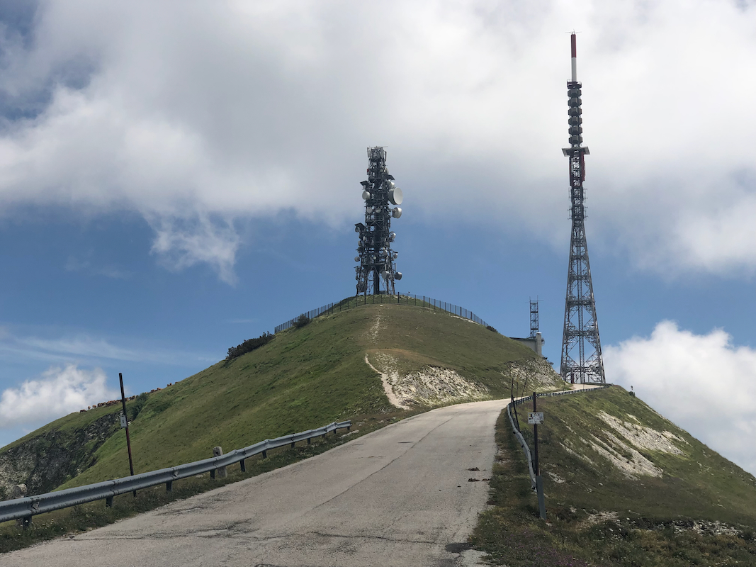
Drive up towards the final top with antennas. Park along the road or perhaps
at the small turnout on your right hand
side just before the final hill.
I parked at location N43.55736, E012.51754, near elevation 1490 meter.
Route:
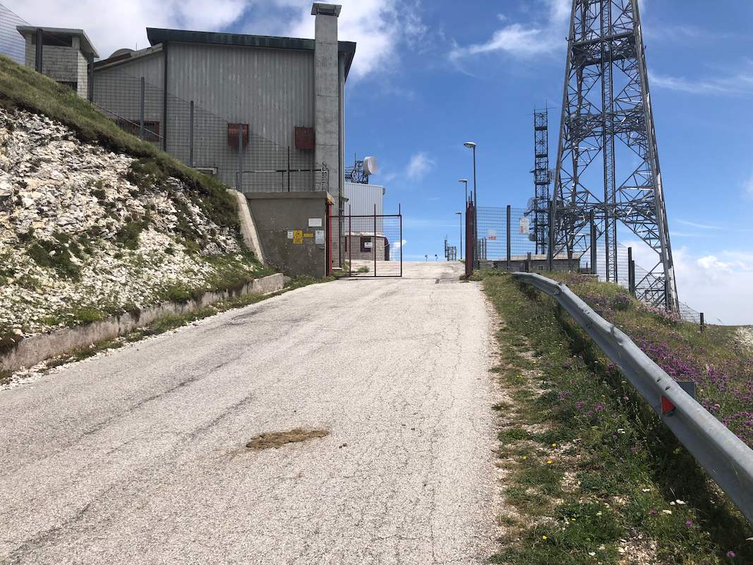
Walk up the remaining part of the road, you will arrive at a gate. There are some
signs in Italian, not easy to understand for a Norwegian.
If the gate is open, consider
taking a few steps inside. You will see a staircase that climbs towards the highest
point, immediately to your left. From the top of the steps, there is a short and easy
hill to get you to the flat area below the antenna. Return the same way.
If for various reasons, the above approach will not work, then walk back down the road and
find a small trail that gets you onto the main ridge. Walk up to the fence and locate its
highest point. This is near location
N43.55772, E012.51785. The summit is quite close, but clearly higher than your location.
Comments:
I had been to Pietralata in the morning, this
mountain would be my last to visit in this area.
I parked my car near the gate and first hiked to the highest point on the outside
of the fence. The summit was indeed close, but clearly quite a bit higher than my
location.
Next, I went back down on the street and walked up to the gate. It was sort of
half open. Stepping inside, I noticed a couple of cars, but no person to
ask if a short summit visit would be possible.
A nice and easy access to the highest point would be to just take the steps leading
up directly to my left hand side and immediately inside the gate.
I walked up these steps, then a short grassy slope and stood at the flat summit directly
below the antenna. The summit had obviously been a few meter higher before they
constructed the antenna.
Returning the same way, I was quite happy with my brief but successful visit.
