Location: North 67.72149, East 015.61936 (GPS on the summit)
Nordland, Norway
Difficulty: (YDS) class 3
Climbed September 17. 2015
First Ascent.
Information:
This mountain is located on the border between Steigen and Sørfold. More precisely, it is
located between the Stavfjorden fjord
and the Mørsvikfjorden fjord. The mountain has no name on the
M711 maps and the locals living in Steigen did not know a name either.
The mountain is located on a ridge that extends south from Reinviktinden (1117m) and then continues
from the summit, further south to Ingerbakktinden (1190m).
Ketil Hansen has lived in the area for more than 70 years, he claims that nobody had visited this
peak before.
However, the peak is the highest
in the area and it has more than 1000 meter of prominence. I found no information about this
peak anywhere, thus it might just be possible that it had indeed never been climbed.
How to get there:
I had researched this question quite extensively. In particular, when taking a boat back to
Nordfold after climbing Helldalisen in 2014, I asked the boat to make a detour in order to
get some high resolution pictures of a possible route.
Thus, one possible approach is to drive to Nordfold in Steigen and organize a boat transport
from there to Stavfjorden.
Route description:
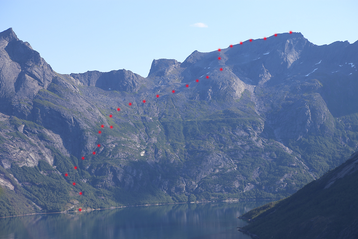
Start at the coast, location N67.72018, E015.54841. From here, head uphill until cliffs, then follow
below while ascending to your right. Our route went by location
N67.72278, E015.55864, at elevation 200m. Then continued to location
N67.72303, E015.56280, at elevation 300m, and further uphill to elevation
400 meter at location N67.72325, E015.56633.
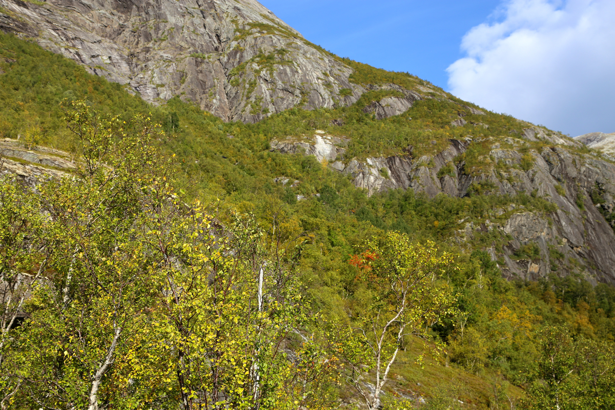
In general, the best guidance is to follow below the cliffs more or less all the way up.
The vegetation is not bad close to the rock and in this way one also follows near the
best overall route.
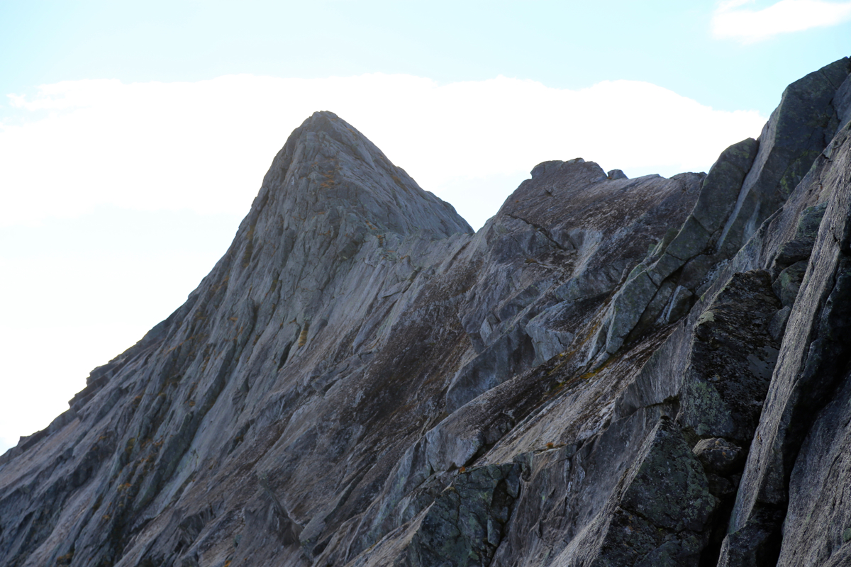
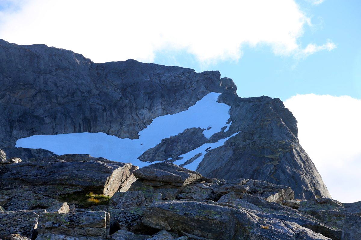
This picture shows an outline of the route.
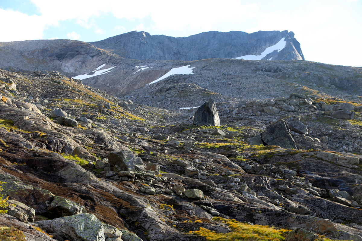
Above 400 meter, the terrain is more gentle and it is easy to
pick a way onwards. Aim for the ridge
that runs down from the summit ridge
on the left side of the summit. A good line will pass
by two big rocks along the way.
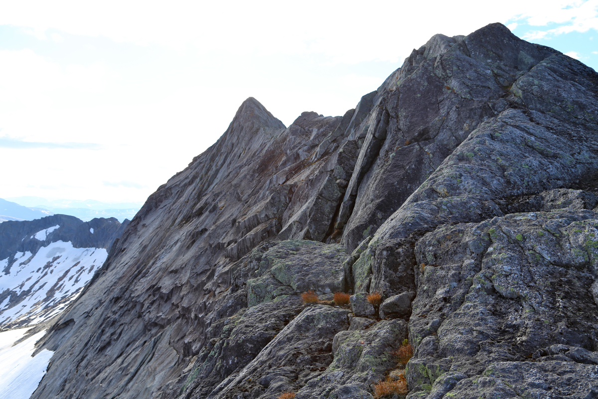
Ascend onto this broad
ridge, then follow it to the top of the ridge.
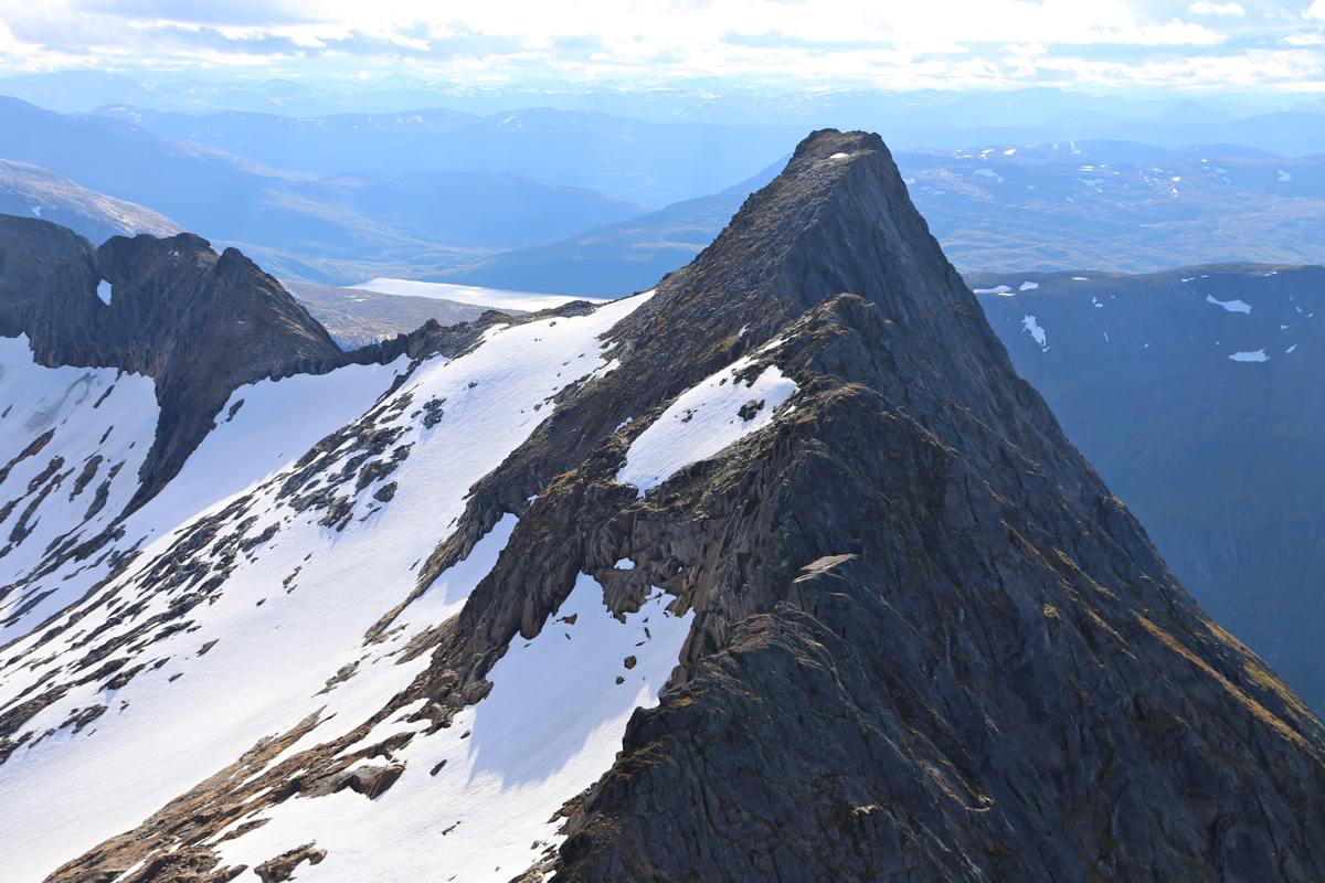
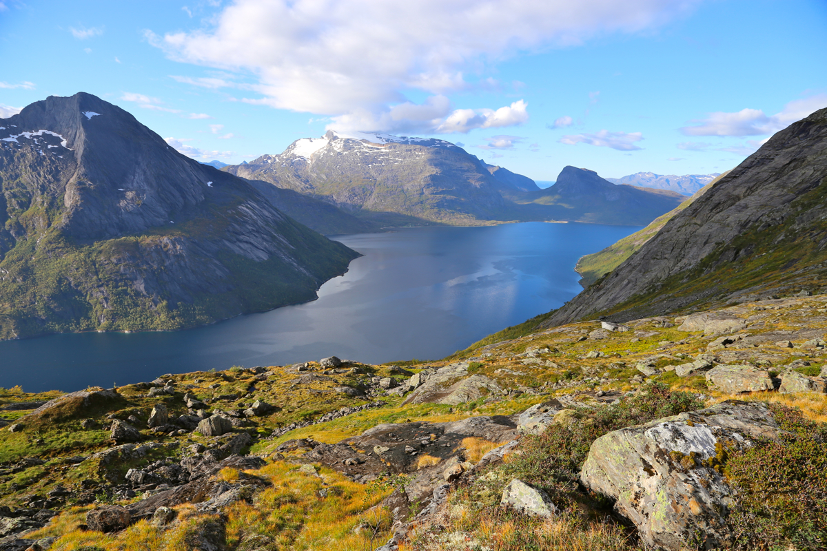
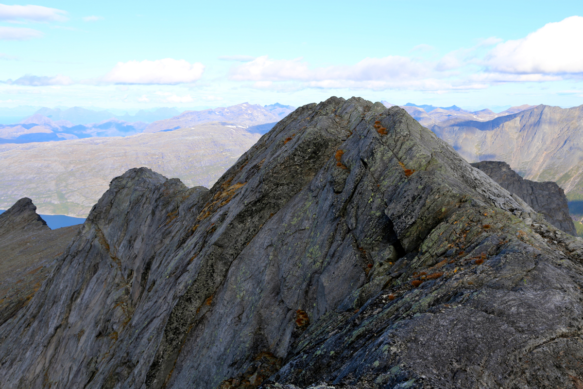
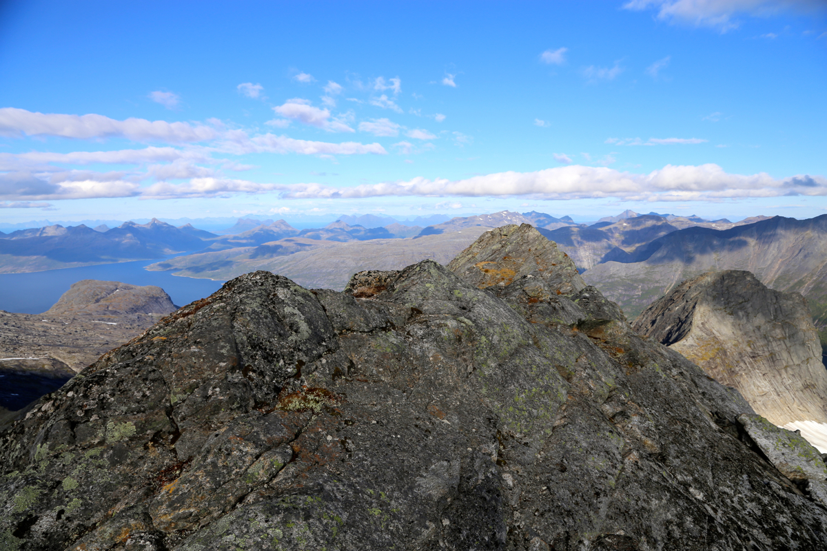
From here, the main crest, a new view opens up across Mørsvikfjorden (east).
To this point, the route has been (YDS) class 2.
From here to the summit,
requires easy scrambling (YDS class 3)
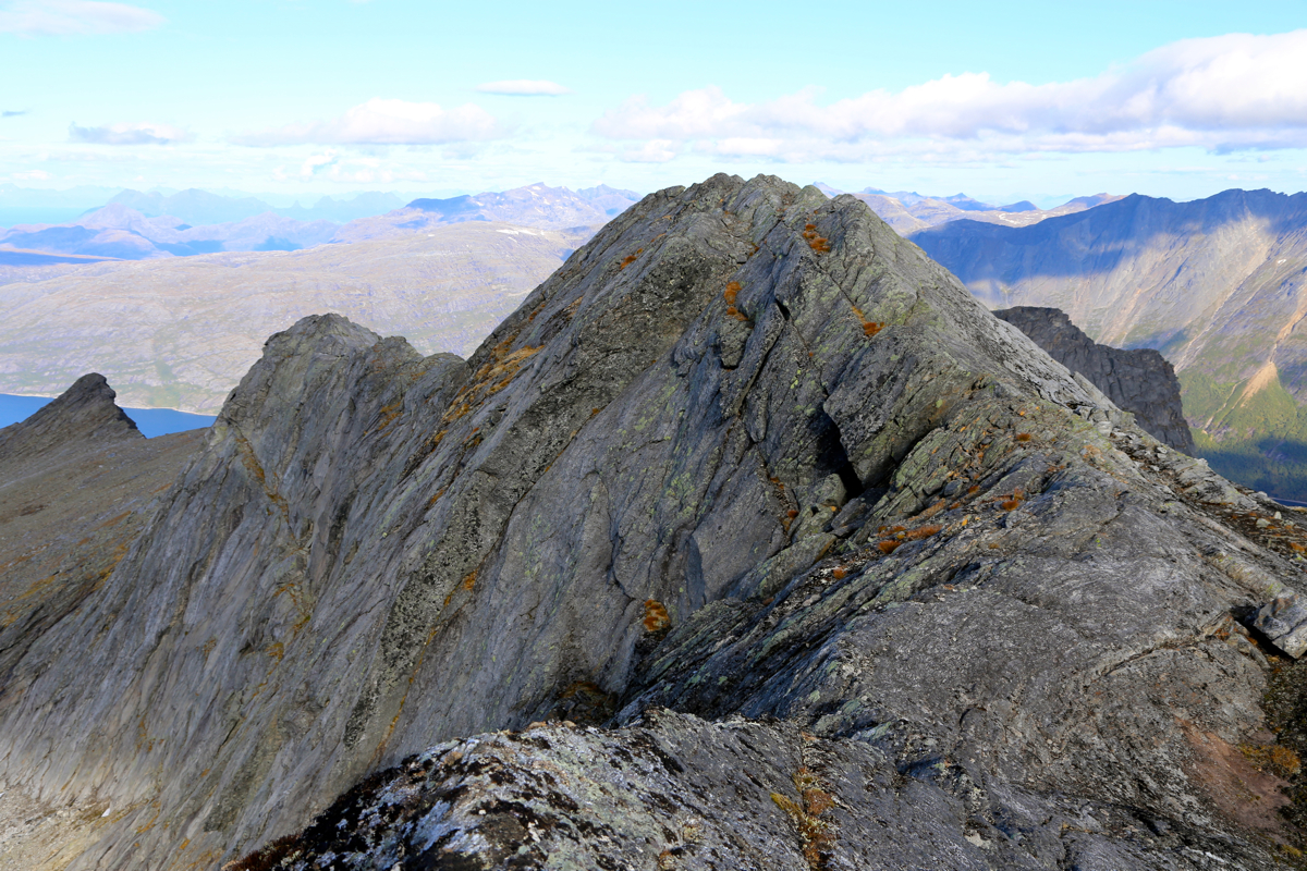
along a sometimes airy ridge. However, this
should pose no difficulties when the conditions are reasonable (no ice etc.) First,
follow along the ridge,
next do an easy down-climb
following a big crack. The next section is a bit protected
and is just a nice walk. The last part of the ridge has a couple of narrow spots, none are
difficult as long as one is careful. The summit
itself is located directly on the top ridge.
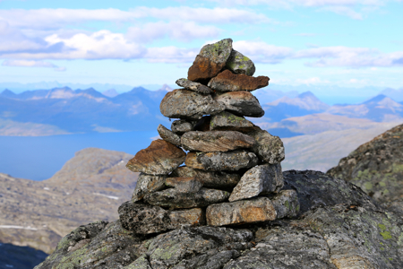
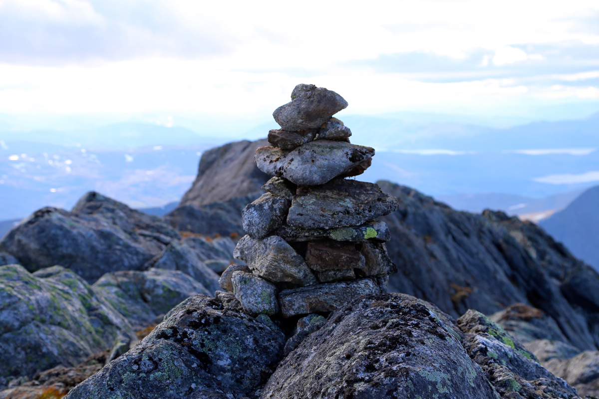
A bit further on is another local bump, but it is lower than the first summit point. You will
locate the small cairn that we built near the highest point of the ridge.
Comments:
This mountain had been a bit mysterious ever since it entered my list of
peaks in Norway having at least 1000 meter of prominence. It soon became clear
that there were no information available on the internet. In short, I was unable
to find any reports or documented climbs. Access looked difficult, as a boat was
almost certainly required. In the beginning, I called this peak Reinviktinden, however after my visit in 2014
when I climbed Helldalisen, I became aware that Reinviktinden is located North-East
and that Reinviktinden is only 1117 meter high.
My friend Åke and I arrived late in the evening before. We stayed with my very
hospitable friends Nina and Agnar in Bogøy, then met our boatman Ketil in
Norfold at 0800 the next morning.
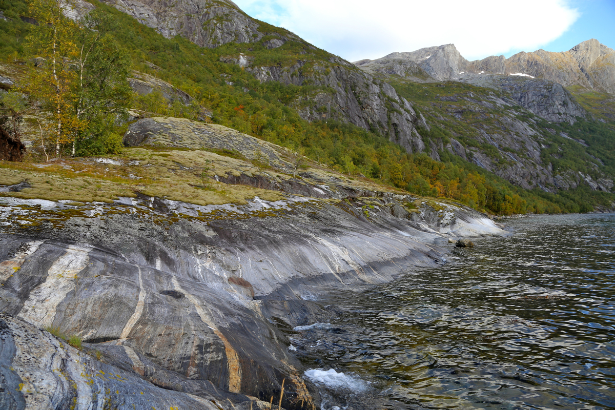
The boat trip went smoothly and we stepped ashore around 0900. The first challenge would
be to find a route uphill avoiding
all the steep cliffs that could be seen from below.
Progress was fine and we gained the first 400 meter of elevation in one hour.
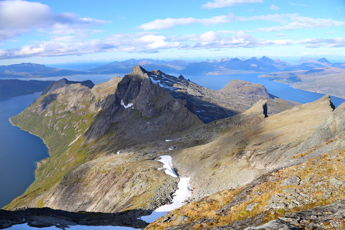
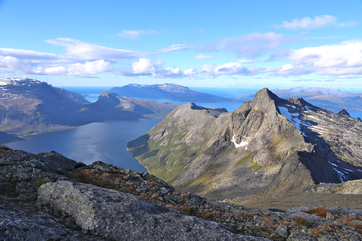
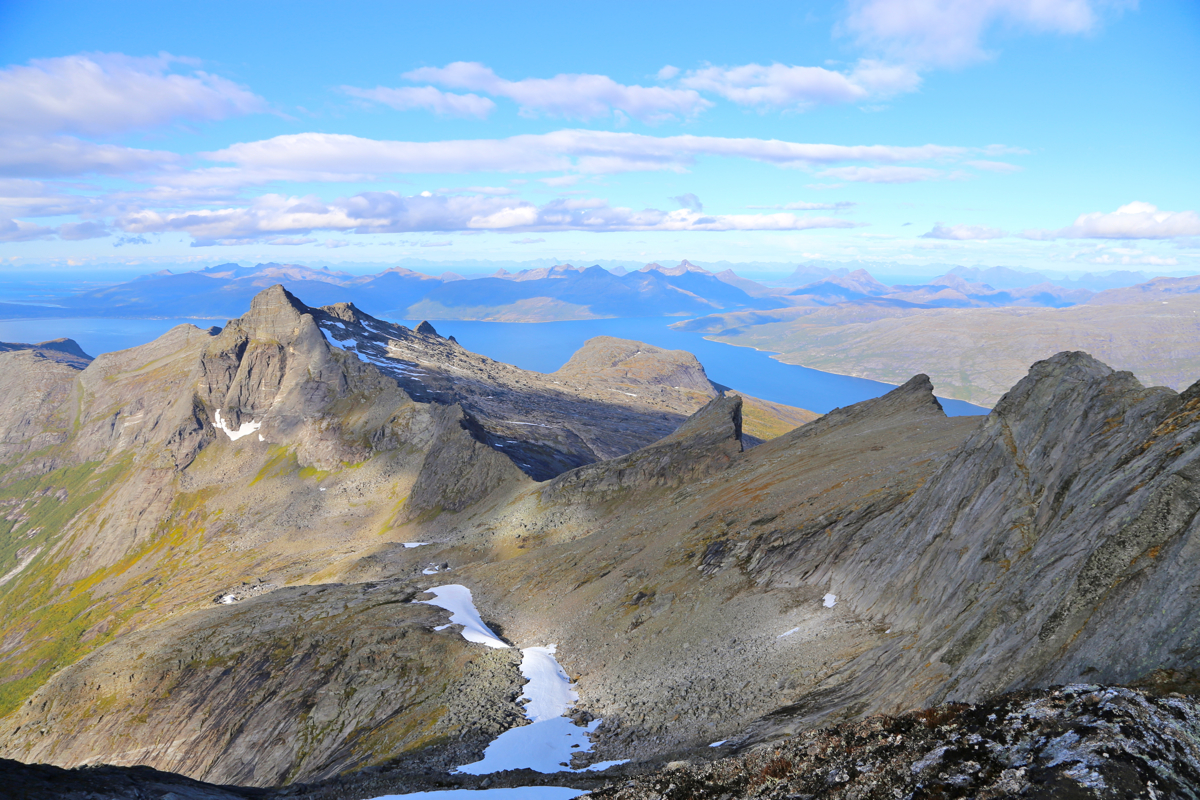
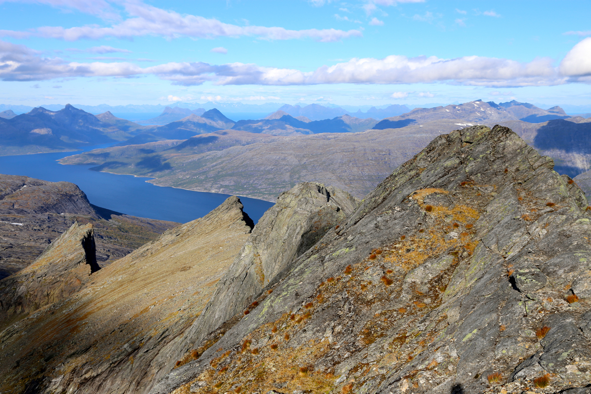
From here, there is already a nice view back
down at the fjord with
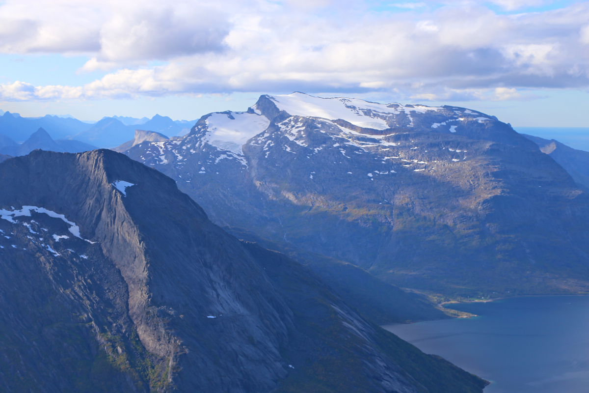
Helldalisen very prominently
across.
The weather
was also nice and it was exciting to explore a completely new route. We agreed that the ridge
looked most promising, but that the snow on
our right followed by a scramble would be our
backup plan.
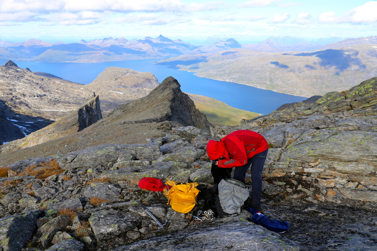
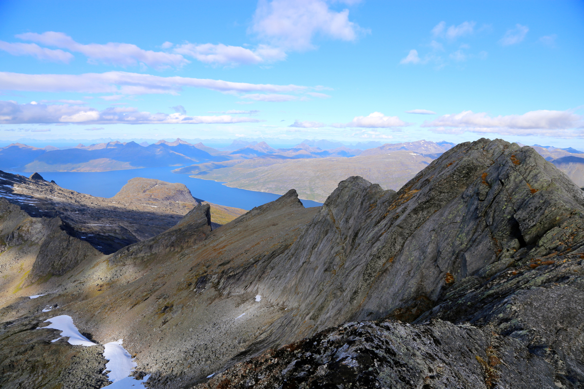
We made the main crest around 1145,
left one backpack and quite some gear there.
From this spot, the summit looked
a bit challenging, but overall not bad. We scrambled along and
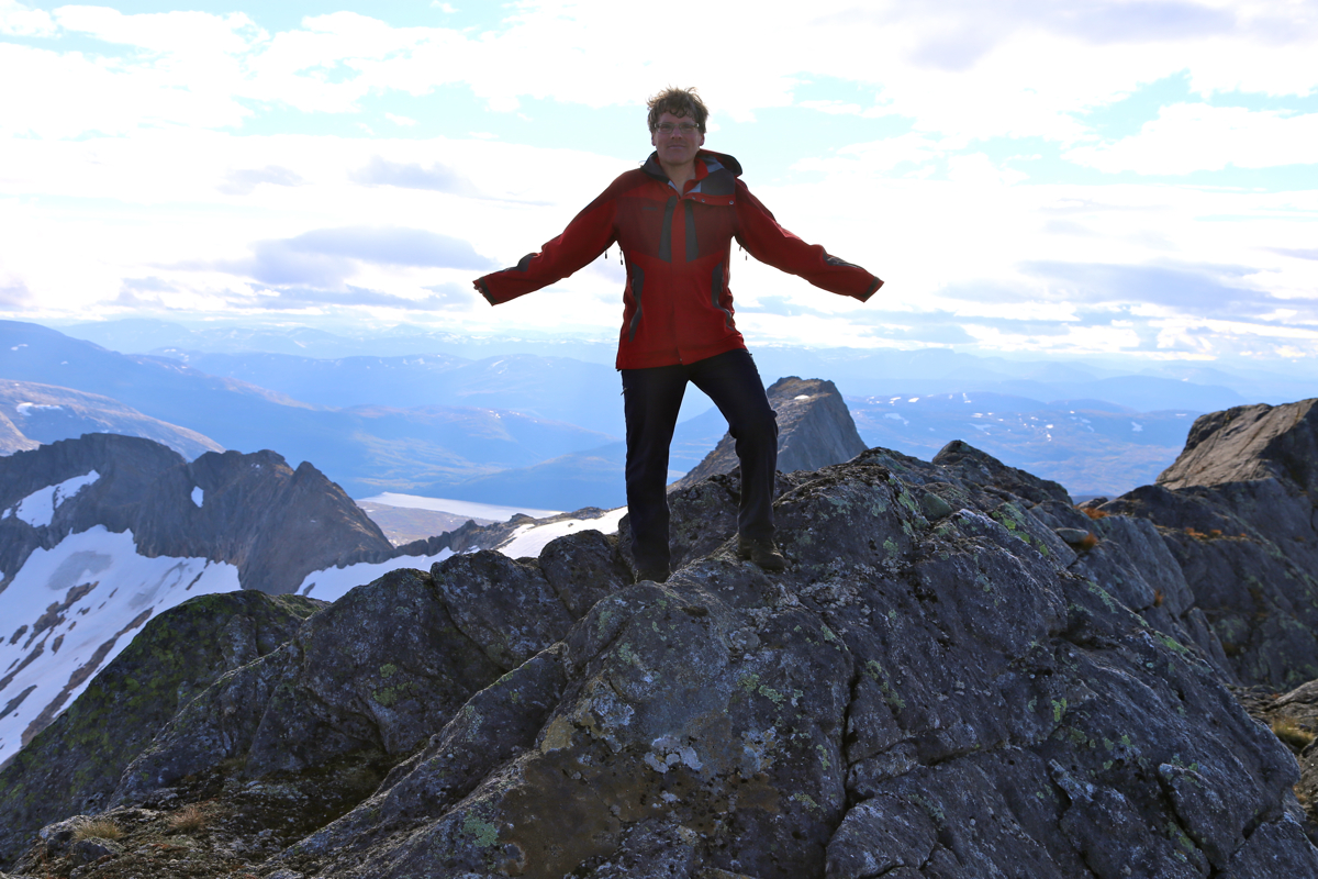
within about 15 minutes we were both standing at the highest point.
No sign of any previous visit could be seen.
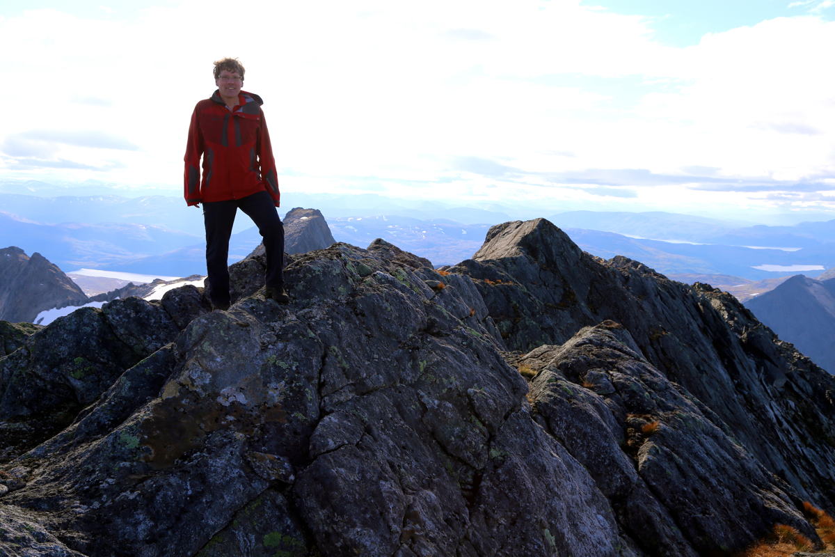
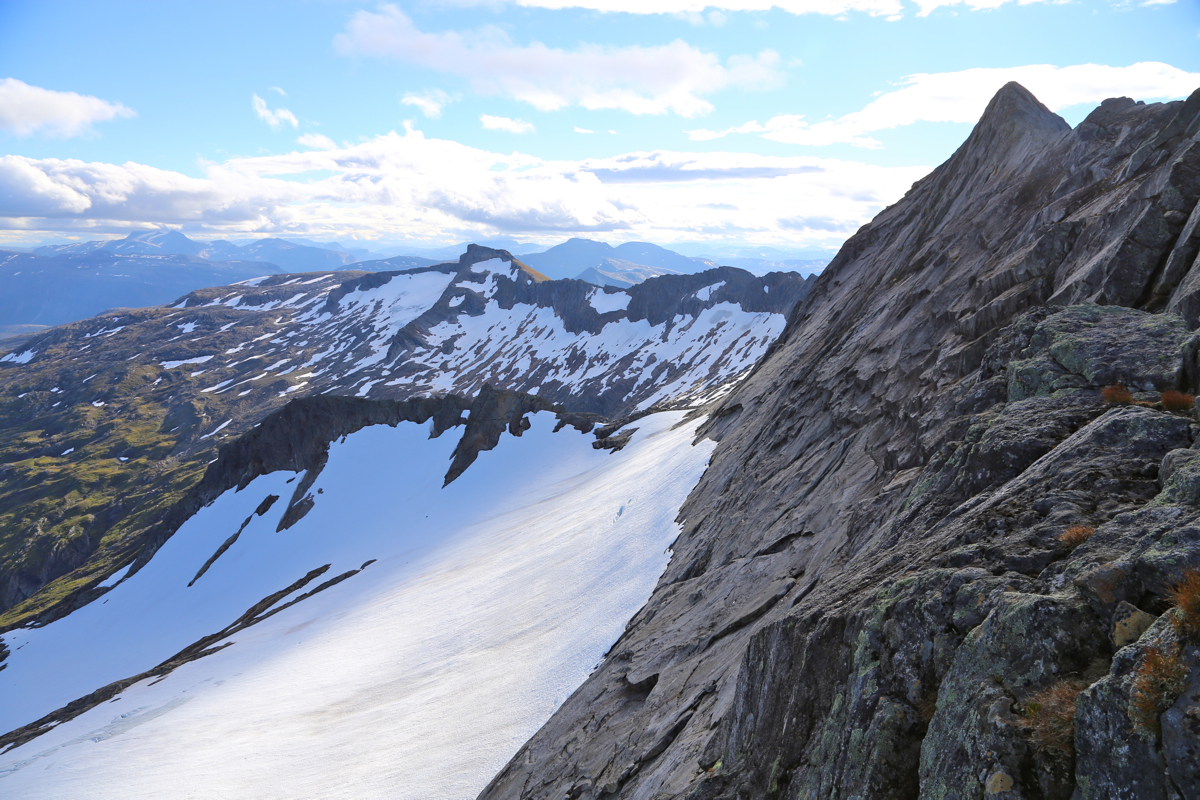
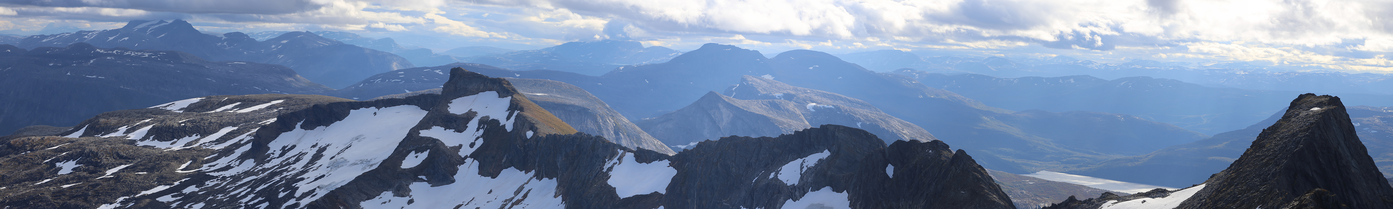
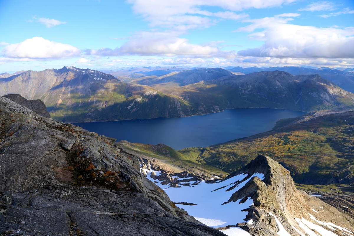
Looking back, the ridge
we just traversed is sharp, but very smooth.
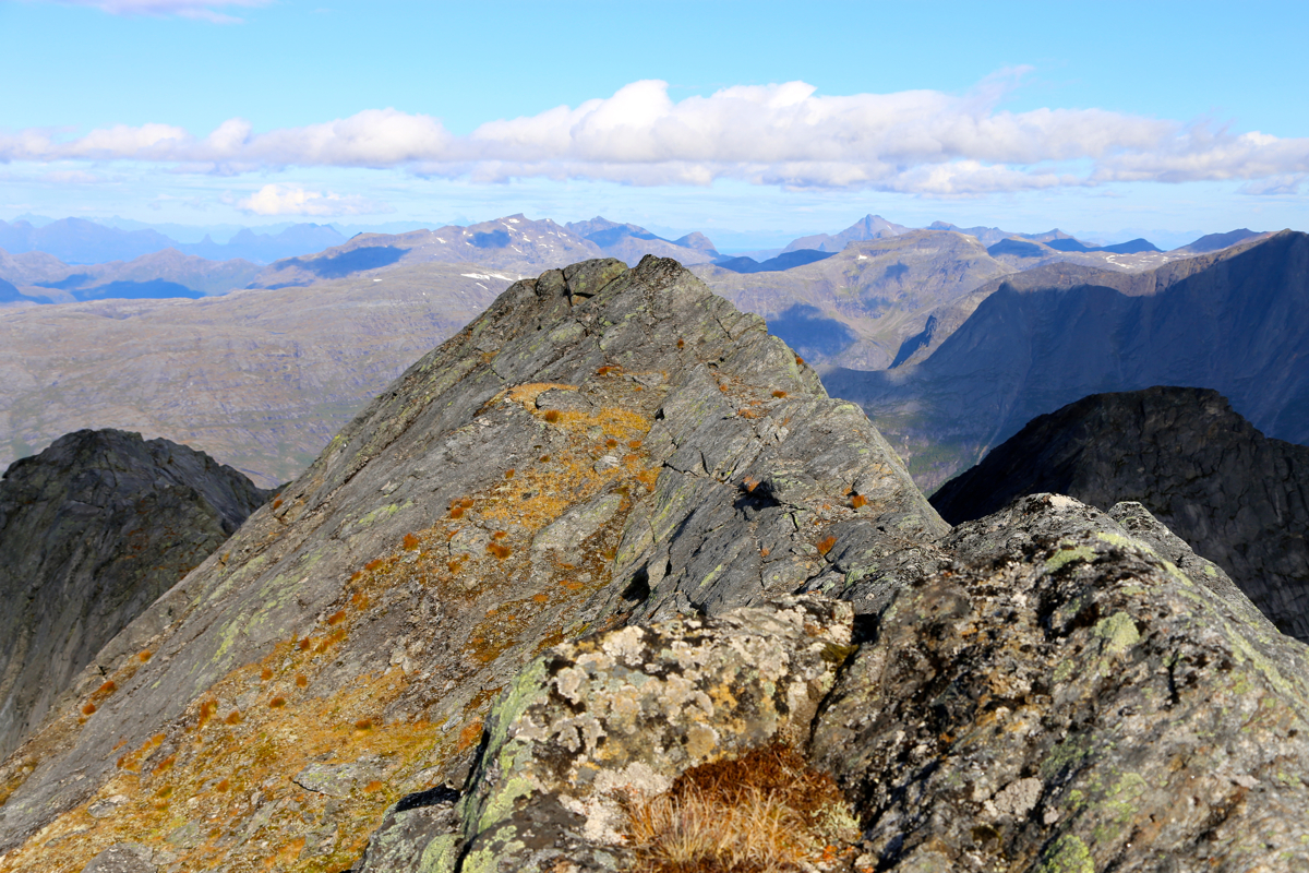
We continued along the ridge to the next small
hump (clearly lower), from here the ridge drops off.
We took a photo looking back at
the summit from there, before returning to
the highest point. We next spent some minutes to build
a small, nice-looking cairn. The weather
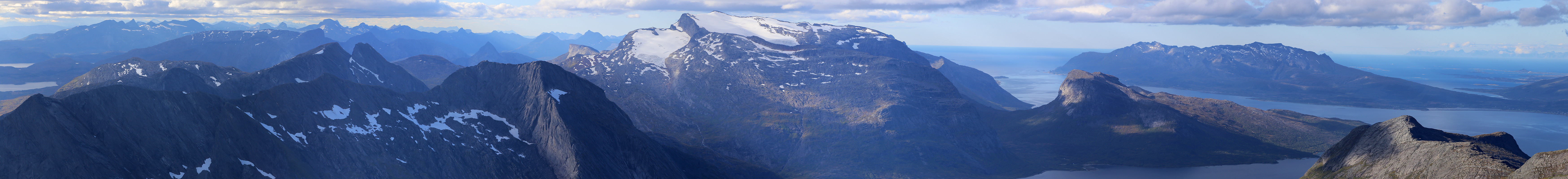
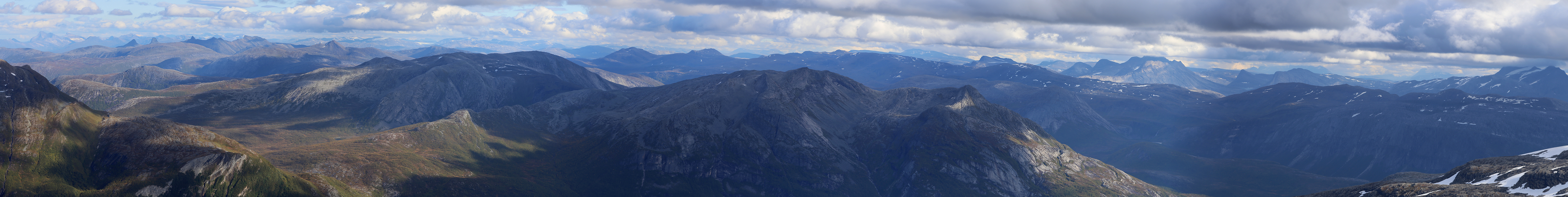
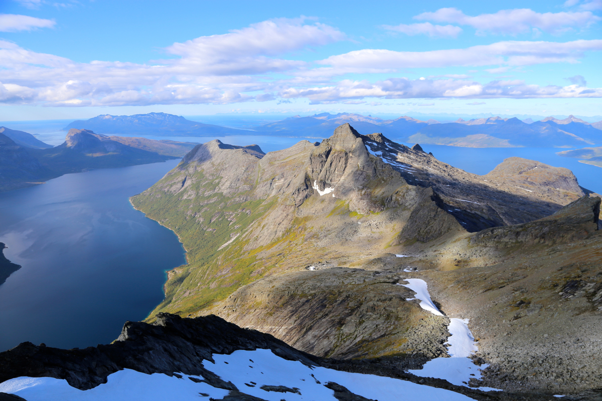
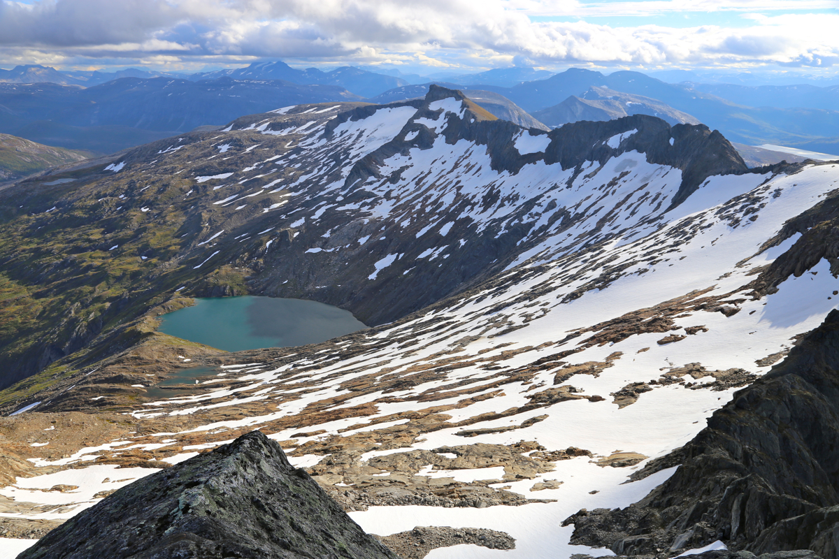
stayed nice and the scenery is absolutely stunning.
Sharp ridges, the Helldalisen glacier, the
blue fjords, distant
peaks across in Lofoten, all coming together - the making of a complete
landscape.
We left around 1230 and had a nice return hike pretty much following the same route.
Back down by the fjord at
1545. Ketil showed up at 1615 due to somewhat rougher sea.
Altogether, a very memorable day in a spectacularly scenic landscape.