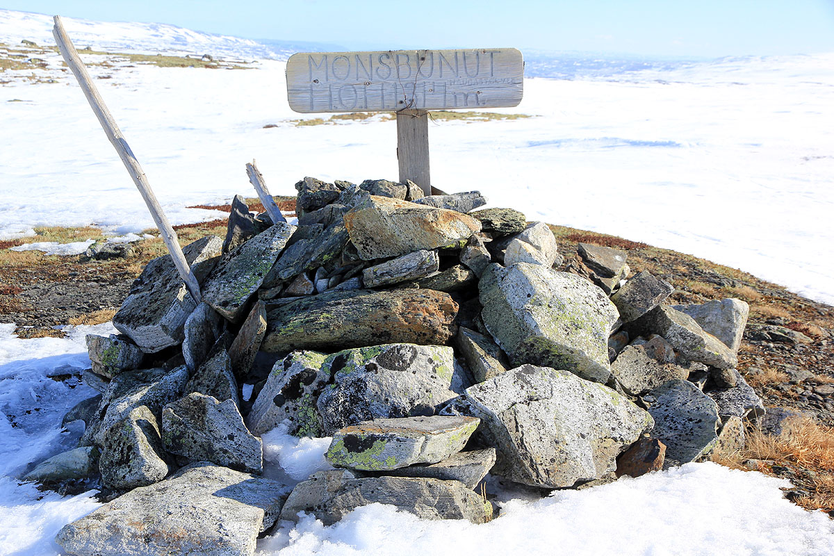
Location: North 60:27.285, East 007:52.176 (GPS at the summit)
Difficulty: YDS class 2
Climbed March 25, 2012
Information:
How to get there:
A good starting point is the railway station Haugastøl. This is the
last station before Finse when travelling from the east. It is also the point
where the road (Hwy. 7) and the railroad separates when travelling westward.
Route description:
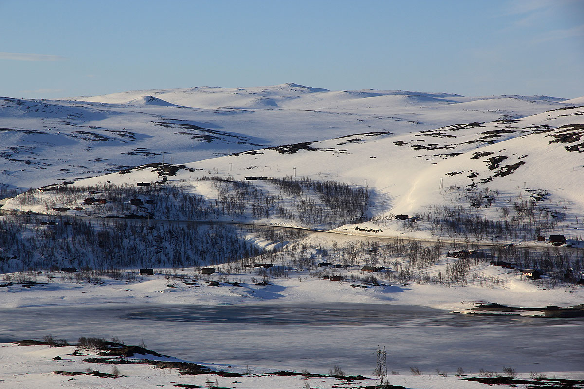
Note that in (late) winter, the lake Ustevatn is lower and there is a land
connection from the railroad station to the area south called Tangen. There is
a solid wooden bridge across the short, connecting river. This is not well
shown on current maps.
Ski south from the railroad station and cross the bridge that connects this
area with the small penisula Tangen. Continue south to the proper south side of the lake.
The route ascends this hillside while tending slightly west of south. Higher up, you
will see a pretty distinct summit directly south. As it turns out, this is the false
summit marked at 1320 meter on the map. Monsbunuten is located about one kilometer
further south.
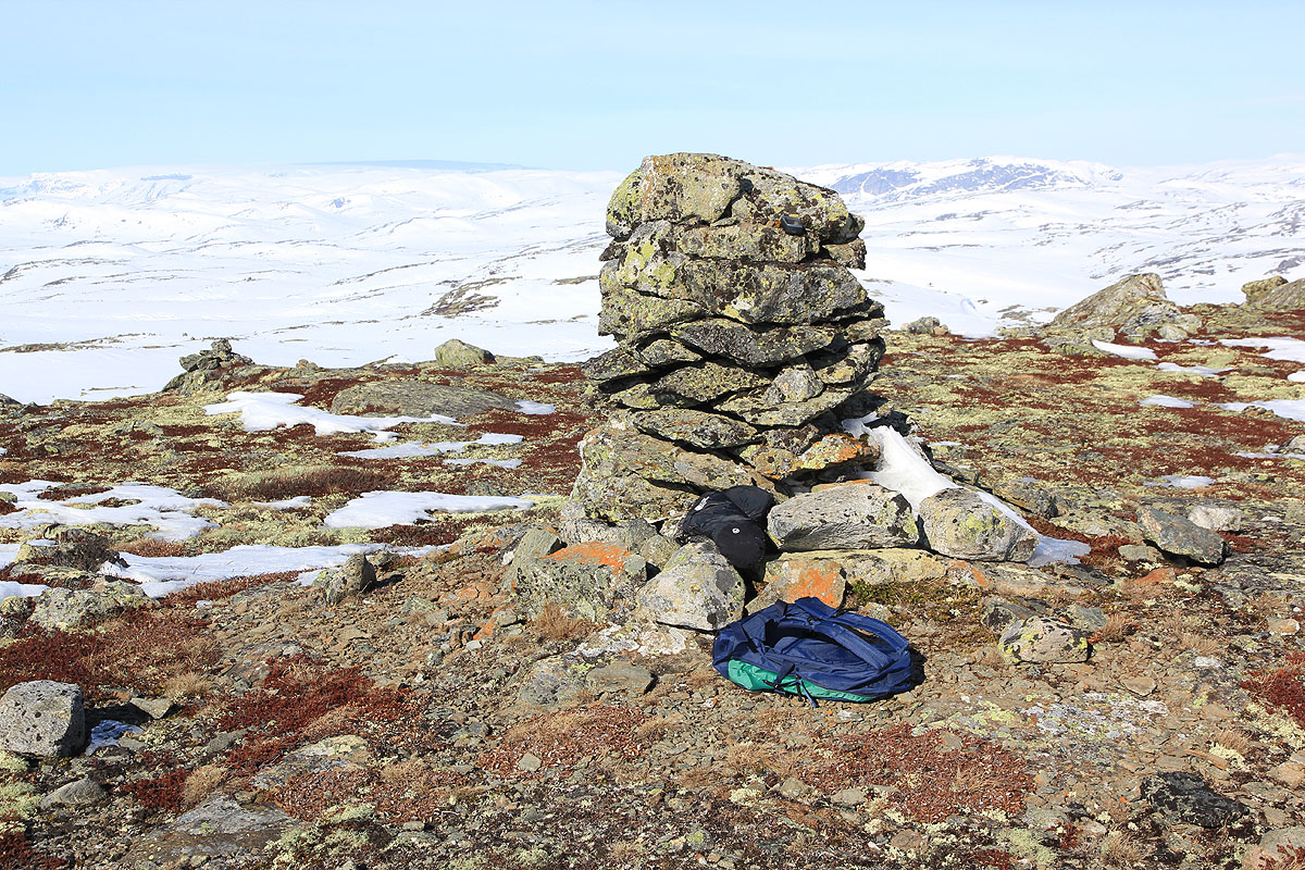
Also note that the cairn on Monsbunuten is located slightly north of the
highest point.
Comments:
I was having a very nice weekend
with friends (Henning, Per, Trygve and Jeremy) from Bergen.
Henning Lygre owns
a mountain hut located on the hillside just north of the railroad station.
On Saturday, we had been skiing to the Lordehytta, a very nice mountain shelter
built in 1880 by the English lord Garvagh jr.
On Sunday, I decided to ski across to Monsbunuten. After descending to the railroad,
I was skiing by 1015 and made the first (false) summit a bit before 1130. Onwards to
the proper summit, arriving there by 1145. The weather was nice and the view pretty good.
I measured the false summit to 1332 meter, while Monsbunuten measured 1336 meter, ie. the relative
difference is as on the map, but the absolute elevation is off by 12 meter. (GPS with
100 samples and an estimated accuracy of 2.0 m)
I started back after about a 10 minute rest and skied further east to avoid the false summit.
Near perfect conditions with a predictable crust having a slightly softer top surface.
Back near the railroad station by 1230.
We returned later that day by train to Bergen at 1700.
Thanks to Henning for organizing a very nice pre-Easter weekend trip!
Resources:
Images
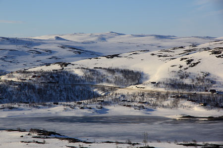
Monsbunuten, as seen from Haugastøl. Actually, this is the
false summit. The true summit is hidden further behind.
Hallingskarvet, as seen from the first summit (1320 summit).