Location: North 65.99017, East 013.54446 (GPS on the summit)
Nordland, Norway
Difficulty: (YDS) class 2
Climbed July 22. 2020.
Information:
How to get there:
From the town Mosjøen (on hwy. E-6 in Nordland), continue north on
E-6 about 27 kilometer. You first pass Fustvatnet and Mjåvatnet on your
right hand side, then lake Ømmervatnet on your left. About 800 meter
before you reach lake Luktvatnet, a small road forks right, descends slightly and
crosses the river. A new Hwy. E-6 is being constructed, so details may change, but
this side road heads off near coordinates N66.0418, E013.5111.
Drive this road, keep right after crossing the main river, then curve left and follow
the road uphill towards the mountain. You will pass a couple of small farms then
follow the mountain road further uphill to a small (forest) road fork where one may park without
blocking the road. This location is N66.00707, E013.50965, elevation about 350 meter.
Route description:
First, continue up the left fork, but soon turn more left (east) and find a
reasonable line across to the small valley between Lukttinden and the much smaller
Nordtinden (923m). Turn the broad ridge somewhere below 500 meter of elevation
and ascend on easy terrain above the creek and below the steeper hillside of
Lukttinden to location N66.00454, E013.53970, elevation about 585 meter.
You should find a couple of cairns here indicating the best access to reach
easier ground a bit higher on the Lukttinden slope. Ascend near a small
creek that runs down here.
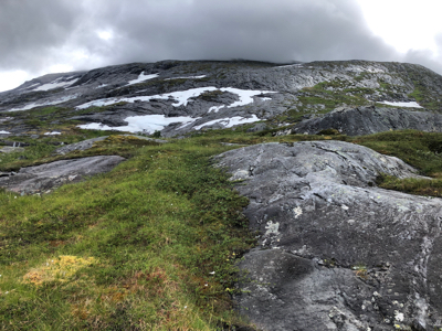
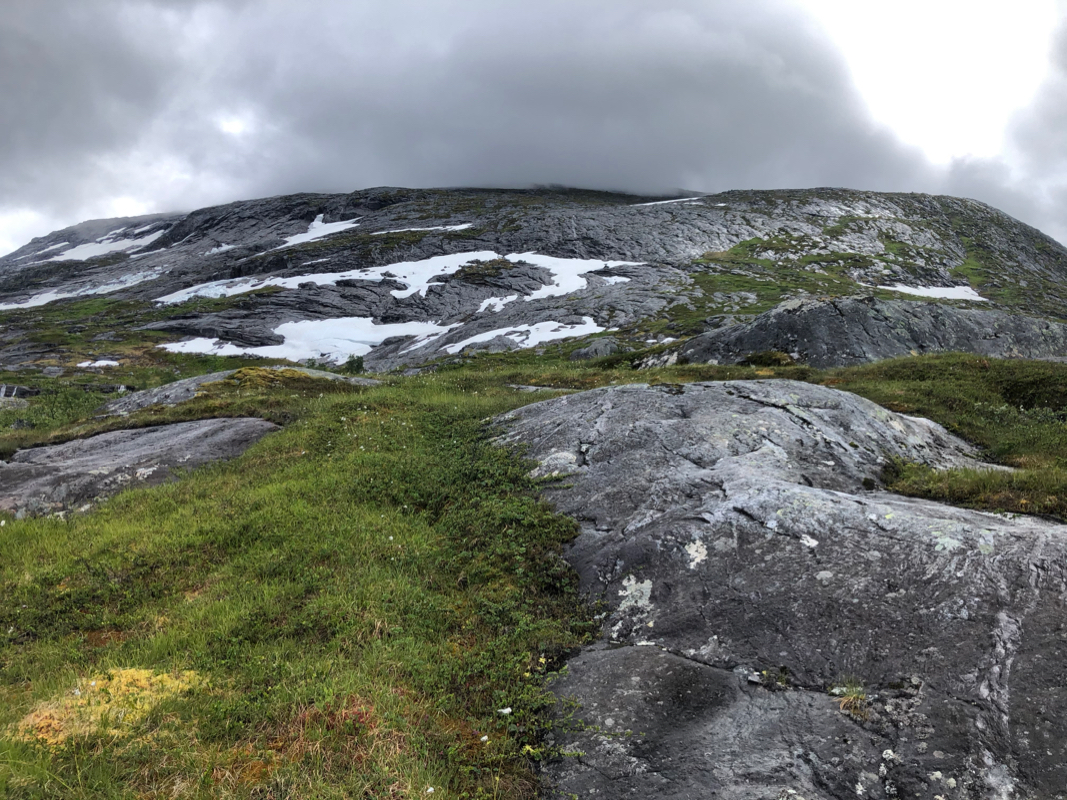
Higher up, the slope is more gentle and the mountain is covered mostly by grass
and low vegetation. Do an ascending traverse south-west. There is a broad and shallow
gully going this way. One may stay just left of this, pay attention in order to
stay on ground that has vegetation and avoid smooth rock that may be wet and
slippery. Continue until you reach Lukttindrauva, a fairly distinct north-west
ridgeline.
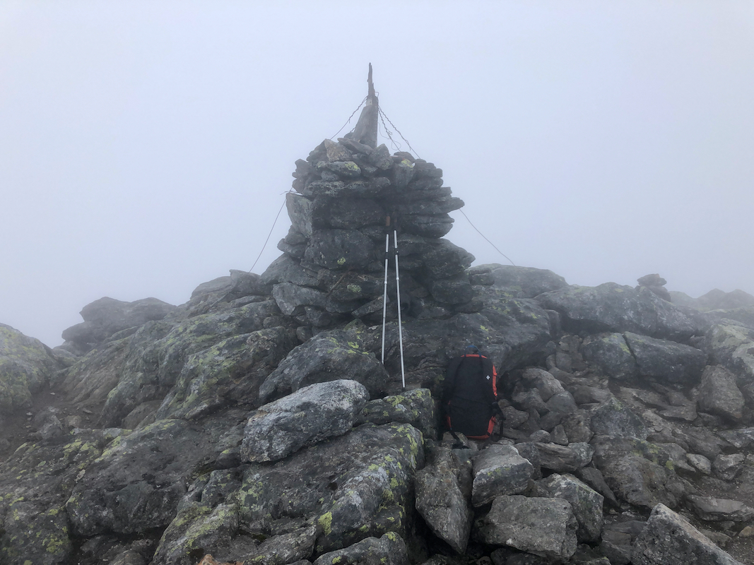
What remains is now to follow this ridge to the summit. The route is marked by
many smaller cairns. In a few places one may avoid cumbersome talus by
seeking more right, near the edge of the ridge. Near the top, the slope is
more gentle and a large number of cairns clutter the area. Proceed to
the main and proper summit cairn. Comments:
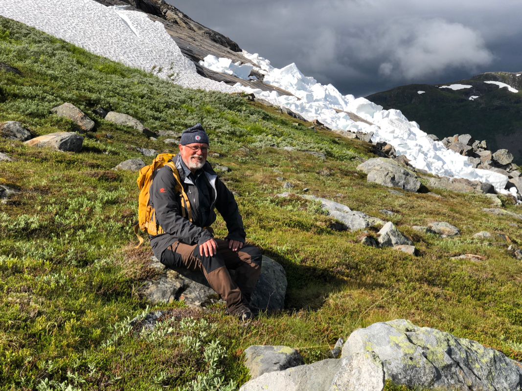
I arrived with my friend Jostein after climbing Lihauet the day
before and staying overnight in the town of Mosjøen. The weather
was far from perfect, but certainly ok for another climb. We left at
0915 and walked across to the area between Nordtinden and Lukttinden.
The rock was wet and the slopes more
directly up towards Lukttinden
looked uninviting. Once across,
we had a short break and agreed that
Jostein would attempt the smaller Nordtinden while I climbed
Lukttinden. We split at 1045 and a big patch of snow facilitated
the first part of my ascent. I arrived at the summit in dense fog
at 1235. A brief 10 minute stop, then returning the same way down.
I was back at the car by 1500, about one hour after Jostein had
returned from his visit to Nordtinden.