Location: North 60.56636, East 006.82227 (GPS at the summit)
Difficulty: (YDS) class 2.
Climbed January 26. 2013.
Information:
How to get there:
The best access is from the road connecting Voss and Granvin. If coming from Voss, look for a side road
going left,
Hwy. 572, connecting to Ulvik (the sign says Espeland).
The fork is about 1.5 kilometer after you start driving along lake Granvinsvatnet.
From Granvin, turn left onto Hwy. 13 (from Hwy. 7, direction Voss), and measure from this intersection.
(To the left you have the tunnel entrance serving the Hardanger bridge.)
Turn right onto Hwy. 572 (signed Espeland, see above)
at kilometer 4.2. Then at kilometer 5.6, leave Hwy. 572 in a sharp
left curve, by taking a smaller side road going right (A sign says Vindal).
At kilometer 5.7, keep right, then at kilometer
7.3 continue straight. As you arrive on top of a hill, at kilometer 7.6, turn right and continue uphill
until kilometer 8.3. A small forest road/path forks left (not possible to drive), continue a few meter more
and find parking on the (right) side of the road. This is the trailhead, location N60.55025, E006.75092,
elevation about 346 meter.
Notes:
With a prominence of 487 meter, Kvasshovden ranks number 34 in Hordaland.
There is an annual mountain race from Ulvik to the top of this mountain.
The race is 7.5 kilometer with a vertical gain of 1030 meter. The best runners take about 50 minutes.
There is also an alcoholic cider beverage (from apples) called Kvasshovden Cider. Route description:
From the parking, walk back to the last curve of the road and locate the path that heads north. This path
initially descends very slightly and enters an open area (the trees has been cut here). Be aware, as the trail
turns right and ascends the gentle slope staying on the right side of this clearing. Continue to follow
this path as it ascends only very gently, heading north until it makes a sharp bend right. The next section
is gaining about 100 vertical meter, the trail (in winter) becomes less well defined, but it is easy and obvious
to continue uphill. You will run into a big path coming from your left side. Follow this the reamining short
distance to the old farm buildings at Heller.
Above Heller, the terrain is more open and fine for skiing. The route climbs uphill in a natural, small valley,
shift slightly left and continue uphill in a new, small valley. When nearing 750 meter, turn more east and cross
near (south of) the small lake Lyngerstjørn (780 meter).
Continue more on the main (broad) ridge staying a bit left of the highest line in order to reach the
small lakes just west of Svortetjørn (884m).
Ascend along a nice, gentle ramp (from west to east), north of Svortetjørn. This will get you to the
upper part of a small valley that gains the 990 meter saddle just west of the summit. From here, the summit can
be reached quite easily.
Comments:
I had been attending a math. winterschool at Geilo and wanted to ski a
mountain on my way home to Bergen. To find a place to sleep turned out to be
harder than anticipated. I started looking on the west side of Hardangervidda before
descending to Eidfjord - nothing.
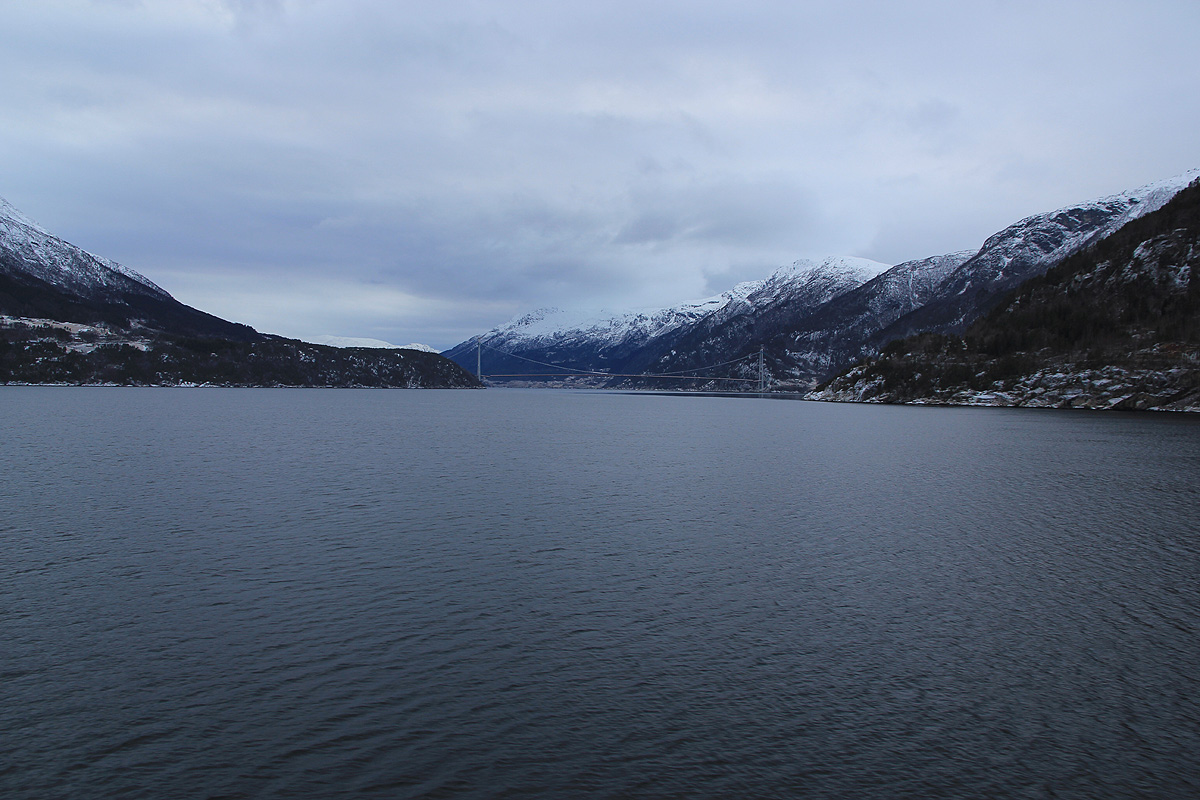
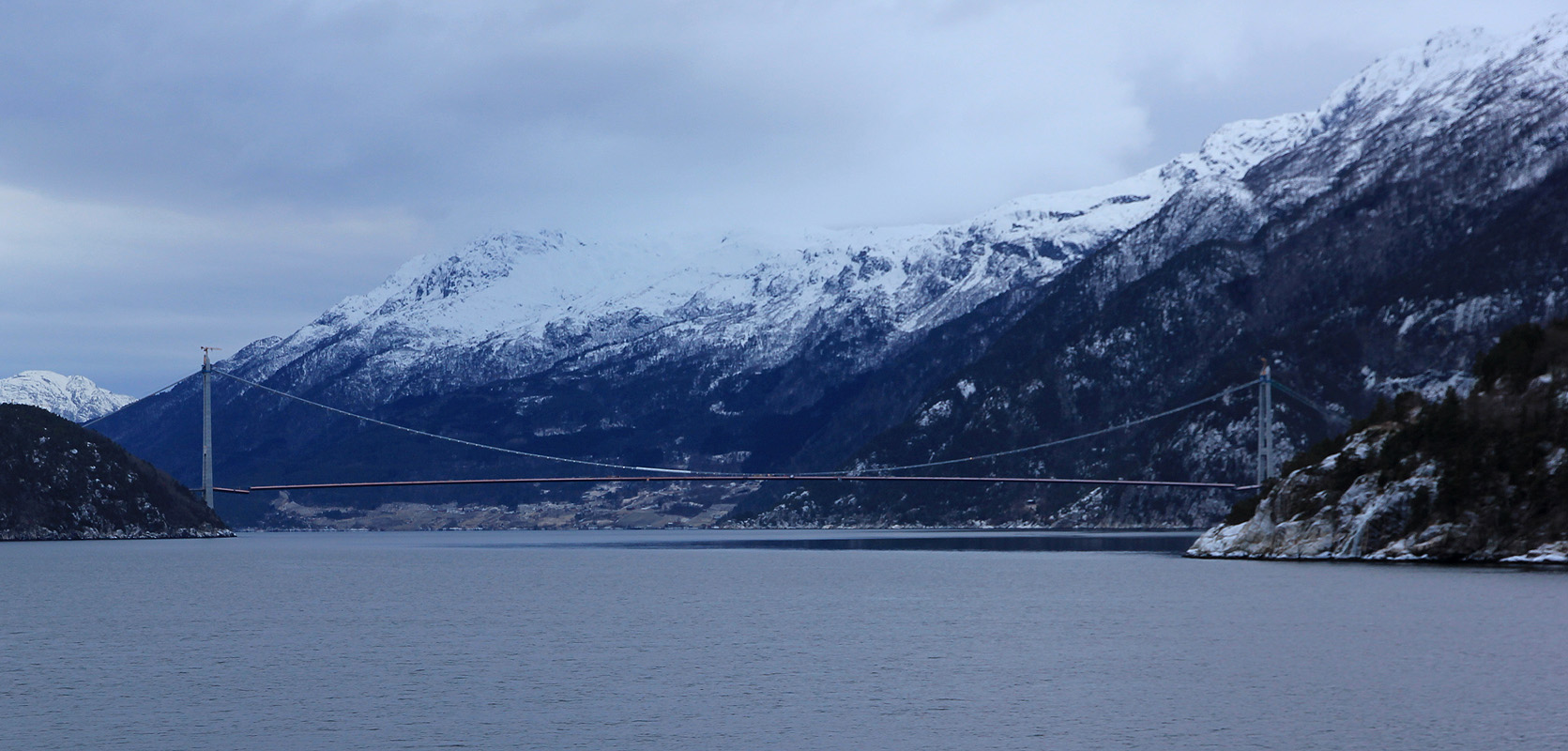
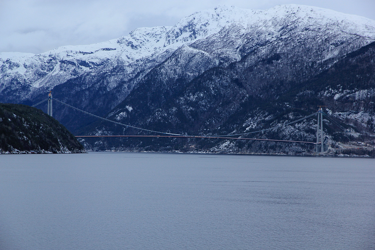
Driving onwards, I crossed the fjord with the ferry that
soon will be obsolete as the new Hardanger bridge opens in June this year.
It is the longest
suspension bridge in the world
with only two lanes for traffic, thus less stiff than other
bridges of this length. The bridge has towers
exceeding 200 meter in height, but they are still
dwarfed by the mighty landscape. I noticed that the bridge
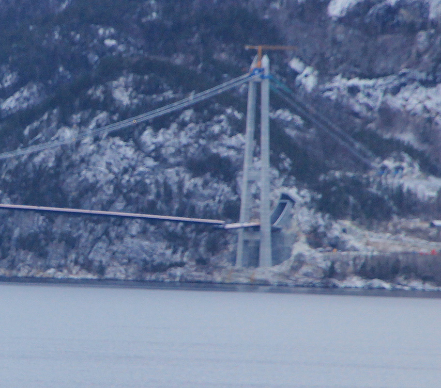
is still not completely done, they have
left a break in the road
surface at both ends.
Possibly, the giant construction needs to settle
into final form before welding the final sections?
I then drove to Ulvik only to discover that the hotel opened
January 26! Driving across to Granvin, I ended up at an old, wooden (small) hotel.
It turned out, that the place Jaunsen Gjestgjevarstad,
had served this purpose since 1666.
This place was run by a very friendly man. I got a room for the
night, dinner served at seven, as well
as breakfast the next morning. The place also runs the local pub, it was fun observing the locals
as they started arriving around 2300, to have a beer and exchange local gossip.
I said farewell and headed to my chosen trailhead around 0915.
After reading the report by Arnt,
I decided that to climb this mountain in January was likely best attempted from the south.
I left the trailhead around 0945 and almost immediately lost the trail! I failed to notice that the
path turned uphill shortly after entering an open area where trees had been cut down. This caused
trouble as I entered into dense forest with no snow. I carried my skis and ran into sections of the
hill covered with blue ice, horribly slippery. After quite some struggle, I finally intersected the
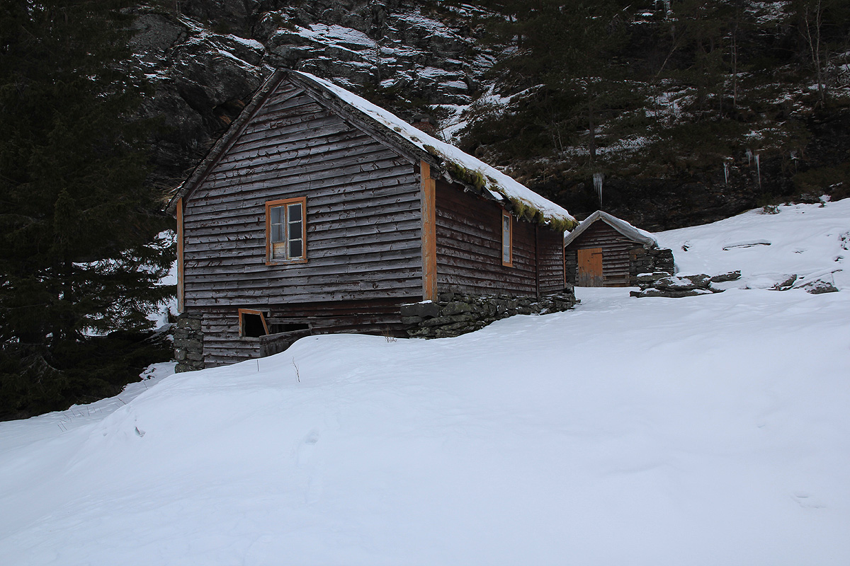
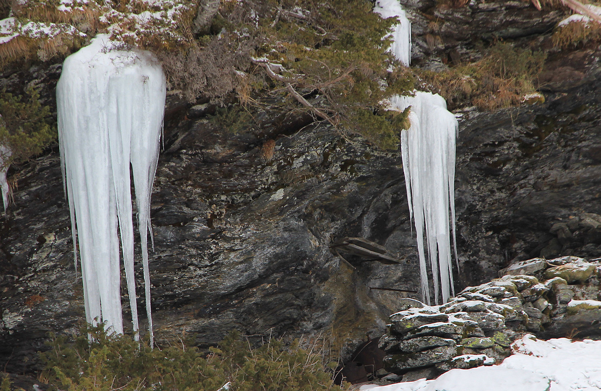
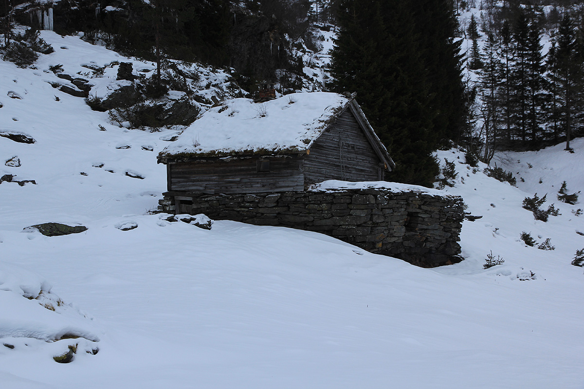
trail and suddenly everything got very easy. I arrived at Heller by 1030,
two old farm buildings and a smaller
house, all nicely located below the steep cliffs with nice hanging ice from frozen water.
Above Heller, the skiing was quite nice, unfortunately, the (overcast) light made it exceedingly difficult
to see the snow surface and adjust for ups and downs in the terrain. I skied up a small local valley, then
more right onto the main (south) ridge. The route I took was
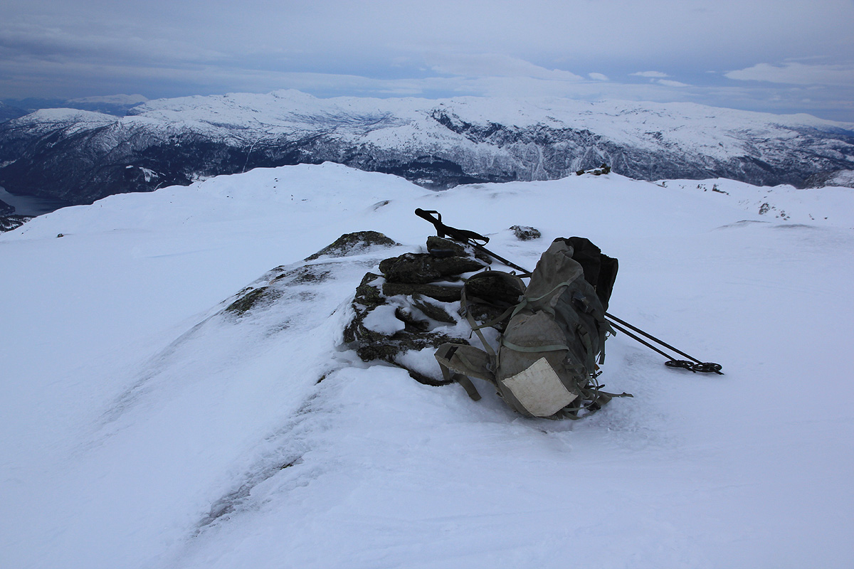
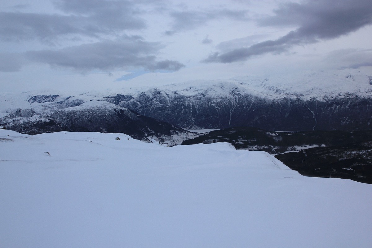
quite nice all the way and I arrived at the summit
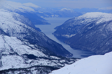
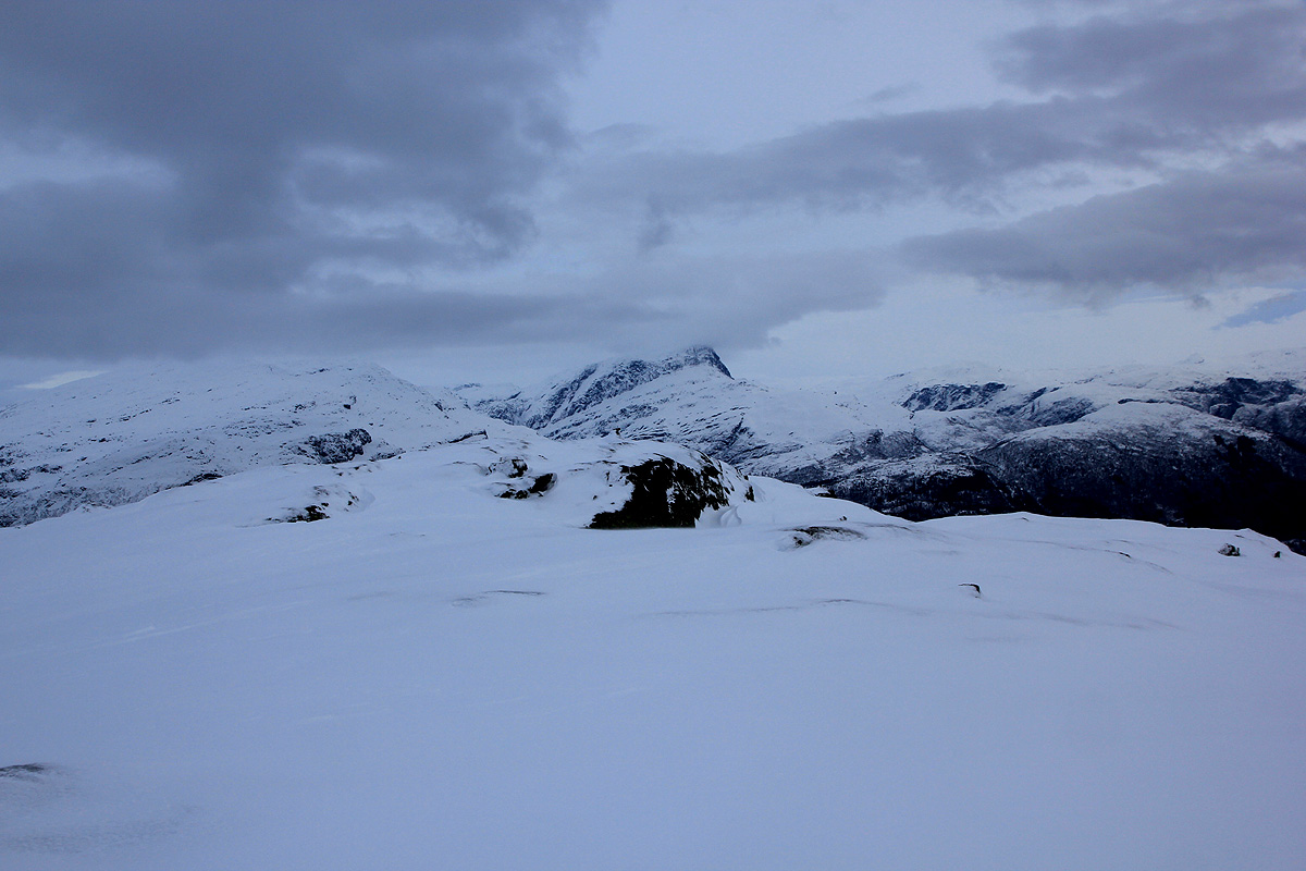
at 1220. Despite the overcast weather, I still had some view. East,
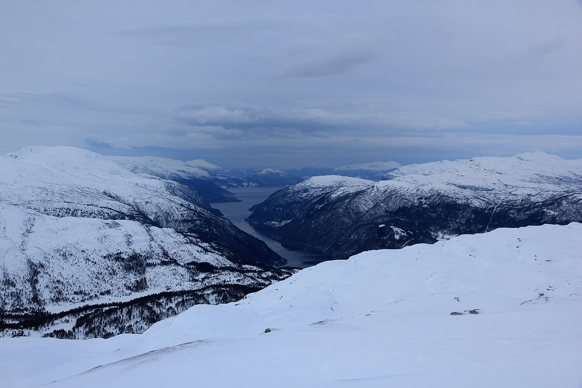
towards Vassfjøra - west out the
branch of the Hardangerfjord that serves Granvin.
I left by 1230, the weather was turning quite nasty and I quickly decided not to visit the nearby
Kjerringafjell (1051m). Skiing back down was nice and I made
a short rest at Heller around 1400.
It was most convenient to walk from here, reaching my car at 1425, this time following the nice path
all the way back.