Location: North 65.74113, East 014.23637 (GPS at the summit)
Difficulty (YDS) class 2
Climbed April 24. 2021
Information:
How to get there:
From Hwy. E-6, turn east towards Hattfjelldal in the small place called
Trofors, this is about 35 kilometer south of Mosjøen. In Hattfjelldal, continue
Hwy. E-73 towards Sweden, but fork left in Krutå, in order to remain along the
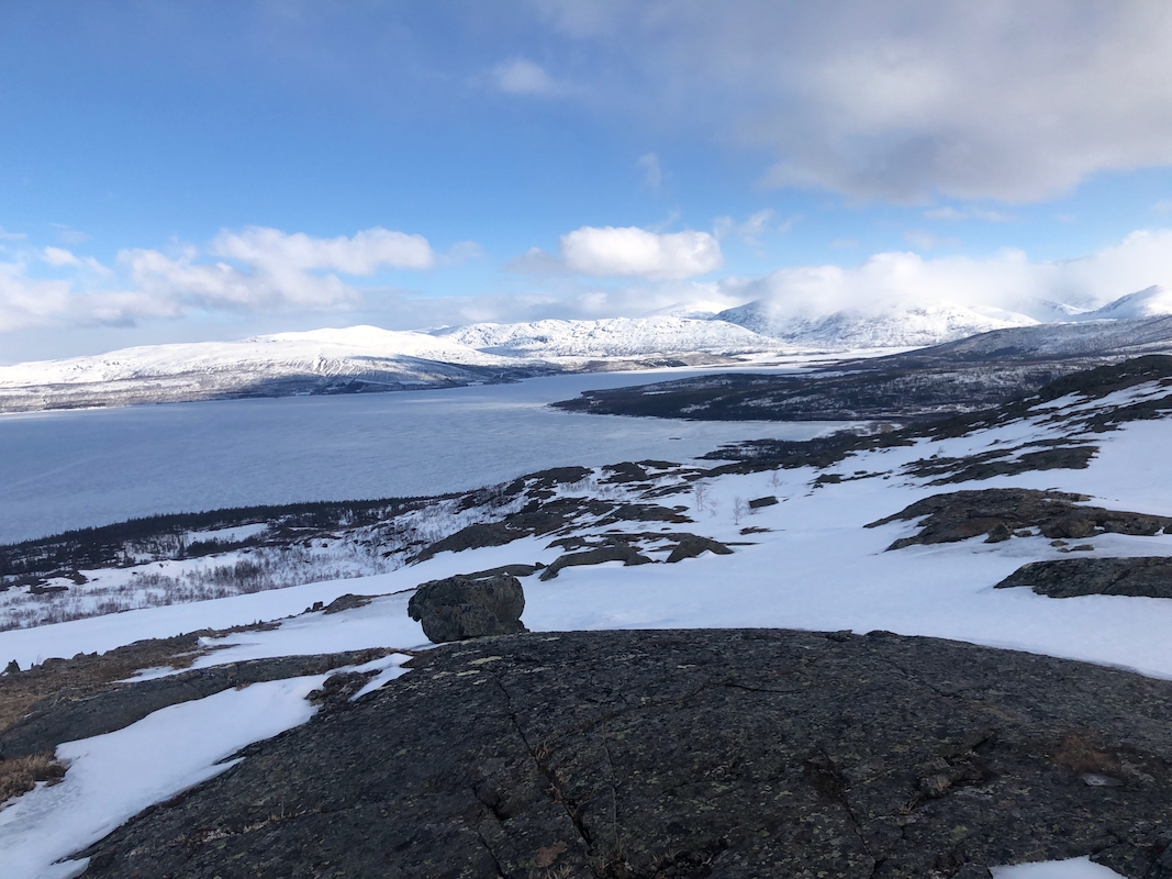
shore of lake Røssvatn. About 15 kilometer from this fork, as the road stays
a bit higher above the lake, find parking off the road (you may use a part of a signed
meeting place). I parked at location N65.78003, E014.17689, elevation near 440 meter.
Route description:
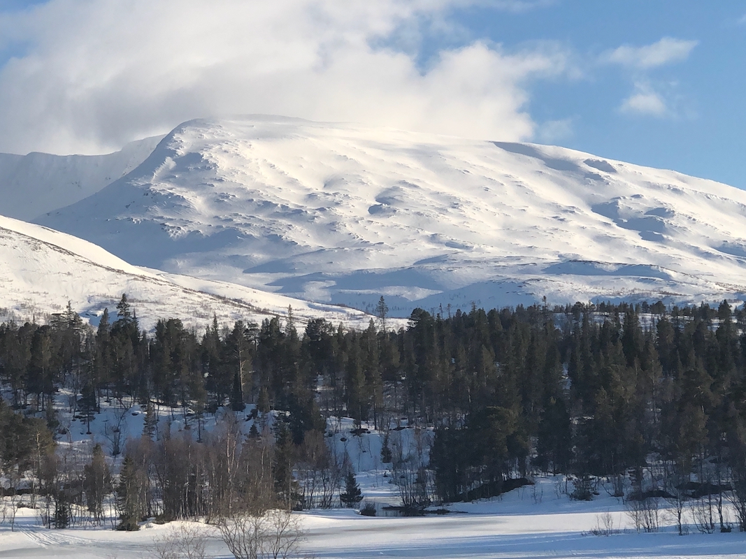
Head directly towards Flakhaugen, 550 meter, find good slopes with space between the trees and
ascend on the west (right) side of the main ridgeline. Turn more east as you leave the trees
behind and make a gentle traverse across to the very distinct valley just west of
Vestertinden (1039m). Follow this valley south as it bends slightly left, you will find pretty
easy slopes that gains the ridge between Vestertinden 1322m, (this is another Vestertinden!) and
Krutfjellet. Finally, ascend the nice and broad ridge to reach the summit plateau. The highest
point is a short way east.
Comments:
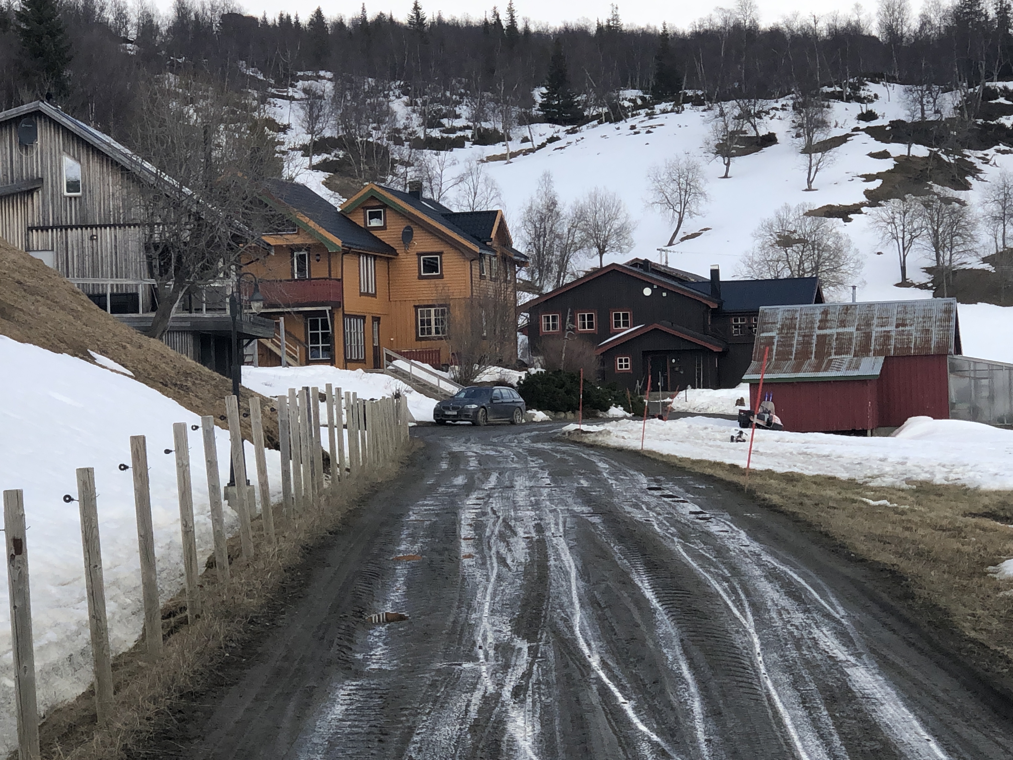
I established myself at the nice farm Sæterstad.
This is located a few kilometer beyond
the trailhead. I left early and started skiing at 0730. It was a pretty easy ascent, arriving
on top at 0950. I stayed about 15 minutes, then skied back down to my car in 35 minutes.
Unfortunately, the clouds made for pretty flat light at the upper part, causing somewhat
slow skiing. I returned back to Sæterstad, planning to do Hjartfjell the next day.
