Location: North 37.18679, East 021.71396 (GPS on the summit)
Peloponnes, Greece
Difficulty: (YDS) class 1
Climbed October 5. 2021.
Information:
How to get there:
The best approach is from the west. Locate the road fork near location
N37.1613, E21.6796. Leave the paved road here and head uphill on a fairly
good dirt road. High clearance recommended, but perhaps not required.
Drive this road up and across the crest, descending you should stay left
at a road fork. The road quality is slightly better. Continue to location
N37.17279, E021.71638. The summit road forks sharply left here. You may
decide to park here. A 4WD may continue until location
N37.17986, E021.71436, elevation about 1060 meter. There is nice parking here.
A good 4WD can drive onwards essentially to the summit, however the road gets
quite a bit rougher along this last part.
One may also drive to the final road fork described above, from the east.
This access road is longer and somewhat rougher. To do this, turn off the
main Hwy. near a shell gas station at location
N37.28197, E021.85379. Continue on a good paved road to location
N37.19803, E021.78680, go right here. Continue (mostly on reasonable dirt roads)
to location N37.16274, E021.76657, go right here. The road is rougher, but not
terrible, continue until you arrive at the summit road fork.
Route description:
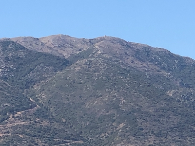
Continue along the road. It first heads south, then turns left and follows the main
crest. The summit is marked with a concrete pillar. You must follow a small trail
the final few meter to the top. The road continues then ends just below the second
summit that has a building on top. Again, a small trail climbs the last few meter.
The summit with the concrete marker is slightly higher, perhaps 1-2 meter.
Comments:
I left our hotel in Mystras (near Sparta) around 0930 and had a nice drive
with stops for grocery as well as fuel. Ready to hike at 1200 - noon.
The hike was nice and the weather almost a bit on the hot side. I arrived on the
top after 20 minutes. Next, heading across to the competing top with a
building. My GPS measured 2 meter lower.
Leaving at 1230, it was an easy stroll back to my car.
I drove down to the road fork, then decided to explore if