Location: North 59.76030, East 006.74502 (GPS on the summit)
Location: Hordaland, Norway
Climbed January 22. 2017.
Difficulty: YDS class 2.
Information:
How to get there:
A good point of reference is the village Røldal located along the
main Hwy. E-134 connecting Haugesund to the eastern part of Norway.
Two roads run south from Røldal, Hwy. 520 and Hwy. 13.
In summer, Hwy. 520 is a good access to climb the mountain from the north
side. This road is closed in winter. Thus, for an ascent in January, an alternative is
Hwy. 13. Drive to the end of the lake, continue, first on the left side, then on the right hand
side of the river. There is a small access road forking right that may not even be plowed
in the winter. This location is N59.72432, E006.72889, elevation about 360 meter. Find
parking off the main Hwy. here.
Route description:
Ski up the small access road to the river. I crossed this river (at least two bridges), then
proceeded uphill in zig-zags between many trees. Cumbersome skiing. As you get into thinner
vegetation continue more right, ie. towards the center of the valley. Above 700 meter of elevation,
you leave the trees behind. Continue up the middle of the valley Hegerlandsdalen. You will have the
local top marked 977 m on your right side. Turn right and ski into the very distinct, small
valley that branches right (east) at around 900 meter. This is south of the local summit marked
1043. When you reach a small lake, location N59.74125, E006.72962, turn left and ski uphill following
a natural route/gully. Ascend about 100 vertical meter to location N59.74528, E006.73255.
Continue more level, north to a distinct lake located at elevation 1040 meter. Going north from here,
you will note the slope ahead that ends in a pretty
steep gully, a small creek is running down
here in summer. This gully can be skied, after the steepish section, more gently, then a new, short
step before you approach steeper cliffs at elevation 1240 meter. Turn sharply right and ski below
the steeper terrain until you turn to the south-east side of the mountain. This location is close to
N59.75391, E006.74553, elevation near 1260 meter. From here, one
may follow more gentle slopes north until one is very close to the summit. There is a final, small
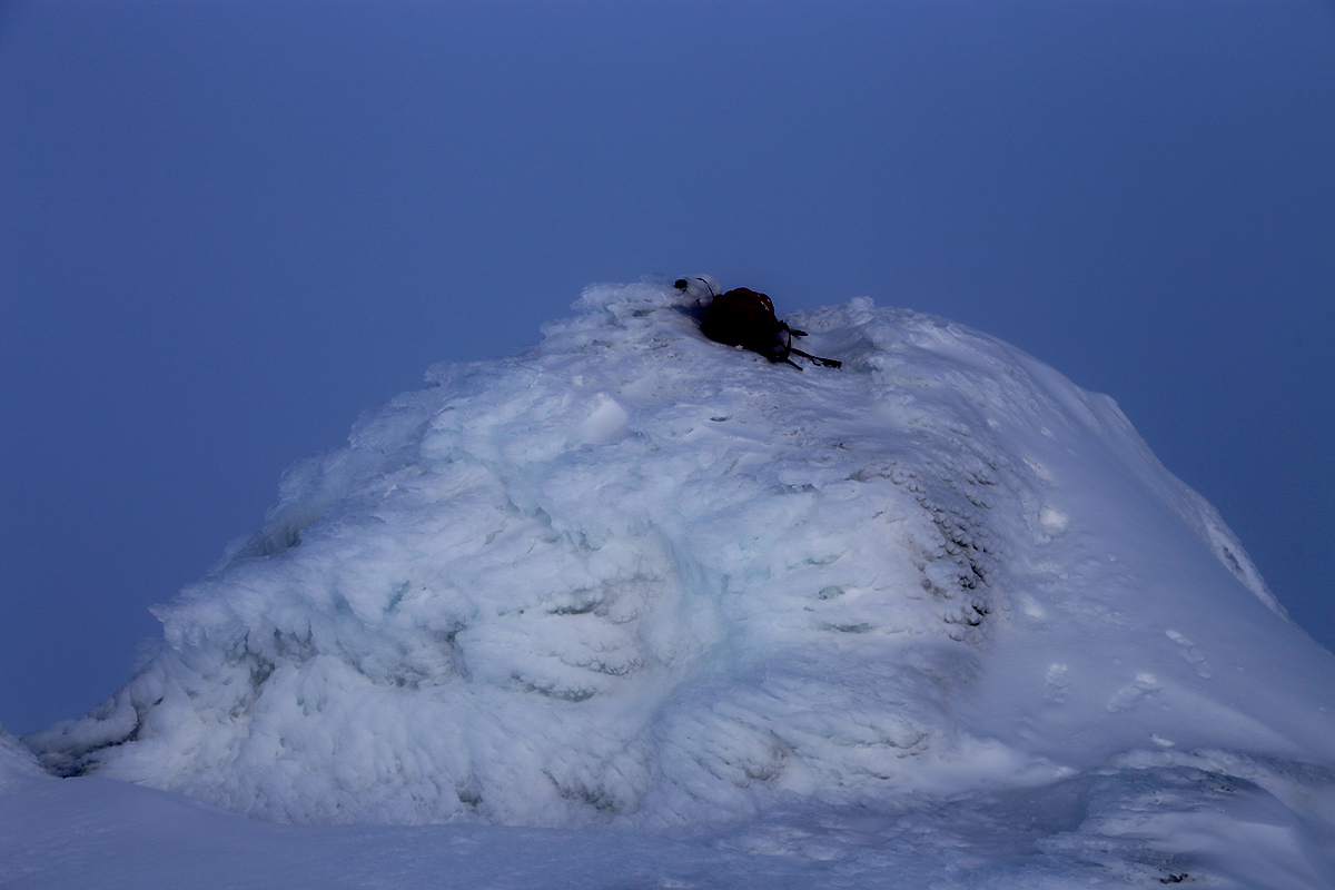
cliff that is perhaps best crossed on foot, depending on the snow conditions. The summit itself
is a rather small bump on this highest ridge.
Comments:
I had stayed at the DNT hut Haukeliseter the previous night. This hut has
full hotel standard and serves a high class, 3 course dinner. On my way home
to Bergen, I wanted to try this mountain, since it is located very far away
from Bergen, but figures on the list of the 100 most prominent peaks in Hordaland.
¨
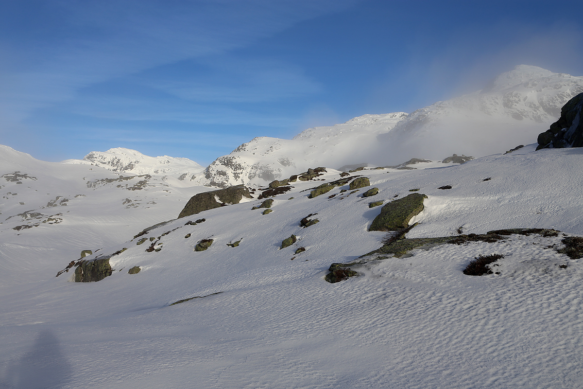
I started out from my car at 0930. The terrain was somewhat complex with lots of
trees and steep enough to require careful uphill skiing finding what looked like
the best route along the way. This part of the ascent took place in fog, ie.
a cloud I was quite happy when the trees became thinner and
the terrain more open and skier friendly. Moreover, it was clear that I had climbed
up and out of the cloud.
The next section of the trip had sunshine and good visibility, but it was evident that
another cloud was about to settle around the very summit.
Higher up, the snow got very icy and I was happy to have my crampons. At elevation about
1260 meter, I decided to leave my skis and carry out what remained of the ascent on foot.
I arrived at the summit around 1300
and stayed around for about 10 minutes. The sun could
be seen through the local cloud,
the weather remained ok, but with somewhat limited
visibility.
I walked back down to my skis, the steepish gully did not invite to pleasant skiing,
I therefore kept my crampons until below the steepest part of it. A section of skiing
followed. Further down among the birchtrees and with a pretty steep slope, I decided to
walk downslope the final part. This time, crampons were not needed as my skiing boots
would dent the snow surface here, exceptionally even step through the surface for
a deeper step. I was back down by my car at 1530. Quite happy to successfully have
climbed this rather far away (from Bergen) mountain that ranks among the more
prominent in Hordaland.
It was time to drive home in order to make a nice evening meal that Heidi had
prepared with her normal expertise.
