How to get there:
From Bergen, drive E-16 to Trengereid, then Hwy. 7 onwards, signed
for Norheimsund. Continue uphill until after you have driven through
the uphill tunnel called Fossen Braatte Tunnel. The road turns left
and runs flat with the river on the right hand side. A distinct ridge
comes down on your right. Find parking off the road somewhere here.
My parking was at location N60.38715, E005.90073, elevation about 390
meter. Note that this trailhead is not the easiest/shortest way to this
mountain.
Route description:
Note: The easiest route to this mountain is to start near the
small skilift on Kvamsskogen and follow the small farmers road to Mødalen.
From there, a marked path going to Kvitingen, will pass just south of the summit.
From the car, cross the road, then locate one of several small bridges that cross
the river (they serve private huts). Once across, proceed left and gradually climb.
There are cliffs higher up that you need to circumvent on the left.
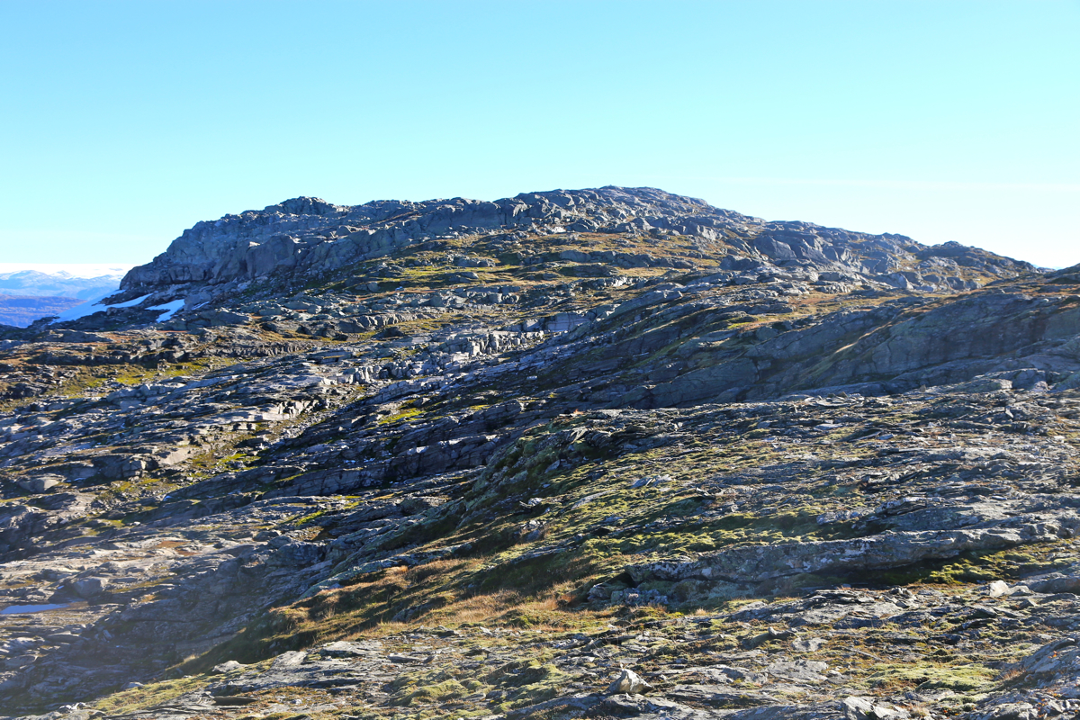
Once on the ridge, the terrain gets easier, but there are small cliff bands running
across that one needs to overcome. In two places, there are wooden steps to help.
Proceed uphill, passing east (left) of the local top Rabalhei (700 meter). Next, cross
a somewhat level area while aiming to cross a number of powerlines close to the
broad col from where the powerlines run downslope to your right. There is a small lake
near this col that you should pass on its west (right) side. You will now see a broad
gully with some broken rocks, straight ahead. This is an easy way up. Near the top,
turn left on grass, rather than going to the very top of the gully. Continue
horizontally (east), then gradually ascend as the terrain becomes pretty level.
Cross the small creek from Langatjørna near the north end of the lake.
The route onwards is again full of various cliffs that typically runs across the
direction of travel. The best approach is likely to stay near the top of this very
broken ridge. One will the pass near a small lake and discover that the remaining distance
to the summit seems much longer than
anticipated. However, after a pretty long and
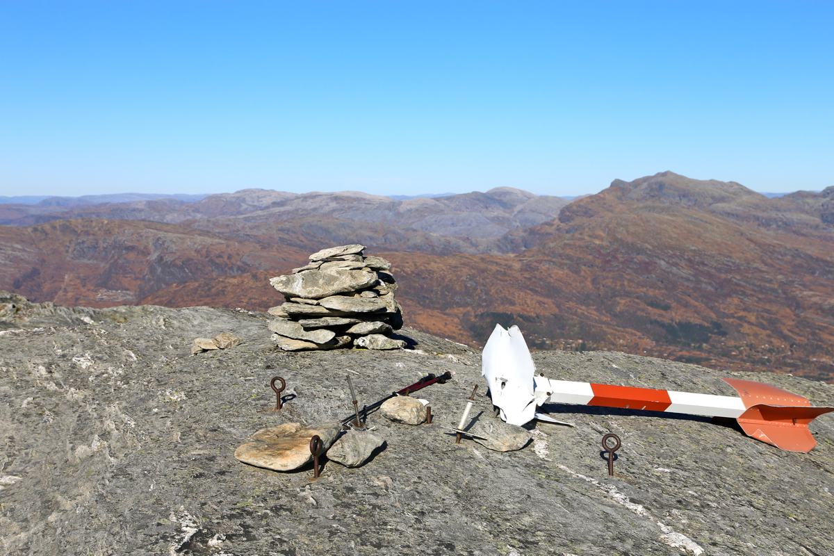
slightly convoluted hike, you will arrive at the highest point, marked with a small
cairn and a broken trigonometric marker.
Comments:
Beautiful, stable October weather had arrived. More than 10 days, all the same.
Cold, crisp mornings, the sun rising around 0900. All leaves with colors of
red and brown, then snow already at higher elevations. This is fall, nature is
preparing for winter.
I left my car at 1125 and immediately found myself in rather cumbersome terrain.
This turned out to be the tune of the day, cliffbands blocking the direction of
travel. I had decided on this trip in order to have a slightly longer trip in the
fantastic weather, above timberline. In this context, the route delivered. However,
what looked like a nice and smooth ascent on the map turned out to be rather
rugged and complex terrain, all features at a micro-scale not resolved on a scale
1:50K map. It was still a nice day and a good mountain, not a single person to
be seen anywhere. Obviously, very few people walk along this route. The hike
took considerably longer than predicted, it was 1400 by the time
I arrived at the summit.
Two persons there, having arrived along the standard route from
Mødalen.
Time for a short rest and some photos.
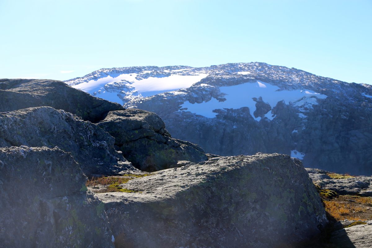
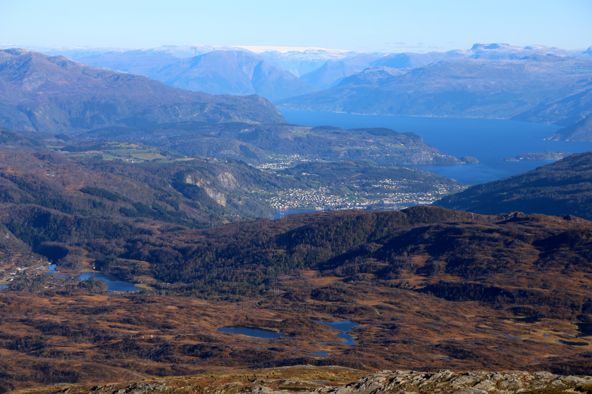
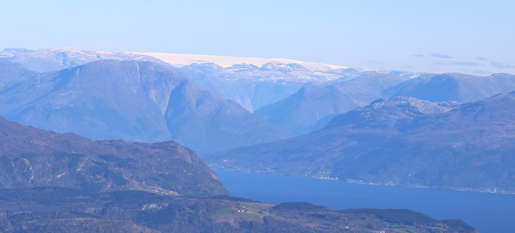
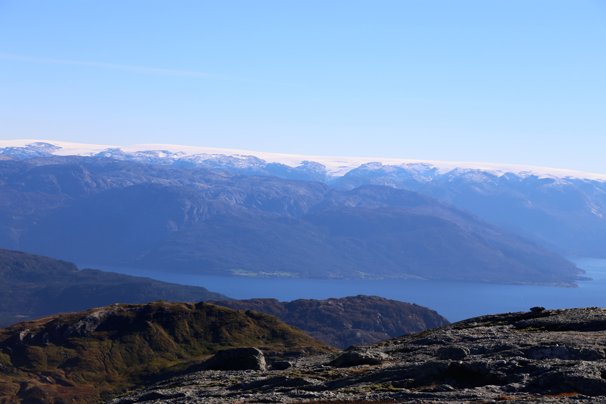
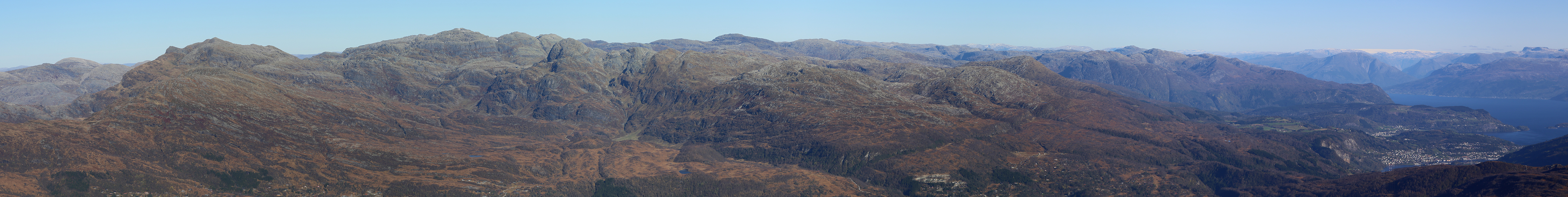
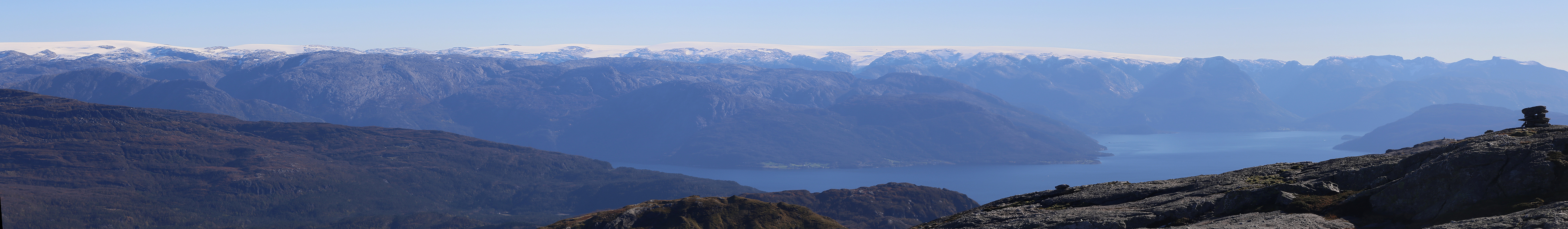
The higher Kvitingen mountain blocks the
view in its direction, but aside from this,
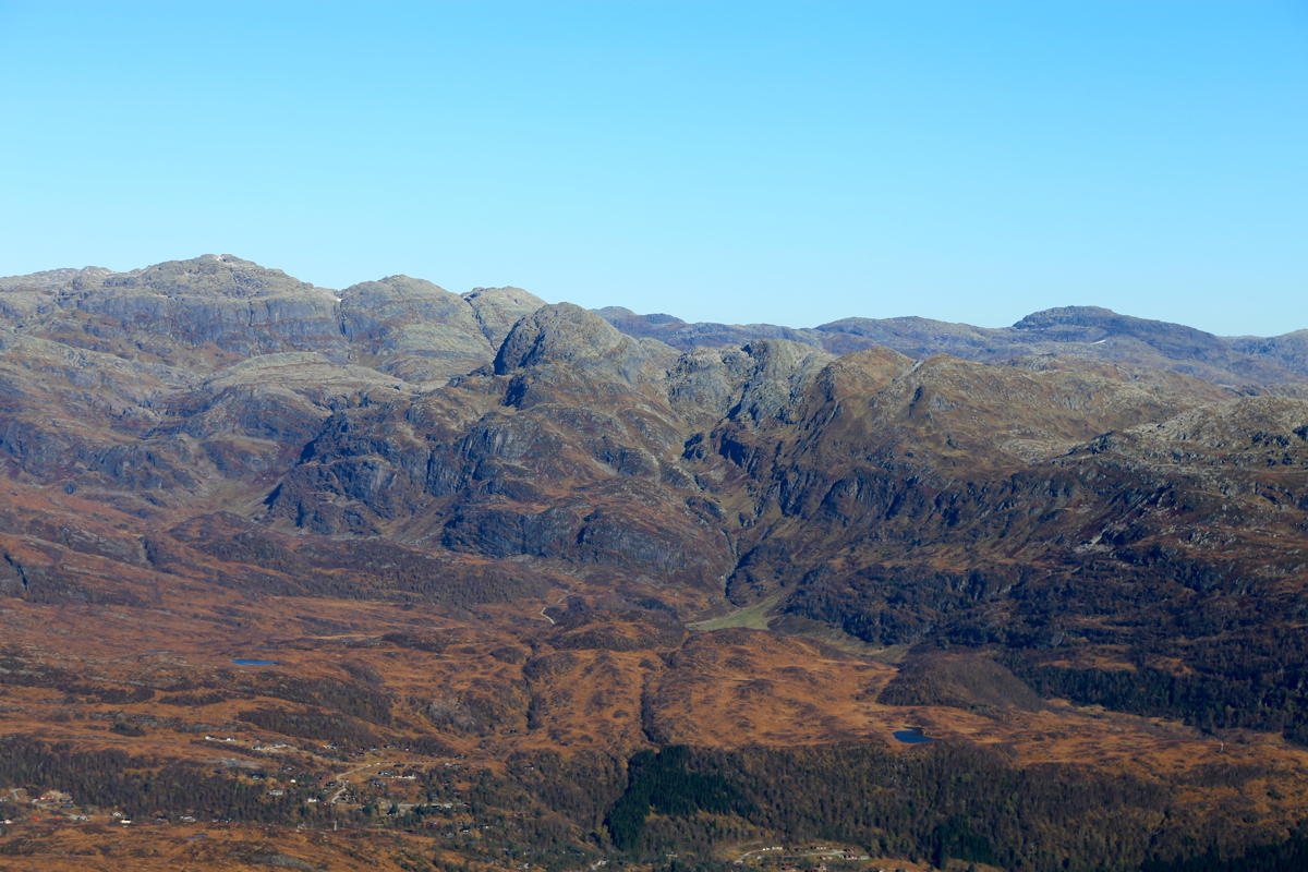
the view from this summit is
pretty nice. One sees the community of Norheimsund,
the Hardangerfjord and the
mountains beyond. The Hardangerjøkel
glacier looks small, while the
Folgefonnen glacier
stretches along the skyline for a considerable distance.
The other man had a binocular, using it one could see a couple of the production
oil platforms out in the ocean to the west.
I left around 1415, having made up my mind to find a better line for the return hike.
However, taking a line of travel that stayed slightly further east did not seem
any better. I returned to my car at 1710, having spent 20 minutes more on the return
trip! Descending the final ridge I essentially stepped on a ptarmigan, the bird
flew up more or less between my legs, quite a surprise! Of course, having walked more
than 5 hours, one would normally expect to see several such birds at this time
of year.
