Location: North 60.30844, East 005.87710 (GPS at the summit)
Difficulty YDS class 2.
Climbed June 11, 2016.
Information:
How to get there:
From Bergen, follow E16 towards Oslo. At Trengereid, exit right onto highway 7.
Follow highway 7 down to Samnangerfjorden and pass Bjørkheim.
After two tunnels, exit right onto highway 48 (Rosendal/Tysse/Mundheim). Follow highway 48 to
Eikelandsosen and continue further along Hwy. 48 to a somewhat sharp turnoff (left).
This location is Near Holdhus, the road is Hwy. 123.
Measure from here.
After 200m, keep right towards "Tveita/Øvre Hålandsdal".
At 400m, continue straight.
At 3.3Km, turn left towards "Tveita/Gjøn". At 3.7Km fork left, the sign
says Gjøn 3km. When you arrive in Gjøn, go straight. There is a sign
along the road that says Gjønakvitingen, follow this. You will shortly
arrive at a small parking (turn right), with trail signs and information posted
on your right hand side. Park here without blocking the farm road that extends
uphill. This location is N60.30329, W005.61710, elevation about 50 meter.
Route:
Start by walking up the local farm/tractor road that climbs the hill with zig-zag turns.
There are a couple of unsigned forks, generally do follow the "biggest" road, ie. the
one that seems to be in most use. The trail leaves the road going steeply up on the right
side just before the road gets to a small, wooden gate.
The route / trail is generally marked with small cairns and red paint, normally the well
known red "T". The trail tops out on a first hill, then runs more horizontally to reach the bottom of a distinct
valley that cuts directly uphill. There is a creek in the middle, the trail stays up pretty high
above this creek on the left side as you ascend. Emerging from the trees, the route continues
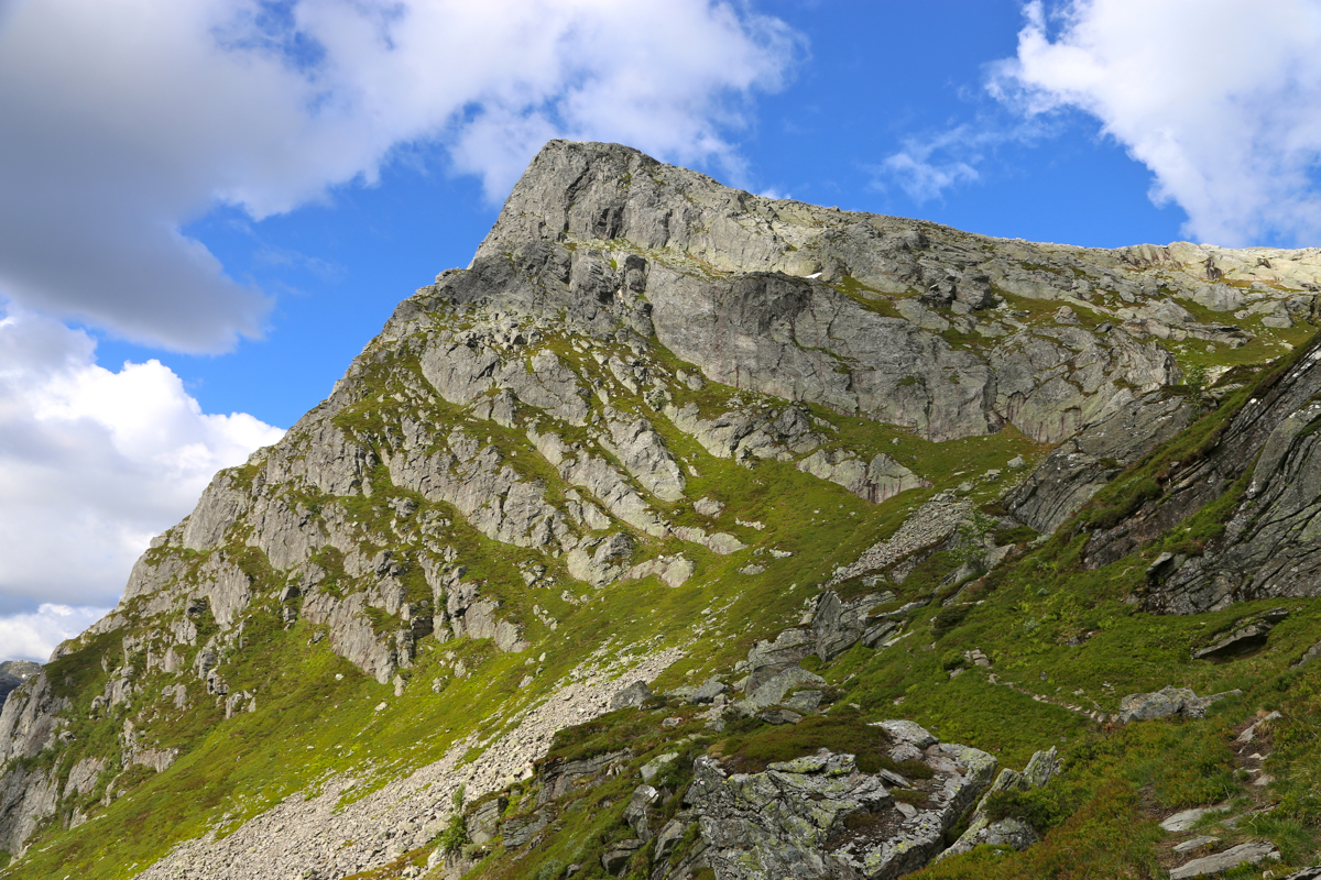
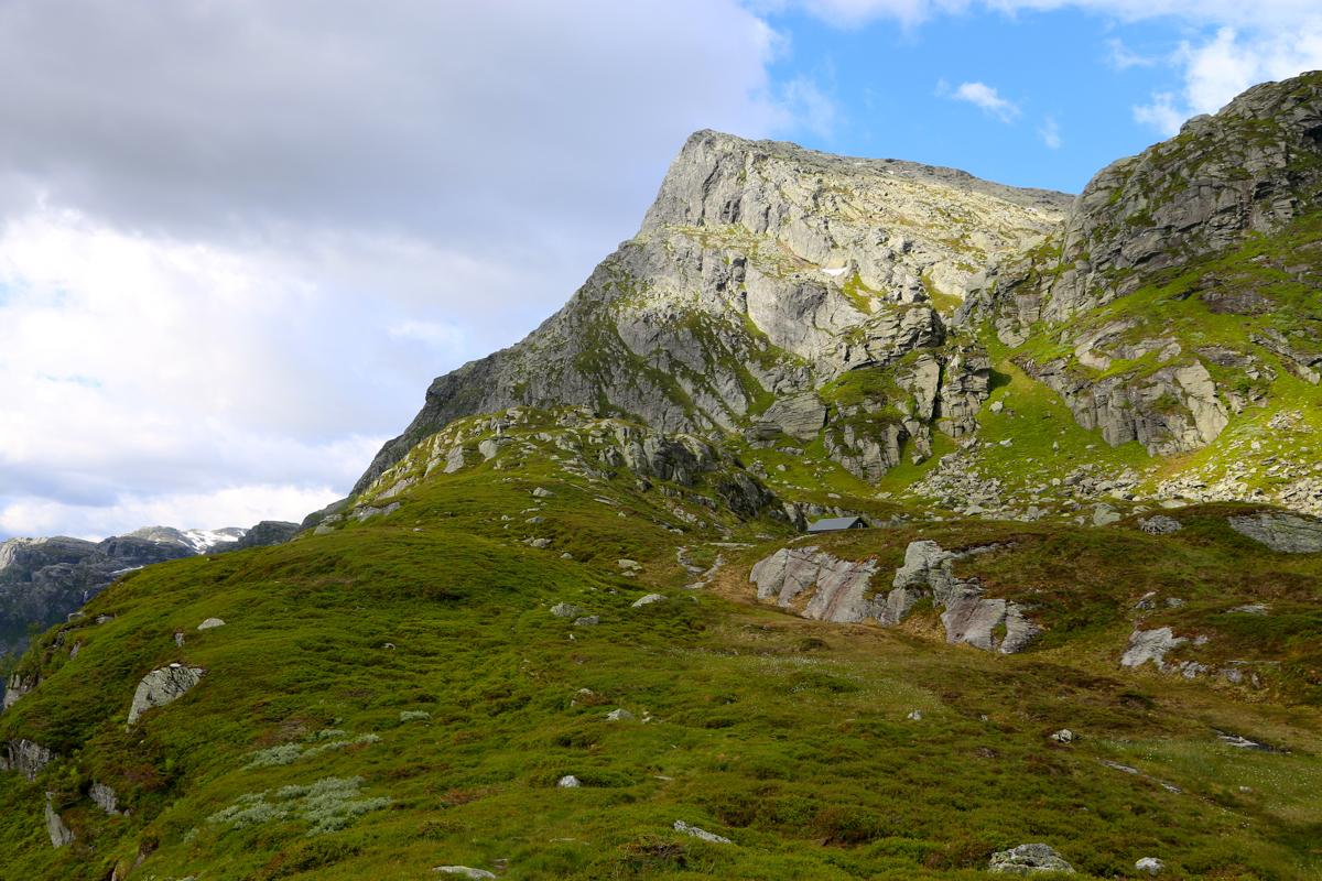
in the same direction, reaching a mountain cabin nicely located below the commanding
Kvitingsnibba (1114m).
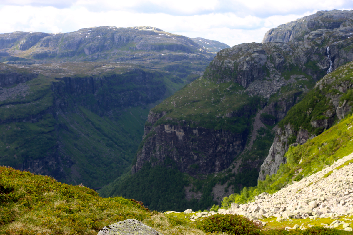
Continue north with good views steeply
down on the left side, into Norddalen, the east
up this valley to the saddle where the route again turns sharply left (north) to climb
Kvitingsnibba. The route is well marked with red "T"s on the rocks. Higher up, the terrain
levels off then descends slightly to the last saddle before a final ridge to the summit
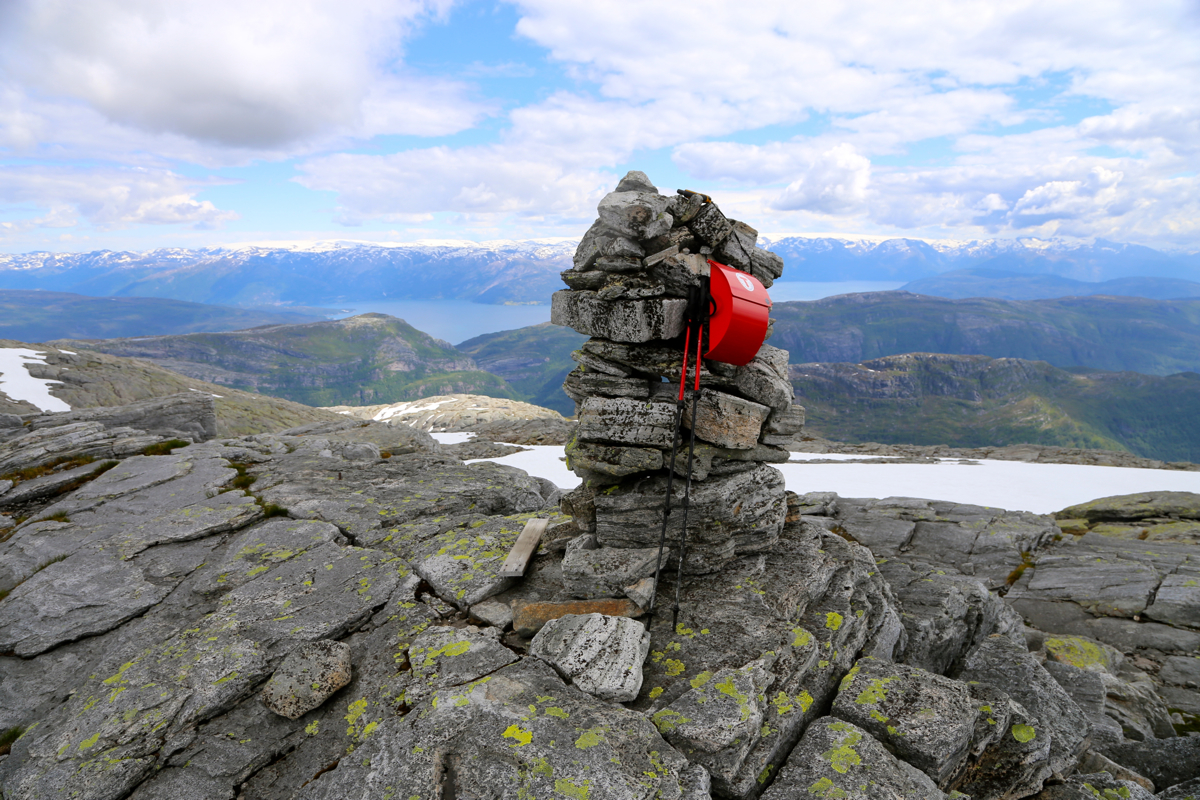
of Gjønakvitingen, 1213 meter. This peak has a nice cairn, a visitor register
and perhaps more important, a very good view. However, almost no prominence since the next
top along, called Loftet, is higher. Loftet, on the other hand, is also connected via a pretty
high saddle to Gavlen, the only peak among
these with more than 100 meter of prominence.
From Gjønakvitingen to the summit of Gavlen, the best route is a semi-circle traversing
north of Loftet, into the connecting saddle, then up
to the Gavlen summit. Comments:
With quite a late start this Saturday, but a very ambitious goal. I skied to Raudaberget in February,
the plan had been to bag Gavlen on that trip, but we turned back before this "last summit". Thus, it was
time for a new attempt, this time from the south and on foot.
I started at 1240 and took the wrong turn (left instead of right) at the first road-fork
with no signs or markers. However, I quickly got back on track ascending to the first plateau.
Next, following the trail? I got to the creek and had some water there before I continued
on a clear trail on the opposite side. Further uphill, I lost the trail, or perhaps more to the point,
the trail vanished. It was obvious that the route went up along the creek somewhere. I hiked up
staying on the right side and recovered the
trail at the very top, before arriving
at the hut.
From here, the trail was easy to follow, but also very nice to hike. Incredible views
steeply down into the valley on the left.
Half way up, after Norddalen, I got onto a long
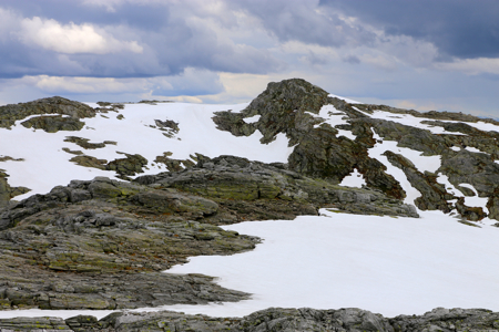
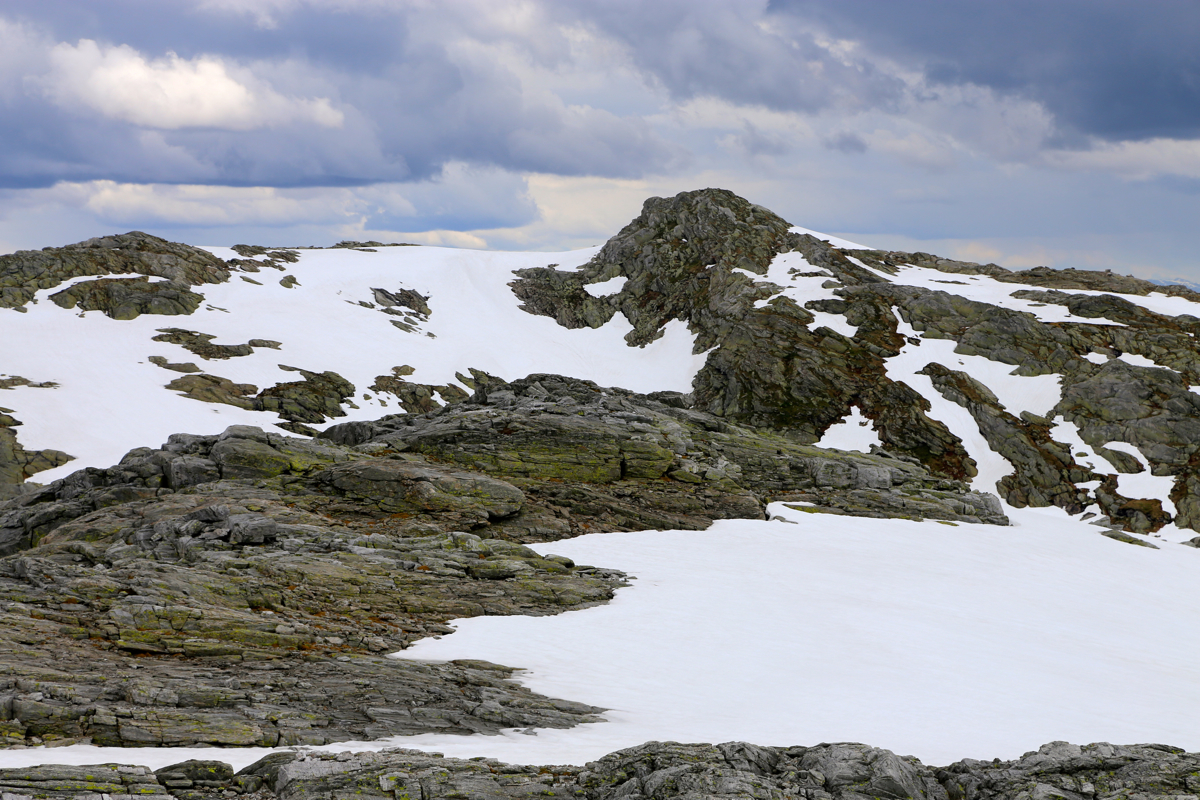
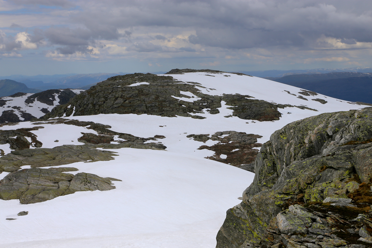
patch of snow that was easy to climb. From here on, most of the trip continued on snow.
Easy to walk on, just soft enough at the top layer to be comfortable. I arrived on the
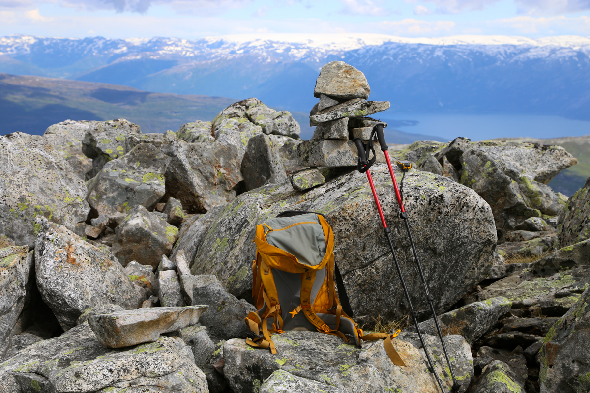
Gjønakvitingen cairn around
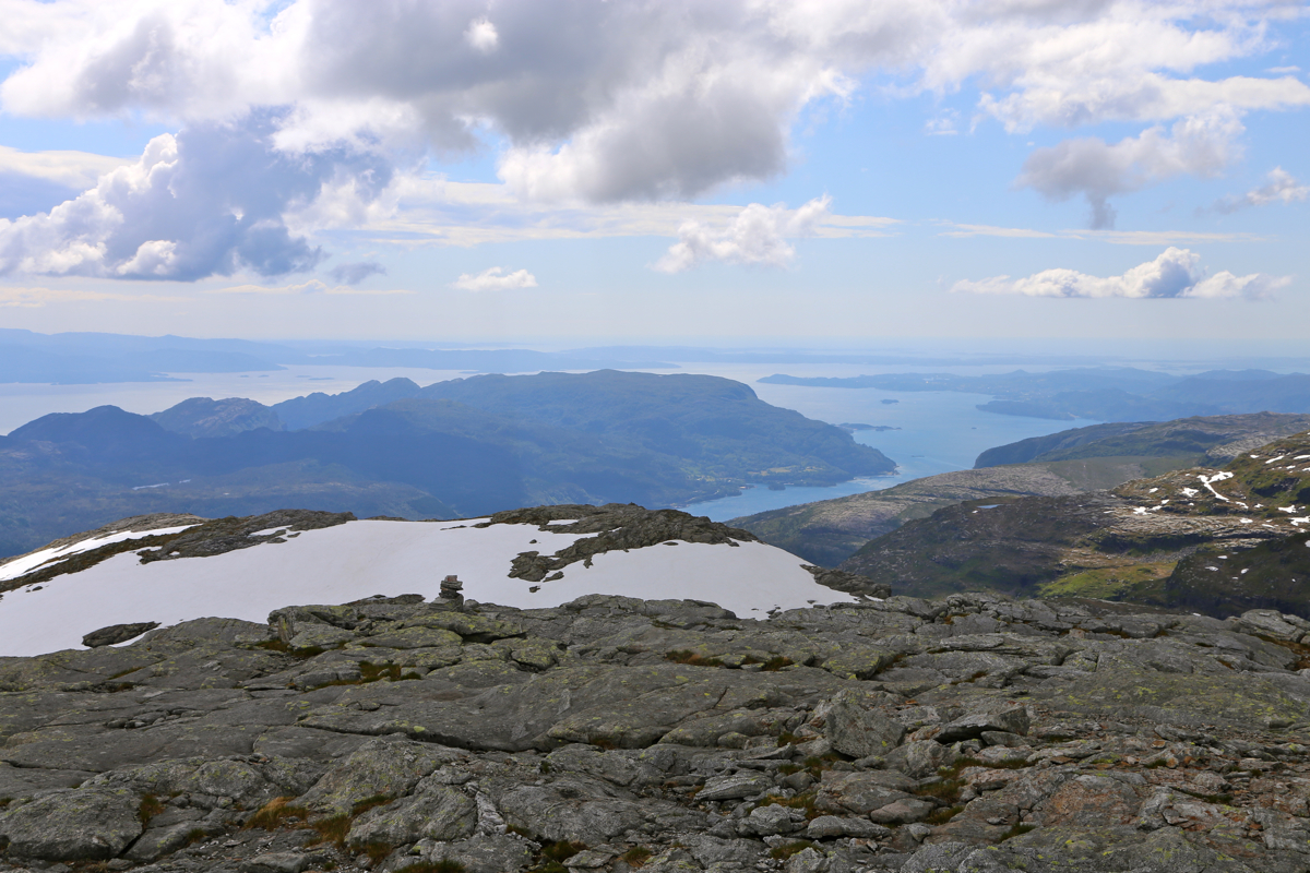
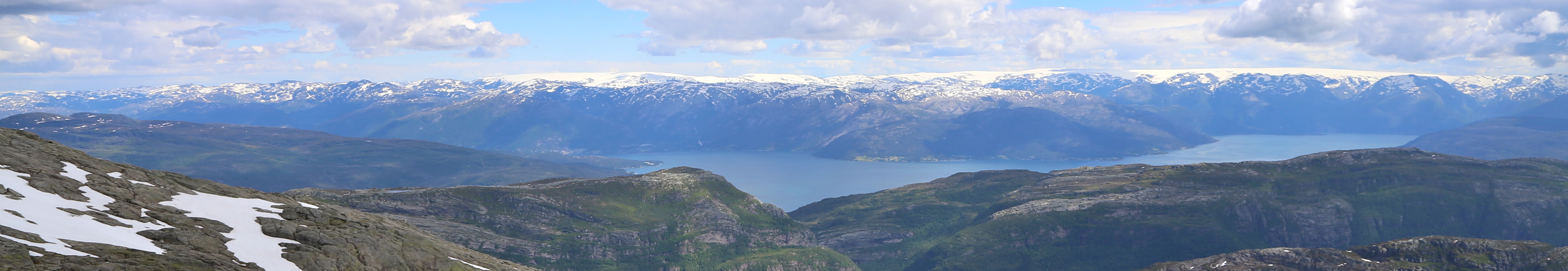
1515 and took time to capture the nice scenery. Folgefonna,
a long white line against
the sky. The lake from where
I travelled to the trailhead, yes
Gjønakvitingen is indeed a good viewpoint despite its lack of prominence.
I continued around 1525, taking a line of gradual descent on the north side of
Loftet in order to make the connecting saddle. This worked well and soon, I was on my
way up the last snow slope before Gavlen. I arrived at Gavlen just before 1600. From here,
one has a clear view across to the more
famous Tveitakvitingen, as well as north
to Raudaberget.
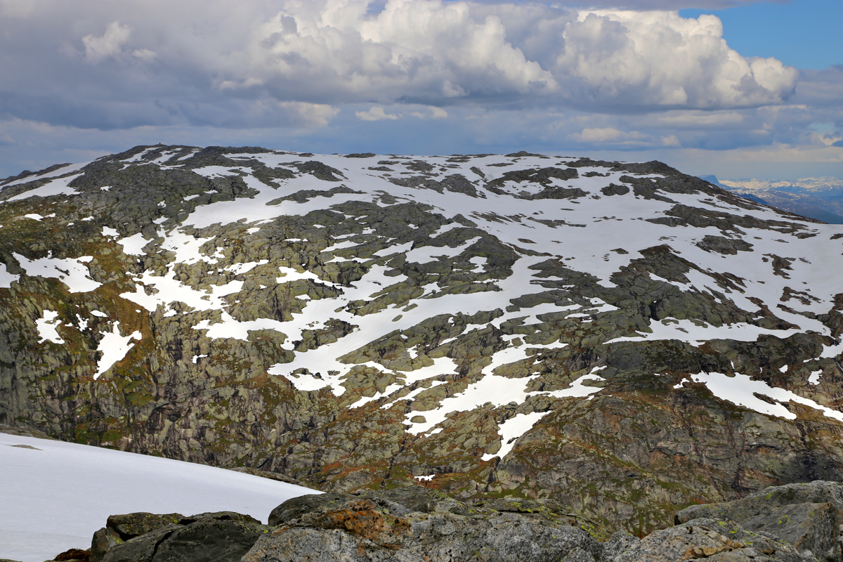
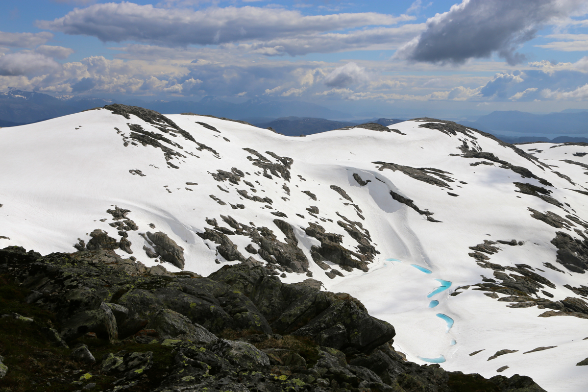
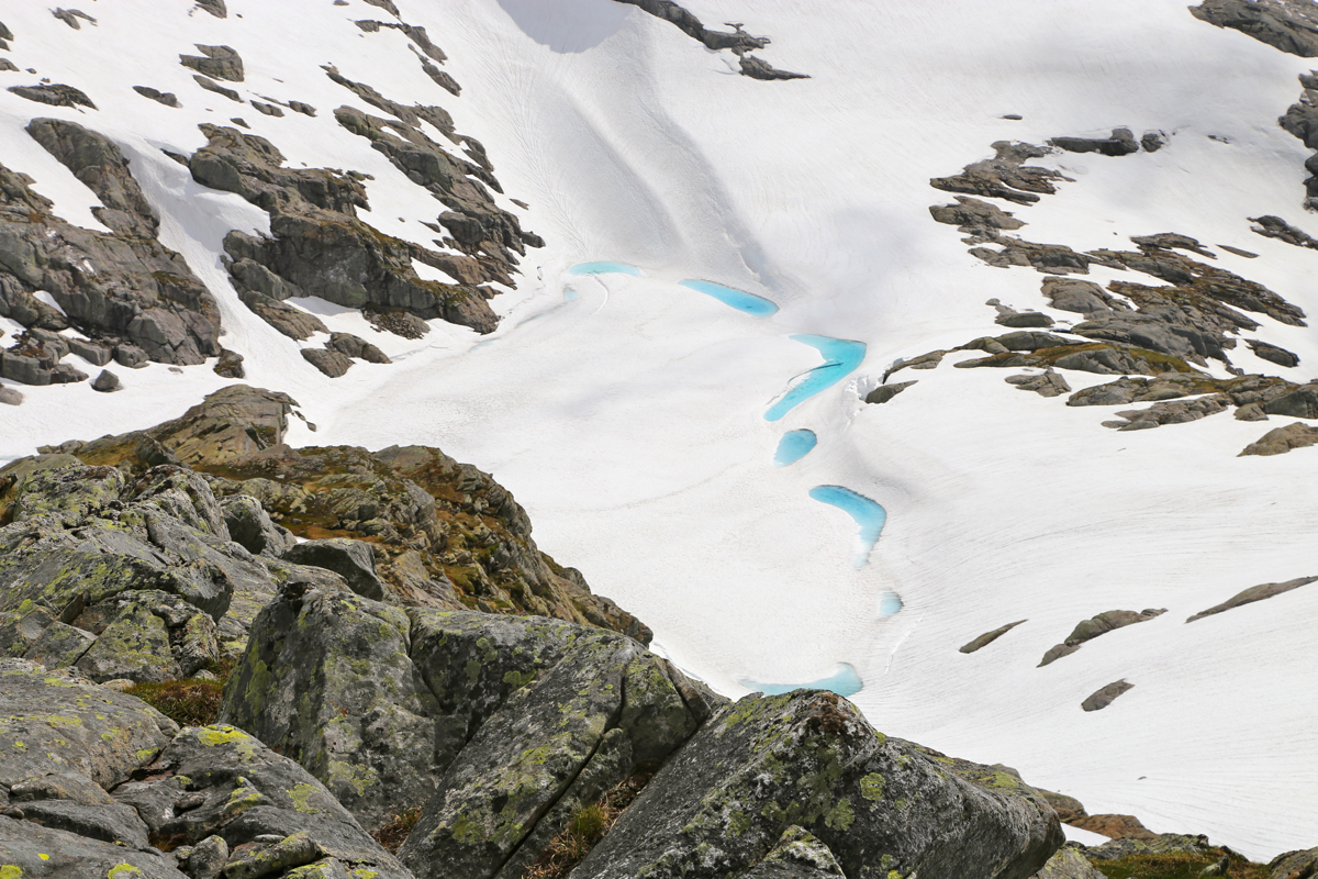
Still a lot of snow up here above 1200 meter. I looked back to
Gjønakvitingen,
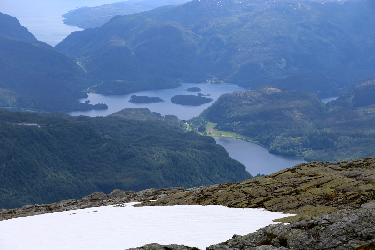
the connecting route had been 100 percent on snow.
Similarly, the lake between the
two tops, still covered by ice, only small
signs of spring near its edge.
I left at 1615 and at the same time, observed black clouds with heavy rain further west.
What was potentially more of an issue, a couple of flashing lightning and booms of
thunder. I increased my speed a bit, should really get off the top ridges here in case
that weather moved inland in this direction.
As it turned out, the weather never came my way. The descent was easy, taking maximal
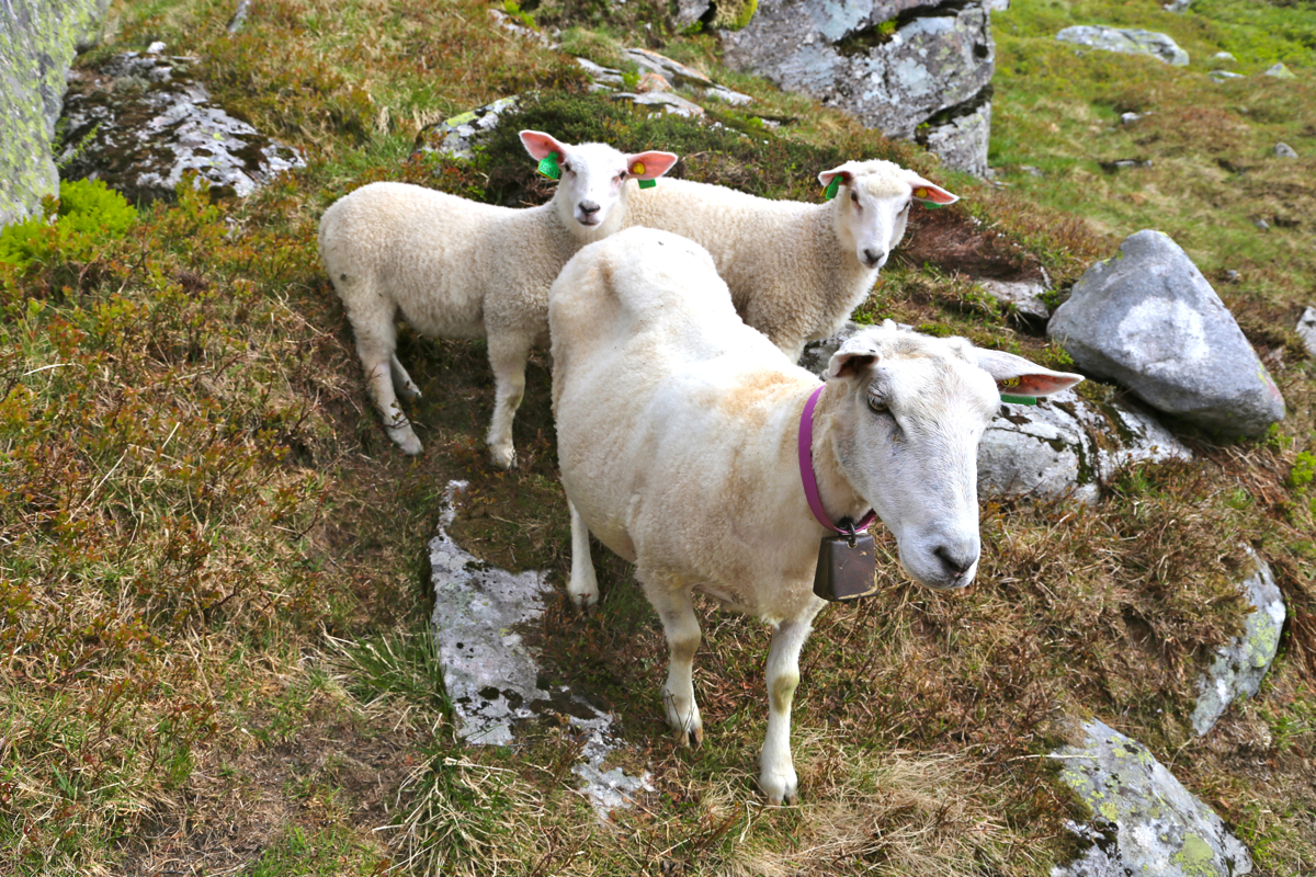
advantage of the downsloping snow slopes. I walked by the mountain cabin then met a
bunch of sheep coming in the opposite direction. I got out of the way, the farmer
came behind the sheeps, this was a trip to get them up in the mountains. At the very end,
two reluctant sheep, the last one being pushed forward by the farmer's boy - a ten
year old helping out.
The time was 1730, I called Heidi and estimated that I would reach the car at
1830, then drive home with an estimated time of arrival at 2000.
This worked out as planned, I first followed the trail down to see how
I lost it. This remained a mystery as the trail never got close to
the creek. Down by 1830, home by 2000. A bottle of Chablis, lobster and
the first Norwegian strawberries of the season - a fine conclusion
of what had been a very nice day.