Location: North 59:53.784, East 005:52.523 (GPS at the summit)
Hordaland, Norway
Difficulty: YDS class 1
Climbed: September 13, 2009
Information:
How to get there:
From Bergen, drive Hwy. E-16 towards Oslo to the traffic circle at
Trengereid, where Hwy. 7 forks right. Follow Hwy. 7 as it circles the
Samnanger fjord, then runs through a pretty long tunnel. Immediately as
you exit this tunnel, make a sharp right onto Hwy. 48 with signs for
Mundheim and Gjermundshamn. The distance from this intersection to Gjermundshamn is
about 54 kilometer. In Gjermundshamn, take the ferry across to
Årsnes (previously Løfallstrand). Continue south along Hwy. 48 for approximately 18 kilometer.
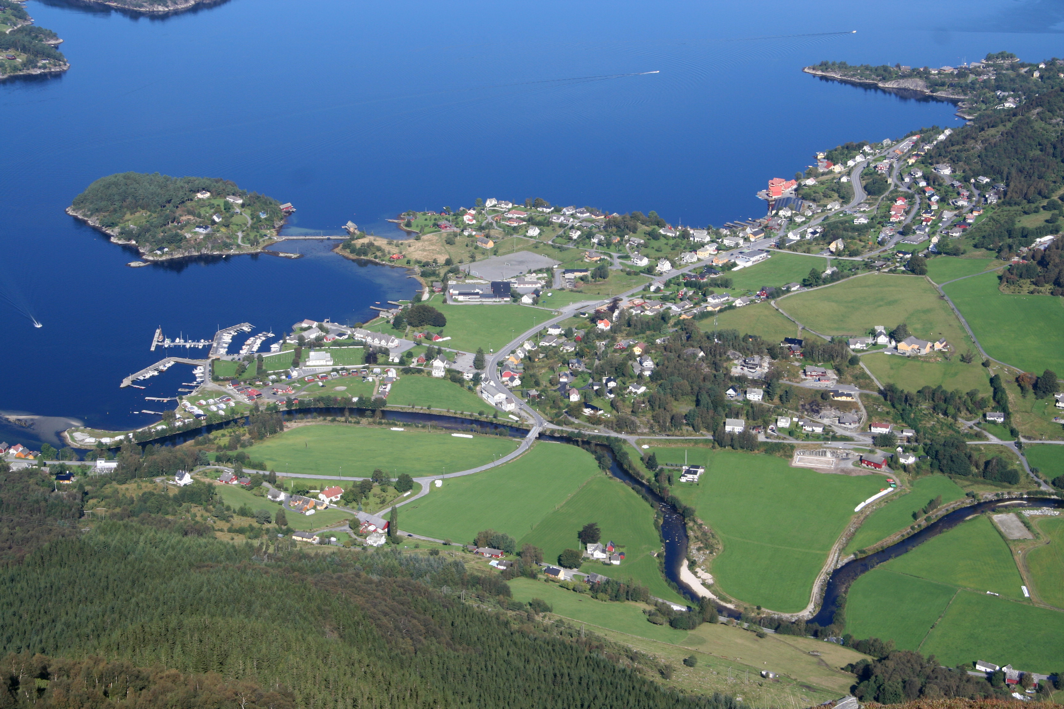
You will pass through the small village of Rosendal, then arrive in the even smaller
community called Uskedalen. Pay attention as your road crosses the river, then turn left
on a small road with a sign for Musland. Drive only 50 meter, in the first left curve
a small dirt road runs straight uphill. Just after this road, as you complete the curve,
find parking on your right hand side. Make certain that you do not block any access.
This is the trailhead, location N59:55.668, E005:51.595, elevation about 10 meter.
Route description:
Walk back (a few meter) and take the small dirt road uphill. There is a sign
saying Englafjell. Continue this road until you cross a gate. At this point,
leave the road and head uphill across some (wet) grass. There is another sign
here. Shortly, you connect with a forest road that initially runs to your
right. Follow this road as it climbs uphill with a few curves. Higher up,
just as the forest road has a gentle left curve, look for a trail (there is also
a sign saying Englafjell) that goes left and directly in among the big trees in
the forest. Take this trail, it is marked with red paint, generally the familiar
red "T".
The trail climbs steeply among the trees, then enters a short section
of birch trees before emerging into open terrain. A bit higher, you arrive at a
small viewpoint called Såta at 652 meter. The trail continues uphill, then
traveses left below a more rocky section, with a small descending part before
climbing a very natural small ridge that extends higher. Above here, the route
runs into rocks as it continues a climbing traverse before gaining the main crest
of the mountain. Follow the more gentle slope as it climbs to the summit. The very
last stretch has a nicely curved vertical drop on your left hand side.
There is an alternative route up Eikedalen on the west side of Englafjell. This
climb could use this route as part of a circular round trip. For a more detailed
description consult with the excellent
information provided by Arnt Flatmo. Comments:
This weekend was originally reserved for a possible trip to the Alps or to Northern Norway
depending on weather and possible company. However, the forecast was pretty miserable and
people generally busy. I changed my mind and decided to make a day hike of a local mountain.
Englafjell (Angel's mountain) is very noticeable to the south when viewed from
Ulriken. There are two pronounced peaks (they look like cones) the other being Ulvanosa.
I left home at 0930 and made the 1130 ferry from Gjermundshamn. Thus, slightly after
1215 I was on my way. It had been raining for more than a week, but today was clear
and sunny. The trail was a bit slippery, but generally quite fine. I made the Såta
viewpoint after about 50 minutes and stopped in order to capture the nice view
with my camera. From here, one has a good view back down to the small
Uskedalen community.
The continuation was equally nice and even the upper part with rocks
provided very good conditions. The rocks are generally big and flat and very easy
to hike.
I reached the summit before 1415,
thus slightly less than 2 hours from the car.
The mountain had a big cairn as well as a summit
register.
Quite surprisingly, three ladies were sitting near the cairn enjoying the good view as
well as their lunch. The very first (and last) people I saw on this beautiful Sunday.
The mountain really ends near the cairn. After following the very gentle ridge I was
a bit surprised to look down
at the lower terrain extending south and west.
I had lunch and took more pictures.
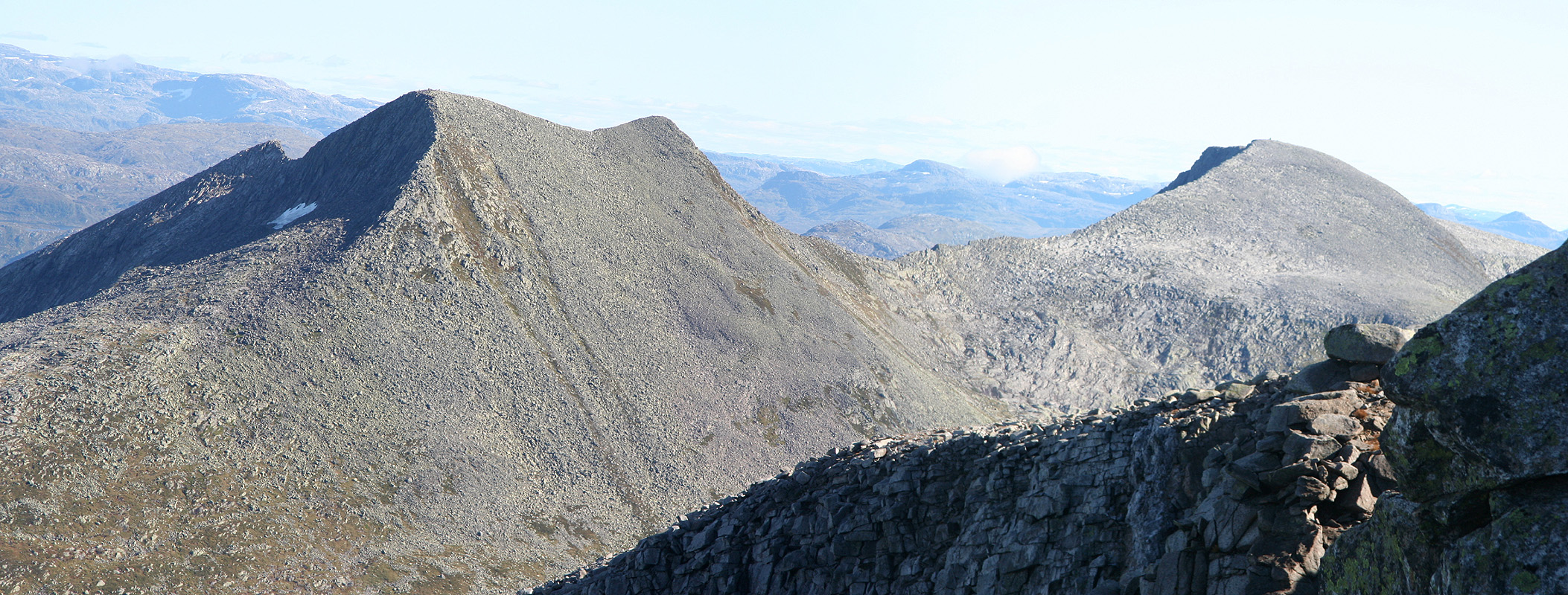
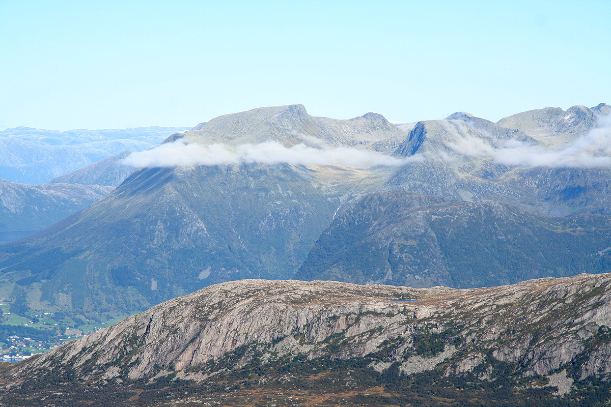
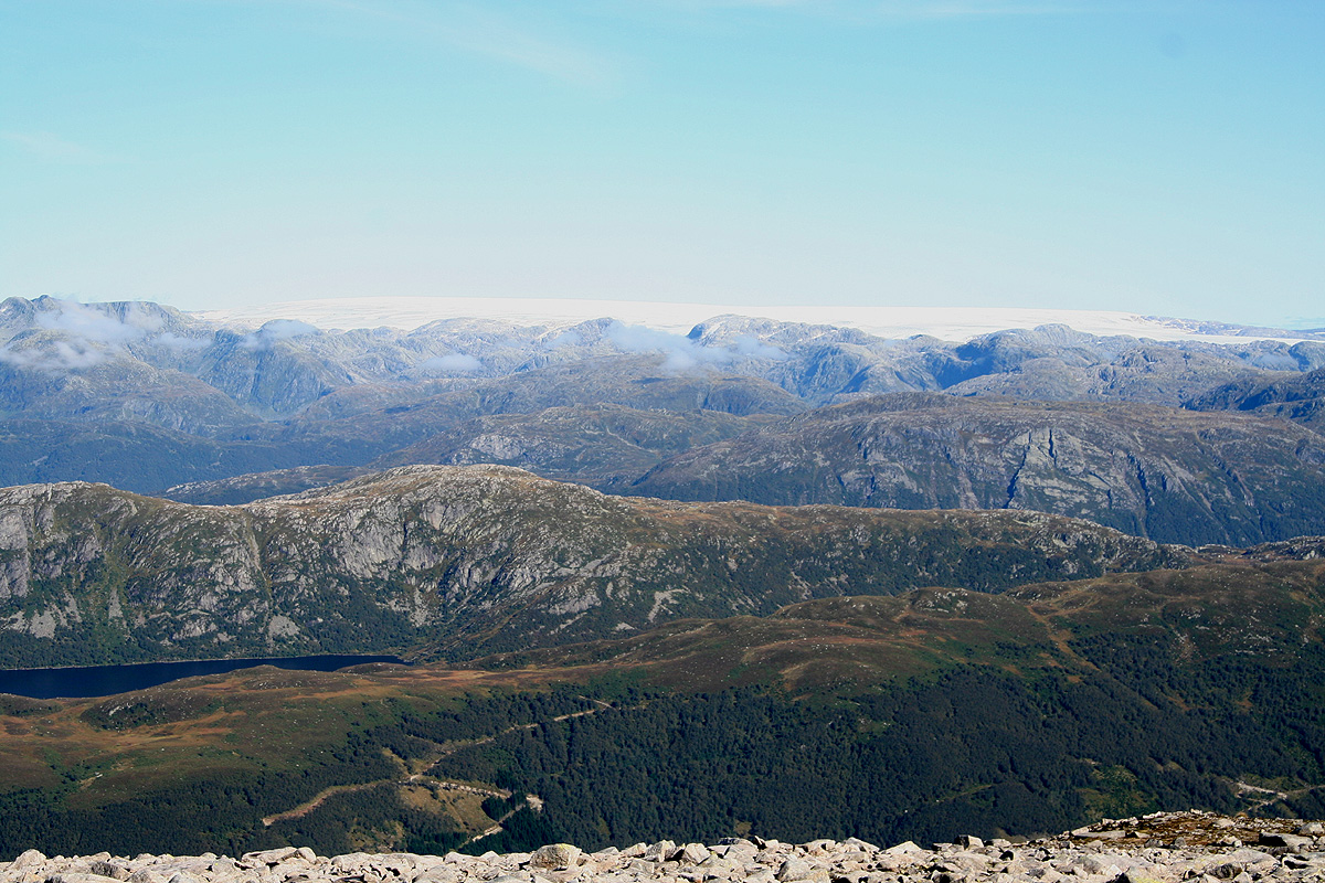
The views across to neighbors
Geitadalstind and Ulvanosa as well as further
north to Melderskin
and the Folgefonna glacier revealed a landscape with minimal
snow. At this time, in the middle of September, fall is approaching, but the first
snow has yet to come.
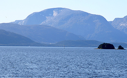
To the west, one has a great view
of the outer parts of
the Hardanger fjord. It was sunny and
quite warm, I walked in a T-shirt only and carried a small backpack with extra clothing.
The ladies left and headed back down towards Eikedalen. I saw that the valley already
had shade and decided to return the same way as my ascent, enjoying the great view and
the nice sunshine. I left the summit at 1445 and were back by my car in 1:30, at
1615.
Many people had travelled to Rosendal this weekend, I made the 1700 ferry except that
the line of cars offered no hope to get onboard. In fact, I was the third last car
to make the 1800 ferry. By that time, at least two full (ferry) loads of cars were waiting in order
to return home after a very, very sunny day in Kvinnherad.